For Irish quarry operators, aggregate suppliers, civil contractors and survey teams, the best drone is the one that turns a complex site into measurable data: stockpile volumes, haul-road conditions, face movement, drainage issues, progress records and safer inspection evidence.

Quick Answer: Which Drone Should You Choose?
Choose DJI Matrice 4E if your main work is regular stockpile measurement, quarry progress mapping, orthomosaics, 3D models and site records. It is the most practical portable mapping drone for many Irish quarry and construction material sites.
Choose DJI Matrice 400 with Zenmuse L3 if the site is large, uneven, partially vegetated or requires high-accuracy LiDAR point clouds for terrain modelling, corridor mapping, restoration records or engineering deliverables.
Choose DJI Dock 3 with Matrice 4TD only when you need scheduled remote monitoring, safety checks or site visibility. It is excellent for repeatable inspection, but it is not a replacement for a dedicated survey mission when accurate volume reports or LiDAR deliverables are required.
Why Mining and Quarry Surveying Needs More Than Aerial Photos
A quarry is a changing site. Material is extracted, stockpiles move, haul roads wear, water collects, faces advance and restoration areas develop over time. Because of this, quarry survey data has to be repeatable. A single nice image does not help enough unless it can be measured, compared and shared with the people making operational decisions.
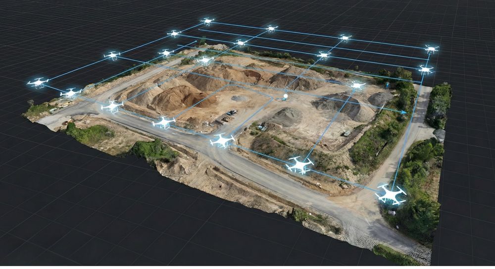
For Irish aggregate, limestone, sand, gravel, recycling and civil engineering sites, drone surveying can reduce time spent walking over uneven ground and help teams capture the full site from a safer position. Ground control, GNSS checks and professional survey practice still matter, but a drone can collect large amounts of data quickly and turn that data into maps, models and reports.
Stockpile volumes
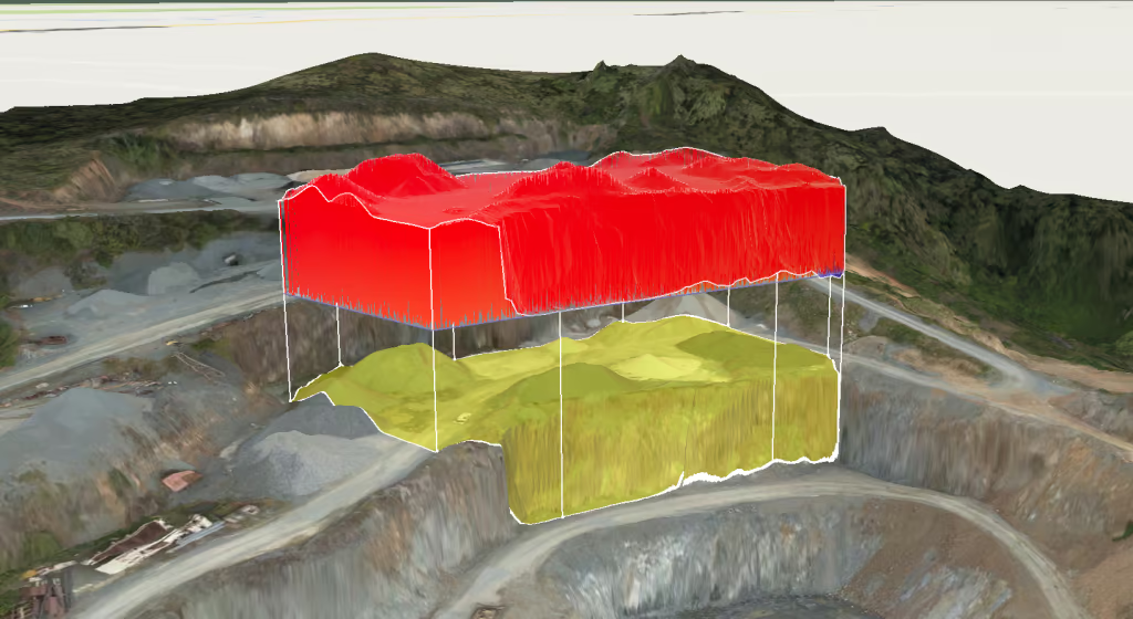
Measure aggregates, recycled material, sand, gravel, overburden and production piles with a repeatable workflow that supports inventory and commercial reporting.
Pit and face records
Create a visual and measurable record of extraction faces, benches, bunds, water areas and site boundaries before teams move into higher-risk areas.
Progress reporting
Compare monthly or weekly site changes using orthomosaics, 3D models, contours and annotated maps that can be shared with managers and consultants.
Site safety support
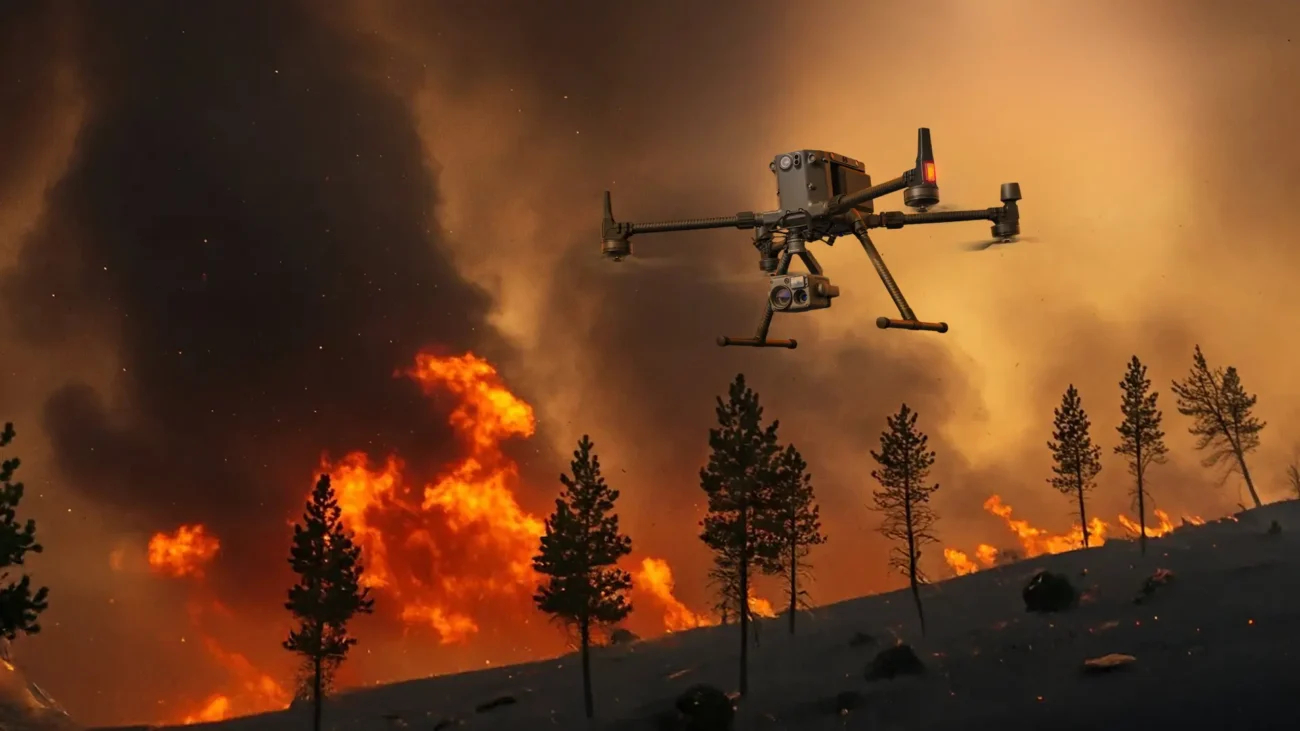
Review haul roads, high walls, access points, standing water and restricted areas from above before sending staff near plant, edges or unstable ground.
Best DJI Enterprise Setups for Irish Quarry Sites
There is no single best drone for every quarry. A portable mapping drone is usually better for frequent stockpile work, while a larger LiDAR platform is better for complex terrain and high-accuracy deliverables. The right decision depends on the site, the required accuracy and how the outputs will be used.
Recommended for most regular quarry surveys
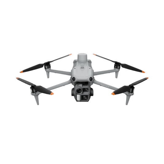
1. DJI Matrice 4E + DJI Terra
The DJI Matrice 4E is the best starting point for many Irish quarry teams because it is portable, efficient and built around mapping work. It is suitable for regular stockpile volume reports, 2D maps, 3D models, site progress records, quarry planning updates and construction material depots.
The important point is the camera and workflow. The Matrice 4E includes a 4/3-inch CMOS 20 MP wide camera and a mechanical shutter, which helps reduce rolling-shutter issues during mapping. It also supports RTK accuracy, making it a practical platform for repeatable survey capture when used with proper control and validation.
- Best for: stockpile measurement, smaller quarry surveys, construction material yards, regular progress maps and multi-site survey days.
- Typical outputs: orthomosaic maps, DSMs, 3D models, volume reports, annotated site maps and comparison records.
- Why it works: compact deployment, mechanical-shutter capture, mapping-focused camera and efficient processing through DJI Terra or other survey software.
Recommended for large or complex sites
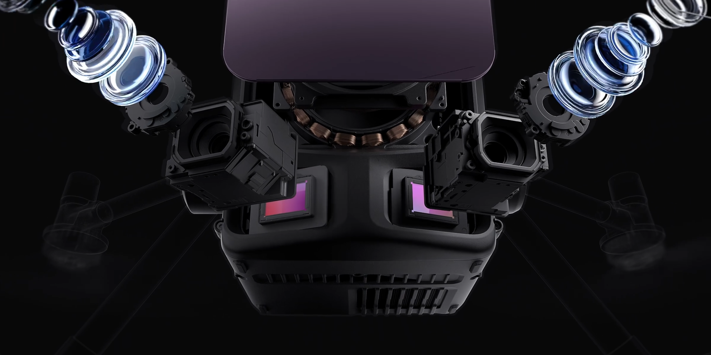
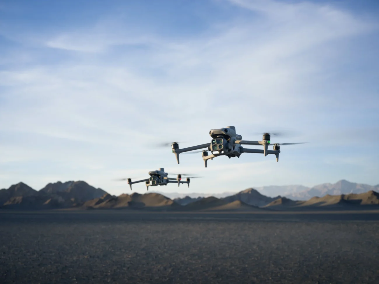
2. DJI Matrice 400 + Zenmuse L3
For large quarries, complex terrain, restoration surveys, forestry-edge boundaries and engineering-grade point cloud deliverables, the stronger setup is DJI Matrice 400 with Zenmuse L3. This is the higher-performance option when the project needs LiDAR data rather than standard camera-only photogrammetry.
Matrice 400 gives the aircraft platform: long endurance, larger payload capacity and enterprise-level resilience. Zenmuse L3 gives the survey data: long-range LiDAR, dual 100 MP RGB mapping cameras and high-density point clouds that can support more demanding geospatial outputs.
- Best for: large limestone quarries, extraction faces, steep ground, vegetation edges, road corridors, restoration areas and complex terrain modelling.
- Typical outputs: LiDAR point clouds, true-colour point clouds, terrain models, contours, CAD/GIS exports and high-accuracy site models.
- Why it works: LiDAR can be more reliable than photogrammetry where ground surfaces, vegetation, slopes or access conditions make image-only modelling difficult.
Recommended for inspection and safety awareness
3. DJI Matrice 4T or Matrice 400 + H30 Series
Not every quarry flight is a survey flight. Sometimes the team needs to inspect a high wall, crusher area, conveyor, pond, blocked access route or storm-damaged section before sending people in. For these tasks, a thermal and zoom inspection drone can be more useful than a pure mapping drone.
The DJI Matrice 4T is a compact option for fast thermal and visual checks. For larger, longer and more demanding inspection missions, Matrice 400 with an H30 Series payload is the more capable enterprise inspection platform.
- Best for: high-wall checks, access-route review, emergency site assessment, thermal observation and safety support.
- Typical outputs: zoom images, thermal snapshots, geotagged inspection photos, video evidence and annotated site safety records.
- Why it works: inspection data helps teams decide whether an area needs manual access, remedial work or further survey capture.
Recommended for recurring remote visibility
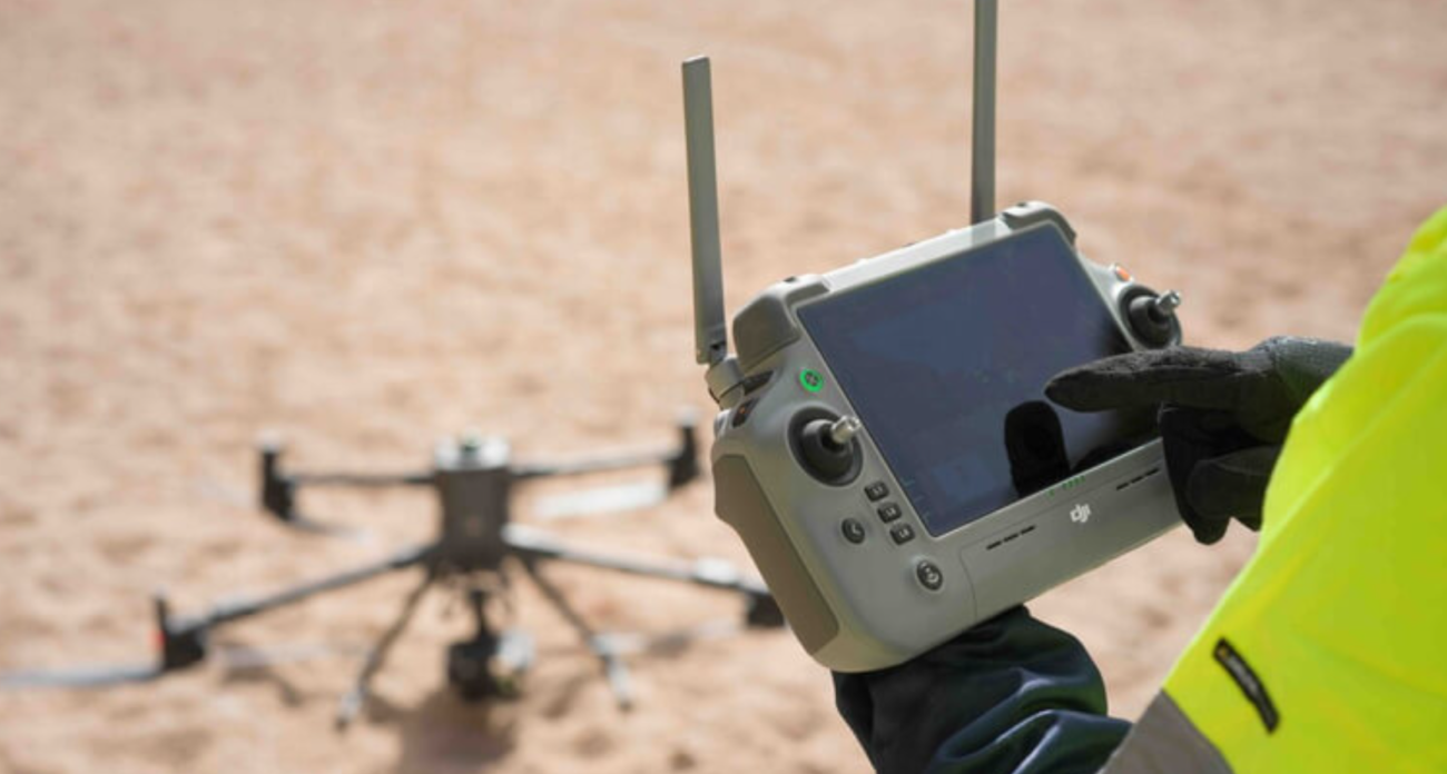
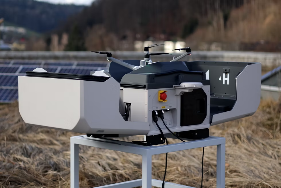
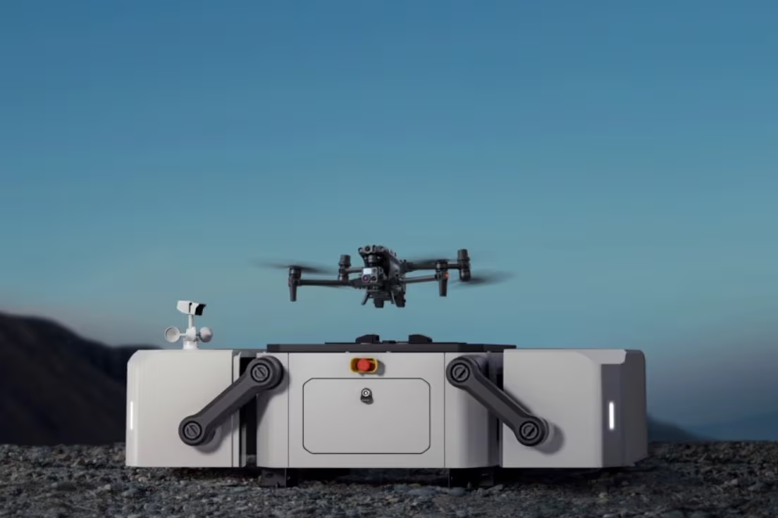
4. DJI Dock 3 + Matrice 4TD
DJI Dock 3 with Matrice 4TD is best understood as a remote monitoring and inspection solution, not as the first choice for accurate quarry volume reporting. It becomes useful where the same site needs frequent scheduled checks: water build-up after rain, perimeter activity, haul-road condition, site access, safety zones or incident response.
For Irish operators with remote or multi-site assets, a dock system can reduce travel time and create a consistent visual record. For monthly stockpile reports or LiDAR data, however, Matrice 4E or Matrice 400 + Zenmuse L3 remains the better survey choice.

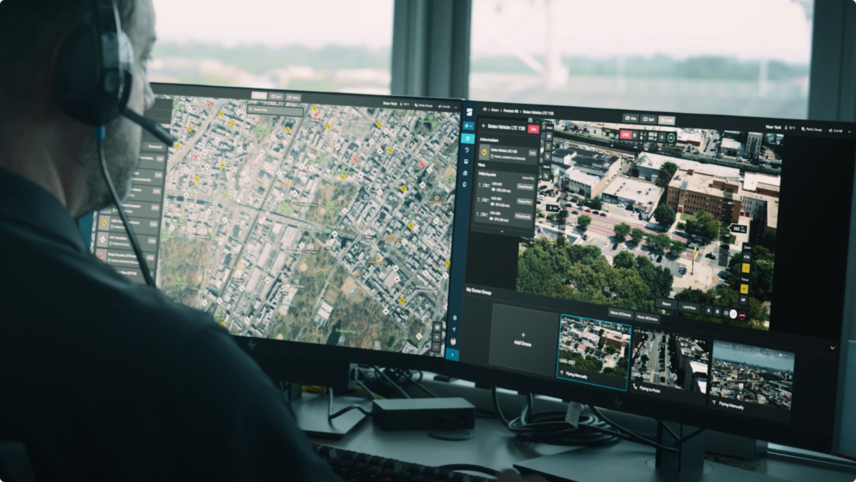
A Better Workflow for Quarry Drone Surveying
The old version of many drone articles jumps from product to product without explaining the workflow. A quarry survey should be planned around the decision the client needs to make. The drone is only one part of the system.
Define the job before choosing the drone
Is the project for stockpile volume, pit mapping, extraction-face review, drainage planning, restoration monitoring, safety inspection or LiDAR terrain modelling? Each objective needs a different flight plan and data output.
Set accuracy and control expectations
RTK, checkpoints and ground control should match the commercial value of the output. A quick management map is different from a volume report used for payment, inventory valuation or engineering design.
Fly repeatable missions
Use consistent altitude, overlap, speed, route direction and camera settings where possible. Repeatability is what allows a quarry team to compare current conditions with previous surveys.
Process the data into a measurable model
Drone images or LiDAR data should be processed into orthomosaics, DSMs, point clouds, contours, 3D models and volume reports. DJI Terra can support DJI visible-light reconstruction and DJI LiDAR data processing.
Deliver a report that managers can use
A useful quarry drone report should explain quantities, changes, risk areas, data date, method, assumptions and next steps. It should not be a random folder of images with no decision-making context.

What Should a Quarry Drone Survey Deliver?
The best drone setup is the one that produces the right deliverable. For an Irish quarry, that usually means one or more of the following outputs.
Orthomosaic map
A georeferenced top-down map for site overview, access planning, production areas, water management, stockyard layout and progress comparison.
Stockpile volume report
Measured volumes by pile, material type or zone, with base-plane assumptions and a consistent method for month-to-month comparison.
3D model or DSM
A digital surface model or mesh that helps teams review terrain, slopes, benches, pit geometry and site changes.
LiDAR point cloud
A point cloud for complex terrain, vegetation edge mapping, corridor work and more detailed terrain modelling where photogrammetry may not be enough.
Annotated safety map
A visual record highlighting high-risk areas such as water build-up, edge hazards, access issues, damaged roads or restricted zones.
CAD/GIS export
Exportable data for engineers, planning consultants, quarry managers, quantity surveyors and GIS teams.
Photogrammetry vs LiDAR for Quarry Surveying
Photogrammetry is usually the best starting point for regular stockpile and site progress work. It creates visually rich maps and models from overlapping images. For open stockyards, clear stockpiles and regular quarry progress records, Matrice 4E can be the most efficient choice.
LiDAR becomes more valuable when the site is large, steep, vegetated or geometrically complex. It can capture terrain and point cloud data in ways that are difficult for camera-only workflows. For large extraction zones, restoration areas, high walls, access corridors and vegetation-edge surveys, Matrice 400 with Zenmuse L3 is the stronger option.
| Method | Best use | Recommended DJI setup | Main limitation |
|---|---|---|---|
| Photogrammetry | Stockpiles, open yards, regular site maps, 3D models and progress reporting. | DJI Matrice 4E + DJI Terra | Can struggle with vegetation, uniform surfaces, steep faces or poor image texture. |
| LiDAR | Complex terrain, vegetation edge mapping, quarry faces, corridors and higher-end geospatial deliverables. | DJI Matrice 400 + Zenmuse L3 | Higher system cost and a more specialist processing workflow. |
Recommended DJI Setups by Quarry Use Case
| Use case | Recommended setup | Why it fits | Typical deliverable |
|---|---|---|---|
| Monthly stockpile measurement | DJI Matrice 4E + DJI Terra | Portable mapping workflow with mechanical-shutter image capture and RTK support. | Volume report, orthomosaic, DSM, 3D model. |
| Large quarry or complex terrain | DJI Matrice 400 + Zenmuse L3 | Long endurance, heavier payload support and high-accuracy LiDAR capture. | Point cloud, terrain model, contours, CAD/GIS exports. |
| High-wall or operational inspection | DJI Matrice 4T or Matrice 400 + H30 Series | Zoom and thermal tools help inspect difficult or potentially unsafe areas from a safer distance. | Inspection photos, thermal snapshots, safety notes. |
| Remote site visibility | DJI Dock 3 + Matrice 4TD | Scheduled remote operation for recurring checks and faster situational awareness. | Scheduled visual records, incident review, routine monitoring. |
| Processing and reporting | DJI Terra + CAD/GIS software | Converts drone imagery and LiDAR data into maps, models and measurable outputs. | Reports, measurements, exports, comparison maps. |
Irish Operating Considerations
Drone operations in Ireland should be planned around site risk, operator registration, aircraft class, pilot training, permissions and the operating category. Quarry work can involve people, vehicles, machinery, restricted areas and complex terrain, so the operating plan should be more detailed than a simple open-field flight.
Before deploying a drone for quarry or mining survey work, review airspace, site permissions, take-off and landing areas, controlled ground areas, machinery movement, dust, wind, GNSS conditions, emergency procedures and data protection. For more complex operations, especially those outside basic Open category limits, the operator may need Specific category planning or authorisation.
- Confirm operator registration and pilot competency.
- Check nearby airspace restrictions and local site rules.
- Plan around plant movement, blasting schedules and restricted zones.
- Use checkpoints or ground control where accuracy must be proven.
- Document weather, flight settings, survey date and processing assumptions.
- Deliver outputs in a format that quarry managers, engineers and consultants can use.
FAQ: Mining and Quarry Survey Drones in Ireland
What is the best DJI drone for quarry stockpile measurement?
For most regular stockpile measurement work, DJI Matrice 4E is the most practical choice because it is portable, mapping-focused and uses a mechanical-shutter wide camera. For very large or complex sites, Matrice 400 with Zenmuse L3 is the more advanced LiDAR option.
Do quarries need LiDAR?
Not always. Photogrammetry is often enough for clear stockpiles and regular site maps. LiDAR becomes more useful for large areas, vegetation edges, steep faces, complex terrain, restoration surveys and projects that require high-quality point cloud data.
Can drone surveys replace ground surveyors?
No. A drone improves speed, site coverage and safety, but professional survey knowledge is still required for control, validation, coordinate systems, accuracy checks and interpretation.
Is DJI Dock 3 suitable for quarry surveying?
DJI Dock 3 is better for scheduled site monitoring and remote inspection than for high-accuracy survey work. It can support routine visibility, incident checks and safety patrols, while Matrice 4E or Matrice 400 with Zenmuse L3 should be used for dedicated survey deliverables.
Which software should be used for quarry volume reports?
DJI Terra can process DJI drone imagery and DJI LiDAR data into maps, models and measurable outputs. Some teams also export data into CAD, GIS, quarry management or third-party survey platforms depending on reporting requirements.
How often should a quarry be surveyed by drone?
It depends on production speed and reporting needs. Many sites benefit from monthly stockpile and progress surveys, while active projects may need weekly updates. Remote dock checks can be scheduled more frequently for site visibility, but they should not replace formal survey capture when accurate measurements are required.
Need Help Choosing a Quarry Survey Drone?
Irish Drone can help you compare DJI Matrice 4E, DJI Matrice 400, Zenmuse L3, Matrice 4T, DJI Dock 3 and DJI Terra workflows for mining, quarrying, aggregates, construction materials and infrastructure survey projects in Ireland.
Contact Irish DroneNote: DJI aircraft specifications and payload compatibility should always be confirmed against the latest DJI Enterprise documentation before purchase or deployment. Operational requirements in Ireland should be checked against current IAA/EASA rules and the specific site risk profile.
Leave a comment