How Drone LiDAR Helps Surveyors Save Time on Large Sites
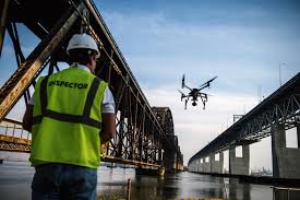
Surveyors working on large sites in Ireland are under growing pressure to collect more data in less time. Whether the job involves a quarry, a road corridor, a wind energy project, a solar farm, a utility route or a major construction site, the challenge is usually the same: cover a large area efficiently, reduce repeat site visits, and deliver usable outputs quickly for engineers, planners and project teams. This is where modern drone LiDAR has become a genuine time-saving tool rather than just a specialist extra.
The most important difference today is that surveyors no longer need to depend on older drone platforms or outdated payloads. DJI’s latest enterprise mapping workflow gives professionals a far stronger route to efficient data collection. For large-site LiDAR work, the standout combination is now DJI Matrice 400 with Zenmuse L3. For routine visible-light mapping and general site capture, DJI Matrice 4E remains a highly practical companion platform. Combined with DJI Terra, these tools can significantly reduce time spent in the field while improving the quality and usefulness of the final dataset.

Why large sites slow survey teams down
Large sites create problems that traditional field methods feel immediately. Distances are longer, access routes are slower, terrain can vary across the site, and some areas may be difficult or unsafe to reach on foot. On active sites, the work environment is also changing all the time. Earthworks move, material stockpiles shift, temporary roads appear, equipment gets repositioned and access conditions can change week by week.
For Irish surveyors, that means time can be lost in three places: collecting the data, re-checking areas that were missed, and returning to site because the original dataset was not broad enough to answer follow-up questions. Drone LiDAR helps solve that problem by gathering dense spatial data across a wide area in a more structured and repeatable way.
In simple terms, drone LiDAR saves time because it lets surveyors capture more site information in a single operation and bring more of the measurement and review work back into the office.
Why LiDAR is different from standard drone mapping
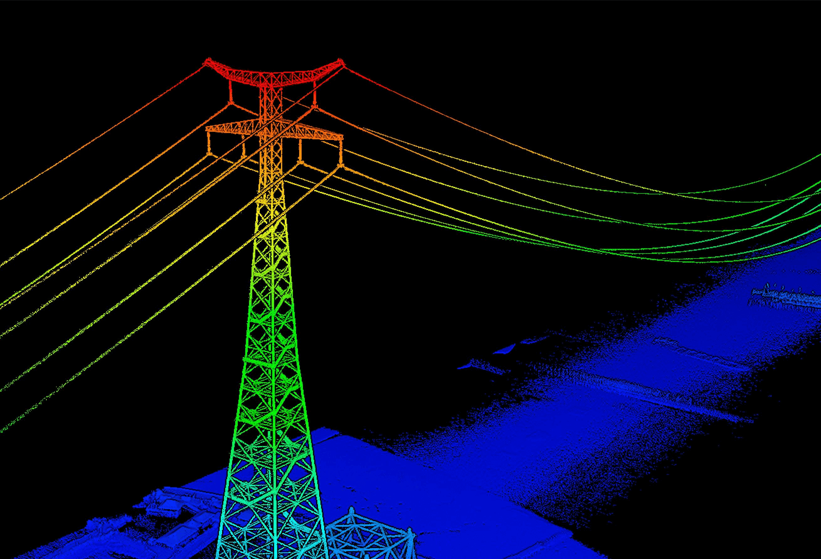
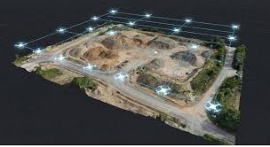
Standard photogrammetry is still excellent for many jobs, especially when the deliverable is a 2D orthomosaic, a visual 3D model or regular construction progress imagery. But on very large sites, or on terrain that includes vegetation, uneven surfaces, embankments, repetitive textures or complex infrastructure, LiDAR becomes more useful because it directly measures distance and creates dense point cloud data.
That matters because the surveyor is not just looking for a nice image. They need a dataset that can support terrain modelling, corridor understanding, surface change analysis, cut-and-fill review, stockpile work, infrastructure planning and other engineering tasks. The more useful the captured data is, the less time the team wastes returning to site.
The latest DJI setup for large-site LiDAR work
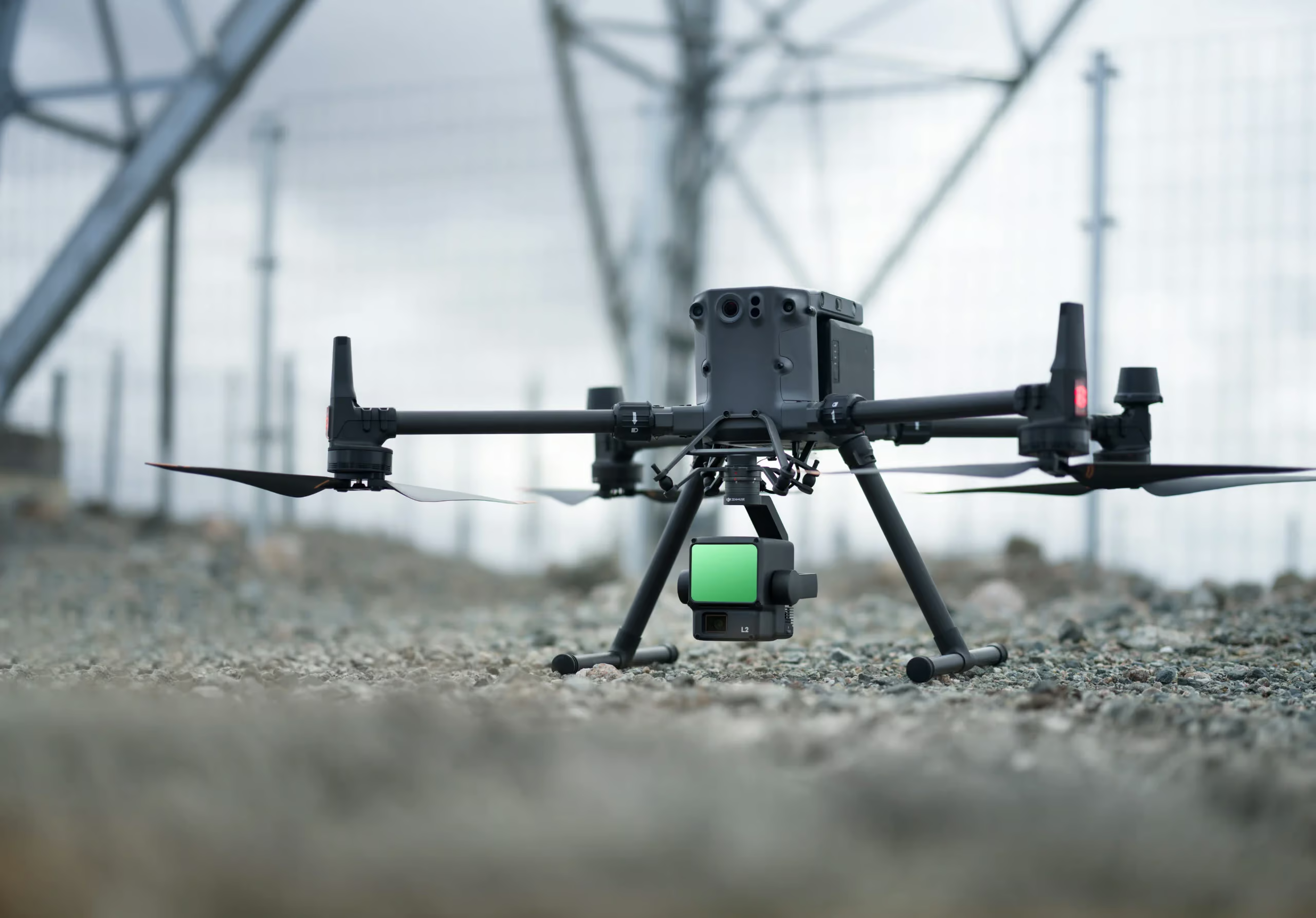
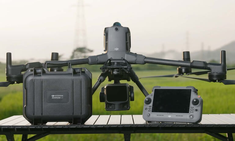
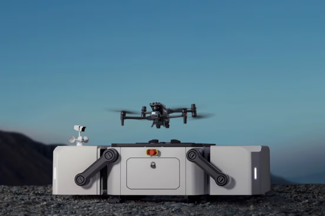
DJI Matrice 400 + Zenmuse L3
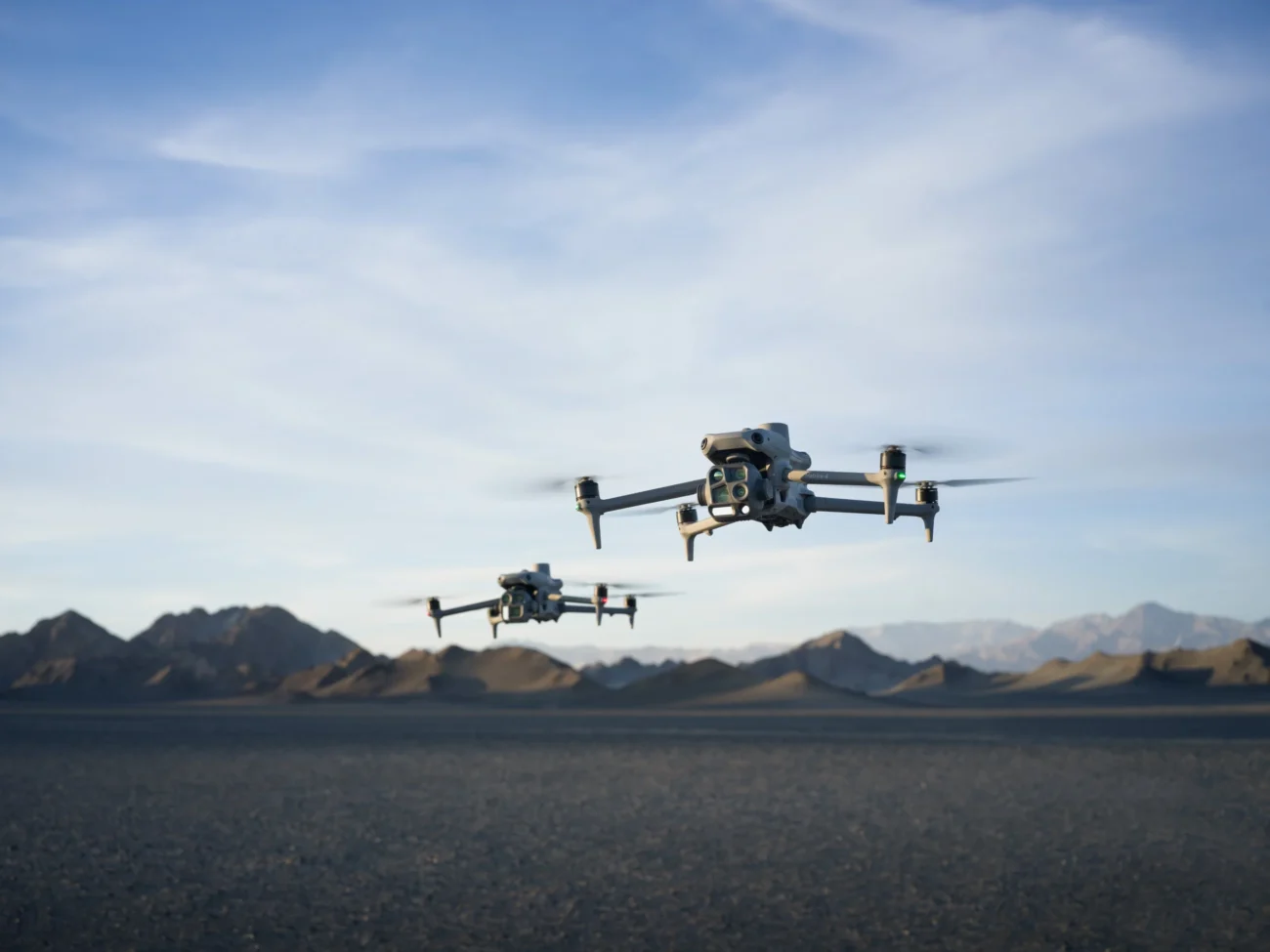
If the aim is to save time on large sites using the newest DJI equipment, the most relevant combination is DJI Matrice 400 paired with Zenmuse L3. DJI describes the Matrice 400 as its enterprise flagship drone platform with up to 59 minutes of flight time and payload capacity of up to 6 kg. That alone makes it better suited to large, demanding sites than smaller or older systems.
The Zenmuse L3 is the key payload in this workflow. DJI describes it as a next-generation high-accuracy aerial LiDAR system that integrates a 1535 nm long-range LiDAR, dual 100 MP RGB mapping cameras, a high-precision POS system, and a three-axis gimbal. For surveyors, that means one payload can support efficient point cloud capture while also gathering strong RGB mapping data for broader geospatial workflows.
| Latest DJI element | Why it saves time on large sites |
|---|---|
| Matrice 400 | Longer flight endurance reduces the number of take-offs and landings needed across bigger sites and improves productivity over a full working day. |
| Zenmuse L3 | Captures LiDAR data and RGB mapping data in a single enterprise workflow, reducing the need for separate collection passes. |
| High-precision POS | Supports more reliable geospatial outputs, which helps reduce rework and improves confidence in the final deliverable. |
| DJI Terra | Turns field capture into usable outputs such as point clouds and models more efficiently, helping teams move faster from survey to reporting. |
How drone LiDAR saves time in practice
1) It covers more ground in less time
On large sites, the biggest time cost is often simple coverage. Survey teams need to reach more ground, and every extra visit adds travel, setup and coordination time. Drone LiDAR reduces that burden by collecting wide-area spatial data from the air. This is especially helpful on quarries, large civils projects, linear infrastructure schemes and mixed terrain sites where walking every section is slow and inefficient.
2) It reduces repeat site visits
A common issue on large projects is that teams collect enough information for the initial brief, but not enough for the follow-up questions that arrive later. Once engineers, planners or contractors review the data, they often want extra measurements, additional checks or more context. With a stronger LiDAR dataset, more of those questions can be answered from the office, reducing the need to send people back out to site.
3) It handles difficult terrain better
Irish sites are rarely perfect. There may be uneven ground, areas of vegetation, water channels, embankments, spoil heaps, rock faces, corridor routes or partially obstructed zones. LiDAR becomes valuable because it is better suited to these conditions than purely image-based mapping. That saves time by making the original capture more useful.
4) It improves office efficiency after the flight
Time saving is not only about the flight itself. Surveyors save time when the post-processing workflow is straightforward and the resulting data is practical to use. DJI Terra supports visible-light reconstruction and DJI LiDAR data processing, which means the route from field collection to deliverable is more direct. That matters because faster processing means faster review, quicker decision-making and shorter turnaround times for the client.
Where this matters most in Ireland
Road and transport projects
Long alignments, temporary works, embankments and active construction zones make corridor capture time-consuming by traditional means. Drone LiDAR helps teams document more of the route in less time.
Quarries and earthworks
Large and changing landforms benefit from frequent aerial capture. LiDAR helps surveyors review terrain, stockpiles and site change without relying only on slower ground coverage.
Utilities and energy sites
Substations, wind project surroundings, solar developments and route corridors all benefit from stronger site context and efficient large-area 3D capture.
Major construction sites
Large commercial or infrastructure builds often need repeatable site datasets for progress, planning, coordination and measurement. LiDAR reduces time spent revisiting the same zones.
The best companion platform for day-to-day mapping
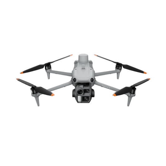
DJI Matrice 4E
Not every site needs LiDAR on every visit. For many routine jobs, a lighter mapping platform is still the right answer. This is where the DJI Matrice 4E fits in. DJI positions the Matrice 4E for surveying, mapping, construction and mining. It uses a 4/3 CMOS 20 MP wide camera with a mechanical shutter, supports rapid 0.5-second interval shooting, and is designed for efficient visible-light mapping workflows.
For Irish survey teams, the Matrice 4E is a sensible companion to a LiDAR setup. Use the Matrice 400 + Zenmuse L3 when the project needs LiDAR-grade terrain or advanced 3D data; use the Matrice 4E when the project mainly needs orthomosaics, visual progress capture, stockpile imagery or standard 2D/3D photogrammetry. Together, they create a far more efficient fleet strategy than trying to force one platform to cover every scenario.
A practical workflow for surveyors
- Define the deliverable first. Decide whether the project needs a point cloud, terrain model, orthomosaic, stockpile review, progress record or corridor analysis.
- Choose the right platform. Use Matrice 400 + Zenmuse L3 for LiDAR-heavy work on large or complex sites; use Matrice 4E for routine visible-light mapping.
- Plan for coverage, not just flight. Think in terms of what the engineer or client will need after the capture, not just what is easy to fly on the day.
- Process efficiently. Use DJI Terra to turn raw data into usable outputs quickly and consistently.
- Keep a repeatable workflow. On large or changing sites, repeatability saves time over the full life of the project, not just on one survey.

Final thoughts
Drone LiDAR saves surveyors time on large sites because it improves the entire workflow, not just the flight. It helps teams cover more ground, reduce repeat visits, capture more useful terrain data, and answer more questions without constantly returning to site. For Irish surveyors working across construction, utilities, quarries, infrastructure and energy, that can make a major difference to both project speed and project quality.
The key is to use the latest equipment rather than rely on outdated platforms. Today, the strongest current DJI workflow for large-site LiDAR surveying is DJI Matrice 400 with Zenmuse L3. For regular mapping support, DJI Matrice 4E is an excellent companion system. Combined with DJI Terra, they give surveyors a modern route to faster, more practical and more scalable site data collection.

Leave a comment