RTK stands for Real-Time Kinematic. In a drone surveying workflow, RTK uses correction data to improve GNSS positioning as the drone captures images or sensor data. For an Irish contractor, the benefit is practical: better route repeatability, more consistent image positions, faster processing, fewer avoidable site revisits and stronger confidence when comparing one site survey against another.
Quick answer: RTK drones improve survey accuracy by correcting positioning errors during flight. For Irish contractors, the most practical current DJI setup is often DJI Matrice 4E with RTK enabled, supported by D-RTK 3 Multifunctional Station where site conditions, network correction availability or workflow control require a dedicated base or rover system. For larger corridors, LiDAR deliverables or heavier payload workflows, Matrice 400 may be the better enterprise platform.
Why survey accuracy matters on Irish construction sites
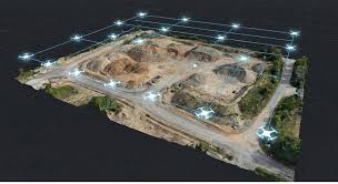
On a busy Irish site, a drone map is only useful if people can trust it. A site manager may use it to review progress. A quantity surveyor may use it to compare earthworks. A civil engineering contractor may use it to document drainage, kerbs, haul roads or embankments. A renewables contractor may use it to track access roads, solar farm foundations or substation works.
If the drone data is inconsistent from one flight to the next, the team wastes time questioning the output. RTK helps solve that problem by improving the positional quality of each capture and making repeat surveys easier to compare.
For contractors, accuracy is not a vanity metric. It is what turns drone imagery into a usable site record, a reliable measurement layer and a practical decision-making tool.
What RTK actually improves
More accurate camera positions
RTK improves the positional data recorded during capture. This helps mapping software align images more reliably and reduces the chance of inconsistent outputs.
Better comparison over time
For weekly or monthly site flights, RTK helps contractors compare progress from the same coordinate framework instead of relying on rough visual matching.
Fewer unnecessary ground points
RTK can reduce the number of ground control points needed for many workflows, although check points are still important for quality assurance.
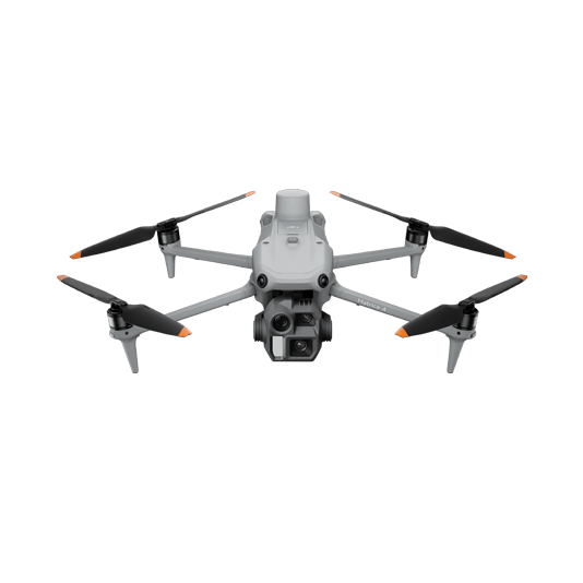
Best DJI RTK drone for most Irish contractors: Matrice 4E
DJI Matrice 4E is the strongest practical choice for many Irish contractors because it is designed for geospatial work such as surveying, mapping, construction and mining. It is portable enough for single-pilot operations, but it still includes a serious mapping camera system and RTK workflow.
DJI lists Matrice 4E with a 4/3 CMOS 20 MP wide camera, mechanical shutter, 0.5-second minimum photo interval, a 70 mm medium tele camera, a 168 mm tele camera and a laser rangefinder. DJI also lists RTK GNSS accuracy for the Matrice 4 Series at 1 cm + 1 ppm horizontal and 1.5 cm + 1 ppm vertical when RTK is fixed. In plain English, this is the specification mix contractors want for structured aerial mapping rather than casual site photography.
Why mechanical shutter matters for mapping accuracy
RTK improves positioning, but survey quality also depends on the camera. A mechanical shutter helps reduce rolling-shutter distortion during image capture. For construction mapping, this matters because the images are stitched into orthomosaics, DSMs, point clouds and 3D models. If the image capture is poor, better GNSS positioning alone will not fix the output.
That is why Matrice 4E is a better mapping choice than a general inspection drone for many contractor workflows. DJI’s Matrice 4 Series FAQ states that Matrice 4E supports precise mapping after RTK is enabled, while adding an RTK module to Matrice 4T cannot guarantee final precision. This distinction is important for Irish buyers choosing between thermal inspection and mapping deliverables.
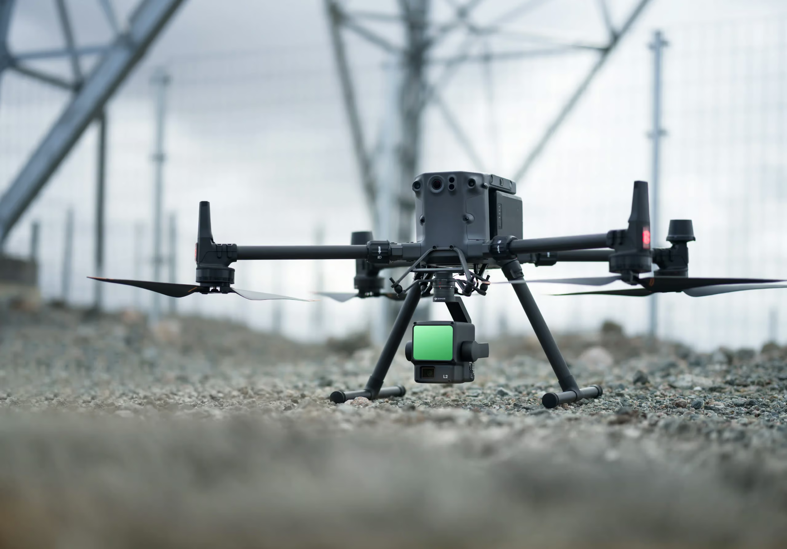
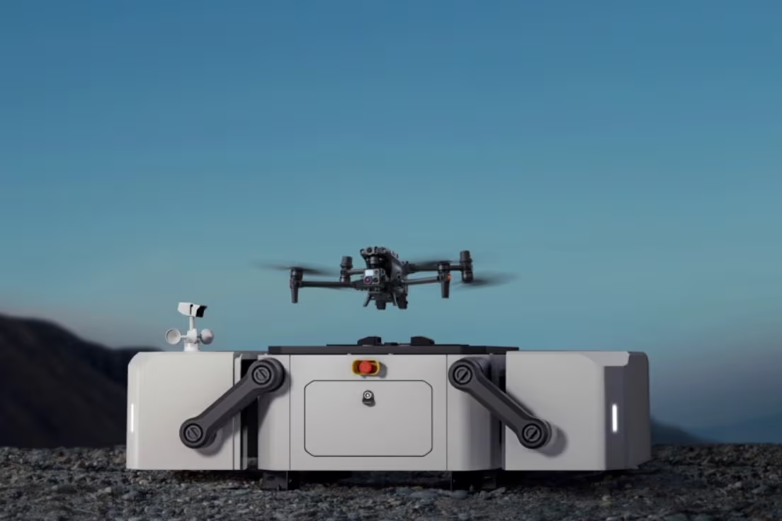
Where D-RTK 3 fits into the workflow
D-RTK 3 Multifunctional Station is DJI’s high-precision positioning and relay system. DJI describes it as using high-performance antennas and receiver modules that track and resolve data from major global satellite navigation systems. It can operate as a base station, relay station or rover station. For contractors, that makes it useful beyond one simple task.

Base station, relay station and rover station in one system
On a construction site, D-RTK 3 can support centimetre-level positioning for compatible drones. In rover workflows, it can also help with point collection and site positioning tasks when used with DJI Enterprise app and DJI Terra workflows.
This is particularly useful where a contractor wants a repeatable project coordinate setup, where mobile signal conditions are not ideal, or where the surveying team wants tighter control over how drone and ground data are collected.
Drone positioning support
Use D-RTK 3 to support compatible drone mapping operations with centimetre-level positioning corrections.
Ground point workflow
Use the rover mode for high-precision site points and supporting survey workflows where ground data is part of the deliverable.
Range and signal support
Use relay functionality where signal coverage and operational range are concerns on larger or more complex sites.
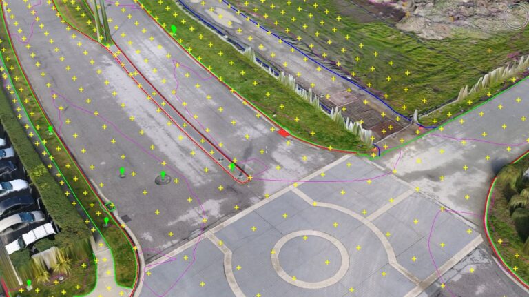
RTK does not replace survey quality control
One of the biggest mistakes is assuming that RTK automatically makes every map “survey-grade”. RTK improves positioning, but survey accuracy also depends on camera calibration, flight height, overlap, lighting, wind, processing settings, coordinate systems, site control and independent check points.
For commercial work in Ireland, contractors should still use a quality workflow. That normally means clear coordinate-system setup, known control or check points, documented flight plans, consistent capture height, sensible overlap, good image quality and review of residuals in the processing software.
Important: RTK can reduce ground control requirements, but it should not remove all quality checks. For contractual deliverables, use check points and a documented QA process so the model can be trusted by engineers, surveyors and project managers.
Practical RTK drone use cases for Irish contractors
Weekly site records
RTK makes it easier to compare one site capture against another. This is useful for housing developments, commercial buildings, logistics sites, schools, hospitals and public works projects.
Cut-and-fill and stockpiles
Drone data can support earthworks monitoring, stockpile volumes, haul-road records and contractor payment discussions when the workflow is properly controlled.
Corridors, culverts and access routes
RTK drone mapping supports corridor documentation, drainage layouts, embankments, junction upgrades and change records for local authorities and civil contractors.
Recurring site surveys
Quarries benefit from repeatable mapping for stockpiles, extraction zones, haul roads, benches, environmental boundaries and operational planning.
Step-by-step workflow for a contractor site survey
Define the deliverable
Decide whether the output is an orthomosaic, 3D model, DSM, stockpile report or progress comparison.
Set the coordinate logic
Confirm Irish Grid, ITM or project-specific coordinates before flying, not after processing.
Set RTK correction
Use network RTK or D-RTK 3 depending on site conditions, availability and the required workflow.
Capture consistently
Use suitable overlap, flight height, speed and lighting. Avoid windy or low-quality capture conditions.
Check the result
Use check points and processing reports before handing over the data to the site team.
Network RTK vs D-RTK 3: which should contractors use?
Many Irish sites can use network correction services where coverage and workflow allow. A dedicated station such as D-RTK 3 becomes more relevant when a contractor wants a controlled local reference setup, is working in difficult connectivity conditions, needs rover workflows, or wants the flexibility of a dedicated DJI Enterprise positioning system.
| Option | Best for | Strength | Watch-out |
|---|---|---|---|
| Network RTK | Sites with reliable correction coverage and a straightforward mapping workflow. | Fast setup and no need to deploy a local base station. | Depends on connectivity, subscription/access and project requirements. |
| D-RTK 3 as base station | Contractors who want local site control and repeatable drone positioning support. | Centimetre-level support for compatible DJI Enterprise drones and multiple-drone workflows. | Requires correct placement, setup and coordinate-management discipline. |
| D-RTK 3 as rover station | Ground point collection, site checks and high-precision support tasks. | Adds a useful ground-survey layer alongside the aerial workflow. | Still needs a trained operator and correct coordinate setup. |
| D-RTK 3 as relay station | Larger or complex sites where communication range and signal quality matter. | Can extend operational support in relay workflows. | Should be planned as part of an overall site communication strategy. |

When Matrice 400 is the better RTK platform
Matrice 4E is the best fit for many contractor mapping tasks, but larger projects may need a bigger platform. DJI Matrice 400 becomes relevant when the site requires longer flight endurance, heavier payload options, LiDAR capture, full-frame photogrammetry workflows or multi-payload operations.
For example, a civil engineering company working on a long road corridor, a quarry group needing LiDAR through vegetation, or an infrastructure contractor documenting large earthworks may be better served by Matrice 400 paired with the appropriate payload, such as Zenmuse L3 for LiDAR or a compatible mapping camera where the project specification requires it.
Simple buying logic: choose Matrice 4E for portable RTK mapping and everyday contractor surveys. Choose Matrice 400 when the project needs heavier sensors, LiDAR, long corridor coverage or more advanced enterprise payload flexibility.
Accuracy mistakes to avoid
- Flying without a coordinate plan: decide the project coordinate system before capture.
- Skipping check points: RTK improves positioning, but check points verify the deliverable.
- Using the wrong aircraft: Matrice 4T is strong for inspection and thermal work, but Matrice 4E is the better mapping-focused choice.
- Ignoring weather: wind and poor light can degrade image quality and the final model.
- Delivering raw visuals as “survey data”: contractors need measured, processed, checked outputs, not just a folder of aerial images.
Irish regulatory considerations
RTK survey drones used by contractors are professional aircraft, not casual camera drones. In Ireland, operators using drones over 250 g, or drones with a camera or sensor, must register as drone operators with the Irish Aviation Authority. Companies should make sure the business holds the correct Operator ID, pilots have the correct competency for the operation, and each job is assessed for airspace, people, roads, site access, privacy and insurance.
Where the work involves construction sites, roads, utilities, rail corridors, quarries or public areas, the project should be planned with clear permissions, documented risk assessment and safe separation from people and plant.
Compliance reminder: an RTK drone can improve mapping accuracy, but it does not remove the need for IAA registration, pilot competency, safe operating procedures, insurance and proper site permission.
Final recommendation
Best RTK drone for most Irish contractors: choose DJI Matrice 4E for portable, accurate and repeatable construction-site mapping.
Best positioning accessory: choose D-RTK 3 Multifunctional Station when the job needs a dedicated base, relay or rover workflow.
Best heavy-duty option: choose DJI Matrice 400 where the project requires LiDAR, long corridors, heavier payloads or more advanced enterprise survey workflows.
Best practice: combine RTK with check points, good flight planning, controlled coordinates and professional processing. That is what turns a drone flight into a reliable survey deliverable.


Leave a comment