For Irish surveyors, engineers and construction teams, drone mapping is not only about producing a good-looking aerial image. The real value comes from reliable, repeatable and measurable data. RTK drone mapping helps connect aerial imagery to precise ground coordinates, so maps, models and point clouds can be used with confidence across construction, roads, utilities, quarrying, renewable energy and land development projects.

Traditional drone mapping can create useful orthomosaics and 3D models, but without accurate positioning, the outputs may shift when compared with ground survey data, CAD drawings or previous site records. On Irish projects, this can create practical problems: earthworks quantities may not align, a road corridor may not sit correctly against design files, or a bridge inspection model may be difficult to compare with earlier survey information.
RTK, or Real-Time Kinematic positioning, improves the quality of drone mapping by correcting the drone’s GNSS position during the flight. Instead of relying only on standard satellite positioning, an RTK-enabled drone receives correction data from a base station or network correction service. This helps the drone record far more accurate camera positions for every image captured during the mission.
What RTK Means in Drone Mapping
RTK is a positioning method used to improve GNSS accuracy. In a drone mapping workflow, the drone records image coordinates while receiving correction data. Those corrected coordinates are then used during photogrammetry or LiDAR processing to create more accurate deliverables.
For surveyors, the main benefit is not that RTK removes all survey control. The benefit is that it makes aerial capture more consistent, faster to process and easier to verify. Ground control points and check points may still be needed depending on the accuracy standard, contract requirement, terrain, coordinate system and final deliverable. However, RTK helps reduce the amount of manual control needed on many sites and gives the processing software stronger positional data from the start.
Why Accuracy Matters for Surveyors
Aerial mapping is often judged by visual clarity, but survey teams need more than a sharp image. They need data that can be measured, compared and trusted. A clean orthomosaic is useful for site communication, but if the map is not accurately positioned, it may not support engineering decisions.
Accurate drone mapping helps Irish businesses reduce site revisits, avoid duplicated measurement work and improve communication between surveyors, site managers, engineers and clients. When drone outputs are aligned correctly, the same dataset can support progress tracking, cut-and-fill calculations, planning documentation, digital twins, BIM coordination, asset records and safety briefings.
1. Better alignment with design and survey control
Construction and infrastructure teams often need to compare aerial data with design drawings, topographical survey files, road alignments or utility layouts. RTK improves the likelihood that drone data will sit correctly against these project references, reducing the need for manual shifting during processing.
2. More reliable repeat surveys
Many Irish sites are surveyed repeatedly: weekly construction progress, monthly quarry measurement, pre-works and post-works condition surveys, or seasonal infrastructure inspections. RTK helps keep each survey consistent, so changes between datasets are easier to measure.
3. Faster fieldwork on large sites
Large sites can take significant time to walk with traditional equipment. RTK drone mapping allows surveyors to capture large areas from the air while keeping a stronger link to real-world coordinates. This is valuable on projects where machine movement, traffic, wet ground or restricted access make conventional measurement slower.
4. Cleaner handover to CAD, GIS and BIM teams
Survey deliverables often move into CAD, GIS, BIM or asset management workflows. RTK-supported drone data gives downstream teams a more dependable starting point, especially when creating orthomosaics, point clouds, DSM/DTM surfaces, 3D meshes or volume reports.

RTK, PPK, GCPs and Check Points: What Is the Difference?
RTK is one part of a larger accuracy workflow. Surveyors should understand how it relates to PPK, ground control points and check points before deciding how to run a project.
| Method | What it does | Best used for |
|---|---|---|
| RTK | Applies positioning corrections during flight so image locations are recorded more accurately in real time. | Fast mapping, repeat surveys, construction progress, stockpiles, road corridors and sites where efficient field capture is important. |
| PPK | Applies positioning corrections after the flight using recorded GNSS data. | Projects where real-time correction links are difficult or where post-processing is preferred by the survey workflow. |
| Ground Control Points | Known points placed or identified on the ground and marked in the imagery to improve absolute accuracy. | High-accuracy deliverables, contractual survey requirements, difficult terrain, or projects needing strong external validation. |
| Check Points | Independent measured points used to verify the accuracy of the final model, not to adjust it. | Quality assurance, client reporting and survey sign-off. |
For many professional projects, the strongest workflow is not simply “RTK or GCP”. It is RTK plus a sensible control strategy. On a straightforward site, RTK may reduce the number of control points required. On a complex site, surveyors may still use control and check points to verify the final result.
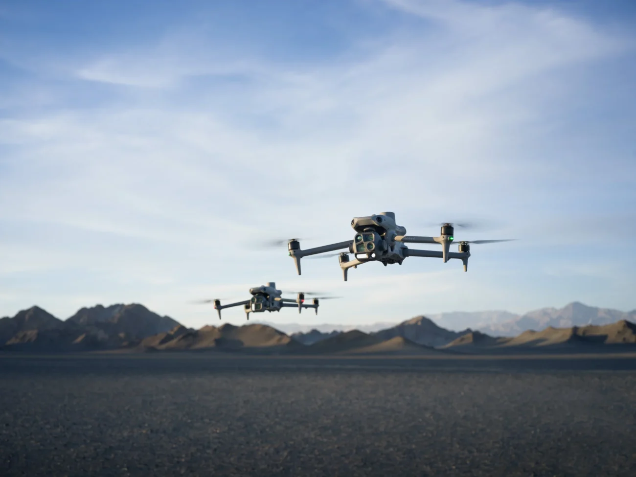
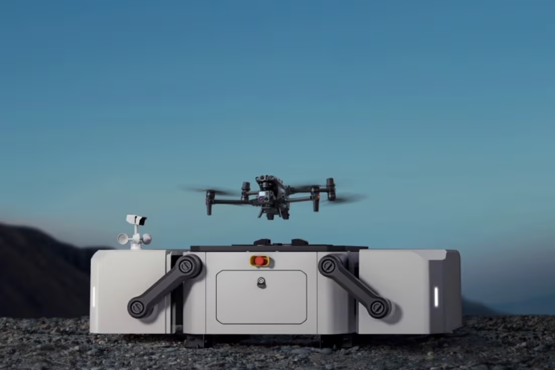
Latest DJI Equipment for RTK Drone Mapping
The best RTK drone mapping setup depends on the project size, required output, terrain and deliverable. For Irish surveyors, the most relevant current DJI Enterprise options are the DJI Matrice 4E for compact mapping work, the D-RTK 3 Multifunctional Station for positioning support, and the DJI Matrice 400 with Zenmuse L3 for demanding LiDAR and large infrastructure datasets.
DJI Matrice 4E: Compact RTK Mapping for Survey and Construction
The DJI Matrice 4E is designed for surveying, mapping, construction and inspection work. It is particularly suitable for Irish contractors and survey teams that need a portable aircraft for regular site mapping without bringing a larger heavy-lift platform to every job.
For mapping, the Matrice 4E’s key advantage is its wide-angle camera built around a 4/3 CMOS 20MP sensor with a mechanical shutter. Mechanical shutter capture is important for photogrammetry because it helps avoid rolling-shutter distortion when the drone is moving. The platform also supports rapid interval shooting for orthophoto and oblique missions, allowing surveyors to capture structured datasets efficiently.
In practical terms, Matrice 4E is a strong fit for housing developments, commercial construction, road works, car parks, earthworks, embankments, agricultural land development, site logistics records and building envelope documentation. Its integrated multi-sensor design also allows survey teams to capture visual inspection detail alongside mapping data when required.
D-RTK 3 Multifunctional Station: Base, Rover and Control Support
The D-RTK 3 Multifunctional Station supports centimetre-level positioning workflows and can be used in different modes depending on the task. For surveyors, it is useful because the same RTK ecosystem can support drone positioning and ground point collection workflows.
On sites with poor mobile correction coverage, restricted networks or inconsistent internet access, a local RTK base station can help maintain a controlled mapping workflow. This is relevant for rural Irish sites, quarries, wind farm access roads, coastal works, forestry edges and remote utility corridors where correction services may be less predictable.
DJI Matrice 400 + Zenmuse L3: Advanced LiDAR Mapping for Demanding Sites
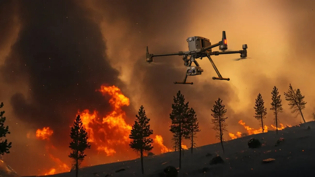
For large infrastructure, complex terrain and high-value 3D capture, the Matrice 400 paired with Zenmuse L3 moves the workflow beyond standard photogrammetry. Matrice 400 is DJI’s long-endurance flagship enterprise platform, suitable for mapping, AEC, power inspection and emergency response. When paired with Zenmuse L3, it supports advanced LiDAR point cloud capture for projects where vegetation, complex geometry or large coverage areas make standard image-only mapping less suitable.
Zenmuse L3 combines long-range LiDAR, dual high-resolution RGB mapping cameras and a high-precision positioning system in a single payload. For Irish survey and infrastructure teams, this combination is relevant for rail corridors, road cuttings, quarries, forestry boundaries, flood defence works, transmission corridors, industrial plants and uneven terrain where a dense point cloud is more useful than a simple 2D map.
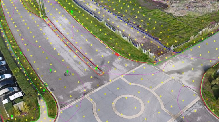
How an RTK Drone Mapping Workflow Works
A well-run RTK mapping project should be planned before the drone leaves the case. Accuracy depends on flight planning, camera settings, control point strategy, GNSS correction quality and processing settings.
- Define the deliverable. Decide whether the client needs an orthomosaic, DSM, DTM, 3D mesh, point cloud, stockpile report, contour output or CAD/GIS-ready file.
- Choose the coordinate system. Set the project coordinate reference correctly at the start so exported deliverables can be used by engineers and designers.
- Plan RTK correction. Decide whether to use a network correction service, local base station or another approved survey workflow.
- Set control and check points. Use ground control and check points where accuracy requirements, contract terms or site complexity demand verification.
- Fly with consistent settings. Use appropriate altitude, overlap, shutter settings and flight speed for the required ground sample distance and site conditions.
- Process in mapping software. Import images, RTK data and control data into suitable software such as DJI Terra for 2D/3D reconstruction or LiDAR processing.
- Verify before delivery. Check residuals, control/check point errors, surface quality and alignment against known references before issuing survey outputs.
Where RTK Drone Mapping Helps in Ireland
Construction and earthworks
RTK drone mapping supports progress records, site logistics, cut-and-fill reporting, haul road planning and pre-pour documentation. It helps project teams compare planned works with actual site conditions.
Roads and bridges
Surveyors can capture approach roads, bridge decks, embankments, drainage channels and adjacent land without placing crews in high-risk traffic or difficult access areas.
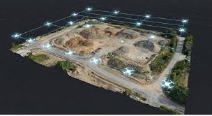
Quarries and aggregates
Repeat RTK drone surveys help measure stockpiles, benches, haul routes and extraction areas. Consistent positioning is critical when comparing volumes across reporting periods.
Utilities and renewables
RTK-supported mapping can help with solar farm layouts, substation records, wind farm access roads, transmission corridors and asset documentation for engineering teams.
Common Accuracy Mistakes to Avoid
RTK mapping improves positional accuracy, but it does not make every dataset survey-grade automatically. Surveyors and drone teams should avoid these common mistakes:
- Flying without a clear accuracy target. A marketing map and an engineering survey are not the same deliverable.
- Ignoring coordinate systems. Incorrect coordinate settings can cause a good dataset to appear wrong when imported into CAD or GIS software.
- Using no check points. Without independent check points, it is difficult to prove that the final output meets the project requirement.
- Poor image overlap. RTK positioning will not fix weak photogrammetry geometry caused by insufficient overlap or poor flight planning.
- Flying in unsuitable conditions. Wind, low light, rain, moving machinery, reflective surfaces and poor texture can all affect data quality.
- Overstating accuracy. Accuracy should be verified and reported honestly rather than assumed from the equipment specification alone.
RTK Mapping vs Standard Drone Mapping
Standard drone mapping can still be useful for general site photography, marketing visuals and broad progress communication. However, when the output needs to be measured, compared or integrated into engineering workflows, RTK mapping is usually the stronger option.
For an Irish construction company, a standard drone map might be enough to show a client how a site is progressing. For a surveyor preparing volume reports, road alignment records or repeatable site models, RTK data and proper verification become far more important. The difference is not just image quality. It is whether the data can support decisions.
Which DJI RTK Setup Should Irish Surveyors Choose?
For compact, frequent mapping work, the DJI Matrice 4E with RTK positioning and a sensible ground control strategy is the most practical starting point. It suits surveyors who need fast deployment, accurate image capture and repeatable mapping across construction, land survey and infrastructure jobs.
For larger corridors, complex terrain, vegetation penetration requirements or advanced point cloud work, the DJI Matrice 400 with Zenmuse L3 is the more capable enterprise setup. It is better suited to organisations that need LiDAR-grade datasets, longer endurance and a flexible payload platform for demanding work.
For positioning support, the D-RTK 3 Multifunctional Station gives teams more control over RTK workflows, especially on sites where relying only on external correction networks may not be ideal. DJI Terra then supports the processing side by handling 2D reconstruction, 3D reconstruction and LiDAR point cloud workflows.
Final Takeaway
RTK drone mapping matters because survey work depends on reliable data, not just impressive aerial images. For Irish surveyors, the right RTK workflow can reduce time on site, improve repeatability, support safer data capture and create mapping outputs that fit into real engineering, construction and infrastructure workflows.
For most Irish mapping teams, the practical choice is to use DJI Matrice 4E for regular RTK photogrammetry, D-RTK 3 for positioning support, DJI Terra for processing, and Matrice 400 with Zenmuse L3 where large-scale LiDAR or complex infrastructure capture is required.

Leave a comment