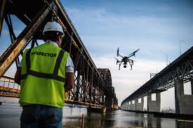
For Irish county councils, civil engineering firms, contractors, utilities and infrastructure owners, the value is practical. A drone can document the same bridge elevation or road section again and again, from similar angles and heights, so teams can compare change over time. It can also capture areas that are awkward or unsafe to view from the ground, including bridge bearings, parapets, piers, cable zones, retaining walls, drainage features, steep embankments and works taking place beside live traffic.
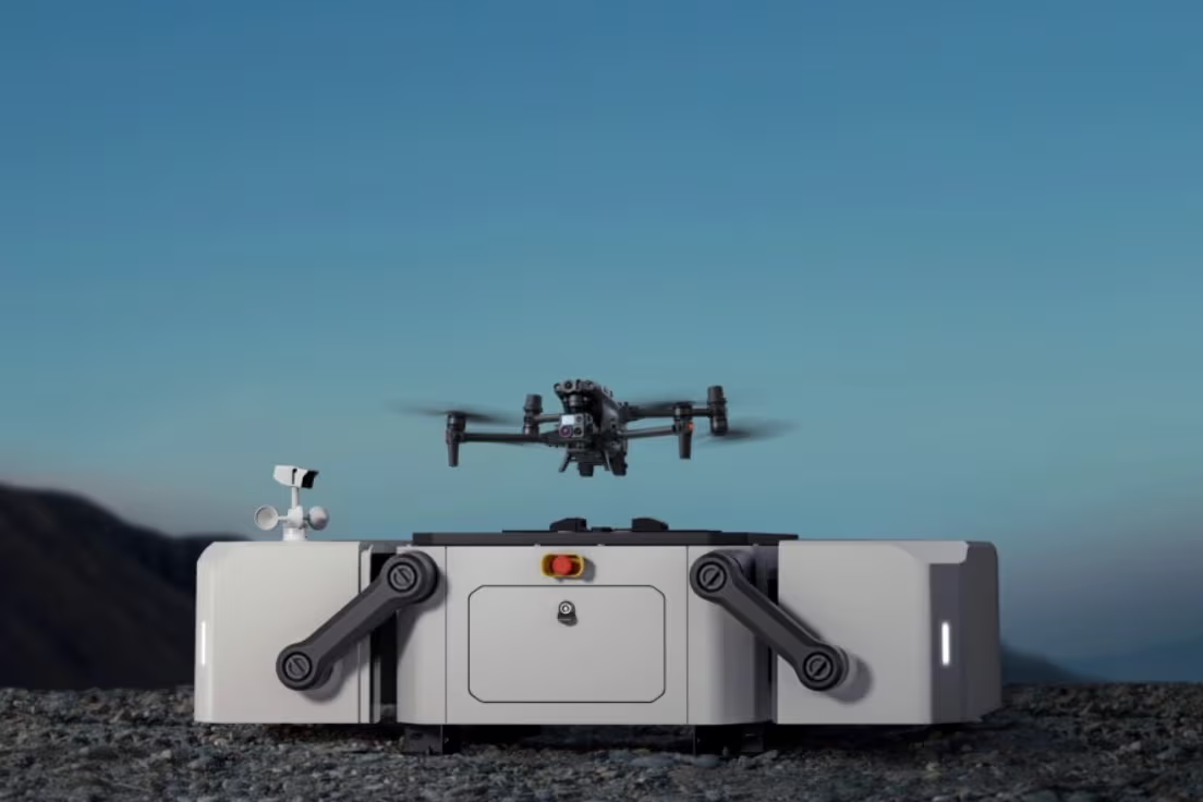
The most useful results come from choosing the right aircraft and sensor for the task. A compact mapping drone is suitable for routine visual surveys and 3D modelling. A larger multi-payload platform is better for complex bridge structures, long-range inspections and LiDAR work. A docked drone system is suitable for repeat inspections where an organisation wants remote, scheduled flights from a depot, yard or fixed infrastructure location.
Why bridge and road inspections are difficult
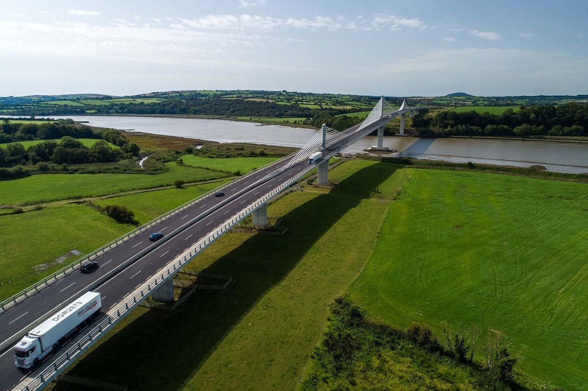
Road and bridge assets are rarely simple. A bridge inspection may require a team to look at the deck, underside, abutments, expansion joints, piers, cables, corrosion points, water damage, concrete cracking, spalling and drainage outlets. A road inspection may involve pavement condition, road markings, signage, lane closures, retaining walls, barriers, lighting columns, slopes, drainage channels, culverts and adjoining utilities.
In Ireland, the challenge is often made worse by weather, coastal exposure, narrow rural access, traffic management requirements and the cost of repeatedly sending crews to the same site. Drone inspection helps because data can be gathered from above, below and around an asset, while keeping people away from many of the most exposed positions.
Safety
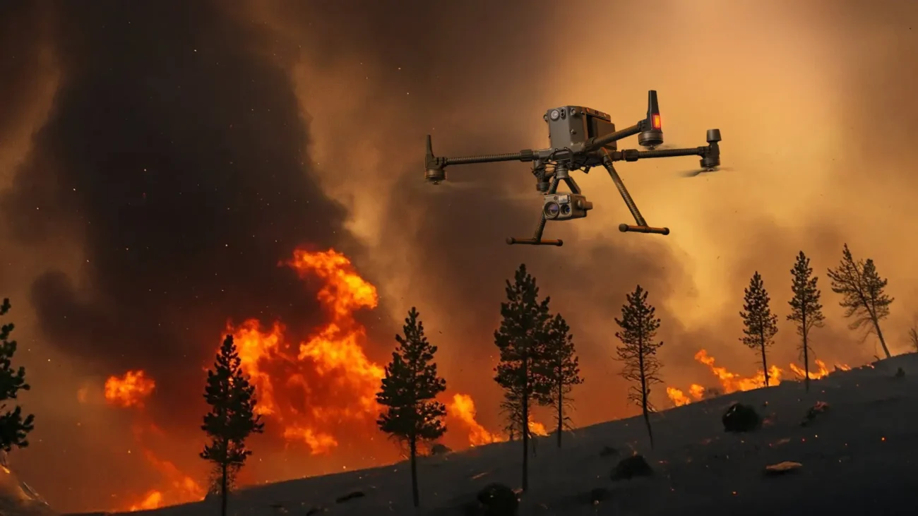
Drones reduce the need for crews to work at height, stand near live traffic or rely on elevated platforms for every visual check. They are especially useful for first-pass inspection before deciding whether rope access, under-bridge units or lane closures are required.
Speed
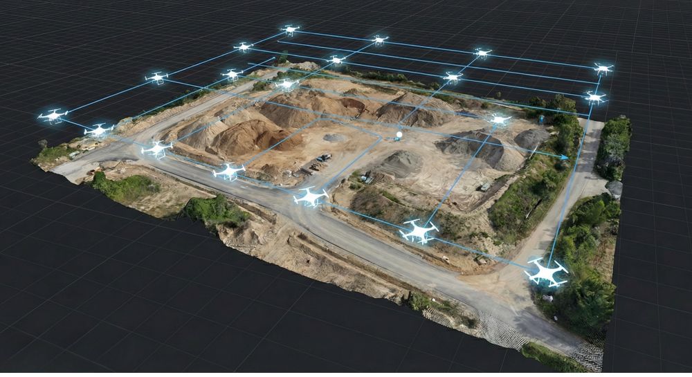
A planned flight can cover large bridge faces, junctions, road sections and embankments quickly. Automated routes make repeat inspections more consistent than purely manual photo capture.
Evidence
High-resolution imagery, thermal data, 3D models and LiDAR point clouds create a permanent visual record for engineering review, maintenance planning and contractor communication.
Access
Hard-to-reach bridge components, drainage outlets, culverts, slopes and underside zones can be documented from angles that are difficult or expensive to capture from the ground.
The latest DJI Enterprise equipment for this work
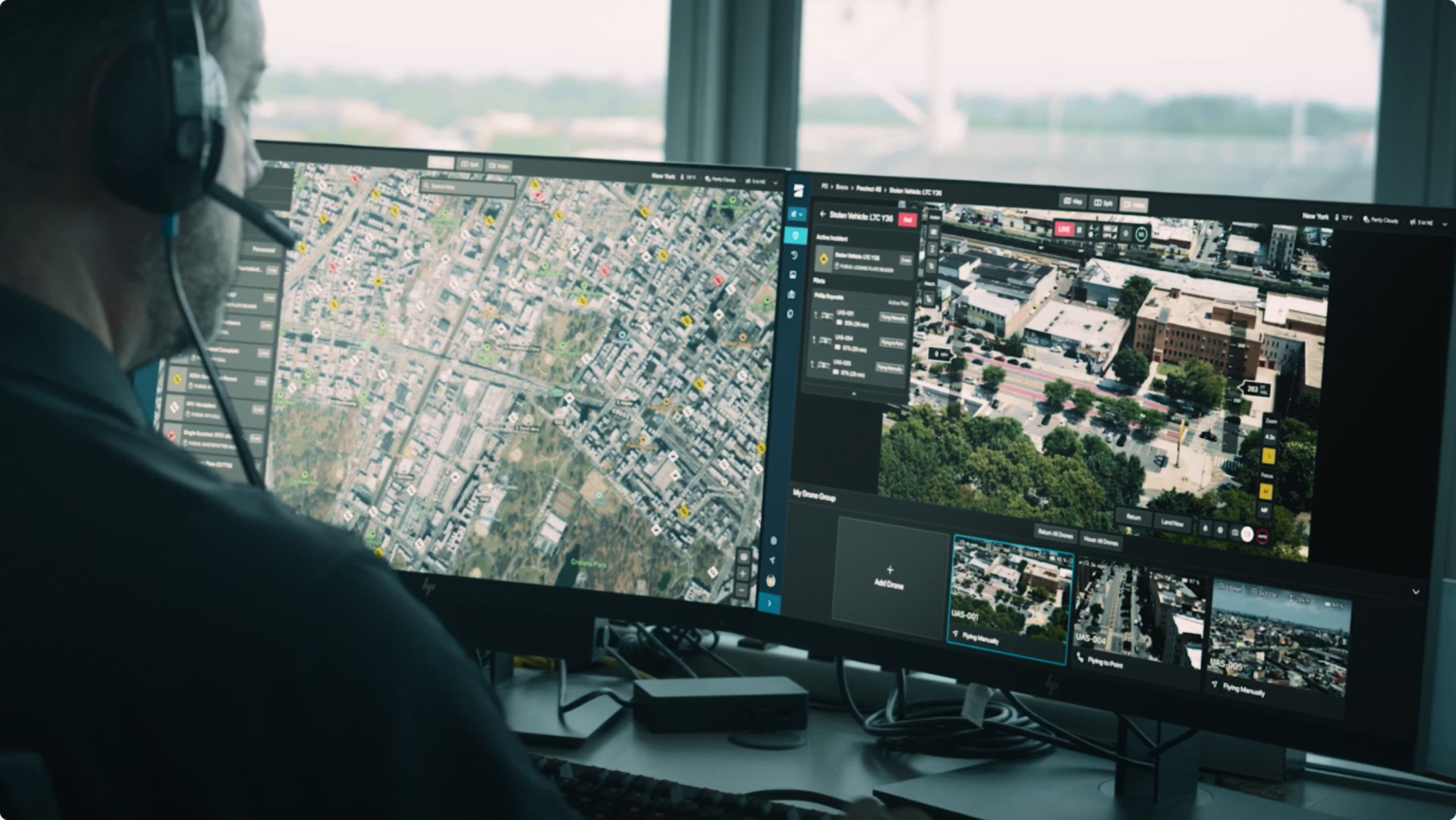
For a modern Irish bridge or road inspection programme, the drone should be selected around the expected deliverable. A condition report needs detailed visual imagery. A digital twin needs accurate photogrammetry or LiDAR. A safety or incident-response task may need thermal awareness. Routine road corridor monitoring may suit a docked drone system.
| Equipment | Best use in bridge and road inspection | Why it matters |
|---|---|---|
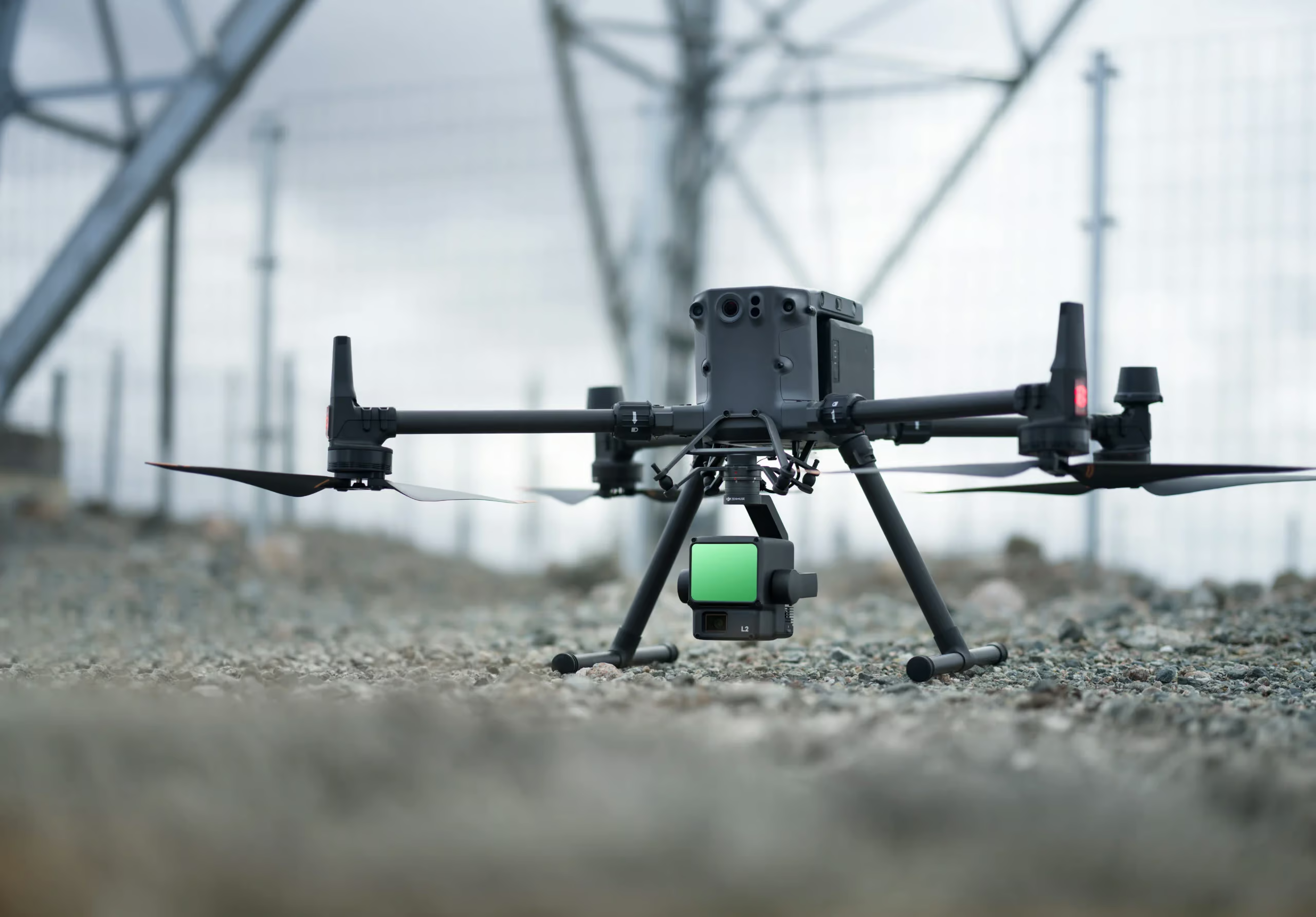
| DJI Matrice 4E | Portable bridge visual inspection, road corridor mapping, 2D orthomosaics, 3D models and repeatable asset documentation. | Compact enterprise platform with a 4/3-inch 20 MP wide-angle camera, 48 MP medium tele and tele cameras, RTK-enabled workflows and an 1800 m laser rangefinder for measurement-supported inspection work. |
| DJI Matrice 4T | Inspection tasks where thermal awareness, low-light work, public safety support or incident monitoring is required. | Useful for spotting heat anomalies, checking night-time road incidents, supporting emergency response and providing a compact multi-sensor view of assets and surroundings. |
| DJI Dock 3 with Matrice 4D / 4TD | Scheduled road corridor patrols, remote infrastructure monitoring, depot-based operations and repeat inspections after storms or incidents. | Dock 3 enables 24/7 remote operations and supports Matrice 4D/4TD drones. Matrice 4TD adds thermal imaging for infrastructure, safety and night operations. |
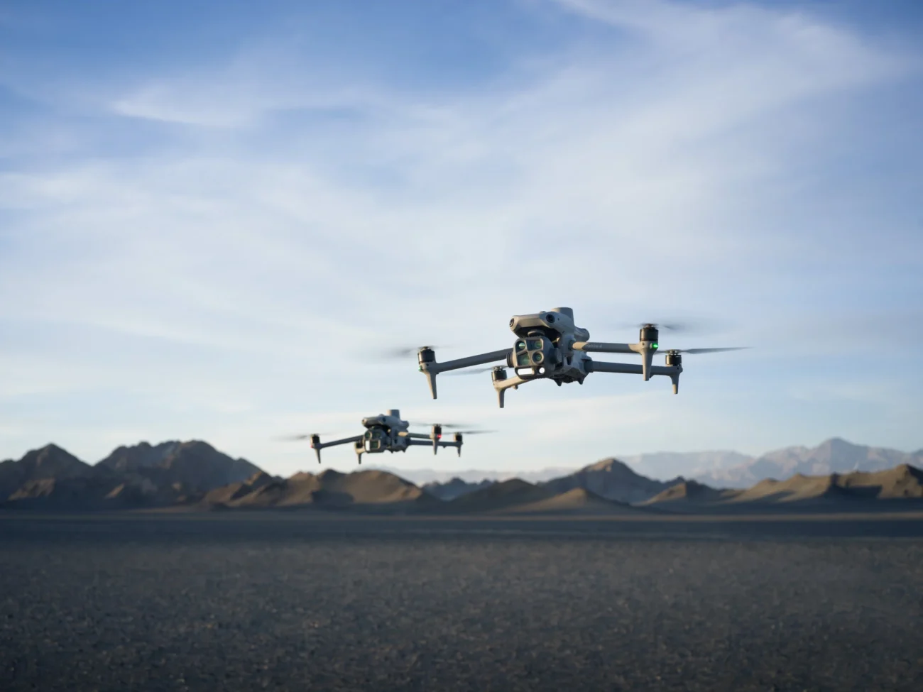
| DJI Matrice 400 | Complex structures, long-span bridges, larger infrastructure sites and multi-payload work. | Designed for demanding enterprise operations with up to 59 minutes of flight time, up to 6 kg payload capacity, IP55 protection and compatibility with Zenmuse H30 Series, Zenmuse L3, Zenmuse S1, Zenmuse V1 and other payload options. |
| Zenmuse L3 | Bridge digital twins, LiDAR point clouds, terrain modelling around roads, embankments, cuttings and complex structures. | Provides LiDAR point cloud capture for accurate 3D representation where photogrammetry alone may struggle, especially on repetitive surfaces, vegetation-adjacent structures or complex geometry. |
| Zenmuse H30 Series | Long-range visual inspection, detail capture from safe stand-off distances and thermal-capable workflows when using H30T. | Useful when teams need detailed situational awareness without flying too close to traffic, cables, confined spaces or sensitive infrastructure. |
How drones are used for bridge inspection
A bridge inspection flight usually starts before the drone leaves the ground. The team reviews drawings, previous inspection reports, traffic management constraints, nearby airspace, take-off and landing options, obstacles, weather and the specific components that need to be documented.
1. Pre-survey planning
The inspector defines the asset sections that need evidence: deck surface, soffit, piers, abutments, bearings, parapets, joints, cables, retaining walls, scour zones and access routes. In many Irish projects, the aim is not simply to capture attractive aerial photos. The aim is to create a repeatable inspection record that can be compared against earlier data.
2. Visual inspection from safe stand-off distances
Using a Matrice 4E, Matrice 4T or Matrice 400 with the right payload, the pilot can capture high-resolution imagery of visible defects such as cracking, staining, corrosion, impact marks, exposed reinforcement, vegetation growth, failed drainage points and surface deterioration. Tele cameras and zoom-capable payloads allow the drone to remain at a safer distance while still recording details for later review.
3. Under-deck and difficult-angle documentation
Some bridge areas are hard to see from ground level. Drones help capture oblique views of the underside, pier faces, bearing shelves and hidden drainage outlets. This is especially useful for deciding where a more detailed hands-on inspection is justified. The drone can act as a fast screening tool, reducing the amount of time crews spend in exposed or difficult positions.
4. 3D modelling and digital twins
Where a bridge owner needs a measurable model, photogrammetry and LiDAR can be combined. DJI Terra can be used to process imagery and point cloud data, while DJI Modify can support model cleaning and refinement. For larger bridge assets, Matrice 400 with Zenmuse L3 is the current high-end option for point cloud capture, while Matrice 4E can support efficient photogrammetry and visual modelling for smaller or more portable jobs.

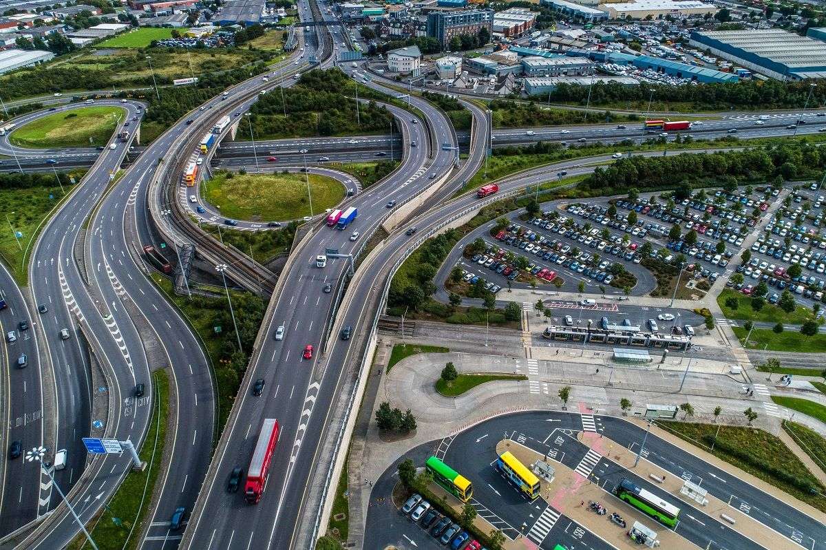
How drones are used for road inspection
Road inspection is broader than checking the surface of the carriageway. For many Irish projects, drones are useful because they capture the road and the surrounding context together. This is important for maintenance planning, drainage investigations, traffic management reviews and construction progress documentation.
1. Road surface and asset recording
Drones can document road markings, lane layouts, kerbs, barriers, signs, lighting columns, footways, cycleways and temporary works. For defects such as potholes, cracking or rutting, the drone is most useful as part of a wider inspection workflow: it identifies areas that need closer review and provides a location-based record for maintenance planning.
2. Drainage and flood-risk checks
Drainage is a recurring issue on Irish roads, especially after heavy rainfall. Drone imagery can show ponding, blocked channels, damaged outfalls, culvert approaches, erosion and surface water movement across adjoining land. Thermal or low-light sensors can support certain incident and emergency tasks, while visual mapping can help engineers see how water interacts with the road corridor.
3. Embankments, cuttings and retaining walls
Roadside slopes are often difficult to inspect from the carriageway. A drone can fly controlled routes along embankments, cuttings and retaining structures to look for slippage, vegetation changes, erosion, cracking, rockfall risk or blocked drainage. LiDAR can be useful where vegetation and geometry make standard imagery less complete.
4. Construction-stage monitoring
For road upgrades, bridge works and active construction sites, aerial data helps teams track progress, check temporary traffic management, document earthworks, compare as-built conditions and communicate status to stakeholders. Weekly or fortnightly drone records can reduce disputes because everyone is looking at the same visual evidence.
Recommended workflows for Irish projects
The best drone workflow depends on whether the client needs a simple visual report, measurable mapping data, a digital twin, emergency situational awareness or repeat scheduled monitoring. The following workflows are practical starting points.
| Project type | Recommended DJI setup | Deliverables |
|---|---|---|
| Small bridge visual inspection | Matrice 4E or Matrice 4T | High-resolution inspection photos, annotated defect images, repeatable viewpoints, asset condition report. |
| Large bridge or viaduct inspection | Matrice 400 with Zenmuse H30 Series and/or Zenmuse L3 | Detailed imagery, stand-off inspection views, LiDAR point cloud, 3D model, maintenance planning evidence. |
| Road corridor mapping | Matrice 4E with RTK workflow | Orthomosaic, 3D model, road asset record, drainage and roadside context imagery. |
| Remote monitoring after storms or incidents | DJI Dock 3 with Matrice 4D or Matrice 4TD | Scheduled flights, rapid visual checks, thermal-assisted awareness with Matrice 4TD, cloud-based mission review. |
| Bridge digital twin and BIM support | Matrice 400 with Zenmuse L3, supported by DJI Terra and DJI Modify | Point cloud, 3D mesh, structural context model, comparison dataset for future inspections. |
What inspection teams should capture
A strong bridge or road inspection is not just a collection of drone photographs. It should be structured so engineers can find the right image, understand where it was captured and compare it with future inspections. Before flying, agree the naming convention, asset references, route plan and reporting format.
- Overview images: show the whole bridge, road section or junction layout for context.
- Component-level images: focus on piers, deck edges, joints, parapets, bearings, cables, barriers, retaining walls and drainage features.
- Defect close-ups: capture cracks, staining, corrosion, spalling, blocked drainage, impact marks and surface failures.
- Mapping data: capture nadir and oblique imagery for orthomosaics, 3D models or point clouds.
- Repeatable routes: save mission paths where routine inspections will be repeated over time.
- Site safety context: record traffic layout, restricted areas, temporary works and access limitations.

Compliance and safety in Ireland
Irish drone inspection work should be planned around the Irish Aviation Authority rules, EASA operating categories, airspace restrictions, site permissions, insurance, data handling and public safety. Many bridge and road projects take place near traffic, people, railways, utilities, controlled airspace or urban areas, so the operation may require more than a basic open-category approach.
For complex work, organisations should confirm that the operator has the correct registration, pilot competency, insurance and operational authorisation where required. Where flights are close to live roads, public areas or controlled sites, the drone plan should be coordinated with the client, traffic management team and any other relevant stakeholders.
When drones should not be the only inspection method
Drones are powerful inspection tools, but they do not replace every form of engineering assessment. Some defects require hands-on testing, hammer sounding, material sampling, structural analysis, specialist access or destructive investigation. The strongest workflow uses drones to improve safety, prioritise risk, capture measurable evidence and guide follow-up inspections.
In practice, a drone may identify corrosion staining under a bridge deck, while an engineer then decides whether a closer inspection is needed. A drone may produce a point cloud of an embankment, while a geotechnical specialist interprets movement risk. The drone provides the data; the professional team makes the judgement.
How IRISH Drone can support bridge and road inspection projects
IRISH Drone can help infrastructure teams select the right DJI Enterprise platform for bridge and road inspection work in Ireland. For compact survey and mapping tasks, Matrice 4E is often the most efficient starting point. For larger structures, complex access, long inspection windows or multi-payload work, Matrice 400 with the appropriate payload gives more capability. For repeatable remote inspection, Dock 3 with Matrice 4D or 4TD can support scheduled operations from a fixed or mobile deployment point.
Plan the right drone workflow before buying equipment
The best bridge or road inspection setup depends on the asset, access constraints, required accuracy, reporting format and Irish operating permissions. Start by defining the deliverable, then choose the aircraft, sensor and software workflow that can produce it safely and repeatedly.
FAQ
Can drones inspect the underside of bridges?
Yes, drones can capture underside and oblique views of many bridge components, including soffits, piers, bearings and drainage points. Access, lighting, GNSS conditions, obstacles and flight permissions still need to be assessed before the flight.
Which DJI drone is best for road corridor mapping?
For many Irish road corridor projects, DJI Matrice 4E is a strong choice because it is portable, RTK-ready and built for mapping and visual inspection. Larger corridors or more complex 3D requirements may justify Matrice 400 with a suitable payload.
When is LiDAR useful for bridge and road inspection?
LiDAR is useful when the project requires accurate 3D geometry, point clouds, digital twins, embankment modelling, vegetation-adjacent terrain capture or measurable structural context. Zenmuse L3 on Matrice 400 is suited to high-end LiDAR workflows.
Can drones reduce road closures?
Drones can reduce the amount of manual access needed for visual documentation, but they do not eliminate every traffic management requirement. The final plan depends on the road environment, proximity to people and vehicles, airspace, permissions and the inspection method.
Are docked drones useful for infrastructure inspection?
Yes. DJI Dock 3 with Matrice 4D or 4TD can support scheduled and remote inspections for fixed assets, depots, road corridors and sites that need frequent checks. It is most useful when repeatability and rapid deployment are more important than one-off manual flights.
Leave a comment