Ireland Transport Infrastructure Drone Guide
For Irish engineering teams, transport contractors, local authorities and infrastructure asset owners, the best drone is not simply the newest aircraft. It is the platform that can safely collect clear, repeatable and decision-ready data around live roads, bridges, rail corridors, culverts, viaducts and difficult access structures.
Quick Recommendation
Best overall enterprise platform: DJI Matrice 400 with Zenmuse H30T or H30 for detailed inspection from a safe stand-off distance.
Best compact mapping option: DJI Matrice 4E for roadworks progress, bridge approach mapping, construction records and geospatial survey work.
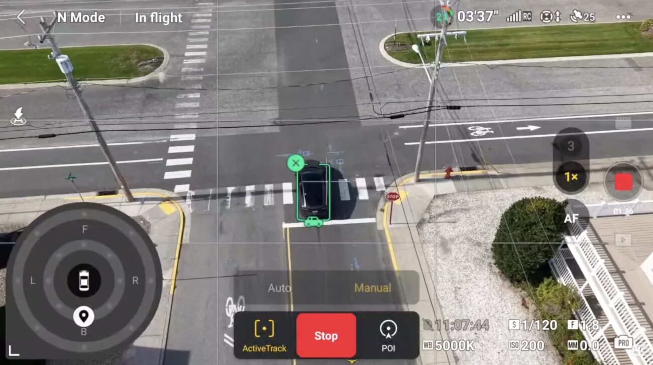
Best compact inspection and thermal option: DJI Matrice 4T for faster visual and thermal checks where portability matters.
Best remote monitoring route: DJI Dock 3 with Matrice 4D or Matrice 4TD for repeatable scheduled missions where the site and permissions support an automated workflow.
Road, bridge and rail inspection is not one simple use case. A road contractor may need orthomosaics and progress records. A bridge engineer may need high-zoom images of bearings, joints, piers, cracks and corrosion. A rail-adjacent asset owner may need corridor mapping, embankment monitoring or repeat checks near restricted infrastructure. Because the deliverables are different, the right DJI Enterprise setup should be chosen around the inspection objective, not around a generic “best drone” label.
Why Transport Infrastructure Teams Use Drones
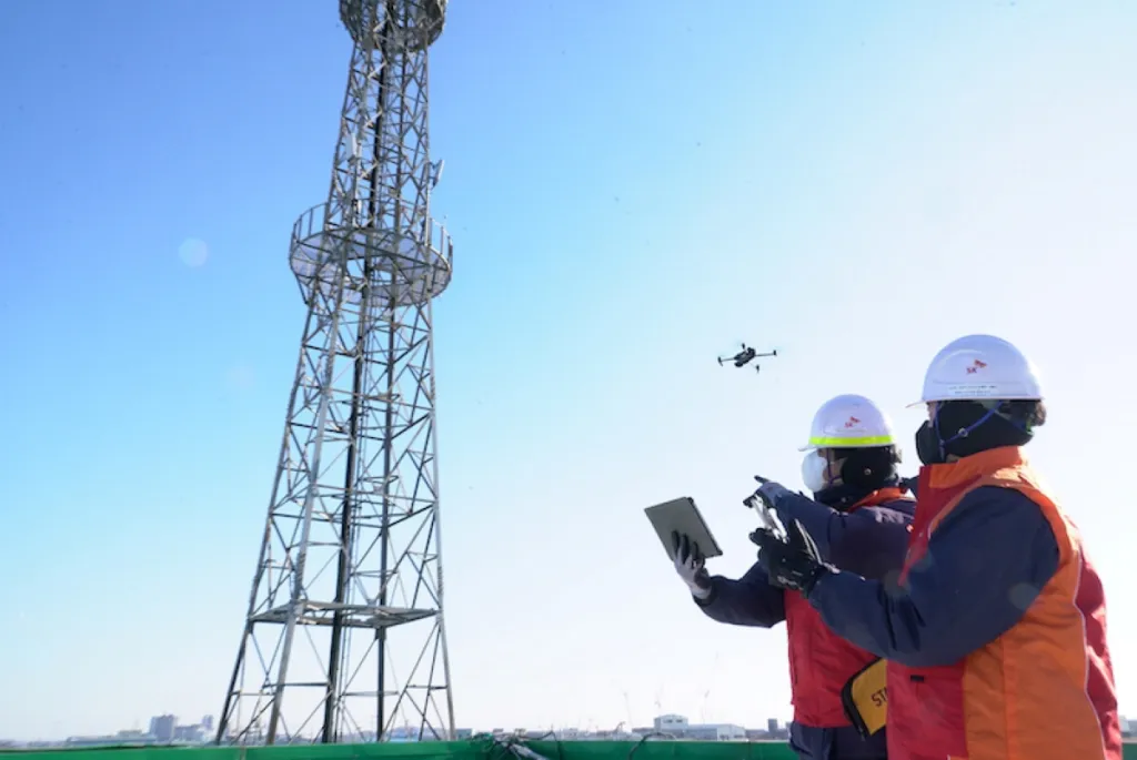
Traditional inspection often depends on lane closures, mobile elevated work platforms, rope access, scaffolding, walking surveys, manual photography or working close to traffic and water. Drones do not replace qualified engineers, surveyors or inspectors, but they give those teams better evidence before they decide where people, traffic management or specialist access equipment are really needed.
Less Exposure to Risk
Drones can capture visible defects before teams work near live traffic, bridge edges, steep embankments, water, rail corridors or difficult access zones.
Faster Condition Records
Repeatable imagery, zoom inspection, thermal data, mapping outputs and LiDAR point clouds help build a clearer history of the asset over time.
Better Maintenance Decisions
Engineers can compare outputs, identify change, prioritise repairs and communicate issues more clearly with clients, councils and contractors.
Best DJI Drone Setups by Inspection Scenario
| Inspection Scenario | Best DJI Setup | Why It Fits | Typical Irish Use |
|---|---|---|---|
| Major bridge inspection | Matrice 400 + Zenmuse H30T or H30 | Strong flagship platform for stand-off inspection, high-zoom imagery, thermal support and flexible payload workflows. | Bridge decks, piers, bearings, expansion joints, river crossings and viaducts. |
| Road corridor mapping | Matrice 4E or Matrice 400 + Zenmuse L3 | Matrice 4E suits compact photogrammetry and progress mapping; L3 supports advanced LiDAR and 3D corridor records. | Road upgrades, bypass works, junction improvements, earthworks and contractor reporting. |
| Rail corridor and embankment inspection | Matrice 400 + H30T / L3, subject to approval | Useful for high-detail visual records, thermal checks and 3D corridor context, but operational planning is critical near active rail assets. | Embankments, drainage, retaining structures, vegetation risk, access routes and rail-adjacent assets. |
| Rapid local authority inspection | Matrice 4T | Portable multi-sensor option for fast visual checks, thermal context and incident response support. | Storm damage, blocked culverts, temporary works, road safety checks and emergency call-outs. |
| Repeat fixed-site monitoring | DJI Dock 3 + Matrice 4D / 4TD | Best for scheduled missions where a depot, port, road project, construction site or industrial transport asset needs recurring visual records. | Long-term roadworks, industrial roads, fixed yards, transport compounds and selected remote assets. |
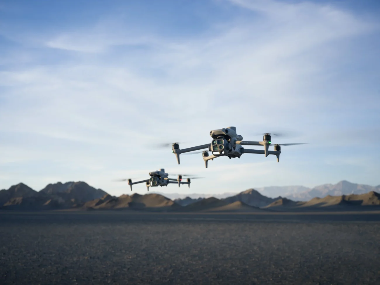
1. Best Overall Drone: DJI Matrice 400 for Demanding Infrastructure Inspection
DJI Matrice 400 is the strongest overall recommendation for serious transport infrastructure inspection because it is designed as a flagship enterprise platform rather than a small portable survey drone. For bridge, viaduct, road corridor and rail-adjacent work, that matters because the aircraft may need to carry high-end payloads, maintain stable flight, capture long-range details and operate in more demanding environments.
The main advantage is flexibility. One project may need the Zenmuse H30T for zoom and thermal inspection. Another may need Zenmuse H30 for detailed visible-light inspection without the thermal requirement. A corridor or engineering survey may justify Zenmuse L3 for LiDAR point clouds and 3D data. Matrice 400 gives an Irish inspection team more room to match the platform to the job instead of forcing every task through one sensor.
Best fit: larger bridges, complex infrastructure assets, multi-day engineering projects, coastal road structures, transport corridors, high-value industrial access roads and inspection work where the payload requirement is more important than ultra-fast portability.
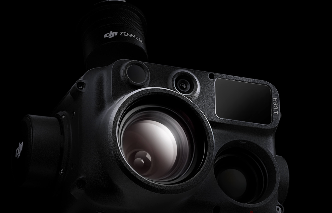
2. Best Payload for Bridge Defects: Zenmuse H30T or H30
For visual inspection, the payload is often more important than the drone body. Bridge inspectors and civil engineers need to see details clearly: cracks, staining, spalling concrete, corrosion, missing fixings, blocked drainage, damaged parapets, movement around joints or early signs of water ingress. A high-zoom payload helps the pilot maintain a safer stand-off distance while still collecting detailed records.
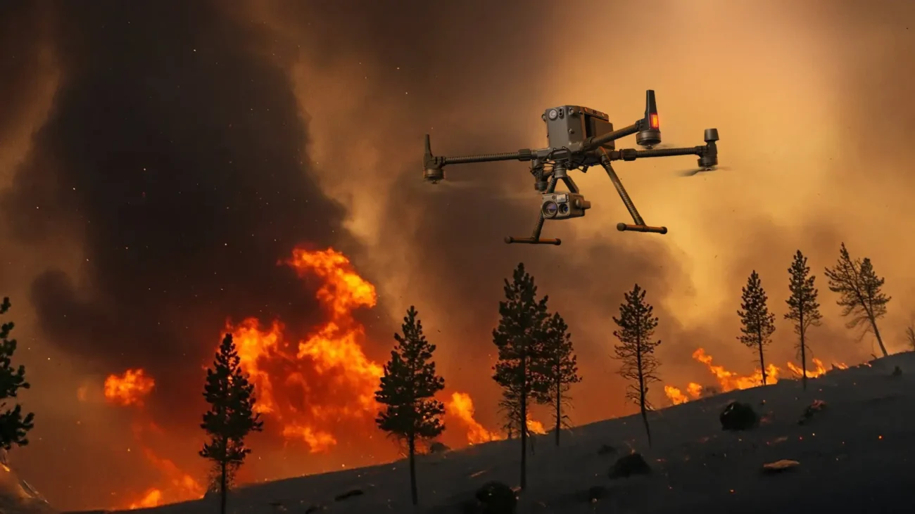
Zenmuse H30T is the stronger choice when the inspection needs thermal evidence as well as visual detail. That can be useful around electrical assets, fire response, heat anomalies, building services near transport infrastructure, or selected night and low-light support tasks. Zenmuse H30 is a practical option where the job is mainly visible-light inspection, zoom observation and range-supported documentation.
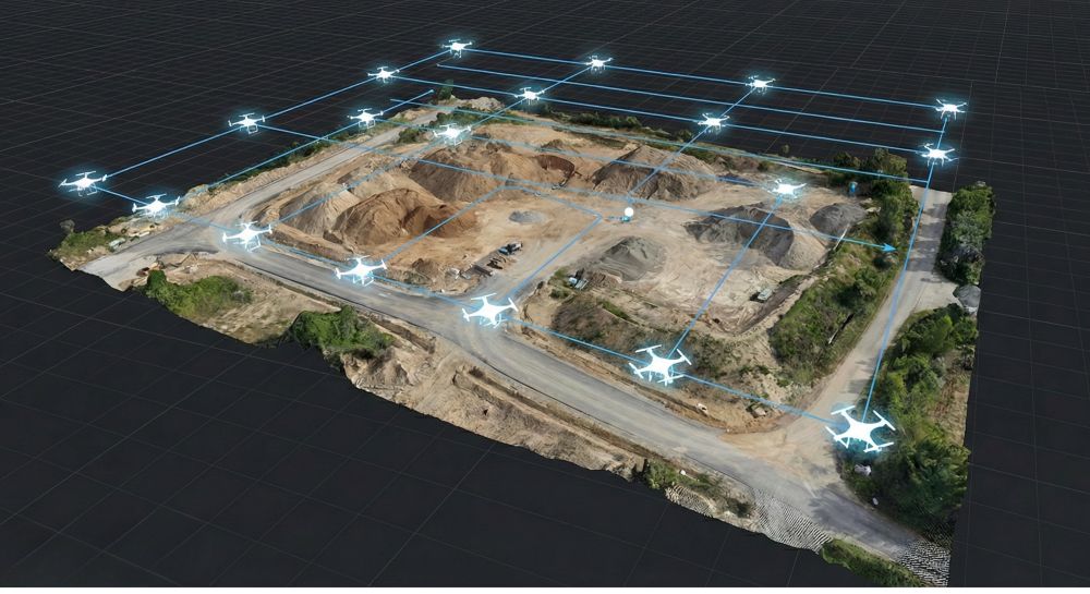
3. Best Compact Mapping Drone: DJI Matrice 4E
Not every transport job needs a large aircraft. For many roadworks, contractor updates, bridge approach mapping and smaller civil engineering sites, DJI Matrice 4E is a more practical choice. It is designed for geospatial work such as surveying, mapping, construction and mining, making it a strong option when the required deliverable is an orthomosaic, 3D model, progress map or site record.
Matrice 4E is especially useful for Irish contractors and survey teams who need regular mapping outputs without deploying a heavier multi-payload system. It is a better match when the priority is photogrammetry, site measurement, construction documentation and mapping efficiency rather than thermal inspection.
4. Best Compact Inspection Drone: DJI Matrice 4T
DJI Matrice 4T is the better compact choice when the job is inspection-led rather than mapping-led. It suits teams that need a portable aircraft for visual checks, thermal context, night support, emergency call-outs or rapid site assessment. In transport infrastructure, this can include quick checks after storms, local bridge inspections, culvert reviews, temporary traffic management areas, road-edge hazards or difficult-to-access structures.
The key decision is simple: choose Matrice 4E when mapping and survey deliverables are the priority; choose Matrice 4T when inspection, thermal context and response speed are the priority.
5. Best Advanced 3D Option: Matrice 400 with Zenmuse L3
For corridor projects, embankments, earthworks, flood-risk areas, coastal roads, retaining structures and rail-adjacent terrain, photographs alone may not be enough. Zenmuse L3 is the stronger option when the deliverable needs a LiDAR point cloud, terrain surface, 3D model, vegetation-aware corridor record or measurable engineering dataset.
LiDAR is particularly valuable where vegetation, uneven ground, shadows, poor texture or complex structure geometry make photogrammetry less reliable. For Irish infrastructure teams, this can support road design updates, railway corridor context, drainage planning, slope monitoring, coastal route documentation and asset-management records.
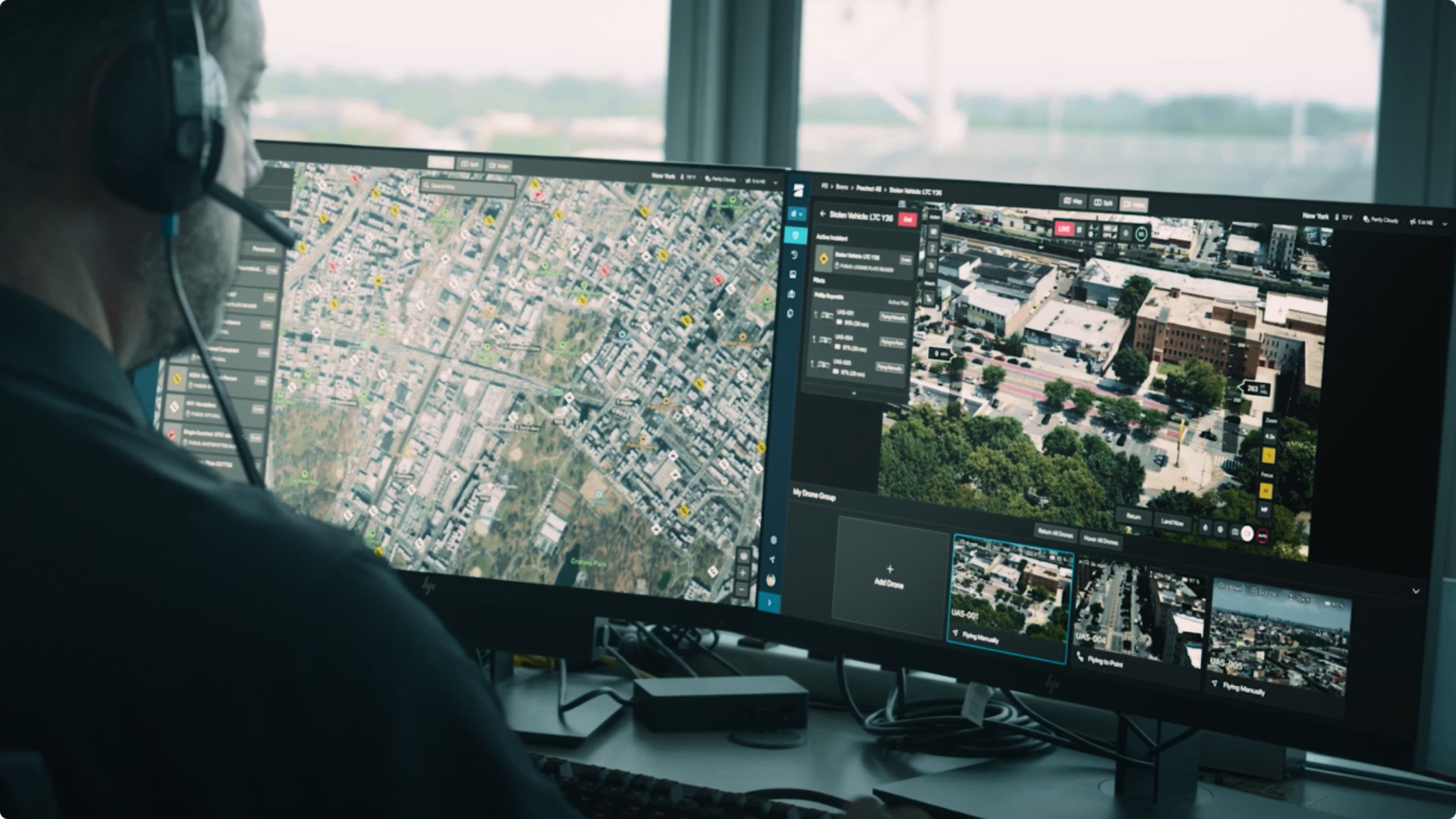
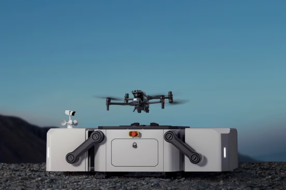
6. Best Remote Monitoring Setup: DJI Dock 3 with Matrice 4D or 4TD
For most inspection teams, a manually deployed drone is the right starting point. However, some sites need repeatable data from the same location, the same route and the same schedule. That is where DJI Dock 3 becomes relevant.
Dock 3 is not the best answer for every road, bridge or rail project. It is strongest where the business case is built around recurring missions: a long-term road project, a fixed transport depot, a port road network, an industrial access road, a quarry route, a logistics compound or a rail-adjacent site with approved procedures. In those cases, Dock 3 with Matrice 4D or Matrice 4TD can support a more consistent monitoring programme.
Recommended Workflow for Irish Road, Bridge and Rail Inspection
- Define the asset and decision: decide whether the output is for condition assessment, engineering review, mapping, emergency response, maintenance planning or contractor documentation.
- Choose the data type: visual zoom imagery, thermal images, orthomosaic, 3D model, LiDAR point cloud, defect table or repeat monitoring record.
- Select the platform: Matrice 400 for demanding multi-payload work, Matrice 4E for compact mapping, Matrice 4T for portable inspection, or Dock 3 for repeat remote operations.
- Plan the safety case: review traffic, people nearby, rail restrictions, water, bridges, wind, take-off location, emergency procedures, insurance and site permissions.
- Capture repeatable data: use consistent angles, flight paths, image overlap, camera settings, naming conventions and location references so future inspections can be compared.
- Review and deliver: check image sharpness, thermal settings, positional accuracy, coverage gaps and whether the output is usable by engineers and asset managers.
Common Mistakes to Avoid
- Buying the drone before defining the deliverable. A bridge defect report, road progress map and rail corridor LiDAR dataset require different equipment and workflows.
- Using thermal data without proper interpretation. Thermal images need context, correct settings and qualified review before they support engineering decisions.
- Ignoring site permissions. Transport infrastructure can involve roads, rail property, private land, public areas, restricted zones and sensitive operating environments.
- Collecting too much unstructured data. Hundreds of photos are not useful unless they are organised, labelled, georeferenced and turned into a clear report.
- Choosing automation too early. Dock 3 is powerful, but only where recurring missions, approval pathways, site design and operational responsibility are properly planned.
Irish Regulation and Operational Notes
Drone operations in Ireland should be planned under the Irish Aviation Authority and EASA framework. Any business using enterprise drones should check operator registration, remote pilot competency, airspace, UAS geographic zones, privacy, insurance, landowner permission and whether the mission falls into the Open or Specific category.
Road, bridge and rail inspection often happens near people, vehicles, infrastructure and controlled areas. More complex operations, night operations, BVLOS-style workflows or automated dock missions may require a stronger operational case and formal authorisation. The aircraft choice is only one part of the project; the permission pathway and operating procedure are just as important.
Practical rule: do not describe a drone inspection service as “simple” just because the aircraft is easy to fly. Around transport infrastructure, the real risk is usually the location, airspace, people nearby, vehicle movement, asset owner requirements and what happens if the mission has to stop.
Final Recommendation
For most serious road, bridge and rail inspection work in Ireland, DJI Matrice 400 is the strongest overall platform because it supports demanding payloads and complex infrastructure scenarios. Pair it with Zenmuse H30T or H30 when detailed visual inspection and safe stand-off observation are the priority. Add Zenmuse L3 when the project needs LiDAR, 3D corridor data or advanced mapping output.
For smaller teams and routine field work, Matrice 4E is the more practical compact mapping drone, while Matrice 4T is the more practical compact inspection and thermal drone. For repeatable fixed-site monitoring, Dock 3 with Matrice 4D or 4TD should be evaluated only when the site, approval pathway and business case support an automated workflow.
Need Help Choosing the Right Inspection Drone?
Irish Drone can help contractors, surveyors, engineering teams and asset owners choose the correct DJI Enterprise aircraft, payload, training route and data workflow for road, bridge and rail inspection projects in Ireland.
Contact Irish DroneFAQ
What is the best drone for bridge inspection in Ireland?
For demanding bridge inspection, DJI Matrice 400 with Zenmuse H30T or H30 is the strongest recommendation because it supports high-detail stand-off inspection and enterprise payload flexibility. For smaller local inspections, Matrice 4T can be a more portable option.
Is Matrice 4E or Matrice 4T better for road inspection?
Choose Matrice 4E when the priority is mapping, photogrammetry, roadworks progress or 3D site records. Choose Matrice 4T when the priority is visual inspection, thermal context, emergency response or fast asset checks.
Can drones inspect rail corridors in Ireland?
Yes, drones can support rail corridor and rail-adjacent inspection, but the operation must be carefully planned with the correct permissions, safety procedures and coordination with the relevant asset owner. Do not fly near active rail infrastructure without proper authorisation.
When should I use LiDAR for transport infrastructure inspection?
Use LiDAR when the deliverable needs 3D geometry, point clouds, terrain surfaces, embankment data, vegetation-aware corridor records or measurable engineering outputs. Zenmuse L3 with Matrice 400 is the current high-end DJI Enterprise route for this type of work.
Is DJI Dock 3 suitable for road, bridge or rail monitoring?
Dock 3 can be suitable for repeat fixed-site monitoring, such as long-term roadworks, transport compounds, industrial roads or selected rail-adjacent assets. It should be assessed carefully because automated operations depend on site design, approval pathway, connectivity, maintenance and operational responsibility.
Recommended Internal Links
Source Notes for Editors
Technical statements in this article are based on DJI Enterprise product information for Matrice 400, Matrice 4 Series, Zenmuse H30 Series, Zenmuse L3 and DJI Dock 3. Before publishing pricing, availability or detailed technical claims, confirm against the latest DJI Enterprise datasheets and Irish Drone product pages.
This article is informational only and is not aviation, engineering or legal advice. Always confirm the latest IAA / EASA requirements and complete a site-specific risk assessment before operation.
Leave a comment