A practical guide for Irish surveyors, contractors, utilities, renewable energy teams and asset owners who need drone data that can be measured, repeated and used in real decisions.
Quick answer
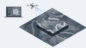
Good drone data collection is not just about taking aerial photos. For professional work in Ireland, the workflow should start with the required deliverable: a map, point cloud, inspection record, thermal finding, progress report or asset history. Once the deliverable is clear, the correct drone, payload, flight plan, processing software and reporting structure become much easier to choose.
Recommended DJI setup by data collection task
| Task | Best-fit DJI setup | Typical deliverable | Irish use case |
|---|---|---|---|
| Survey-grade mapping and LiDAR | DJI Matrice 400 + Zenmuse L3 | Point cloud, terrain model, orthomosaic, contours, stockpile or corridor data | Quarries, earthworks, road schemes, large construction sites, infrastructure corridors |
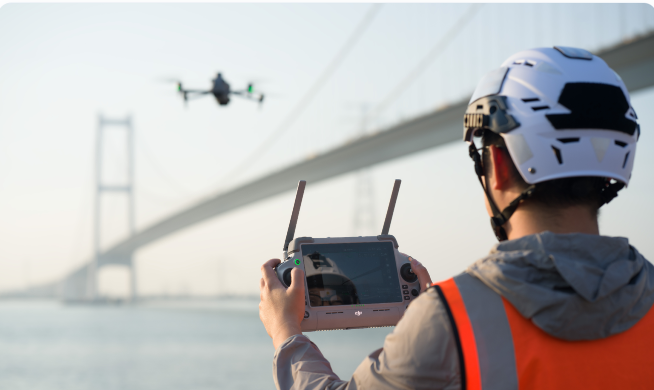
| Compact RGB mapping | DJI Matrice 4E | 2D orthomosaic, 3D model, construction progress capture, roof or site survey image set | Smaller sites, building surveys, planning support, single-pilot mapping work |
| Thermal and visual inspection | Matrice 400 + Zenmuse H30T, or Matrice 4T for smaller teams | Zoom imagery, thermal evidence, defect log, location reference, maintenance priority | Solar PV, wind assets, powerlines, roofs, facades, industrial plant and emergency response |
| Repeat remote data collection | DJI Dock 3 with Matrice 4D / 4TD and FlightHub 2 | Scheduled site records, recurring inspection imagery, remote progress monitoring | Industrial sites, ports, logistics yards, utilities, solar farms and security-led monitoring |
Why drone data collection matters in Ireland
Irish companies are using drones because many sites are difficult, slow or risky to measure from the ground. A quarry may need regular volume calculations. A contractor may need weekly progress records. A solar operator may need thermal evidence of panel faults. A building owner may need roof or facade documentation before repairs. In each case, the value is not the drone flight itself. The value is the data that helps a team make a faster and better decision.
The problem is that many drone projects stop at “nice aerial imagery”. That is not enough for surveying, inspection or asset management. A useful drone programme needs consistent planning, repeatable capture, clear file naming, accurate georeferencing, controlled processing and a report that the client can understand.
Surveying
The main question is accuracy, coverage and deliverable format. Teams need outputs that can support engineering, planning, measurement and site progress decisions.
Inspection
The main question is evidence. Teams need a safe way to document defects, temperature anomalies, access risks and changes over time.
Asset management
The main question is repeatability. Data must be stored against asset IDs, dates, locations and maintenance actions so that the record improves each year.
Start with the deliverable, not the drone
Before choosing a drone, define what the final output must do. This prevents the common mistake of buying a powerful aircraft but collecting data that does not match the client’s reporting needs.
- For mapping: decide whether the client needs an orthomosaic, 3D model, CAD-ready data, point cloud, contours, stockpile measurement or progress comparison.
- For inspection: decide whether the client needs zoom images, thermal readings, location-stamped defects, severity scoring or a maintenance action list.
- For asset management: decide how data will connect to asset IDs, GIS, CAD, BIM, CMMS or internal reporting systems.
Once the deliverable is defined, the flight altitude, overlap, sensor choice, RTK requirement, ground control strategy, processing software and reporting template become much clearer.
Surveying data collection workflow
Surveying data collection needs more structure than a normal photo flight. The aim is to create information that can be measured and trusted. For Irish sites, this usually means planning around site access, weather windows, nearby roads, overhead lines, operating permissions and the final file formats required by the client.
1. Define the survey objective
A construction site progress map has different requirements from a quarry volume survey. A topographic survey has different requirements from a roof measurement project. Write down the output before the aircraft is prepared: area to be covered, required accuracy, ground sample distance, file format, coordinate reference needs and reporting deadline.
2. Choose the right sensor
For compact RGB mapping, the DJI Matrice 4E is a strong choice where portability and single-pilot deployment matter. For larger or more demanding mapping projects, DJI Matrice 400 paired with Zenmuse L3 is better suited to high-volume geospatial data, LiDAR point clouds and larger infrastructure environments.
3. Standardise the mission
Repeatability matters. Use consistent flight lines, overlap, altitude, camera angle, speed and RTK settings where possible. If the same site is captured monthly, keep a record of the mission settings so that progress comparisons are meaningful rather than visually inconsistent.
4. Process and verify
Processing is where the raw images or LiDAR data become a deliverable. DJI Terra can support 2D reconstruction, 3D reconstruction and DJI LiDAR processing. However, processing should not be treated as a black box. Check alignment, ground control, coordinate system, measurement units and any areas where the model may be weaker due to shadows, water, vegetation or reflective surfaces.
5. Deliver in a usable format
A drone survey is not finished when the model is processed. It is finished when the client receives usable data. Depending on the project, this may include an orthomosaic, point cloud, mesh, contour file, annotated PDF, measurement table, web viewer or CAD/GIS-compatible export.
Inspection data collection workflow
Inspection is different from surveying. The goal is not always to map a whole site. The goal is often to find, document and prioritise defects. For Ireland, common examples include solar panel hotspots, roof leaks, facade damage, wind turbine blade issues, powerline components, telecom structures, plant equipment and emergency response scenes.
Inspection data must be traceable
A useful inspection record should show what was inspected, where the issue is located, what the drone saw, why it matters and what action is recommended. Without this structure, the client receives images but not a maintenance decision.
Visual inspection
Zoom cameras allow teams to inspect assets from a safer distance. This can reduce the need for scaffolding, lifts or manual access in the first stage of inspection. For detailed work, record image location, asset ID, heading, zoom level where relevant, and any limitations such as poor light, rain, glare or access restrictions.
Thermal inspection
Thermal data is especially useful for solar PV, electrical infrastructure, building heat loss, industrial plant and emergency response. A thermal image alone is not enough. Record operating conditions, time of day, load conditions where relevant, weather, reflected heat risks and whether follow-up testing is required.
Recommended inspection platforms
For high-end inspection programmes, DJI Matrice 400 with Zenmuse H30T is suitable when the work needs long endurance, strong payload capability, high-quality zoom, thermal imaging and laser rangefinding. For smaller jobs and fast deployment, DJI Matrice 4T is a more compact thermal inspection drone for teams that need portability and speed.
Asset management: turning drone flights into a long-term record
Asset management is where drone data becomes more valuable over time. A single inspection can identify an issue. A structured inspection programme can show how that issue changes across months or years.
For asset owners, the key is to connect drone data with an asset register. That means each image, thermal finding, map or point cloud should be linked to a site, structure, component, date and recommended action. This is useful for budgets, maintenance planning, safety audits, insurance records and contractor management.
A good drone asset record should include
- Asset ID, site name and exact location reference.
- Date, pilot, aircraft, payload and mission reference.
- Weather and operating conditions that may affect the result.
- Annotated RGB or thermal images linked to the asset component.
- Severity level, recommended action and responsible team.
- Comparison with previous inspections where available.
- Exports for GIS, CAD, BIM, CMMS or client reporting systems where required.
Practical Irish use cases
Quarries and earthworks
Drone data can support stockpile measurement, cut-and-fill checks, haul road monitoring, slope observation and progress reporting. For sites where surfaces change frequently, repeatable missions are more valuable than one-off imagery.
Construction and infrastructure projects
Contractors can use drone data to monitor progress, communicate site conditions, document pre-works and post-works conditions, and support stakeholder reporting. For larger projects, a consistent monthly or weekly data capture process can reduce disputes and improve project visibility.
Solar PV and renewable energy
Solar inspections require more than a quick thermal flight. The best results come from a planned workflow that considers irradiance, time of day, panel orientation, load conditions and clear reporting of hotspot location. Drone data can help prioritise maintenance before small issues become wider performance losses.
Powerlines, telecoms and utilities
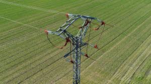
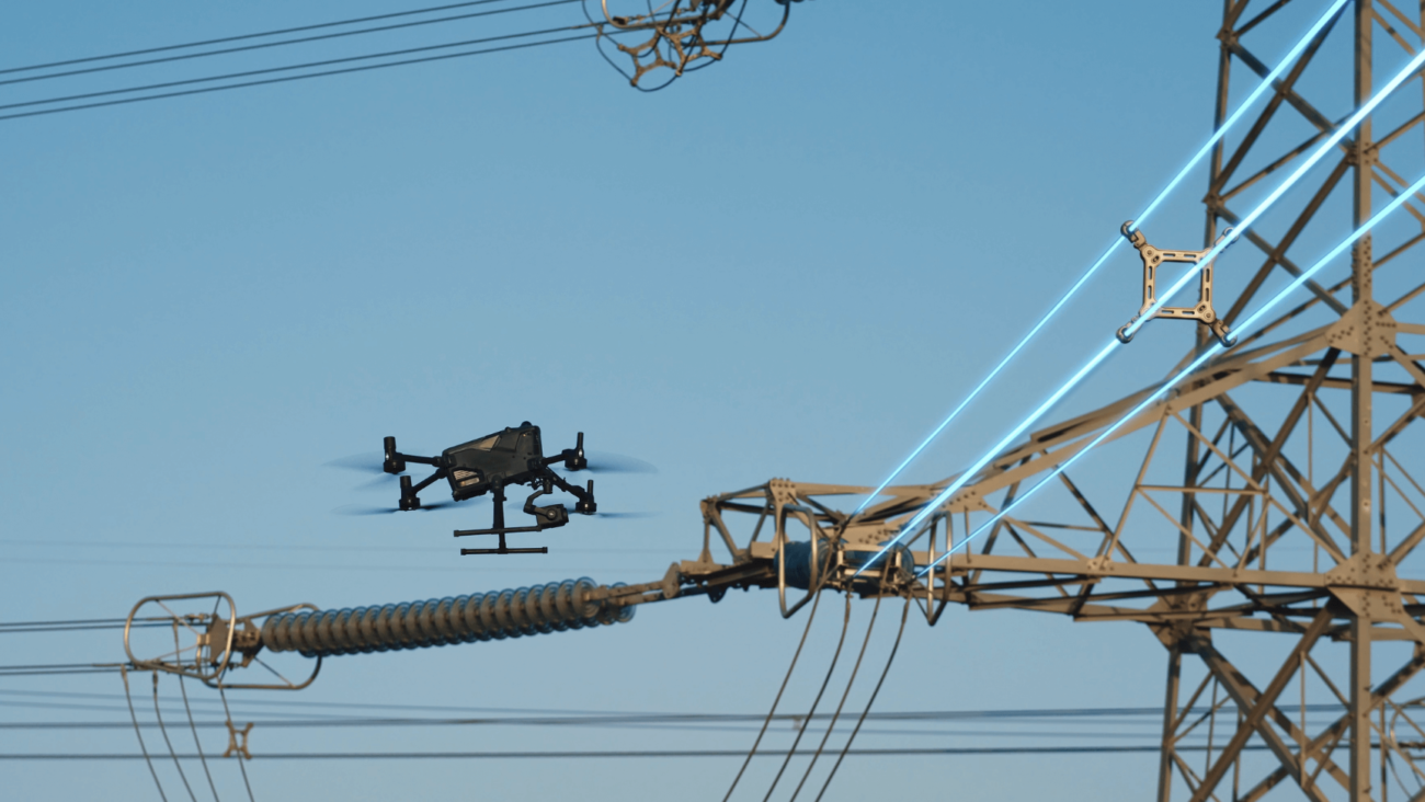
Utilities often need detailed visual data, thermal evidence, corridor context and safe access planning. A drone workflow can support inspection of towers, poles, insulators, vegetation encroachment, substations and storm-related damage without sending crews into every location first.
Buildings, roofs and facades
For commercial buildings, drones can document roof condition, water ingress indicators, facade defects, blocked gutters, plant areas, cladding issues and hard-to-reach elevations. Good reporting should separate confirmed defects from areas that need closer physical inspection.
Forestry, peatlands and environmental sites
Drone data can help teams record site condition, drainage patterns, vegetation change and access routes. LiDAR can be useful where terrain and vegetation make ground-based observation difficult, but the correct workflow depends on the environmental objective and the required deliverable.
Software: from raw data to decisions
The aircraft captures the data, but software makes the workflow usable. For mapping and modelling, DJI Terra can support reconstruction and DJI LiDAR processing. For operational management, DJI FlightHub 2 is relevant when teams need central planning, mission oversight, fleet coordination, route management or remote-operation workflows.
For many Irish businesses, the practical question is not “Which software is best?” but “Which workflow gives our team a repeatable record?” A small survey company may focus on local processing and client deliverables. A utility or industrial site may need central oversight, planned routes, operator permissions, live situational awareness and consistent reporting templates.
Data quality checklist before every project
- Define the deliverable: map, model, point cloud, defect report, thermal report or asset record.
- Confirm site constraints: access, weather, nearby roads, people, overhead lines, controlled airspace and restricted zones.
- Choose the platform and payload: compact RGB mapping, LiDAR, zoom, thermal or dock-based repeat capture.
- Plan repeatability: altitude, overlap, angle, route, RTK settings and naming convention.
- Record limitations: wind, rain, glare, shadows, vegetation, reflective surfaces or inaccessible areas.
- Process carefully: check alignment, georeferencing, coordinate system and weak areas in the model.
- Report clearly: include findings, evidence, severity, recommended action and next steps.
- Archive properly: store data against project, site, asset ID and date so future comparisons are possible.
Irish regulatory and operational considerations
Drone data collection in Ireland must be planned around safe and compliant operations. Many basic flights may fit within standard operating conditions, but more complex work can require additional planning, risk assessment and authorisation. Examples include work close to people, critical infrastructure, controlled or restricted airspace, or beyond visual line of sight operations.
Before commissioning a drone project, confirm that the operator has suitable competency, insurance, operating procedures and any required Irish Aviation Authority permissions for the type of operation. This is especially important for utilities, industrial sites, emergency response, large infrastructure corridors and remote-operation workflows.
How to choose the right DJI Enterprise system
The best system depends on the work, not the product name. Use the following decision route:
- Choose DJI Matrice 4E when the work is portable RGB mapping, construction progress capture, building surveys or compact single-pilot data collection.
- Choose DJI Matrice 4T when the work needs a compact thermal inspection drone for roofs, solar PV, facilities, smaller utilities or emergency response support.
- Choose DJI Matrice 400 with Zenmuse H30T when the inspection programme needs higher-end endurance, zoom, thermal imaging, laser rangefinding and robust enterprise performance.
- Choose DJI Matrice 400 with Zenmuse L3 when the deliverable requires high-quality LiDAR point clouds, survey-grade terrain capture or large-area geospatial data.
- Choose DJI Dock 3 with Matrice 4D / 4TD when the site needs repeat, scheduled or remote data collection rather than occasional manual flights.
FAQ: Drone data collection in Ireland
What is drone data collection?
Drone data collection is the planned capture of aerial information for a defined business purpose. It may include RGB imagery, thermal data, LiDAR point clouds, 2D maps, 3D models, videos, measurements or inspection findings.
Is drone data accurate enough for surveying?
It can be, when the workflow is designed correctly. Accuracy depends on the drone, sensor, RTK or ground control approach, flight plan, processing settings, site conditions and verification method.
What is the best DJI drone for mapping in Ireland?
For compact RGB mapping, DJI Matrice 4E is a practical choice. For larger survey-grade data collection and LiDAR workflows, DJI Matrice 400 with Zenmuse L3 is the stronger enterprise setup.
What is the best DJI drone for inspection data?
For high-end inspection, DJI Matrice 400 with Zenmuse H30T is suited to zoom, thermal and laser rangefinding workflows. For smaller teams, DJI Matrice 4T is a compact thermal inspection option.
Do drone projects need IAA permission in Ireland?
It depends on the operation. More complex flights, restricted areas, controlled airspace, work close to risk, or BVLOS-style operations may require additional authorisation. Always confirm the operator’s permissions before the project starts.
How should drone inspection findings be reported?
A good report should include asset ID, location, date, RGB or thermal evidence, severity, limitations, recommended action and comparison with previous inspections where available.
Need help choosing the right drone data collection setup?
Irish Drone can help Irish businesses choose DJI Enterprise drones, payloads and software for surveying, inspection and asset management workflows.

Leave a comment