
The DJI Matrice 400 is built for demanding infrastructure work where a compact inspection drone is no longer enough. For Irish utilities, renewables, transport, ports and industrial sites, it provides the endurance, payload flexibility and sensing capability needed to inspect larger assets more safely and more consistently.
Quick answer
Choose DJI Matrice 400 when the inspection job involves long assets, complex environments, heavy or multiple payload requirements, or repeat professional reporting. It is especially suitable for powerlines, substations, wind farms, solar farms, bridges, ports, large industrial facilities and corridor inspection. Pair it with Zenmuse H30T for thermal and zoom inspection, Zenmuse H30 for visual inspection, and Zenmuse L3 when LiDAR, corridor modelling or 3D data is part of the deliverable.
1. Why infrastructure inspection needs a different drone workflow
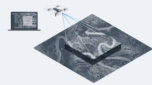
Infrastructure inspection is not the same as taking a few aerial photos. A professional inspection usually needs repeatable routes, stable standoff distances, asset-level image references, thermal evidence, zoom detail, site safety planning and a report that engineers can actually use.
For Irish operators, the challenge is even more practical. Powerline corridors cross farmland and forestry edges. Wind farms sit in exposed locations. Bridges often involve traffic, water or restricted access. Ports and industrial sites include cranes, roofs, tanks, conveyors, facades and live operational areas. In these environments, the drone is only valuable if it helps the team collect better evidence without adding unnecessary risk.
This is where the Matrice 400 makes sense. It is not simply a bigger aircraft. It is a platform for building a serious inspection programme: longer flights, larger payload options, stronger sensing, enterprise transmission and compatibility with specialist sensors.
2. What DJI Matrice 400 brings to infrastructure teams
Longer working time
DJI lists up to 59 minutes of maximum flight time in controlled conditions, giving teams more time for long routes, larger sites and complex viewpoints.
6 kg payload capacity
The platform supports up to 6 kg maximum payload capacity, which gives room for advanced DJI payloads and specialist enterprise configurations.
Advanced obstacle sensing
Rotating LiDAR, upper LiDAR, downward 3D infrared sensing and six-direction mmWave radar support safer operation around complex assets.
Enterprise reliability
With an IP55 aircraft rating and an operating temperature range from -20°C to 50°C, it is designed for professional outdoor operations, while still requiring sensible weather judgment.
Note: official maximum performance figures are measured in controlled conditions. Real flight time and operational limits depend on wind, temperature, payload, route design, reserve settings, altitude and pilot decisions.
3. Best payloads for Matrice 400 infrastructure inspection
The aircraft is only one part of the solution. The real value comes from matching the payload to the inspection question. A bridge defect, an overheated connector and a vegetation corridor issue all require different data.
| Payload | Best for | Why it matters | Irish use cases |
|---|---|---|---|
| Zenmuse H30T | Thermal + zoom + visual inspection | Combines wide camera, zoom camera, thermal camera, laser rangefinder and NIR auxiliary light in one inspection payload. | Powerlines, substations, solar farms, wind turbines, industrial roofs, ports and emergency inspection support. |
| Zenmuse H30 | High-detail visual inspection | Useful when the job needs strong zoom and contextual imaging but thermal evidence is not required. | Telecoms, towers, facades, chimneys, cranes, bridges and daylight structural checks. |
| Zenmuse L3 | LiDAR, corridor modelling and 3D data | Provides long-range LiDAR and dual 100MP RGB mapping cameras for geospatial deliverables. | Powerline corridors, embankments, forestry-adjacent assets, flood defences, rail edges and terrain-linked infrastructure. |
4. Where Matrice 400 is strongest in Ireland
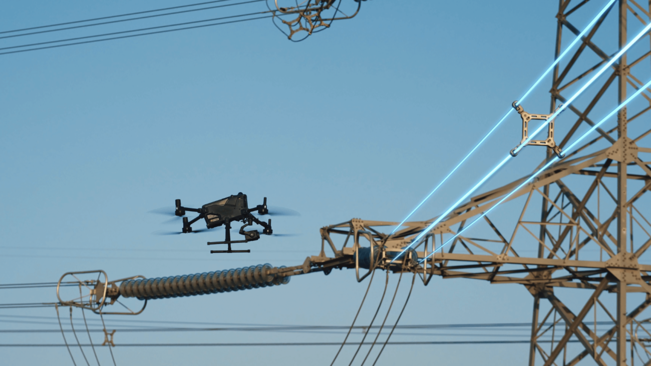
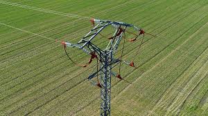
Powerlines and substations
For overhead lines, pylons, insulators, substations and access routes, the Matrice 400 + H30T combination gives inspectors zoom detail, thermal awareness and laser range information. Add L3 when corridor context, vegetation or route modelling is part of the brief.
Wind turbine inspection
Wind assets require controlled standoff inspection of blades, towers, nacelles and surrounding infrastructure. A larger enterprise platform is useful when the site is remote, exposed or requires detailed repeat documentation.
Solar farms and battery sites
For large solar and energy storage assets, H30T can support thermal anomaly checks while the Matrice 400 platform helps cover larger operational areas with a more robust inspection workflow.
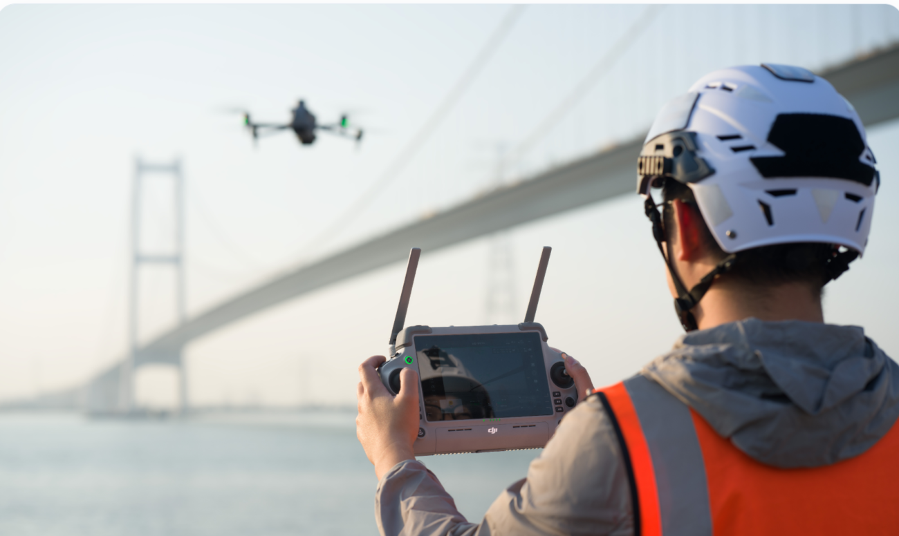
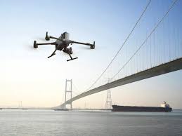
Bridges and transport structures
Bridge inspections often involve hard-to-reach angles, traffic constraints and working over water. Drones can provide visual evidence before rope access, closures or engineering follow-up are required.
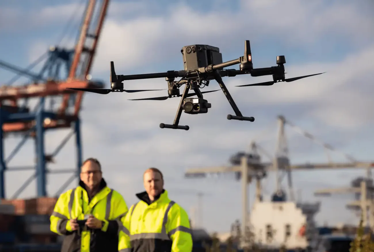
Ports, terminals and industrial estates
Ports and industrial sites have cranes, roof structures, tanks, pipelines, facades, restricted areas and live operations. Matrice 400 is well suited when the inspection needs multiple viewpoints across a large site.
Water, drainage and public assets
Local authorities and asset owners can use enterprise drones for pumping stations, water-treatment sites, coastal structures, drainage corridors, flood defences and hard-to-access civic infrastructure.
5. Recommended configurations
| Main requirement | Recommended setup | Reason |
|---|---|---|
| Mixed visual and thermal inspection | Matrice 400 + Zenmuse H30T | The broadest inspection configuration for utilities, renewables, industrial sites and emergency-style asset checks. |
| Daylight visual inspection only | Matrice 400 + Zenmuse H30 | Strong zoom and visual documentation without paying for thermal capability that may not be needed. |
| Corridor survey and 3D context | Matrice 400 + Zenmuse L3 + DJI Terra | Best when inspection outputs need LiDAR, point clouds, terrain, vegetation or corridor-level geospatial data. |
| Team operations and mission oversight | Matrice 400 + FlightHub 2 workflow | Useful for larger teams that need route planning, task management, live awareness and data coordination. |
6. Matrice 400 vs Matrice 4T vs Matrice 4E
Not every inspection job needs the Matrice 400. Smaller DJI platforms may be a better fit when portability, lower cost or a very specific workflow matters more than payload flexibility.
| Question | Choose Matrice 400 | Choose Matrice 4T | Choose Matrice 4E |
|---|---|---|---|
| Main role | High-end infrastructure inspection and specialist payload workflows. | Compact thermal inspection and fast field deployment. | Surveying, mapping and photogrammetry-focused work. |
| Best fit | Utilities, wind, solar, bridges, ports, industrial sites and corridor inspection. | Routine thermal work, smaller facilities, public safety and quick checks. | Construction mapping, land survey, orthomosaics and site progress data. |
| Main limitation | Higher investment and a more enterprise-level operating workflow. | Less suitable for heavy payloads or the most demanding long-duration tasks. | Not the main choice for thermal infrastructure inspection. |
For many Irish buyers, the decision is simple: use Matrice 4T for compact thermal inspection, use Matrice 4E for mapping, and choose Matrice 400 when the inspection programme needs more endurance, payload choice and long-term scalability.
7. Professional inspection workflow
Step 1: Define the inspection question
Is the team looking for cracked components, missing fasteners, overheating, corrosion, vegetation encroachment, storm damage or 3D corridor context? The question determines the payload and route.
Step 2: Build a risk-aware flight plan
Consider airspace, site access, roads, people, wind, asset status, emergency procedures, battery reserves and safe standoff distances before the aircraft leaves the ground.
Step 3: Capture structured evidence
Use consistent viewpoints, asset IDs, image naming, thermal notes and context shots. A useful inspection is not just a folder of images; it is evidence that can support decisions.
Step 4: Process and organise data
Use DJI Terra for mapping, 3D models and LiDAR workflows where needed. Use DJI Thermal Analysis Tool 3 for H30T infrared analysis when thermal review is part of the job.
Step 5: Deliver an actionable report
The final deliverable should include asset location, issue type, severity, image evidence, thermal reference where relevant, recommended next action and notes for engineering review.
8. Irish regulation and site planning notes
Infrastructure work must be planned within the correct Irish and European drone operating framework. Before flying, operators should check the operating category, pilot competency, operator registration, insurance, site permission, UAS geographical zones, NOTAMs, privacy obligations and any asset-owner safety rules.
More complex work — for example beyond visual line of sight, restricted airspace, complex industrial environments, or higher-risk operations — may require an Operational Authorisation from the Irish Aviation Authority. The aircraft’s capability does not remove the need for compliant operating procedures.
Important: drone data supports inspection and maintenance decisions. It does not replace the judgement of a qualified engineer, electrical specialist, structural inspector or safety professional.
9. Buyer checklist before choosing Matrice 400
- Inspection targets: powerlines, bridges, solar, wind, facades, roofs, ports, tanks, corridors or mixed assets.
- Required evidence: RGB zoom images, thermal files, LiDAR point clouds, orthomosaics, 3D models or video.
- Payload choice: H30T for thermal + visual, H30 for visual zoom, L3 for LiDAR and geospatial data.
- Software workflow: DJI Pilot 2, DJI Terra, DJI FlightHub 2 and DJI Thermal Analysis Tool 3 where relevant.
- Operational setup: trained pilots, maintenance plan, batteries, transport, charging, data storage and reporting templates.
- Compliance: flight permissions, risk assessment, site access, airspace checks and IAA requirements.
10. FAQ
Is DJI Matrice 400 the best drone for infrastructure inspection in Ireland?
It is one of the strongest DJI Enterprise choices for demanding infrastructure inspection, especially when long flight endurance, specialist payloads and complex site conditions matter. For smaller or occasional jobs, Matrice 4T may be enough.
Which payload should I choose first?
For most infrastructure inspection teams, Zenmuse H30T is the most versatile first payload because it combines visual zoom, wide camera, thermal imaging, laser rangefinding and NIR support.
When does Zenmuse L3 make sense?
Choose Zenmuse L3 when the output needs LiDAR, point clouds, terrain context, vegetation data, corridor mapping or survey-linked infrastructure deliverables.
Can Matrice 400 replace rope access or manual inspection?
It can reduce unnecessary access work and help prioritise where closer inspection is required. It should be seen as an inspection data tool, not a complete replacement for engineering judgement or specialist access where hands-on testing is needed.
Is Matrice 400 suitable for powerline inspection?
Yes. Matrice 400 is especially relevant for powerline and substation work because it combines endurance, payload options and advanced sensing. H30T suits thermal and visual inspection, while L3 suits corridor and 3D mapping workflows.
Do I need training before using Matrice 400?
Yes. Enterprise infrastructure inspection requires aircraft training, payload training, risk assessment, data workflow planning and regulatory awareness. Irish Drone can help advise on the correct setup for your use case.
Final recommendation
Choose DJI Matrice 400 + Zenmuse H30T if your business needs a high-end inspection drone for utilities, renewable energy, bridges, ports or industrial assets. Add Zenmuse L3 when the project also needs LiDAR, corridor modelling or geospatial deliverables. Use Matrice 4T or Matrice 4E only when the job is smaller, more portable or clearly focused on thermal quick checks or mapping.
The best setup should be chosen around the asset, risk level, data deliverable and reporting workflow — not simply the aircraft name.
Contact Irish Drone for a Matrice 400 ConsultationOfficial specification notes
This guide is based on official DJI Enterprise specifications and product information for DJI Matrice 400, Zenmuse H30 Series and Zenmuse L3, combined with practical Irish infrastructure inspection use cases.
DJI Matrice 400 Specs | DJI Zenmuse H30 Series Specs | DJI Zenmuse L3 Specs | IAA Operational Authorisations
Leave a comment