
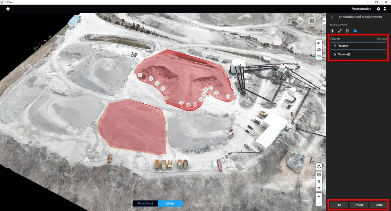
Stockpile measurement is not just a survey task. For Irish contractors, quarry operators and earthworks teams, it affects purchasing, production, haulage records, month-end reporting, payment claims and site safety.

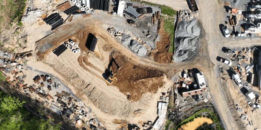
On Irish construction sites, quarries, recycling yards and bulk material facilities, stockpiles change every day. Stone is delivered, topsoil is moved, aggregates are screened, excavated material is reused and haulage records need to match what is physically on site. Drone stockpile measurement gives teams a faster and safer way to turn those changing piles into reliable numbers.
Matrice 4E + RTK + DJI Terra
Ideal for regular construction, quarry yard and earthworks stockpile measurement where visible surfaces can be captured with high-quality mapping images.
Matrice 400 + Zenmuse L3
Better for large quarries, uneven benches, difficult terrain, vegetation-affected areas and projects that need LiDAR point-cloud deliverables.
Consistent repeat surveys
The real value comes from using the same flight plan, control method and volume calculation process each month or week.
What this guide covers
- Why stockpile measurement matters
- Where drones fit on Irish sites
- What data a drone survey produces
- Which DJI setup to choose
- Photogrammetry vs LiDAR
- Step-by-step workflow
- Accuracy and common mistakes
- Buying recommendation
1. Why stockpile measurement matters
Stockpiles are working inventory. If the volume is wrong, the business impact can be very real: materials may be over-ordered, production may be delayed, haulage records may be disputed, project cashflow may be inaccurate and commercial reports may not match site reality.
Traditional methods can work, but they often take time and may require a surveyor to walk close to loose, steep or active material piles. On busy sites, that can create safety concerns and operational disruption. Drone measurement helps because it captures the full pile from above while the surveyor remains at a safer distance.
Construction and civil engineering
Track topsoil, excavated material, imported hardcore, crushed stone, temporary fill and cut-and-fill progress across changing sites.
Quarries and aggregate yards
Measure finished aggregate, overburden, unprocessed rock, sand, gravel and screened material without climbing unstable piles.
Recycling and waste facilities
Estimate volumes of recycled aggregate, construction waste, woodchip, compost, soil and processed material for operational planning.
Ports and bulk storage yards
Monitor outdoor piles of sand, stone, biomass or other bulk materials and keep a visual record for inventory and reporting.
2. What a drone stockpile survey produces
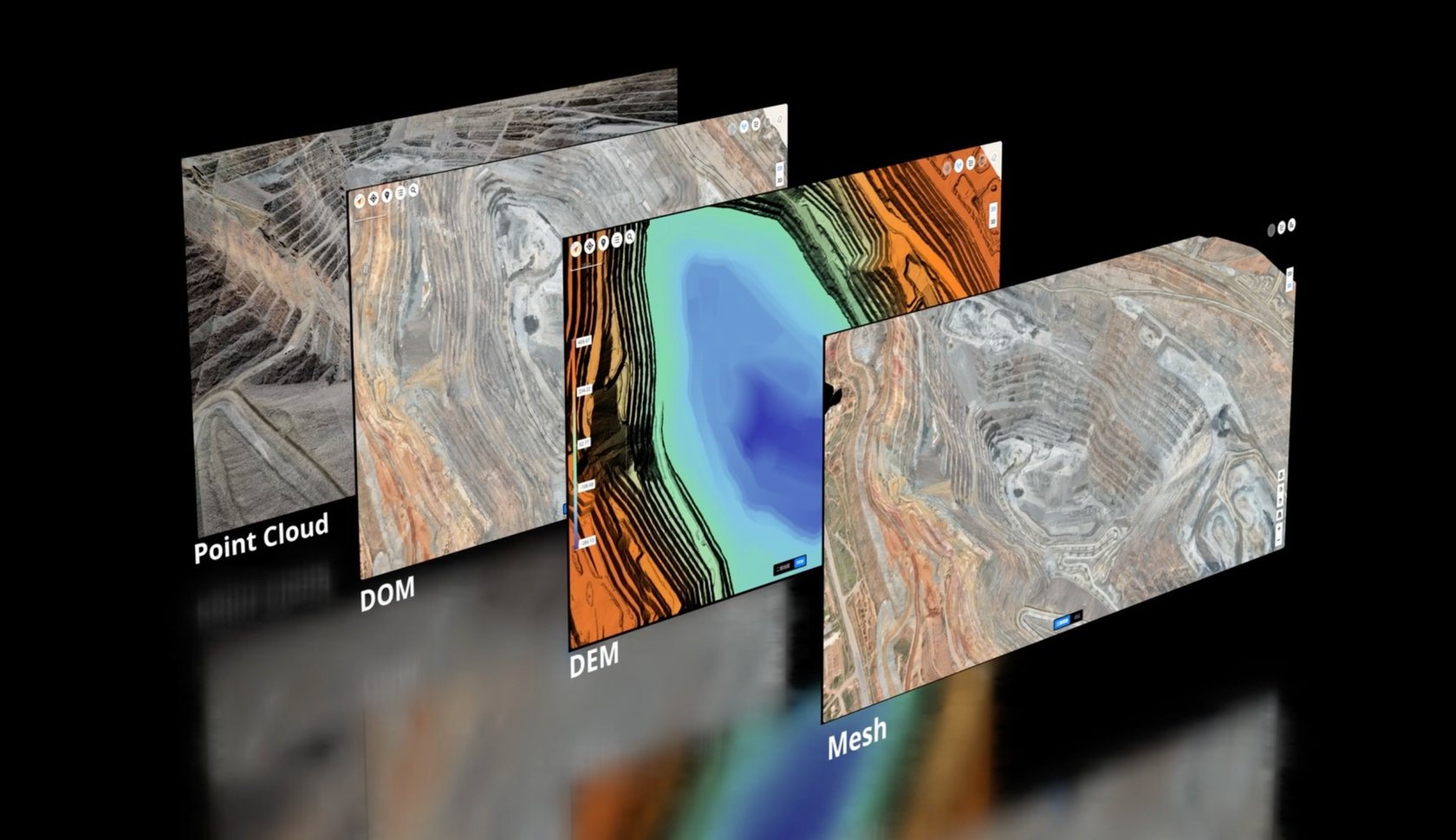
A drone stockpile survey is not only a set of aerial photos. When captured and processed correctly, it creates measurable outputs that can be used by site managers, engineers, quantity surveyors, quarry managers and finance teams.
| Output | What it means | Why it helps stockpile work |
|---|---|---|
| Orthomosaic map | A corrected 2D map made from overlapping drone images. | Shows the current site layout, pile locations, access routes and working areas for easy reporting. |
| 3D model | A visual reconstruction of the site surface and material piles. | Helps managers understand pile shape, slopes, boundaries and nearby operational constraints. |
| Point cloud | A dense 3D measurement dataset created from images or LiDAR. | Supports volume analysis, terrain review, third-party survey workflows and repeat comparisons. |
| Volume calculation | A measured estimate based on the pile surface and selected base plane. | Turns a pile into a reportable number for stock control, billing, reconciliation or planning. |
3. Best DJI workflow for most stockpile projects: Matrice 4E + RTK + DJI Terra
For many Irish construction sites and quarry yards, the most practical starting point is DJI Matrice 4E with RTK and DJI Terra. This setup is portable, efficient and designed for mapping work where sharp, overlapping images are used to create measurable models.
The Matrice 4E is especially suitable where the pile surfaces are visible and the survey area is not too large for a compact aircraft workflow. It is a strong fit for regular monthly inventory checks, smaller quarries, construction compounds, roadworks, housing developments, concrete yards and recycling facilities.
Why it works: stockpile photogrammetry depends on image quality, overlap and repeatability. A mapping-focused aircraft with RTK positioning, a mechanical shutter and efficient mission planning gives survey teams a cleaner foundation for repeat volume reports.
4. Best DJI workflow for large or complex sites: Matrice 400 + Zenmuse L3
Some sites need more than standard image-based mapping. Large quarry floors, uneven benches, long extraction areas, steep faces, mixed terrain, vegetation and demanding engineering deliverables may benefit from LiDAR. In those cases, DJI Matrice 400 with Zenmuse L3 is the stronger high-end option.
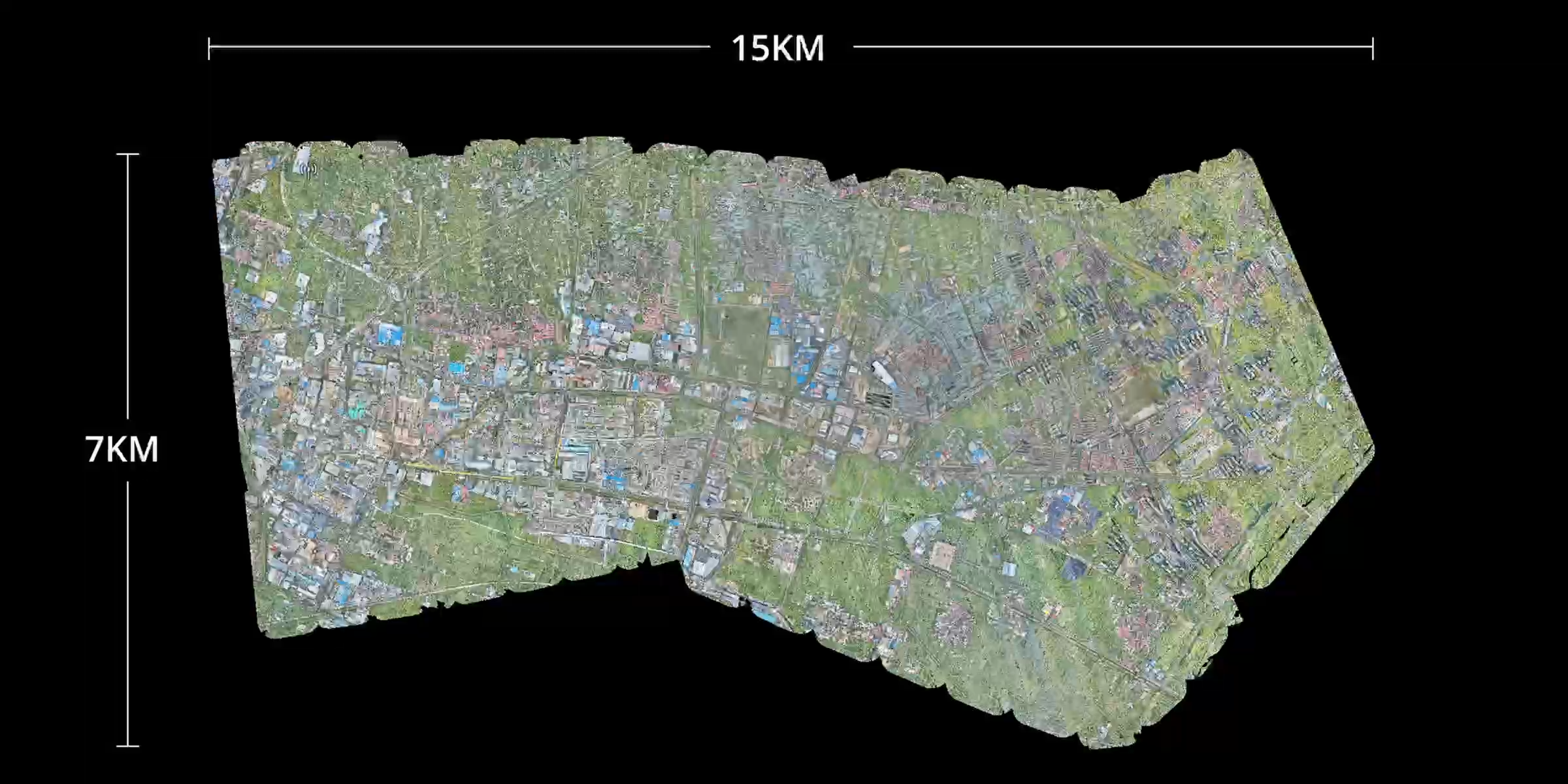
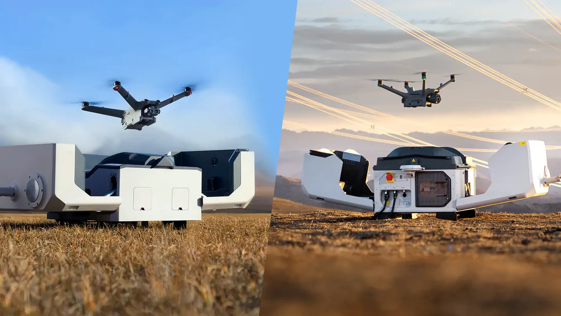
Matrice 400 gives the aircraft platform more endurance and payload flexibility. Zenmuse L3 adds DJI’s newer long-range aerial LiDAR workflow, combining LiDAR with high-resolution RGB capture. For quarry and earthworks teams, this can support dense point clouds, terrain surfaces, DEM/DSM outputs and wider-area deliverables from one survey process.
| Workflow | Best suited to | Key strengths | Typical Irish use case |
|---|---|---|---|
| Matrice 4E + RTK + DJI Terra | Most visible stockpiles and regular site inventory surveys. | Portable, efficient, mapping-focused and easier to deploy frequently. | Monthly construction stockpile survey, aggregate yard inventory, roadworks material reconciliation. |
| Matrice 400 + Zenmuse L3 | Large, complex or LiDAR-focused quarry and earthworks sites. | Longer-endurance platform, advanced payload capability and dense LiDAR/RGB deliverables. | Large quarry floor mapping, complex extraction site, earthworks terrain model, difficult mixed-surface project. |
| DJI Terra | Processing, measuring and exporting drone survey outputs. | Converts captured data into 2D/3D outputs and supports measurement tools for stockpile volume reporting. | Creating orthomosaics, point clouds, models, annotations and volume records for site reports. |
5. Photogrammetry or LiDAR: how to choose
The simplest way to choose is to look at the site surface. If the stockpile is open, clean and visible, photogrammetry is usually efficient. If the terrain is complex, the site is very large, vegetation blocks the ground, or point-cloud deliverables are required, LiDAR becomes more attractive.
Choose photogrammetry when…
- The pile surface is clearly visible.
- The site is suitable for regular image-based mapping.
- You need visual models and practical volume reports.
- The main materials are aggregate, sand, gravel, topsoil, crushed rock or clean fill.
Choose LiDAR when…
- The site is large, uneven or complex.
- Vegetation or mixed surfaces affect terrain visibility.
- You need dense point-cloud or terrain deliverables.
- The survey is part of wider quarry, mine, infrastructure or engineering analysis.

6. Step-by-step drone stockpile measurement workflow
A good stockpile workflow is repeatable. The objective is not only to calculate one pile today; it is to measure the same site again and again with a consistent method so that changes are meaningful.
Define the measurement objective
Decide whether the survey is for internal inventory, contract reporting, payment valuation, production planning or engineering analysis. The required tolerance will influence the workflow.
Mark the survey area and risks
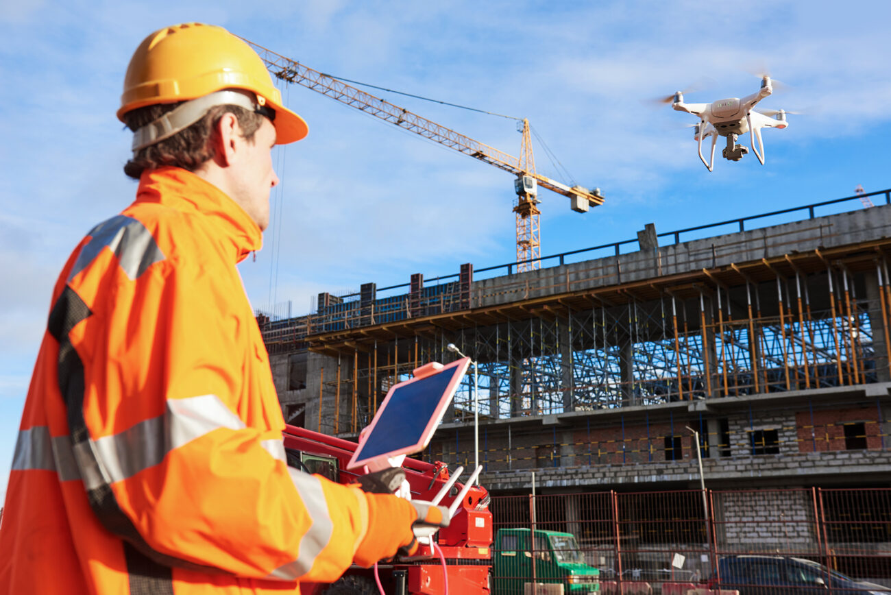
Identify haul roads, moving plant, overhead lines, public roads, steep faces, restricted zones, people on site and safe take-off and landing areas.
Plan a repeatable flight
Use sufficient front and side overlap, suitable flight height and consistent camera settings. Repeatability matters more than dramatic aerial angles.
Use RTK and checkpoints where needed
RTK helps align repeat datasets. Independent checkpoints can help verify that the model is suitable for the required reporting standard.
Capture in suitable conditions
Avoid strong wind, rain, dust, poor light and heavy glare. Blurry or inconsistent images can reduce model quality and weaken the final volume result.
Process the data
Use DJI Terra or another professional processing workflow to build the orthomosaic, model, surface, point cloud or LiDAR deliverables required by the project.
Draw pile boundaries consistently
Trace each pile carefully and use a consistent base-plane method. Boundary and base-plane choices can change the final number, especially on irregular piles.
Export and archive the report
Save the measured volumes, project date, mission details, method notes and outputs so teams can compare future surveys against the same baseline.
7. Accuracy: what Irish businesses should understand
Drone stockpile measurement can be very useful, but accuracy is not automatic. It depends on the drone, sensor, RTK or control method, image overlap, flight height, camera settings, surface texture, processing quality, pile boundary selection and base-plane logic.
For management reporting, consistency may be the most important requirement. For formal engineering or payment-related work, the workflow may need stronger control, documentation, verification and survey sign-off.
Important: a quarry inventory check, an internal monthly stock report and a formal contract valuation may require different accuracy standards. The drone workflow should be matched to the business decision being made.
8. Common mistakes to avoid
- Flying too high for the required detail. This may cover more area but reduce surface detail.
- Changing flight settings every survey. Inconsistent data makes month-to-month comparisons less reliable.
- Ignoring RTK or checkpoints. Repeat models can shift if positioning is not controlled.
- Drawing pile boundaries differently each time. Small outline changes can affect the calculated volume.
- Using the wrong base plane. A free-standing pile and a pile pushed against a wall may need different volume logic.
- Capturing in poor weather. Wind, rain, glare, dust and low light can damage model quality.
- Looking only at one survey. The real business value appears when the same site is measured repeatedly over time.
9. How often should stockpiles be measured?
For many construction projects, monthly measurement is enough for reporting and reconciliation. For busy quarries, aggregate yards and high-volume earthworks, weekly or fortnightly measurement may be more useful. The best schedule depends on how quickly material changes and how important the figures are for purchasing, production, billing or compliance.
Once a flight mission is planned and the processing workflow is standardised, repeat measurement becomes much more practical. A consistent monthly stockpile record is often more useful than an occasional one-off survey with no comparison history.

10. Final recommendation
For most Irish construction, quarry and earthworks teams, start with a Matrice 4E RTK workflow and DJI Terra. It provides the best balance of portability, mapping capability, deployment speed and practical stockpile reporting.
For larger quarries, complex terrain, vegetation-affected areas or projects requiring more advanced point-cloud and terrain deliverables, move up to Matrice 400 with Zenmuse L3. This is the stronger choice when the job is no longer just about measuring a visible pile, but about creating high-quality survey data across a larger and more demanding site.
The key lesson: drone stockpile measurement is valuable when it becomes a repeatable business process. Choose the right DJI platform, keep the flight method consistent, process the data properly and measure each pile with the same rules every time.
FAQ: Drone stockpile measurement
Can drones replace manual stockpile measurement?
Drones can replace many routine manual measurement tasks, especially where safety, speed and repeatability are important. For formal survey, payment or engineering work, the workflow should still match the required accuracy standard and may need professional verification.
Is Matrice 4E enough for quarry stockpile measurement?
For many open quarry stockpiles, yes. Matrice 4E is a practical option when the pile surfaces are visible and the site can be captured with a repeatable mapping flight. For very large or complex quarry sites, Matrice 400 with Zenmuse L3 may be more suitable.
Why use DJI Terra for stockpile volume?
DJI Terra processes drone data into measurable 2D and 3D outputs. For stockpile work, teams can inspect the model, draw pile boundaries, apply volume tools and export records for reporting.
What affects drone stockpile accuracy?
Accuracy is affected by flight height, image overlap, RTK or ground control, camera quality, lighting, surface texture, processing settings, pile boundary drawing and base-plane selection.
Need help choosing a DJI stockpile measurement workflow?
IRISH Drone can help Irish construction, quarry, earthworks and infrastructure teams choose the right DJI Enterprise aircraft, payload and DJI Terra workflow for stockpile measurement, site mapping and material reporting.
Contact IRISH Drone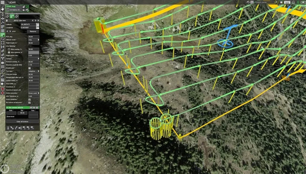
Leave a comment