
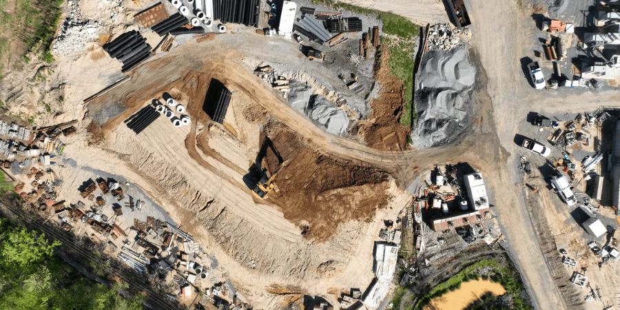
For Irish businesses, drone mapping is not just about taking aerial photographs. The real value is turning a site into reliable digital evidence: orthomosaics, surface models, point clouds, 3D models and repeatable progress records that support faster engineering, planning, inspection and reporting decisions.
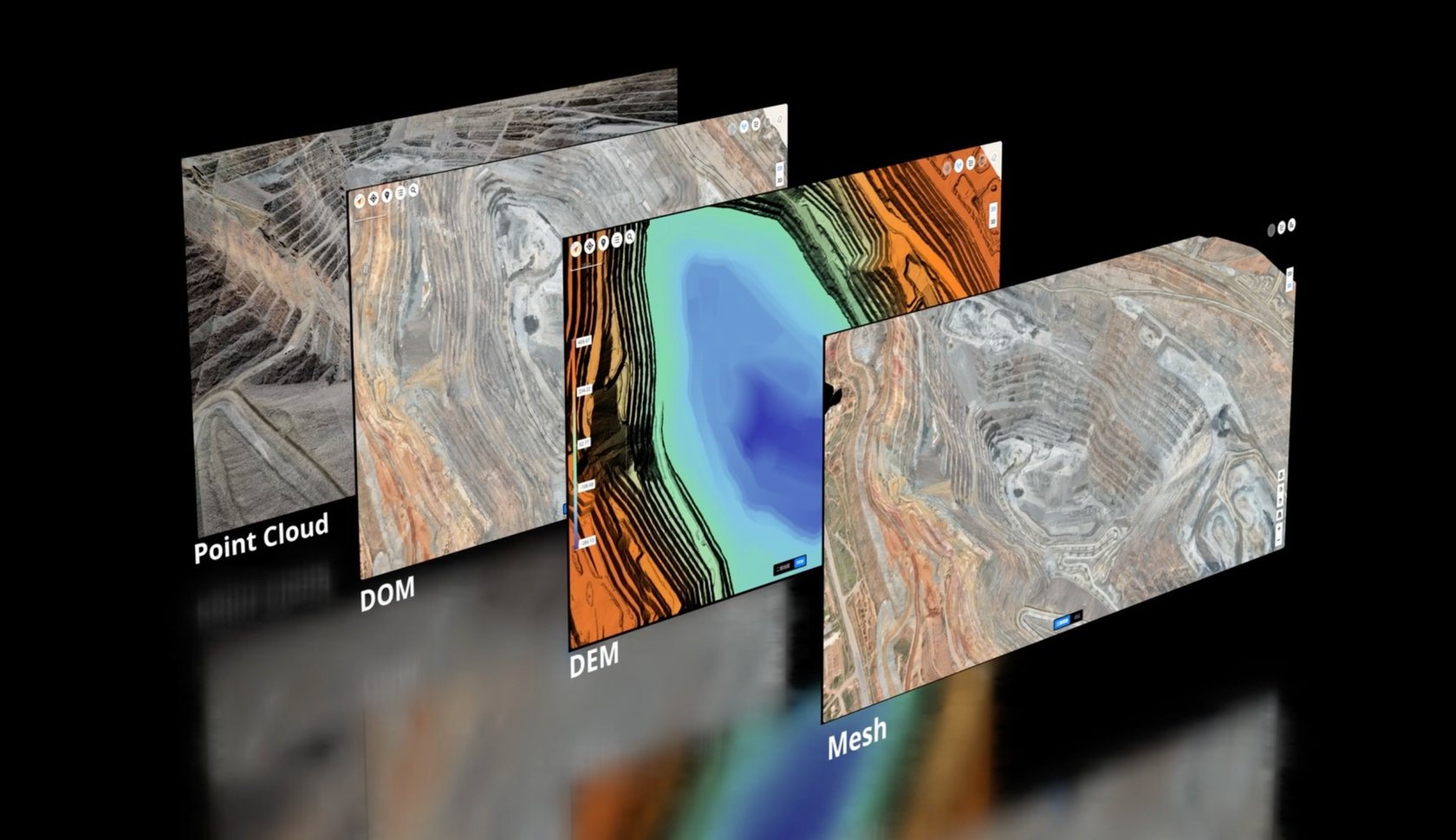
This guide has one purpose: to help Irish companies understand which drone mapping workflow fits which job. A construction progress survey, a quarry stockpile report, a solar farm inspection model and a LiDAR terrain survey are not the same task. Each needs the right aircraft, sensor, flight plan, positioning method and software output.
Quick answer: for most regular 2D and 3D photogrammetry work, DJI Matrice 4E with RTK and DJI Terra is the practical starting point. For large, complex or LiDAR-focused mapping, DJI Matrice 400 with Zenmuse L3 is the stronger choice. For repeated remote capture on fixed sites, DJI Dock 3 with Matrice 4D / 4TD can support automated operations.
What “accurate 2D and 3D drone mapping” actually means
A logical drone mapping project begins with the final deliverable, not the drone. Before choosing aircraft or software, the business should ask: what decision will this data support? If the answer is progress reporting, a 2D orthomosaic may be enough. If the answer is cut-and-fill or terrain analysis, a surface model or point cloud is required. If the answer is asset documentation, a 3D model or digital twin may be more useful.
2D orthomosaic
A corrected map-like image of the site. Useful for construction progress, planning, site records, roof areas, solar layouts and stakeholder communication.
3D model
A visual reconstruction of structures, terrain or assets. Useful for site review, inspection context, digital twins and client presentations.
Point cloud
A dense 3D measurement dataset. Useful for survey workflows, terrain analysis, quarry volumes, design comparison and engineering review.
| Deliverable | Best for | Typical Irish business use | Recommended workflow |
|---|---|---|---|
| Orthomosaic / 2D map | Clear plan-view site records | Construction updates, planning support, solar layout review, quarry yard documentation | Matrice 4E photogrammetry + RTK + DJI Terra |
| DSM / DEM | Surface and terrain understanding | Earthworks, drainage, road corridors, land development, slope review | Matrice 4E for visible surfaces; Matrice 400 + Zenmuse L3 for complex terrain |
| 3D textured model | Visual inspection and digital representation | Building façades, industrial sites, property assets, solar sites, public works | Oblique photogrammetry using Matrice 4E or Dock-based repeat capture |
| LiDAR point cloud | High-density elevation and structure data | Forestry edges, vegetation-affected terrain, power corridors, large quarries, infrastructure mapping | Matrice 400 + Zenmuse L3 + DJI Terra |
Best modern DJI equipment for enterprise drone mapping
The original mistake many mapping articles make is listing drones without explaining the decision logic. A better approach is to match the platform to the work: compact photogrammetry, heavy-duty LiDAR, or automated repeat mapping.
1) DJI Matrice 4E: the practical choice for routine photogrammetry
The DJI Matrice 4E is the most logical starting point for many Irish businesses that need regular mapping. It is compact enough for field teams to deploy quickly, but it still has mapping-oriented hardware: a 4/3-inch CMOS 20 MP wide-angle camera, a mechanical shutter and a minimum photo interval of 0.5 seconds. These features matter because accurate photogrammetry depends on sharp, overlapping images captured in a controlled pattern.
In practical terms, Matrice 4E fits construction progress mapping, quarry yard updates, stockpile records, roof/site surveys, solar site layouts, land development documentation and general 2D/3D modelling tasks where the surface is visible and the site is not too complex.
2) DJI Matrice 400 + Zenmuse L3: the higher-end LiDAR route
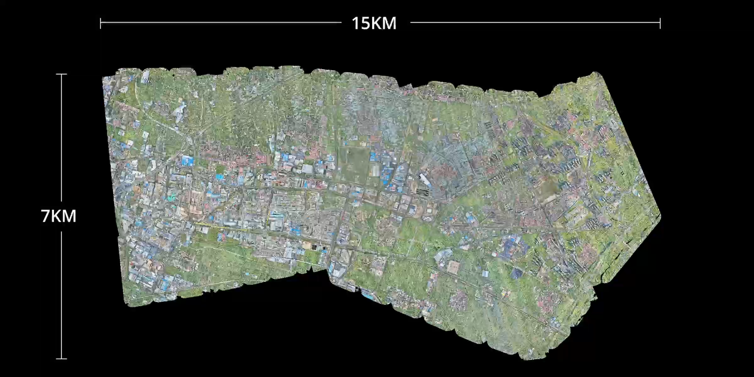
For large or complex sites, DJI Matrice 400 with Zenmuse L3 is the more advanced route. Matrice 400 provides a longer-endurance enterprise platform, while Zenmuse L3 brings long-range LiDAR and dual high-resolution RGB mapping cameras into one payload. This combination is suitable when the job depends on dense point clouds, terrain structure, elevation confidence and wider-area capture.
Zenmuse L3 is especially relevant for sites with vegetation, difficult ground, changing terrain, linear infrastructure, quarry benches, forestry edges or areas where photogrammetry alone may struggle. It also gives mapping teams a stronger dataset for point-cloud-based deliverables.
3) DJI Dock 3 + Matrice 4D / 4TD: when repeat capture matters
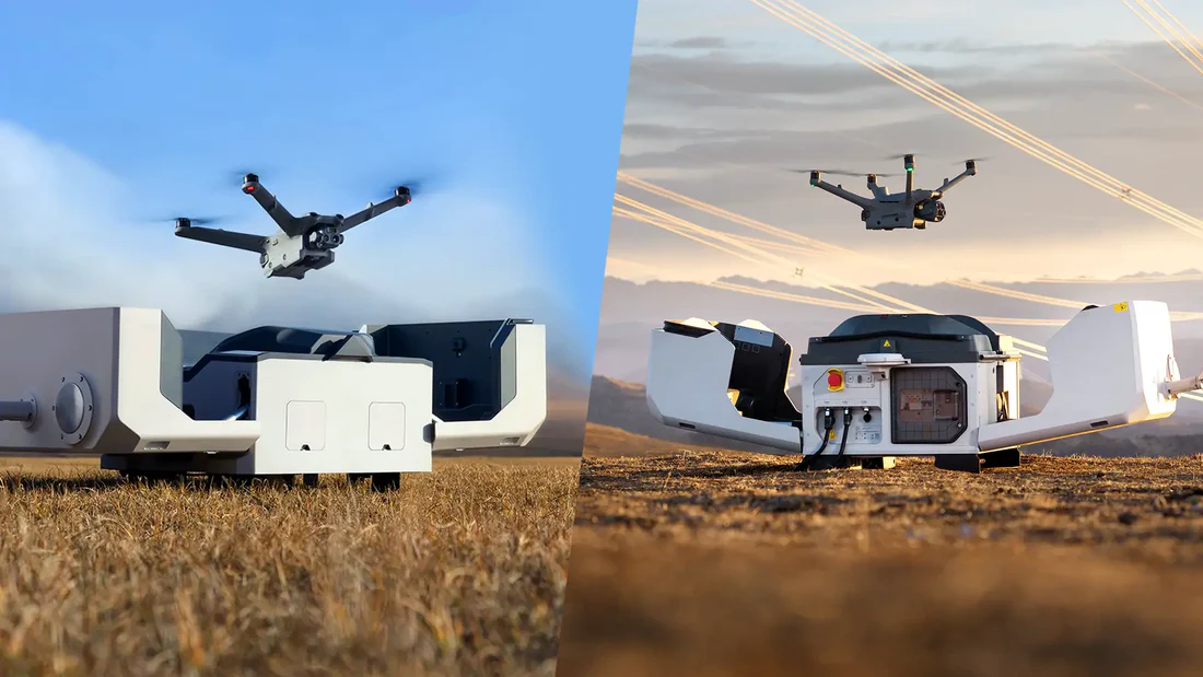
Some mapping jobs are not one-off surveys. A quarry, utility site, construction compound, industrial perimeter or solar farm may need repeated capture on a fixed schedule. In those situations, DJI Dock 3 with Matrice 4D or 4TD can support remote operations, standardised flight plans and more consistent datasets over time.
This does not mean every business needs a dock. It makes sense when the same site must be mapped or inspected frequently, when travel time is expensive, or when a business wants a routine data collection system rather than occasional manual flights.
A logical enterprise drone mapping workflow
A good mapping workflow is repeatable. The aim is not just to fly once and produce an attractive model. The aim is to create data that can be trusted, compared and used by engineers, site managers, consultants, surveyors and clients.
Define the business question
Start by deciding what the data must answer: site progress, stockpile volume, terrain change, asset condition, roof area, corridor documentation or design comparison.
Select the right deliverable
Choose whether the project needs a 2D orthomosaic, DSM/DEM, 3D model, point cloud, LiDAR deliverable or a combination of outputs.
Choose the aircraft and sensor
Use Matrice 4E for routine photogrammetry, Matrice 400 + Zenmuse L3 for LiDAR and larger complex mapping, or Dock 3 for repeat remote capture.
Plan the mission carefully
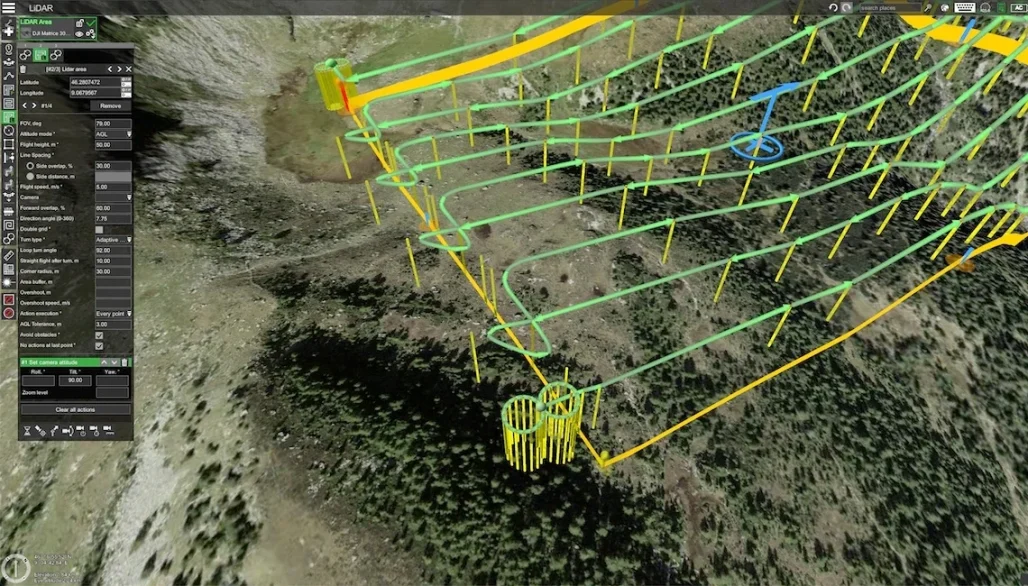
Set flight height, overlap, speed, route, site boundaries, safe take-off points and any Irish site risks such as wind, public roads, cranes, overhead lines or restricted airspace.
Use RTK, checkpoints or control points
Positioning strategy matters. RTK and verification points help keep repeat surveys aligned and make the outputs more useful for reporting.
Process, check and export
Process the data in DJI Terra or the appropriate software, check model quality, export maps or point clouds and document the settings used so future surveys remain comparable.
Where enterprise drone mapping fits in Ireland
Ireland has many practical use cases for mapping drones. The highest value usually comes from sites that change often, are hard to access, require regular reporting or need better visual evidence for decisions.
Construction and housing developments
Track progress, compare work against plans, record earthworks, monitor access routes, create client updates and reduce the need for repeated manual site walks.
Quarrying and aggregates
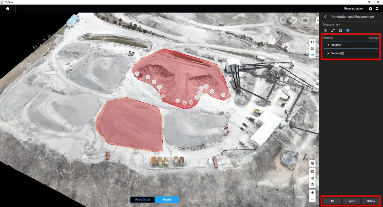
Create current site maps, measure stockpiles, update quarry floor models, review benches and support safer volume checks without walking unstable material piles.
Utilities and infrastructure
Map corridors, inspect difficult areas, document substations, support powerline route work and create repeatable records for maintenance planning.
Solar and renewable energy
Support layout planning, site documentation, panel area checks, access route review, drainage understanding and repeat visual records across large sites.
Commercial property and land development
Produce maps and models for planning, feasibility, stakeholder updates, roof surveys, boundary context and digital site records.
Environmental and terrain projects
Use RGB or LiDAR data for habitat context, terrain modelling, erosion review, forestry edges, drainage patterns and restoration monitoring.

Photogrammetry or LiDAR: which one should you use?
Photogrammetry and LiDAR are not competitors in every situation. They answer different questions. Photogrammetry is efficient when surfaces are visible and image texture is good. LiDAR becomes stronger when the project depends on elevation structure, vegetation penetration, dense point clouds or complex terrain.
| Project condition | Better starting point | Reason |
|---|---|---|
| Open construction site, roof, hardstanding, visible stockpiles | Matrice 4E photogrammetry | Efficient, portable and suitable for high-quality 2D and 3D visual reconstruction. |
| Large quarry, mixed terrain, benches, long corridors | Matrice 400 + Zenmuse L3 | LiDAR point clouds and longer-endurance platform provide stronger terrain capture for complex work. |
| Vegetation, forestry edges or partially hidden ground | LiDAR workflow | LiDAR is more suitable where the ground surface is not always clearly visible in photographs. |
| Repeated mapping of a fixed industrial or infrastructure site | Dock 3 workflow | Automation supports consistent scheduled capture and reduces repeated travel to the same site. |
Accuracy and quality control: what businesses must understand
Drone mapping can be highly accurate, but accuracy is not created by the drone alone. It depends on the entire method: aircraft, camera or LiDAR payload, flight height, overlap, shutter speed, RTK or control points, weather, surface texture, processing settings and quality checks.
Important: a nice-looking 3D model is not automatically a survey-quality deliverable. If the data will be used for measurement, design comparison or commercial decisions, the workflow should include RTK, checkpoints or ground control, documented settings and clear quality checks.
Common mistakes to avoid
- Starting with the drone instead of the deliverable. Decide what output is needed before choosing the platform.
- Flying with inconsistent settings. Repeat surveys should use consistent altitude, overlap and capture parameters.
- Ignoring ground verification. RTK is helpful, but independent checkpoints can still be important for confidence.
- Using photogrammetry where LiDAR is more suitable. Vegetation, poor texture or complex terrain may require a LiDAR workflow.
- Processing without checking outputs. Always review alignment, gaps, distortion, point density and model quality before exporting.
- Forgetting operational compliance. Irish commercial drone work still requires safe planning, airspace awareness and appropriate operator procedures.
Recommended setup by business objective
| Business objective | Recommended DJI route | Main output |
|---|---|---|
| Routine construction progress mapping | DJI Matrice 4E + RTK + DJI Terra | Orthomosaic, 3D model, DSM and progress visuals |
| Quarry and stockpile volume tracking | DJI Matrice 4E for most open piles; Matrice 400 + L3 for complex terrain | Point cloud, surface model and volume report |
| Large terrain or infrastructure mapping | DJI Matrice 400 + Zenmuse L3 | LiDAR point cloud, DEM/DSM, RGB mapping outputs |
| Fixed-site repeat monitoring | DJI Dock 3 + Matrice 4D / 4TD + FlightHub 2 | Scheduled site maps, repeat capture and team visibility |
| Property, roof or land documentation | DJI Matrice 4E | High-resolution map, inspection imagery and 3D context |
FAQ: enterprise drone mapping in Ireland
Is drone mapping the same as aerial photography?
No. Aerial photography is mainly visual. Drone mapping uses controlled flight paths, image overlap, positioning data and processing software to create measurable outputs such as orthomosaics, surface models, 3D models and point clouds.
Which DJI drone is best for most Irish mapping work?
For most regular photogrammetry jobs, DJI Matrice 4E is the most practical starting point because it combines portability with a mapping-focused camera system. For complex terrain, vegetation, larger sites or LiDAR deliverables, Matrice 400 with Zenmuse L3 is the stronger option.
Do I always need LiDAR?
No. Many construction, property, roof, solar and stockpile jobs can be handled with photogrammetry when the surface is visible and capture conditions are good. LiDAR is most valuable when terrain, vegetation, structure or point-cloud quality is the main challenge.
Can drone mapping support monthly reporting?
Yes. In fact, repeat reporting is one of the strongest business cases. Once a mission area and workflow are defined, teams can compare maps and models across dates to understand progress, material movement or site change.
Is DJI Terra required?
DJI Terra is a logical choice for many DJI workflows because it processes mapping data into outputs such as 2D maps, 3D models, DSM/DEM layers, point clouds and measurement deliverables. Some teams may also export data into third-party survey or CAD workflows depending on project requirements.
Final recommendation: do not buy a drone only because it is the newest model. Choose the workflow by the deliverable. Use Matrice 4E for efficient everyday mapping, Matrice 400 + Zenmuse L3 for LiDAR and advanced terrain work, and Dock 3 where repeat remote capture creates real operational value.
Need help choosing a drone mapping workflow in Ireland?
IRISH Drone can help construction, quarry, infrastructure, solar and land development teams choose the right DJI Enterprise drone, payload and processing workflow for accurate 2D maps, 3D models, point clouds and repeat site reporting.
Contact IRISH DroneSources and product references
- DJI Enterprise – Matrice 4 Series
- DJI Enterprise – Matrice 4 Series Specs
- DJI Enterprise – Matrice 400
- DJI Enterprise – Zenmuse L3
- DJI Enterprise – DJI Dock 3
- DJI Enterprise – Earthwork Solution
This article is written for SEO and buyer education. Always confirm aircraft, payload, software and operational requirements against the latest official DJI documentation and Irish aviation rules before purchase or deployment.

Leave a comment