
Quick recommendation: use DJI Mavic 3M for crop health and vegetation-index work, DJI Matrice 4E for farm mapping and visual records, Matrice 4T for thermal and livestock/site checks, Matrice 400 with Zenmuse L3 for forestry LiDAR and terrain modelling, and DJI Dock 3 with Matrice 4D/4TD only where repeated remote monitoring is commercially and legally justified.
Why This Topic Matters for Irish Farms and Forestry Teams
Ireland’s land-management environment is not always easy to inspect from the ground. Farms and forestry sites can include wet fields, fragmented land parcels, hedgerows, slopes, narrow lanes, coastal weather, upland terrain, drainage issues and remote woodland compartments. Walking every field margin, access track, drain, stand boundary or storm-damaged area can take time and may expose teams to unnecessary risk.
A drone helps by giving the team a current, repeatable aerial record. The data can show where grass growth is uneven, where crop stress is developing, where water is sitting after rainfall, where trees have fallen, where an access route is blocked, or where livestock may be located in difficult terrain.
The key is choosing the drone around the decision you need to make. A multispectral crop map, a LiDAR forest model, a thermal livestock check and a spraying workflow are four very different jobs. One aircraft will not be the best answer for all of them.
1. Crop Health, Grassland and Vegetation Monitoring
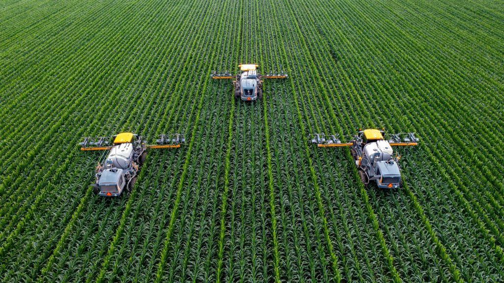
For farms, agronomists and contractors, the most useful drone output is often a vegetation map. Instead of walking a field blindly, the drone helps identify the zones that need closer inspection. This is especially useful for tillage fields, grassland performance, trial plots, reseeding checks and drainage-related variation.
DJI Mavic 3M is the best starting point for this work because it combines a 20 MP RGB camera with four 5 MP multispectral cameras covering green, red, red edge and near-infrared bands. This makes it suitable for NDVI, NDRE and other vegetation-index workflows.
Typical farm uses
- Grassland growth variation on dairy and beef farms.
- Crop stress checks before an agronomist visit.
- Drainage or waterlogging patterns after heavy rain.
- Vegetation-index maps for crop trials and advisory reports.
Best DJI fit
Choose DJI Mavic 3M where crop health and multispectral data are the priority. Choose DJI Matrice 4E where the main requirement is RGB mapping, site records, boundaries, drainage context or construction-style farm mapping.
2. Field Boundary Mapping and Farm Infrastructure Records
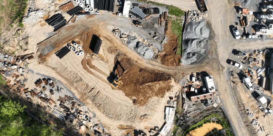
Irish farms often need clear records of boundaries, yards, tracks, drains, hedgerows, watercourses, sheds, solar installations and new works. A fresh drone orthomosaic is often easier to understand than an old satellite image because it reflects the current site condition.
For this type of work, the deliverable is usually a high-resolution map, 3D model, site overview or asset record. Matrice 4E is a practical fit when portability and mapping efficiency matter. Larger land portfolios, estates and forestry-adjacent sites may justify a higher-end enterprise platform such as Matrice 400.
3. Forestry Inventory, Canopy Structure and Terrain Modelling
Forestry is one of the strongest use cases for enterprise LiDAR drones. Conventional woodland surveys are labour-intensive, especially where the site includes steep slopes, soft ground, dense canopy, windthrow, blocked roads or limited vehicle access.
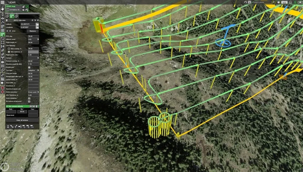
DJI Matrice 400 with Zenmuse L3 is the strongest DJI setup for detailed forestry work. Zenmuse L3 combines long-range LiDAR with dual 100 MP RGB mapping cameras, allowing teams to create point clouds, digital elevation models, digital surface models, true-colour outputs and 3D deliverables.
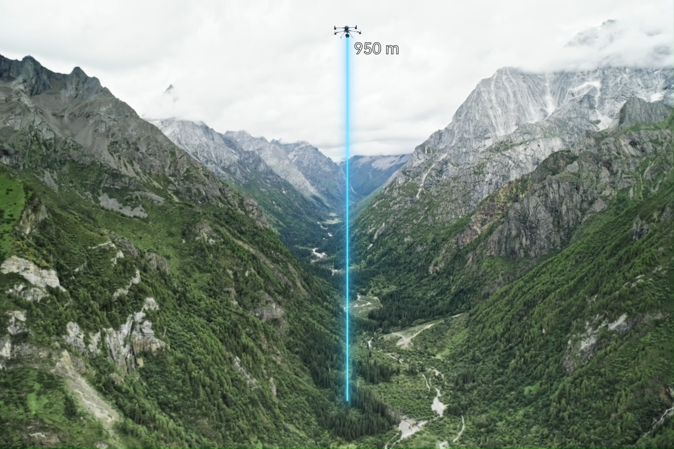
For Irish forestry teams, this can support thinning plans, access-route design, post-storm assessment, forest inventory, estate planning, drainage analysis and long-term asset monitoring. It also gives a stronger baseline for comparing changes over time.
4. Storm Damage, Windthrow and Access Route Checks
After severe weather, forestry roads, farm lanes and estate tracks can become unsafe. Drones help managers inspect windthrow, damaged fences, blocked roads, fallen trees, flooded areas and erosion before staff enter the site.
For rapid site assessment, Matrice 4T is useful because it combines visual cameras, thermal imaging and laser rangefinding in a compact platform. This makes it suitable for low-light awareness, woodland edge checks, livestock searches, rural security, emergency support and site monitoring.
5. Livestock, Wildlife and Estate Monitoring
Thermal drones can help locate livestock in difficult terrain, check remote sheds or boundaries, support deer and wildlife surveys, improve situational awareness around forestry blocks, and monitor rural sites outside normal working hours. They are also helpful where a team needs to assess an area before sending people into it.
This work must be handled carefully. Thermal, zoom and RGB sensors can collect sensitive information. The operator should have a clear purpose, permission basis, data handling process and privacy controls, especially when working near homes, public areas or neighbouring land.
6. Repeat Monitoring with DJI Dock 3
For remote estates, forestry yards, high-value farm infrastructure, solar farms on agricultural land, nurseries or recurring inspection routes, a docked drone system may reduce repeat visits. DJI Dock 3 supports Matrice 4D and Matrice 4TD drones for 24/7 remote operations and mobile vehicle-mounted deployment.
This is most valuable when the same mission needs to be repeated after storms, during seasonal checks or outside normal working hours. However, docked operations can involve complex planning, connectivity, security, emergency procedures and aviation authorisation. It should be treated as a professional UAS programme, not a simple camera installation.
7. Spraying, Spreading and Lifting: High Potential, Higher Compliance
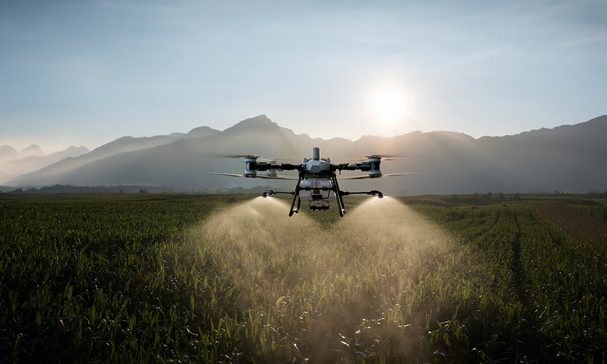
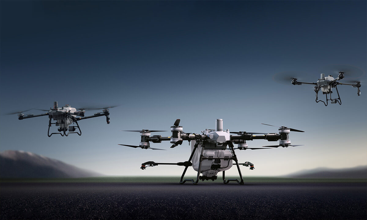
DJI Agras platforms are built for agricultural material application. Agras T100 is designed for large jobs with a 100 L spraying tank, 150 L spreading tank and up to 100 kg lifting capability. Agras T70P and T25P offer smaller configurations for different farm sizes and service models.
Important Irish compliance note: do not present spraying drones as a simple “buy and fly” product. Spraying, spreading or lifting can involve Specific category aviation planning, pesticide rules, environmental controls, insurance, landowner permission and site-specific risk assessment.
Recommended DJI Setups by Use Case
| Business need | Recommended DJI setup | Why it fits | Irish use case |
|---|---|---|---|
| Crop health and vegetation indexes | DJI Mavic 3M | RGB plus multispectral capture for crop growth analysis and vegetation-index workflows. | Grassland checks, tillage scouting, drainage variation, trial plots. |
| Farm mapping and site records | Matrice 4E or Mavic 3M | Efficient aerial mapping for orthomosaics, field records and infrastructure context. | Boundaries, yards, tracks, sheds, drains, hedgerows and planning records. |
| Forestry inventory and terrain models | Matrice 400 + Zenmuse L3 | LiDAR and RGB capture for point clouds, DEM, DSM and forest structure outputs. | Windthrow assessment, thinning planning, forestry road design and estate records. |
| Livestock, wildlife and low-light checks | Matrice 4T or Matrice 4TD | Thermal and zoom sensors support search, monitoring and emergency awareness. | Upland livestock checks, deer surveys, farm security and forestry site monitoring. |
| Recurring remote monitoring | DJI Dock 3 + Matrice 4D / 4TD | Repeatable remote missions and live monitoring for fixed sites, subject to authorisation. | Remote estates, yards, nurseries, solar farms and high-value rural assets. |
| Spraying, spreading and lifting | Agras T100 / T70P / T25P | Designed for agricultural material application where legally permitted. | Potential contractor service only after regulatory, pesticide and site review. |
A Practical Workflow for Irish Agriculture and Forestry Projects
Step 1: Define the decision
Start with the decision, not the drone. Are you trying to find weak growth, measure storm damage, update a boundary, check a remote yard, or produce a forest inventory?
Step 2: Choose the sensor
RGB is for visual mapping, multispectral is for crop health, thermal is for heat signatures and low-light search, and LiDAR is for terrain and 3D structure.
Step 3: Plan repeatable missions
Use consistent altitude, overlap, flight timing, camera angle and naming conventions so future data can be compared accurately.
Step 4: Process and act
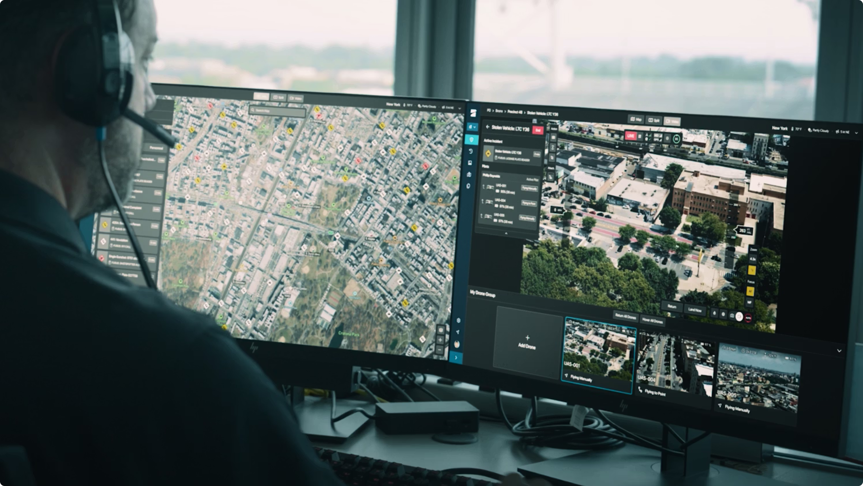
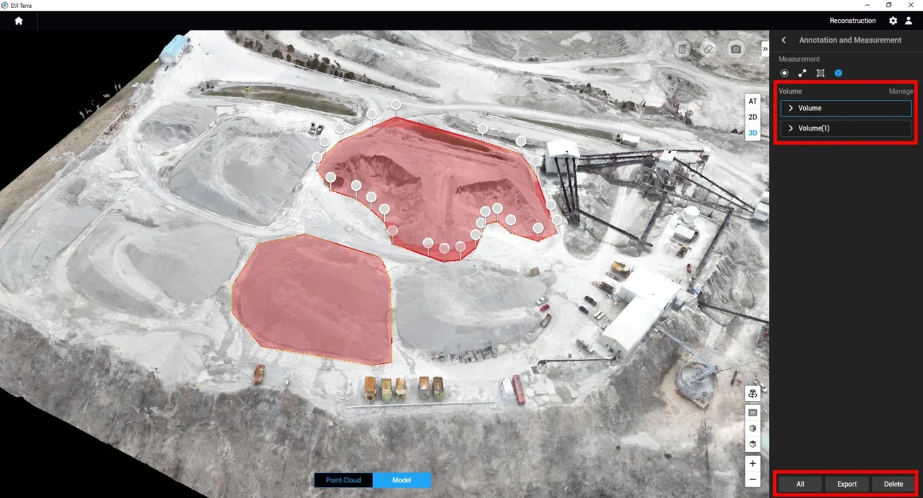
Use DJI Terra, FlightHub 2, GIS or agronomy software to turn images into maps and reports. The final output should guide an action, not just look impressive.
Ireland Compliance Notes
Agriculture and forestry drone work should be planned as a professional UAS operation. Before flying, confirm the following:
- Operator registration: in Ireland, drones over 250 g or drones with a camera normally require operator registration with the Irish Aviation Authority.
- Remote pilot competency: training requirements depend on aircraft, category and operation type.
- Airspace and UAS geographic zones: check nearby aerodromes, controlled airspace, restricted zones, prisons and local limitations before each operation.
- Open vs Specific category: routine mapping may fit Open category only if all limits are met. BVLOS, remote dock operations, complex sites or restricted areas may require Operational Authorisation.
- Spraying and dropping materials: material application is not a simple Open category activity and should be reviewed against aviation, pesticide, environmental and insurance requirements.
- Privacy and data handling: RGB, zoom, thermal and LiDAR sensors can collect sensitive information. Define the purpose, permissions, storage period and access controls.
Best Starting Setup by Business Type
Small to mid-sized farms
Start with: DJI Mavic 3M for crop and grassland mapping. Add a simple reporting workflow for vegetation analysis and field notes.
Agronomy and land advisory teams
Start with: DJI Mavic 3M and a repeatable mapping/reporting process. Add Matrice 400 + L3 for larger terrain and forestry clients.
Forestry contractors and estates
Start with: Matrice 400 + Zenmuse L3 for inventory, terrain models and post-storm assessment. Add Matrice 4T for rapid thermal and security checks.
Recurring remote inspection sites
Start with: DJI Dock 3 with Matrice 4D or 4TD only after confirming the operating authorisation, site design, network coverage and risk controls.
FAQ: Agriculture and Forestry Drones in Ireland
What is the best DJI drone for agriculture mapping in Ireland?
For crop health and vegetation-index work, DJI Mavic 3M is the best practical starting point because it combines RGB and multispectral imaging. For larger terrain or forestry modelling, Matrice 400 with Zenmuse L3 is the stronger enterprise setup.
Which drone is best for forestry inventory?
DJI Matrice 400 with Zenmuse L3 is the strongest DJI enterprise option for detailed forestry inventory, canopy structure, terrain modelling, point clouds, DEM, DSM and long-term woodland asset records.
Can drones replace field walking or forestry surveys?
No. Drones reduce wasted site visits and help teams prioritise where to inspect, but ground truthing is still important. The best workflow combines aerial data, local knowledge and professional agronomy or forestry judgement.
Can Irish farms use drones for spraying?
Potentially, but it is a regulated activity. Spraying or dropping material from a drone should be reviewed against aviation rules, pesticide requirements, environmental restrictions, insurance and landowner permissions before any commercial service is offered.
Are thermal drones useful for farms and forests?
Yes. Thermal drones such as Matrice 4T or Matrice 4TD can help with livestock searches, wildlife checks, security monitoring, emergency awareness and low-light site inspection. Operators should manage privacy carefully and fly within the correct permissions.
Need Help Choosing a DJI Agriculture or Forestry Drone?
Irish farms, forestry teams, estate managers and land contractors should choose the drone around the data they need: crop health, RGB mapping, thermal awareness, LiDAR terrain, automated monitoring or regulated material application.
Recommended next step: list the site size, application, required output, flight frequency and whether the work involves mapping only, thermal inspection, LiDAR modelling, docked monitoring or spraying/spreading.
Leave a comment