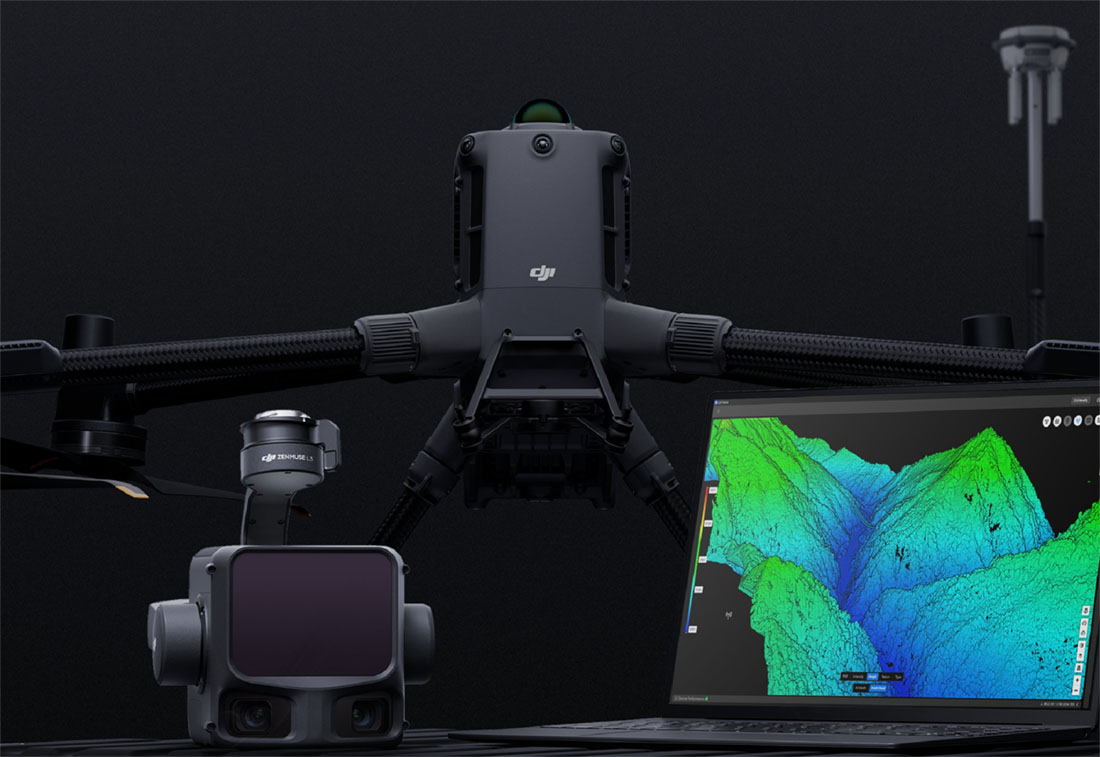

The best current DJI-led LiDAR drone setup for serious surveying and infrastructure work is the DJI Matrice 400 with Zenmuse L3. This is the combination that makes the most sense when the job requires dense point clouds, terrain data, powerline-level detail, and a more advanced 3D workflow than standard photogrammetry can provide.
This article is written for the Irish market. The examples below focus on real working conditions in Ireland: utility corridors in rural areas, road and civil engineering projects, quarries, coastal infrastructure, solar farms, wind farm access routes, industrial estates, and development sites where accurate spatial data matters.
Why LiDAR is different from normal drone mapping
Photogrammetry uses overlapping photographs to build maps and models. It is excellent for orthomosaics, construction progress visuals and 3D models where the surface has enough visual detail. LiDAR works differently. It measures distance using laser pulses, creating a dense 3D point cloud that can be processed into terrain models, elevation models and infrastructure datasets.
That difference matters on infrastructure projects. Grass, scrub, hedgerows, embankments, tree cover, steel structures, power lines and uneven ground can all make image-only mapping harder. LiDAR gives survey and engineering teams another layer of information that is often more useful for terrain analysis and detailed 3D inspection.
Simple rule: use photogrammetry when you mainly need visual maps and models; use LiDAR when the project needs stronger 3D structure, terrain understanding, vegetation penetration or detailed infrastructure data.
Best overall LiDAR drone setup: DJI Matrice 400 + Zenmuse L3
The Matrice 400 gives survey teams a stronger airframe for larger and more demanding missions. DJI lists the Matrice 400 with up to 59 minutes of flight time, payload capacity of up to 6 kg, an IP55 protection rating, and an operating temperature range from -20°C to 50°C. For Irish infrastructure work, that means a more capable platform for longer corridors, larger sites and mixed weather windows.
The Zenmuse L3 is the main reason this setup stands out. DJI describes it as a next-generation long-range, high-accuracy aerial LiDAR system with a 1535 nm LiDAR, dual 100 MP RGB mapping cameras, a high-precision POS system and a three-axis gimbal. For businesses that need serious 3D deliverables, this is a major step up from older LiDAR payload workflows.

| Requirement | Why Matrice 400 + Zenmuse L3 fits |
|---|---|
| Longer infrastructure missions | The Matrice 400 platform is designed for long-endurance enterprise work and can carry heavier payloads than smaller mapping drones. |
| Detailed 3D data | Zenmuse L3 combines LiDAR and high-resolution RGB mapping cameras, giving teams both spatial and visual data. |
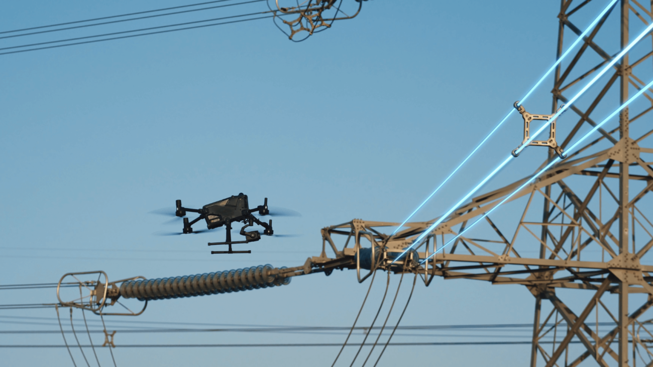
| Powerline and corridor work | LiDAR point clouds are well suited to linear infrastructure, route corridors and complex assets where detail and geometry matter. |
| Vegetation and terrain | Multiple returns and dense point cloud capture help teams work in areas where image-only reconstruction may not show the ground clearly. |
What the Zenmuse L3 brings to surveying
For survey and infrastructure users, the most important point is that Zenmuse L3 is not just a camera. It is a LiDAR and RGB mapping payload built for higher-accuracy geospatial data capture. DJI states that the L3 uses dual 100 MP 4/3 CMOS RGB mapping sensors with a mechanical shutter and can achieve a ground sample distance of around 3 cm at 300 m. It also supports a broad horizontal field of view, allowing wider coverage per capture.
In practical terms, this can reduce the number of passes needed on larger sites and make the data more useful for engineering, design and inspection teams. For Ireland, that is especially useful for road upgrades, wind farm access routes, powerline corridors, quarry faces, flood-risk terrain, coastal defence work and utility planning.

Real Irish use cases
Roads and transport corridors
LiDAR helps capture embankments, junctions, drainage routes, bridges, verges and route corridors for planning, upgrade works and engineering review.
Utilities and power infrastructure
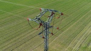
Point cloud data helps teams understand overhead lines, pylons, substations, access routes and clearance conditions without relying only on ground inspection.
Quarries and earthworks
Survey teams can use repeatable 3D capture to monitor slopes, faces, stockpiles, haul roads and site change over time.
Renewables and industrial sites
Solar farms, wind farm access tracks and industrial estates benefit from fast terrain documentation, infrastructure mapping and maintenance planning.

Why not use Matrice 4E for every job?
The DJI Matrice 4E is still one of the most useful modern DJI drones for survey and mapping teams. It is portable, efficient and designed for surveying, mapping, construction and inspection. DJI states that the Matrice 4E uses a 4/3 CMOS 20 MP wide camera with a mechanical shutter, supports 0.5-second interval shooting, and enables Smart 3D Capture for more efficient modelling routes.
However, the Matrice 4E is mainly a photogrammetry platform, not a LiDAR solution. It is excellent for orthomosaics, construction progress, site maps, stockpile visual records and general 3D models. When the job needs true LiDAR point cloud capture, terrain penetration or more advanced infrastructure geometry, the Matrice 400 + Zenmuse L3 is the better choice.

How to choose the right setup
Irish businesses should start with the deliverable, not the drone. The right aircraft and payload depend on what the client or internal team actually needs.
- Choose Matrice 400 + Zenmuse L3 for LiDAR point clouds, terrain models, corridor mapping, vegetation-heavy areas, infrastructure geometry and higher-value survey deliverables.
- Choose Matrice 4E for routine orthomosaics, site progress, standard 2D/3D photogrammetry, construction updates and portable field mapping.
- Use both when the business needs a serious survey fleet: Matrice 4E for frequent visual mapping and Matrice 400 + L3 for advanced LiDAR tasks.
Processing: DJI Terra and point cloud workflow
Capturing the data is only half the job. A useful LiDAR workflow also needs processing, quality checks and export formats that engineers, surveyors and project managers can actually use. DJI Terra supports 2D and 3D reconstruction workflows and can be used as part of the process for turning drone data into deliverables such as point clouds, digital surface models, digital elevation models and 3D models.
For construction and infrastructure teams, that means the data can move from field capture into design review, quantity checks, stakeholder reports, maintenance planning or third-party CAD/GIS workflows.

Compliance and planning in Ireland
For Irish operators, technical capability is only one part of the decision. Survey and infrastructure work may involve controlled sites, roads, power infrastructure, built-up areas, private land or operations that fall outside simple low-risk flying. Teams should consider IAA requirements, EASA operating categories, pilot competency, airspace checks, site permissions, privacy and safety controls before deploying an enterprise drone workflow.
In many complex jobs, especially those involving restricted airspace, higher-risk environments or operations beyond normal Open Category limits, the operator may need appropriate Operational Authorisation. This should be planned before the survey date, not after the aircraft has arrived on site.
Final recommendation
For the best LiDAR drone setup for surveying and infrastructure projects in Ireland, the strongest current DJI recommendation is DJI Matrice 400 + Zenmuse L3. It is the most suitable combination when projects demand accurate 3D point clouds, terrain information, powerline-level detail and high-end infrastructure deliverables.
For day-to-day mapping, the DJI Matrice 4E remains a valuable companion aircraft. The smartest Irish survey and infrastructure teams will often use both: Matrice 4E for efficient routine photogrammetry and Matrice 400 with Zenmuse L3 for the jobs where LiDAR genuinely adds value.

Leave a comment