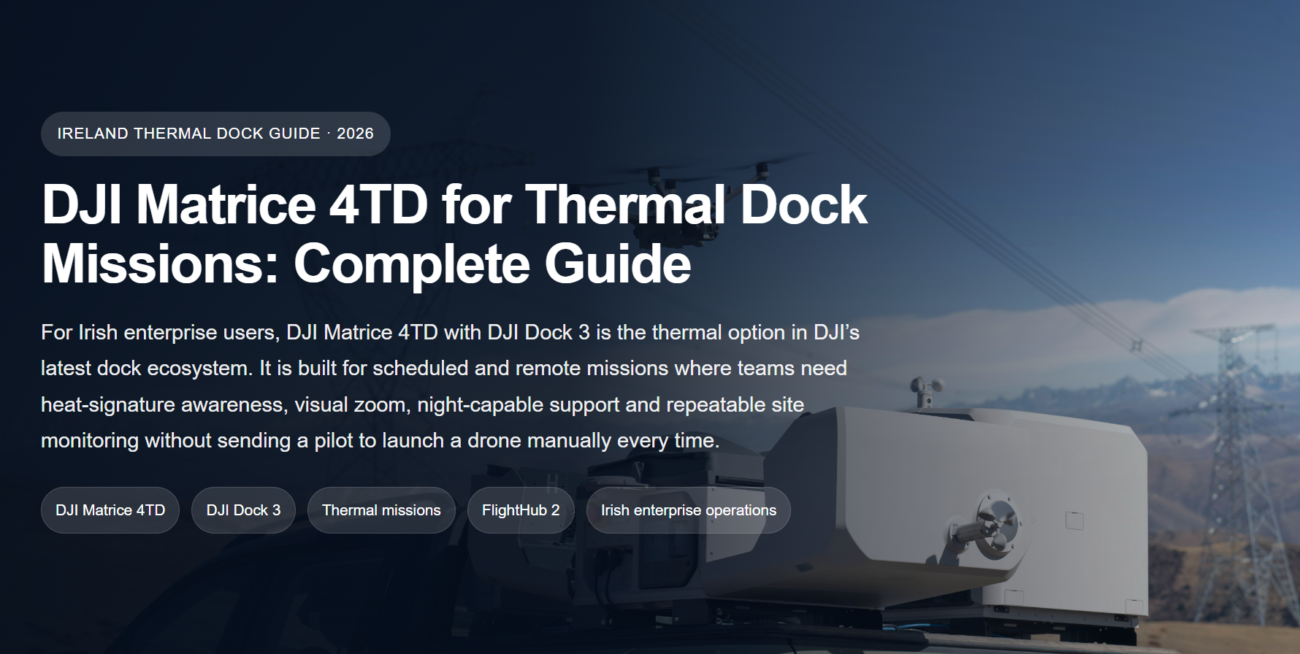
For Irish surveyors, construction teams, quarry operators and infrastructure contractors, the best RTK drone is not simply the aircraft with the longest specification sheet. It is the system that gives repeatable centimetre-level data, fits the site access reality, works with reliable processing software, and can be deployed safely under Irish and EASA operating rules.

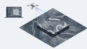
RTK mapping matters because Irish project sites often change quickly. A contractor may need weekly earthworks progress, a quarry team may need accurate stockpile volumes, a civil engineer may need a road corridor model, and a land surveyor may need clean deliverables that can be checked against control. A good RTK drone shortens field time, improves repeatability and gives the office team better data for CAD, GIS, BIM and project reporting.
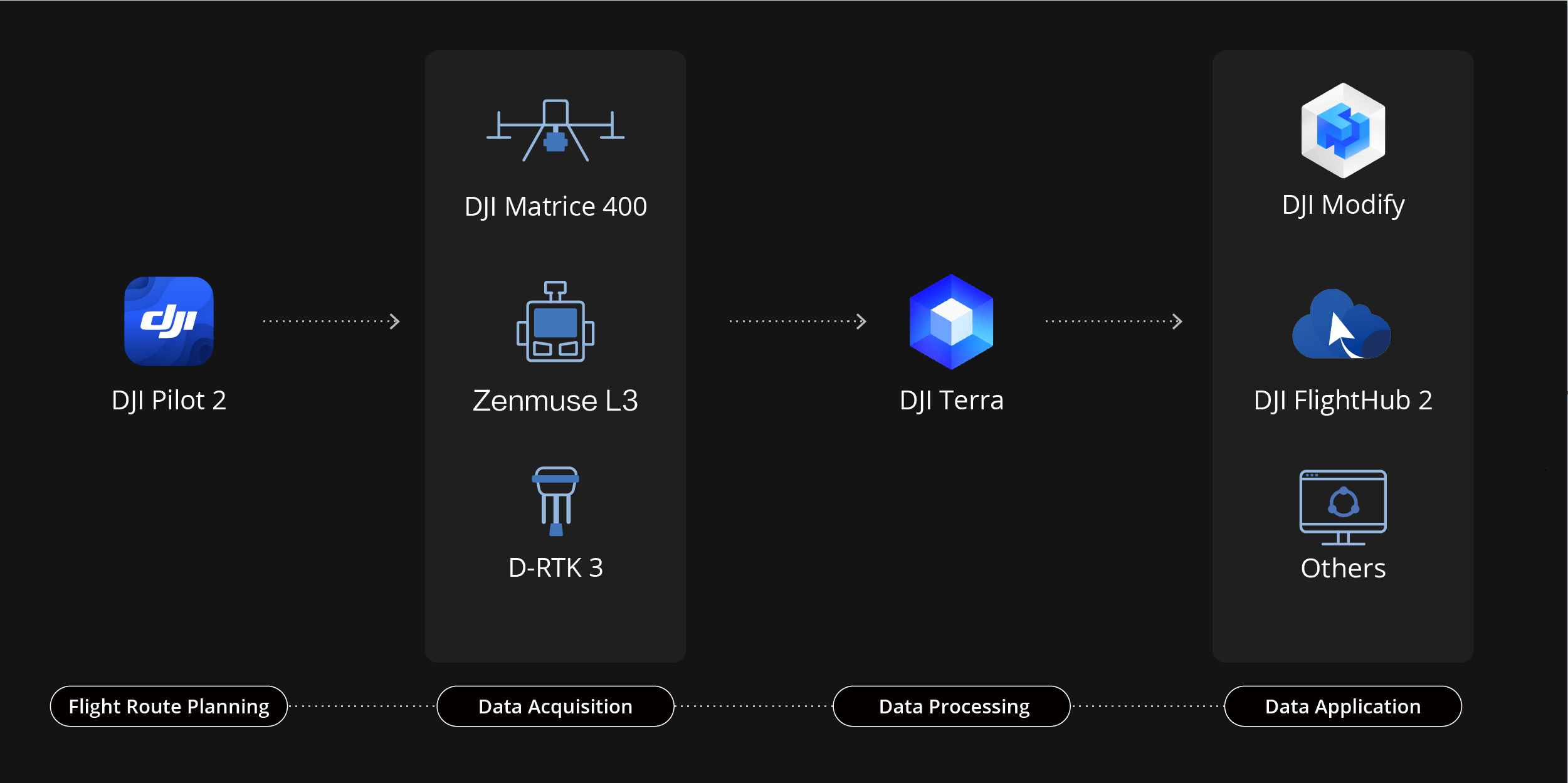
This guide focuses on current DJI Enterprise systems that make sense for Irish commercial surveying in 2026: DJI Matrice 4E, DJI Matrice 400, DJI Zenmuse L3, DJI Zenmuse P1, DJI D-RTK 3 and DJI Terra. Older platforms are not the main recommendation here because most Irish businesses buying now should prioritise current aircraft, current payloads and a workflow that can remain useful for several years.
Quick recommendation: choose Matrice 4E for most single-pilot RTK photogrammetry work; choose Matrice 400 with Zenmuse L3 when you need LiDAR, higher daily coverage, vegetation penetration or a heavier enterprise platform; add D-RTK 3 when network RTK is weak, unavailable or when you need a controlled base/rover workflow.
Why RTK Accuracy Matters for Irish Commercial Surveying
RTK, or Real-Time Kinematic positioning, helps the drone record camera positions with much higher precision than ordinary GNSS. In practice, that means fewer manual ground control points, more repeatable site records and a smoother path from flight data to usable outputs. For Irish survey teams, this is especially useful on sites where access is difficult, terrain is uneven, or repeated visits are required.
In construction, RTK drone mapping can support cut-and-fill checks, site logistics, drainage progress, road alignment records and as-built comparisons. In quarries, it helps teams measure stockpiles and benches without sending staff across unstable ground. In infrastructure work, it supports route planning, embankment assessment, drainage mapping, bridge approach surveys and asset documentation.
RTK is not a magic replacement for survey control. For high-value deliverables, a surveyor still needs appropriate control checks, known coordinate systems, a clear accuracy statement and a workflow that can be audited. The value of an RTK drone is that it reduces wasted field time and improves the consistency of the aerial dataset before processing begins.
Best Overall RTK Drone: DJI Matrice 4E
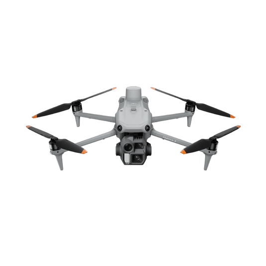
The DJI Matrice 4E is the most practical best-choice RTK drone for many commercial surveying teams in Ireland. It is portable, quick to deploy and designed specifically for surveying, mapping, construction and inspection. For a one-pilot team moving between housing sites, farms, industrial estates, utilities projects or road improvement works, that portability matters as much as the headline camera specification.
The Matrice 4E uses a wide-angle 4/3 CMOS 20 MP camera with a mechanical shutter, which is important for mapping because it helps reduce rolling-shutter distortion during fast image capture. It also supports rapid 0.5-second interval shooting for orthophoto and oblique photography workflows. The result is a compact drone that can collect clean datasets efficiently without needing a heavy aircraft case or a large launch area.
For Irish surveyors who need a repeatable mapping workflow but do not need LiDAR on every job, this is the most sensible starting point. It suits construction progress surveys, site boundary mapping, pre-design topographic context, roof and structure context capture, farm and land management surveys, small quarry updates and local authority asset records.
Where Matrice 4E makes the most sense
- Construction sites: fast weekly progress mapping, volume checks, access road documentation and contractor reporting.
- Land and engineering surveys: orthomosaics, 3D models and terrain context where photogrammetry is appropriate.
- Urban and semi-urban projects: compact deployment where a larger aircraft would slow down the operation.
- Commercial inspection crossover: telephoto options can help capture detail when a site needs both mapping and visual inspection.
Best Heavy-Duty RTK Mapping Platform: DJI Matrice 400

The DJI Matrice 400 is the stronger choice when the job is too demanding for a compact mapping drone. It is a flagship enterprise platform built for long-duration missions, heavier payloads and complex operating environments. It supports a maximum payload of up to 6 kg, offers up to 59 minutes of forward flight time and is suited to large-scale mapping, engineering, construction and infrastructure work.
For Irish commercial surveying, Matrice 400 becomes especially valuable when a business needs to use advanced payloads such as Zenmuse L3 for LiDAR or Zenmuse P1 for high-resolution photogrammetry. It is not the most compact or lowest-cost choice, but it is the better platform when the survey area is large, the site is remote, the payload is specialist, or the data requirement is more demanding.
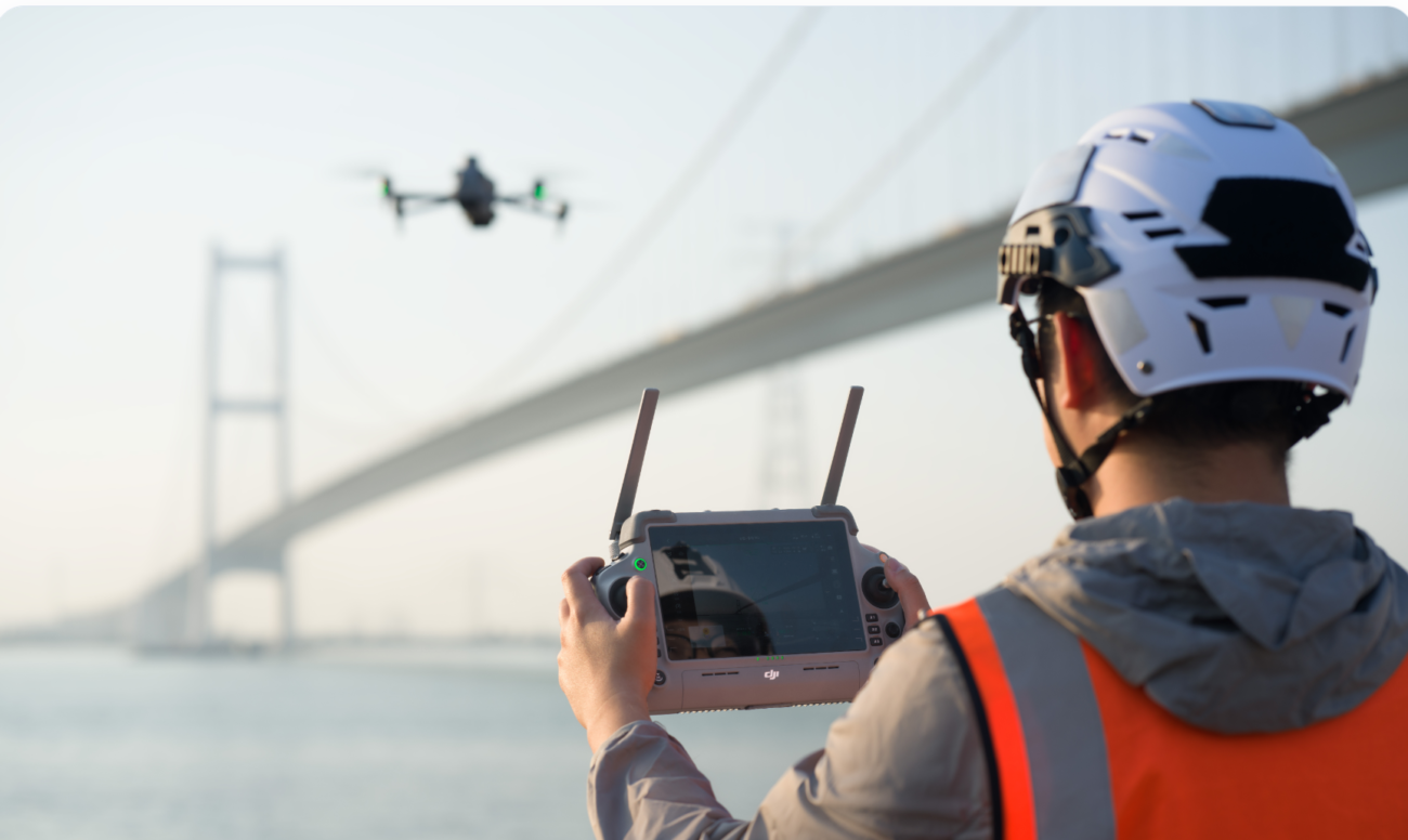
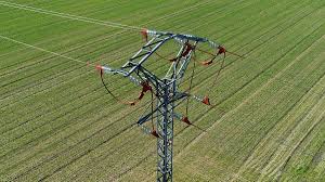
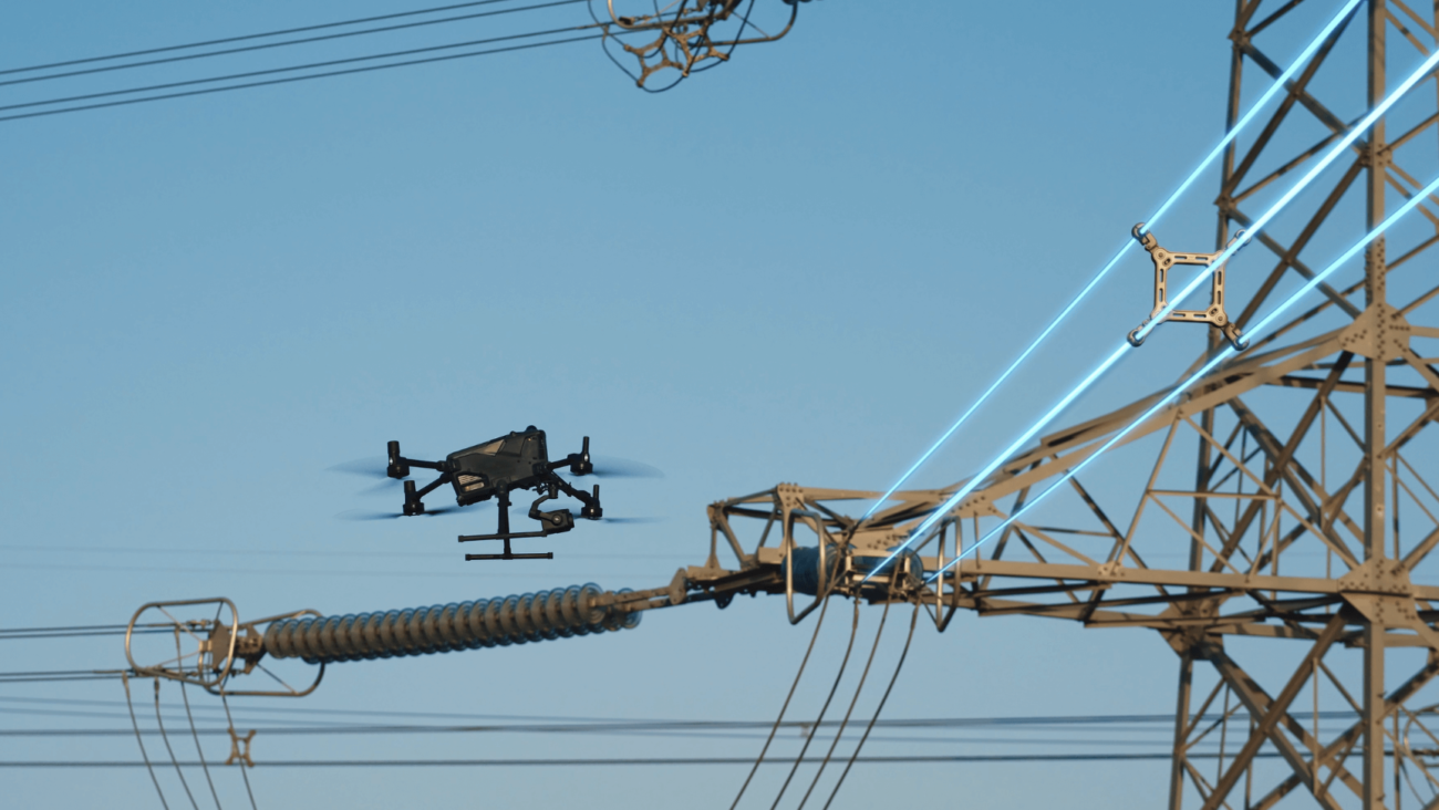
Typical Irish use cases include wind farm access roads, powerline corridors, upland infrastructure, forestry-edge terrain, quarry expansion planning, major earthworks, port infrastructure, industrial estates and large civil engineering projects. In those environments, the aircraft’s endurance, sensing system and payload flexibility can save multiple site visits.
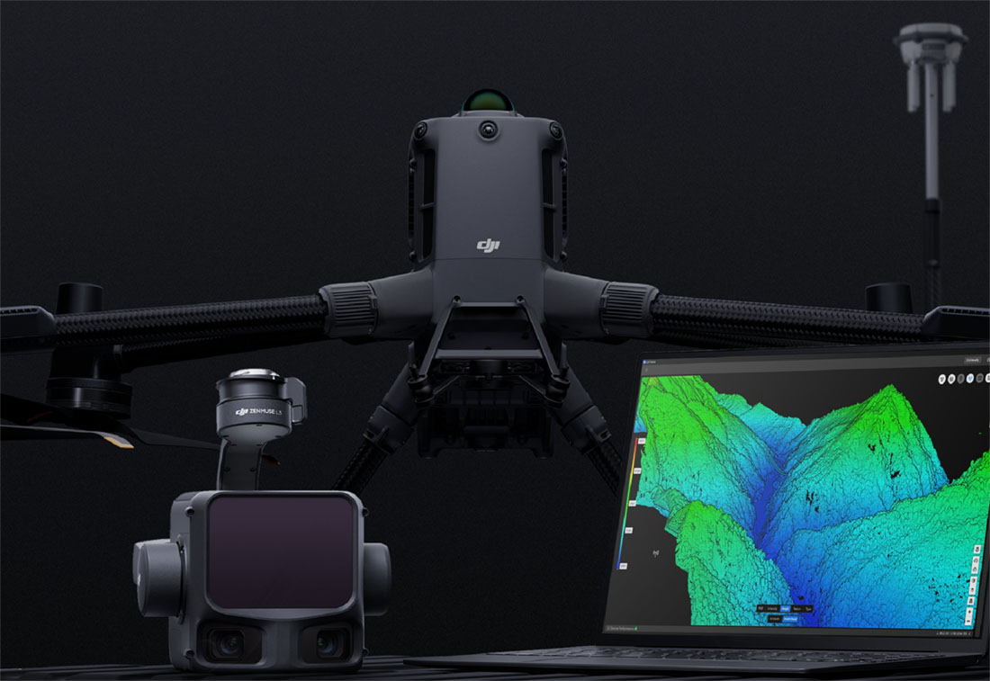
Best RTK LiDAR Setup: Matrice 400 + Zenmuse L3 + D-RTK 3
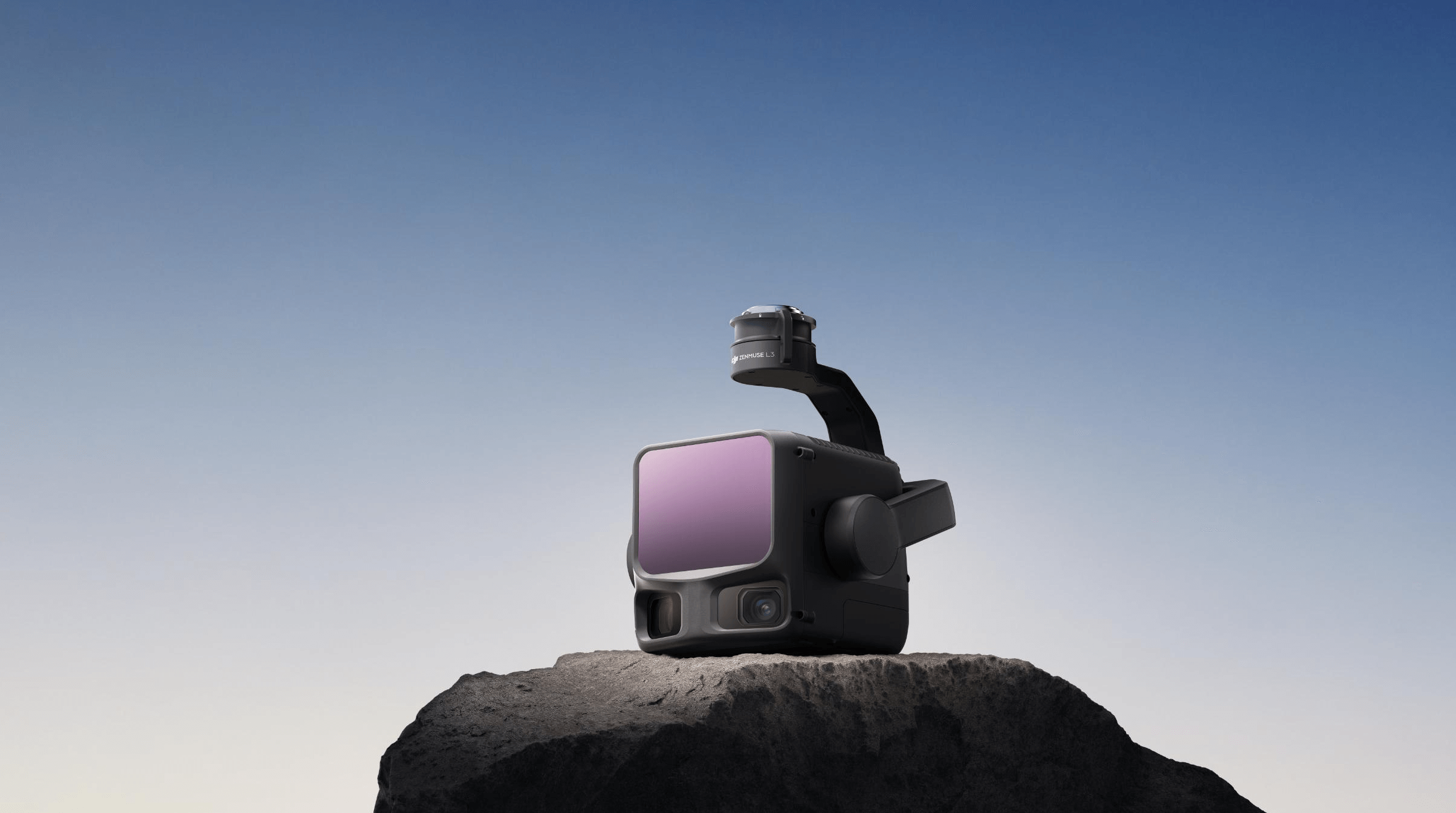
For commercial surveyors who need LiDAR rather than standard photogrammetry, the best current DJI setup is the DJI Matrice 400 with Zenmuse L3 and D-RTK 3. This is the configuration to consider when vegetation, complex terrain, infrastructure corridors or high-output data collection are part of the job.
Zenmuse L3 is a next-generation aerial LiDAR payload with a 1535 nm long-range LiDAR, dual 100 MP RGB mapping cameras and a high-precision POS system. It is designed to capture LiDAR and RGB data in a single flight, helping teams produce multiple deliverables from one operation. For Irish projects, that can be valuable on forestry margins, river corridors, embankments, utility routes, wind farm access roads and large quarries where ground access is slow or hazardous.
LiDAR is particularly useful where photogrammetry struggles. Dense grass, hedgerows, woodland edges, uneven quarry faces and complicated infrastructure can make image-only surface modelling harder. LiDAR can collect point cloud data that gives surveyors more confidence in terrain and structure interpretation, especially when the operator uses appropriate control and processing checks.
When to choose LiDAR
- The site has vegetation or partial ground cover.
- You need a point cloud as the main deliverable.
- The terrain is steep, irregular or difficult to access.
- You need corridor or infrastructure data over a large area.
- The project needs repeatable high-quality 3D data, not just a visual map.
The Role of D-RTK 3 in a Commercial Surveying Workflow

D-RTK 3 is an important part of the DJI surveying ecosystem because it gives teams more control over positioning when network RTK is not ideal. In parts of rural Ireland, upland sites, quarries, wind farm access roads and remote infrastructure locations, relying only on network connection can create delays. A dedicated RTK station helps the crew keep working with a more predictable setup.
D-RTK 3 can support centimetre-level positioning workflows and can also be useful for marking ground control points. For surveyors, the advantage is not only accuracy. It is operational confidence: fewer interruptions, clearer control over the site setup and a better field-to-office handover.
Best RTK Drone Options Compared
Photogrammetry or LiDAR: Which RTK Drone Setup Should You Buy?
For most Irish businesses, photogrammetry should be the first RTK drone workflow to consider. It is efficient, visually rich and suitable for a wide range of survey, construction and inspection records. A Matrice 4E can produce orthomosaics, 3D models and site measurements with a practical operating cost.
LiDAR becomes the better investment when the business repeatedly works on vegetation, complex ground, long corridors or projects where point cloud quality is more important than visual texture. A company that only needs occasional stockpile measurement may not need to buy LiDAR immediately. A survey firm covering quarries, forestry margins, utilities and large infrastructure may justify the Matrice 400 + Zenmuse L3 workflow much faster.
Matrice 4E
The best RTK drone for most commercial surveying teams that need a portable, modern mapping platform.
Matrice 400
The right aircraft when endurance, payload capacity and advanced enterprise workflows are more important than portability.
M400 + L3
The strongest choice for vegetation, corridors, high-output LiDAR capture and advanced point cloud deliverables.
What About Software?
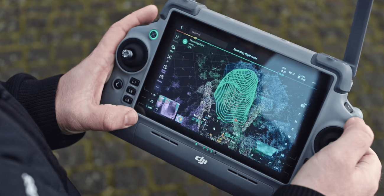
Hardware is only half of the decision. A commercial RTK drone must fit the software workflow your team already uses. DJI Terra is the natural DJI ecosystem tool for processing visible-light images and LiDAR data into mapping outputs such as orthomosaics, 3D models, digital surface models and point clouds. For engineering teams, the key question is how easily those outputs move into CAD, GIS, BIM or volume measurement workflows.
A strong Irish surveying workflow normally includes mission planning, RTK setup, field notes, control checks, data processing, quality review and deliverable export. The best drone is the one that makes each step predictable. That is why the Matrice 4E, Matrice 400, Zenmuse L3, D-RTK 3 and DJI Terra combination is so strong: it gives a more unified path from capture to output.
Irish Compliance and Site Planning Considerations
Commercial drone surveying in Ireland must be planned around Irish Aviation Authority and EASA operating requirements. Low-risk operations may fall under the Open Category, but more complex work can require the Specific Category, especially where the operation is outside Open Category limits, near restricted airspace, close to people, or involves more advanced operating conditions.
Surveyors should also think about landowner permission, site induction, traffic management, worker exclusion zones, data privacy, weather windows and emergency procedures. Ireland’s weather is a real operational factor. Wind, low cloud, rain and poor light can affect both safety and data quality, so the best RTK drone workflow includes a clear go/no-go process, not just a flight plan.
Buyer Checklist: Choosing the Best RTK Drone
- Choose Matrice 4E if your main need is portable RTK photogrammetry for construction, land, property, quarry and infrastructure mapping.
- Choose Matrice 400 if you need a heavier enterprise platform with more payload flexibility and longer mission capability.
- Add Zenmuse L3 if LiDAR data, terrain penetration, point clouds and high-output mapping are core requirements.
- Add D-RTK 3 if your work often takes place where network RTK is weak or where you want more field control.
- Plan software before buying hardware so your drone data moves cleanly into CAD, GIS, BIM and reporting workflows.
Final Recommendation
The best RTK drone for commercial surveying in Ireland is the DJI Matrice 4E for most teams. It is modern, portable, survey-focused and efficient enough for a wide range of daily commercial mapping jobs. It gives Irish surveyors and contractors a strong balance between data quality, field speed and deployment simplicity.
For larger sites and higher-end deliverables, the best system is DJI Matrice 400 with the appropriate payload. Choose Zenmuse P1 for full-frame photogrammetry workflows and Zenmuse L3 for LiDAR. Add D-RTK 3 when positioning reliability and field control are critical. For businesses that want to build a long-term enterprise surveying capability, this combination gives the most room to grow.

Leave a comment