
Ireland Drone Compliance Guide 2026
A practical guide for Irish construction firms, surveyors, utilities, renewable energy operators, estates, councils and contractors planning professional drone operations with DJI Enterprise platforms.
The short answer: commercial drone work is allowed in Ireland, but the permission route depends on the risk of the flight — not simply on whether the job is paid. A normal visual-line-of-sight survey may fit the Open category. BVLOS inspection, automated dock operations, complex urban work or restricted airspace usually need deeper planning with the Irish Aviation Authority.
1. Quick Answer: What Does an Irish Business Need Before Flying a Drone?
For most Irish businesses, drone compliance is not a single “commercial licence” question. It is a decision path: who is the UAS operator, who is the remote pilot, what drone is used, where it will fly, how high it will fly, whether the pilot can keep visual line of sight, and whether the camera may capture personal data.
The Irish Aviation Authority explains that permission is not required only because a drone is used commercially, provided the operation remains within the Open category. If the job goes outside those limits, the operator must look at an Operational Authorisation route.
| Question | Why it matters | Business action |
|---|---|---|
| Is the company registered as the UAS operator? | The operator is responsible for the drone operation, even if an employee or contractor flies. | Register through the correct IAA/MySRS route where required and keep details current. |
| Can the pilot maintain VLOS and stay under 120 m? | These are key Open category limits. | Plan take-off points, observer positions and mission boundaries before quotation. |
| Is the site near restricted airspace or a UAS geographical zone? | A site can look simple on the ground but still have aviation restrictions. | Check IAA UAS geographical zones, published TRAs and NOTAMs before each flight. |
| Will people, vehicles, homes or number plates be captured? | Drone video can become personal data and trigger GDPR responsibilities. | Use notices, minimise capture, restrict access and define retention periods. |
2. Open Category: The Route for Lower-Risk Business Flights
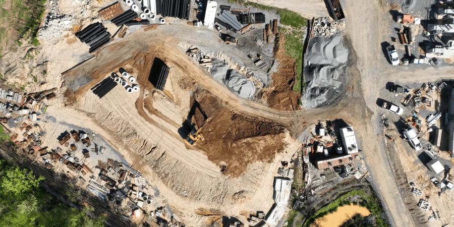
The Open category is for lower-risk drone operations that meet predefined limits. In practical business terms, this may include many routine visual-line-of-sight jobs such as construction progress photography, site mapping, roof checks, farm surveys, estate inspections and basic asset documentation.
Visual line of sight
The remote pilot must be able to maintain direct visual awareness of the aircraft unless another authorised route applies.
120 m height limit
Open category flights generally stay below 120 m above ground level, unless a specific exception or permission applies.
Drone class and weight
The drone class, weight, payload and subcategory affect where and how the aircraft can be flown.
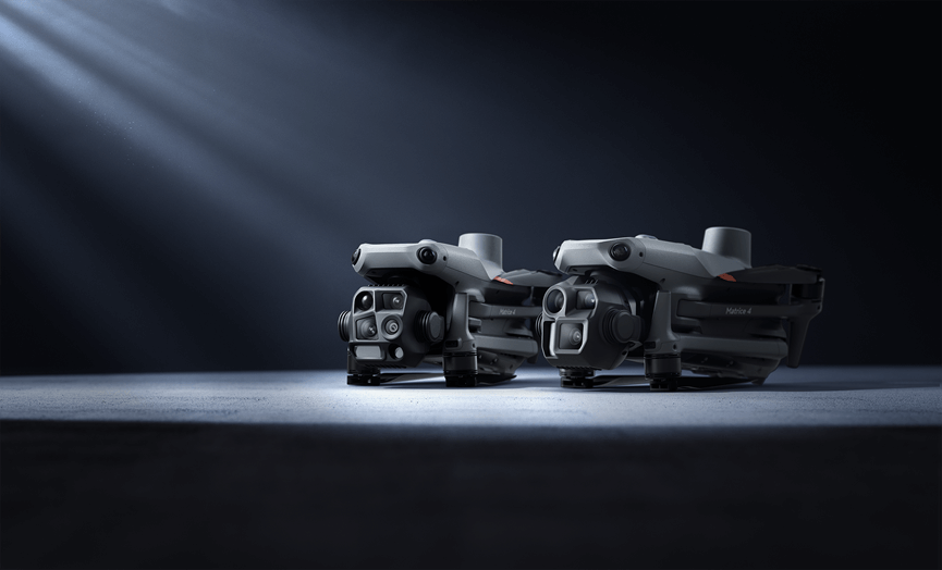
A construction contractor using a DJI Matrice 4E survey drone for controlled site mapping may often plan around Open category limits if the site layout, people, airspace and height are suitable.
3. Specific Category: When the Job Becomes More Complex
The Specific category is where many serious enterprise programmes begin. It is relevant when the mission goes beyond the limits of the Open category, or when the operating environment introduces higher risk.
Examples that may push a business toward Specific category planning
- Beyond visual line of sight inspection of powerlines, pipelines, railways or large estates.
- Automated or remote drone dock operations.
- Operations above 120 m or in restricted/prohibited airspace.
- Complex urban environments with roads, pedestrians or neighbouring properties.
- Night, emergency, thermal or security operations with a higher risk profile.
For example, a utility company using DJI Matrice 400 RTK for corridor inspection may have a strong business case, but the legal pathway should be designed before the workflow is sold internally.
4. Common Irish Business Scenarios and Compliance Direction
The table below is a practical planning guide. It does not replace a site-specific risk assessment, but it helps business owners separate simple jobs from jobs that need regulatory planning early in the sales process.
| Business task | Possible category direction | What to check before flying |
|---|---|---|
| Daylight construction progress mapping | Often Open if VLOS, below 120 m and outside restricted conditions | Site access, cranes, people, roads, airspace, weather and launch/landing area. |
| Roof, facade or solar inspection | Open or Specific depending on location and proximity to people | Privacy, exclusion zones, pedestrian control, thermal data and client permissions. |
| Powerline, railway or pipeline corridor survey | Often Specific if long-distance or BVLOS | Observer positions, terrain, emergency landing areas, land access and operational authorisation. |
| Automated monitoring with DJI Dock 3 | Usually needs Specific category planning for remote or BVLOS workflows | Operating model, command responsibility, remote supervision, airspace, maintenance and emergency procedures. |
| Security patrol or incident response | Open or Specific depending on timing, location, people and control method | Night procedures, GDPR, evidence handling, signage, pilot competence and escalation process. |
5. UAS Geographical Zones, NOTAMs and Airspace Checks
Before every commercial flight, the operator should check Ireland UAS Geographical Zones data, published Temporary Restricted Areas and NOTAMs. This is especially important near airports, ports, emergency service areas, controlled airspace, sensitive infrastructure, city centres and major events.
A site in Dublin, Cork, Shannon, Galway, Waterford or near an active aerodrome may need more planning than a rural estate. The correct answer is not “the drone can fly there”; the correct answer is whether the operator has checked the airspace and has the right permission or operating category for that exact place and time.
6. Insurance, Privacy and GDPR
Commercial drone compliance is not only aviation compliance. Irish businesses also need insurance and data protection controls. Drone cameras may capture staff, visitors, neighbours, number plates, private gardens, public roads or sensitive sites. If people are identifiable, personal data responsibilities may apply.
Insurance
Treat aviation liability insurance as part of the project cost. For enterprise platforms, consider payload and hull cover as well.
Data minimisation
Capture only what the project needs. Avoid unnecessary footage of neighbours, roads or unrelated workers.
Retention and access
Define who can view files, where footage is stored, how long it is kept and how client evidence is handed over.
7. How DJI Enterprise Platforms Fit Irish Compliance Planning
The drone model does not decide the legal category by itself. The aircraft, payload, location, height, flight path, people nearby and control method together decide how the operation should be planned. Still, choosing the right platform can make compliance easier because the drone better matches the mission.
DJI Matrice 4E: mapping, surveying and construction
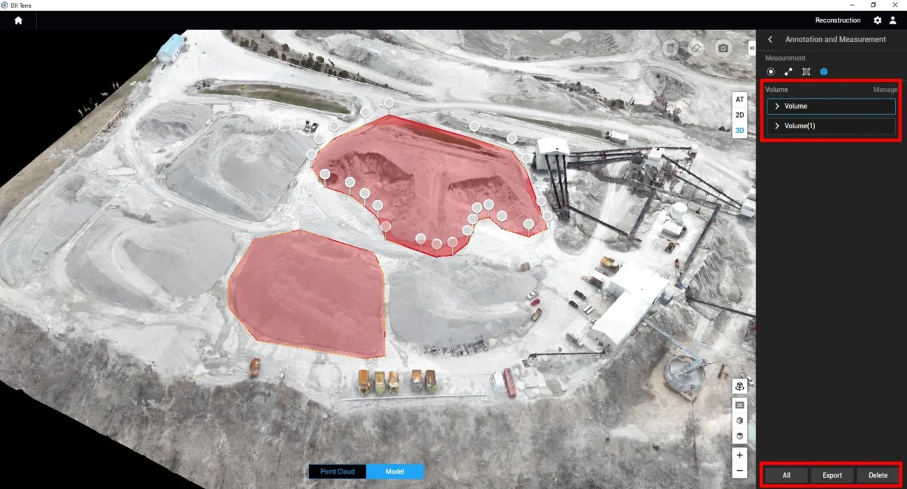
The DJI Matrice 4E is a strong fit for Irish surveyors, construction teams, farms, quarries and estates that need RTK mapping, modelling and progress documentation.
DJI Matrice 4T: thermal inspection and public safety awareness
The DJI Matrice 4T suits inspection, emergency response, thermal checks, site security and night-awareness work. Thermal and zoom capability can improve safety, but privacy and data protection controls become especially important near people, homes or workplaces.
DJI Matrice 400: infrastructure, utilities and long-duration work
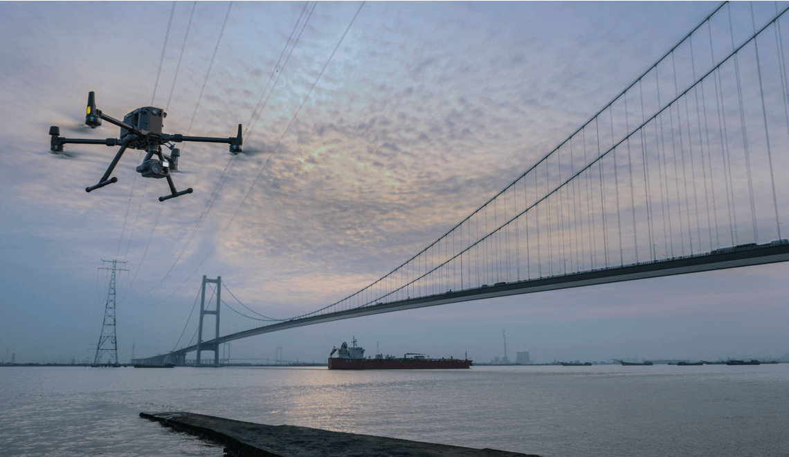
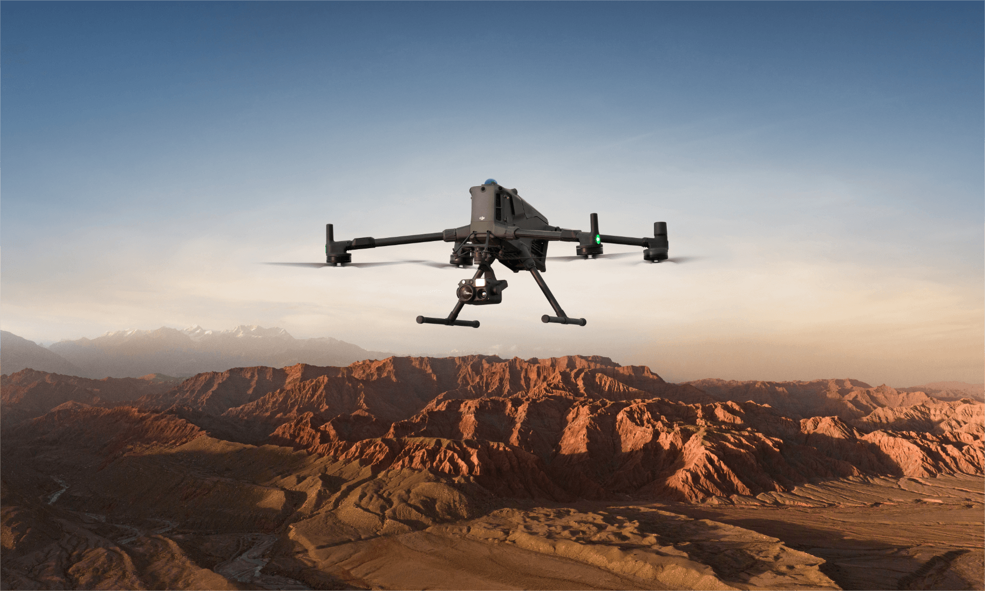
DJI Matrice 400 RTK is better suited to larger enterprise missions such as powerline inspection, bridge inspection, ports, utilities, emergency response and industrial sites. Its capability is valuable, but BVLOS, night work, restricted airspace or heavy payloads should be checked early.
DJI Dock 3: automated and remote operations
DJI Dock 3 with Matrice 4D or Matrice 4TD can support scheduled and remote operations for fixed sites, vehicle-mounted deployments, industrial monitoring, solar farms, campuses and security workflows. Automation does not remove regulatory responsibility.
D-RTK 3 and LiDAR payloads
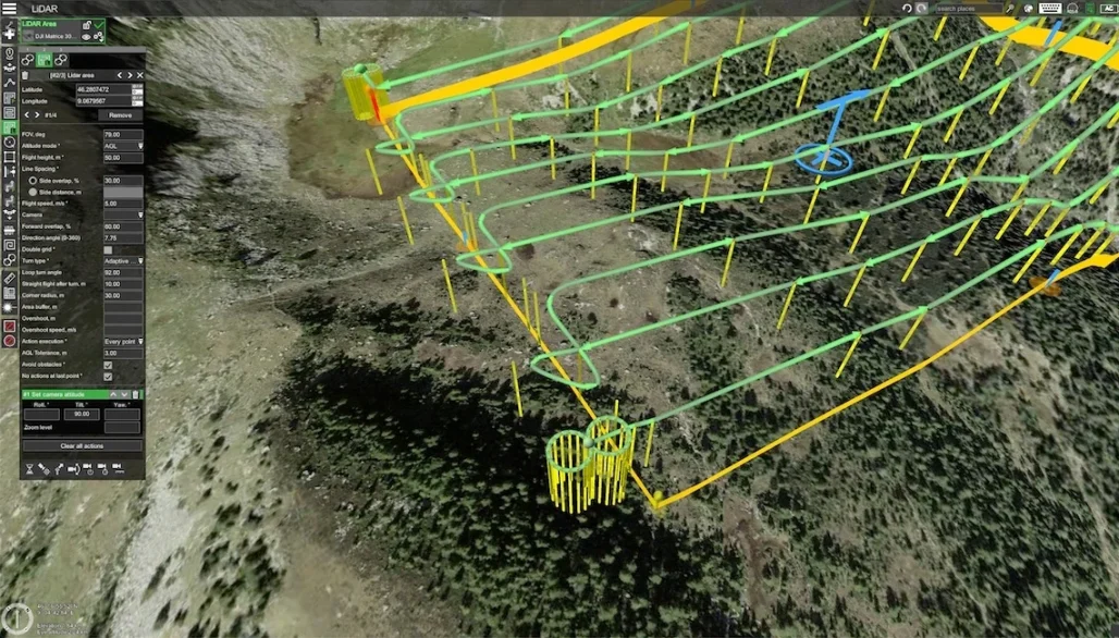
For mapping accuracy, a DJI D-RTK 3 Multifunctional Station can support precise GNSS workflows. For large-area and corridor mapping, Matrice 400 with Zenmuse L3 can be highly productive, but the operational plan still needs VLOS, observer placement, land access, airspace checks and emergency planning.
8. Practical Compliance Checklist for Irish Businesses
Before quoting the job
- Define the mission: inspection, mapping, LiDAR, thermal, security, emergency response or automated monitoring.
- Check whether the work can stay within Open category limits or needs Specific category planning.
- Review the site location against UAS geographical zones, TRAs and obvious airspace risks.
- Decide whether privacy notices, exclusion zones or client-side permissions are required.
Before the flight
- Confirm operator registration, pilot competence and insurance.
- Check NOTAMs, weather, battery status, firmware, fail-safe settings and emergency landing areas.
- Brief site staff and confirm who controls the area during take-off, landing and data capture.
- Use a written flight plan and risk assessment for repeatable commercial work.
After the flight
- Store logs, images, videos, maps and inspection outputs in the agreed location.
- Restrict access to footage that may include people, vehicles or private property.
- Record any incident, near miss, unusual airspace issue or client-side operational concern.
- Review whether the next flight can stay in the same category or needs a different approval route.
FAQ: Commercial Drone Regulations in Ireland
Do Irish businesses need IAA permission just because a drone flight is commercial?
No. Permission is not required solely because the drone is used commercially. The key question is whether the operation stays within Open category limits. If it does not, the business should look at Specific category authorisation.
Can my company fly a DJI Matrice 4E in the Open category?
Possibly. It depends on the aircraft configuration, class/subcategory, site, VLOS, altitude, people nearby and airspace. A controlled VLOS mapping job is much easier than a complex urban or BVLOS mission.
Can DJI Dock 3 run automatic inspections in Ireland?
The technology supports remote and automated workflows, but the legal route depends on the mission. Repeated remote, automated or BVLOS inspections should be planned under a Specific category strategy.
Do drone rules apply over private property?
Yes. Airspace rules still apply. Private land access, privacy, trespass, insurance and client permission may also need to be considered depending on the job.
Is GDPR relevant for drone inspections?
Yes, if the drone captures identifiable people, number plates, homes or workplace activity. Businesses should minimise unnecessary capture, document the purpose, control access and define retention periods.
Need help planning a compliant DJI Enterprise drone setup?
Irish Drone can help your team choose the right platform, understand the likely operating category, and build a practical workflow for surveying, inspection, thermal monitoring, LiDAR mapping or automated dock operations in Ireland.
Contact Irish DroneOfficial sources checked
This article was rewritten using current public guidance from the Irish Aviation Authority, EASA, the Data Protection Commission and DJI Enterprise product pages.

Leave a comment