
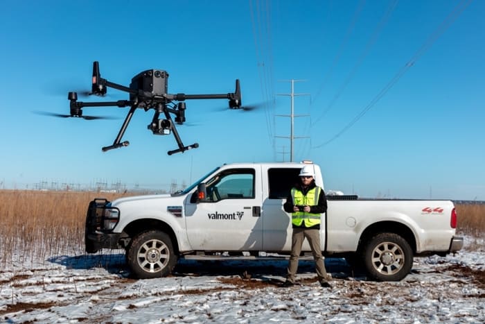
A professional drone programme is not just buying a drone. It is a managed business capability with the right use cases, aircraft, sensors, trained pilots, operating procedures, compliance controls, data workflows and reporting structure.
Quick Answer: What Should a Business Drone Programme Include?
For Irish businesses, a professional drone programme should include a clear business use case, suitable DJI aircraft and payloads, trained remote pilots, IAA/EASA compliance checks, insurance, standard operating procedures, maintenance logs, a secure data workflow and a repeatable reporting process. Without these elements, the drone remains a piece of equipment rather than a reliable operational system.
Why Irish Businesses Need a Structured Drone Programme
Many companies start with one drone and one enthusiastic staff member. That can work for a few simple flights, but it usually becomes a problem when the business needs repeatable results, multiple pilots, client reporting, internal safety approval or compliance records.
A drone programme gives the company a controlled way to use aerial data. The goal is not to fly more; the goal is to make surveying, inspection, site monitoring, asset management, emergency response or security work safer, faster and easier to document.
Safety
Reduce the need for staff to climb roofs, enter live sites, access unstable ground or inspect assets from unsafe positions.
Speed
Capture site records, mapping imagery, inspection evidence and progress updates faster than many manual methods.
Data Quality
Use repeatable flights, RTK workflows, thermal data, LiDAR or zoom imagery to build reliable project records.
Governance
Create one controlled process for pilots, permissions, maintenance, insurance, data storage and client deliverables.
The 8-Part Framework for a Professional Drone Programme
Which DJI Enterprise Drone Should Your Programme Start With?
The right DJI setup depends on the job. A construction company that needs mapping should not choose the same system as a utility team that needs thermal and zoom inspection, or a surveying team that needs LiDAR deliverables.
| Business requirement | Recommended DJI setup | Why it fits | Typical Irish use cases |
|---|---|---|---|
| Compact mapping and surveying | DJI Matrice 4E | 4/3-inch CMOS 20MP wide camera, mechanical shutter and RTK-supported mapping workflows make it suitable for efficient photogrammetry and site records. | Land surveying, construction progress, roof modelling, site documentation, quarry or farm mapping. |
| Thermal inspection and public safety | DJI Matrice 4T | Portable multi-sensor platform for visual, zoom and thermal inspection where small teams need fast deployment. | Solar PV inspection, roof issues, public safety support, factory checks, utilities and security patrols. |
| Long-duration enterprise inspection | DJI Matrice 400 + Zenmuse H30T | Matrice 400 is the stronger platform when the job needs long endurance, heavier payloads, IP55 protection and advanced enterprise sensors. | Powerlines, telecom towers, bridges, wind turbines, ports, industrial estates and emergency response. |
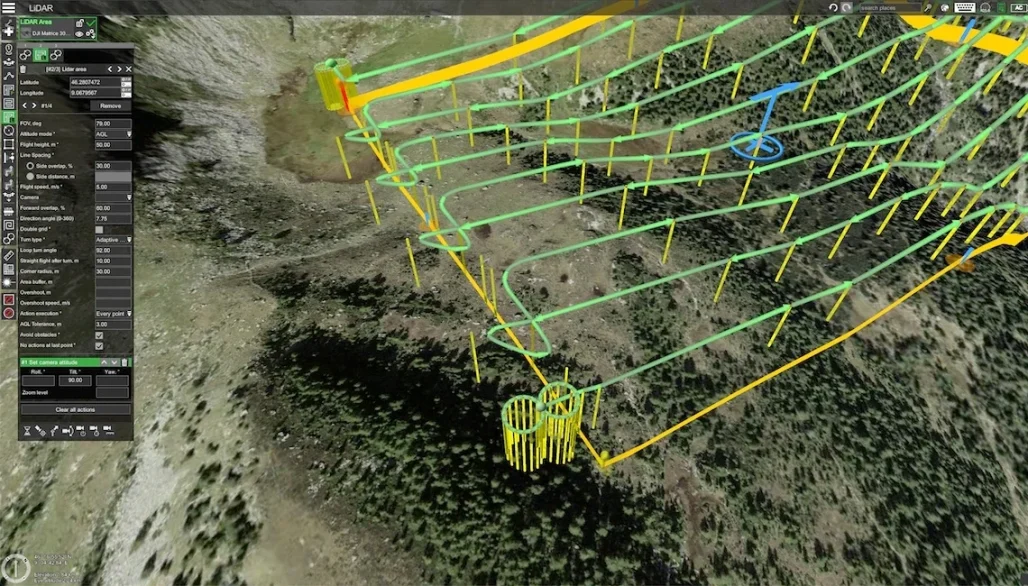
| LiDAR and 3D geospatial data | Zenmuse L3 on Matrice 400 | LiDAR and dual RGB mapping cameras support point clouds, DEM/DSM outputs, 3D models and high-value survey deliverables. | Forestry, infrastructure corridors, quarry volumes, terrain models, engineering design and asset management. |
| Remote and repeatable monitoring | DJI Dock 3 + Matrice 4D / 4TD | Designed for scheduled remote missions, repeatable routes and centralised management through FlightHub 2, subject to authorisation. | Solar farms, utilities, remote yards, public safety standby, ports, campuses and recurring site patrols. |
Match the Drone Programme to the Department
Surveying & Engineering
Needs RTK, mechanical shutter, repeatable mapping missions, ground control decisions, accuracy checks, DJI Terra processing and clear deliverables for CAD/GIS workflows.
Inspection & Maintenance
Needs zoom cameras, thermal data where relevant, defect tagging, before/after evidence, safe standoff distance and a report template that maintenance teams can act on.
Construction & Facilities
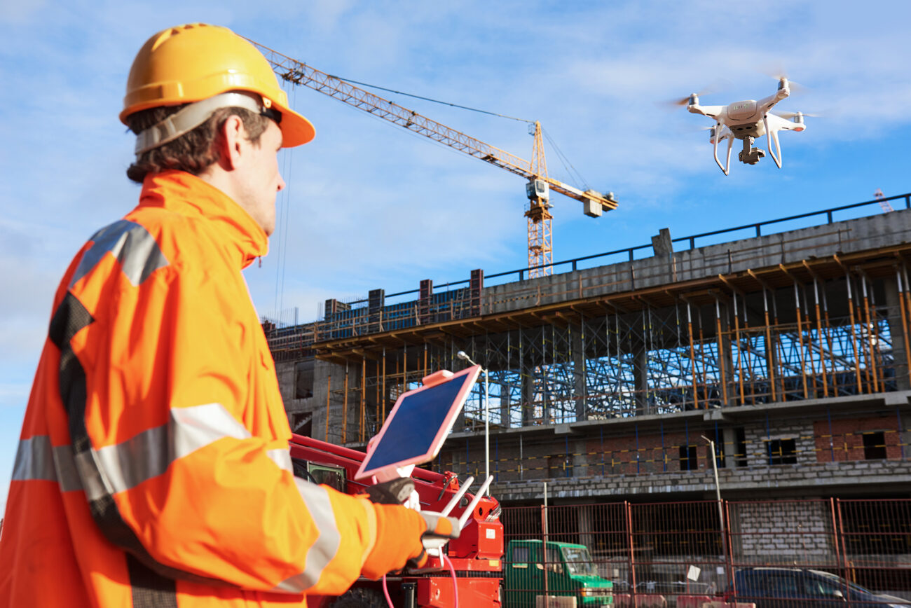
Needs progress records, site overviews, logistics checks, roof and façade documentation, safety observations and repeatable weekly capture points.
Utilities & Energy
Needs careful airspace and site planning, thermal/zoom evidence, asset IDs, route planning, safety separation, operational authorisation review and strong data management.
Public Safety & Security
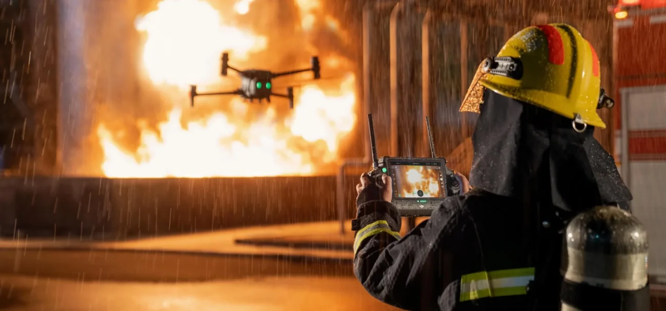
Needs fast deployment, live streaming, thermal awareness, night operation planning, privacy controls, incident logging and clear command roles.
Agriculture & Forestry
Needs crop or vegetation outputs, terrain models, field boundaries, forestry inventory, storm damage records and seasonal repeatability rather than one-off images.
A Practical Drone Workflow for Business Operations
The best drone programmes use the same repeatable workflow for every job. This reduces mistakes, makes reporting easier and helps the business prove that flights are controlled and purposeful.
| Stage | What happens | Output |
|---|---|---|
| 1. Request | Department submits the site, purpose, required deliverables, deadline and risk context. | Flight request record. |
| 2. Planning | Check airspace, weather, people, nearby roads, property access, data privacy, site hazards and required authorisation. | Site risk assessment and mission plan. |
| 3. Capture | Pilot completes pre-flight checks, flies the approved mission and records relevant flight details. | Images, video, thermal files, LiDAR data or live operational feed. |
| 4. Processing | Data is processed in DJI Terra, FlightHub 2, GIS software, inspection software or internal reporting tools. | Orthomosaic, 3D model, point cloud, defect list, annotated image set or inspection report. |
| 5. Review | Engineer, surveyor, safety officer or asset manager reviews the data and converts it into actions. | Decision, maintenance ticket, design input, safety action or client report. |
| 6. Archive | Store flight logs, deliverables and raw data under the company retention policy. | Auditable project record. |
Essential SOP Checklist for a Business Drone Programme
Before the flight
- Confirm the business purpose and required output.
- Check airspace and UAS geographic zones.
- Confirm site permission and access.
- Review weather, visibility and wind limits.
- Assign pilot, observer and site contact if needed.
- Check aircraft, batteries, propellers, payload and firmware.
During the flight
- Maintain agreed separation from people, vehicles and structures.
- Monitor battery, GNSS, signal, weather and aircraft condition.
- Follow the approved mission route.
- Record any deviations or safety issues.
- Stop the operation if conditions become unsafe.
After the flight
- Check aircraft and battery condition.
- Download and back up mission data.
- Complete the flight log.
- Process data using the correct workflow.
- Deliver the agreed report or dataset.
- Log maintenance, incidents or lessons learned.
90-Day Rollout Plan
A business should avoid trying to build a full drone department in one week. A staged rollout gives better control and makes it easier to prove value.
Plan and prepare
Identify use cases, choose the first department, confirm compliance route, select aircraft, define SOPs, assign owners and prepare basic training.
Pilot project
Run a controlled project such as a construction site record, roof survey, solar inspection, land mapping mission or asset inspection route. Measure time, cost, safety and reporting value.
Standardise and scale
Refine SOPs, standardise report templates, train additional users, add data storage rules, review insurance and decide whether to expand to new sites or departments.
Software and Data Management
Drone value is created after the flight. A company needs a software workflow that fits its deliverables and data-security requirements.
| Software / system | Main role | Where it fits |
|---|---|---|
| DJI Pilot 2 | Ground control and mission execution. | Daily flying, route setup and aircraft operation. |
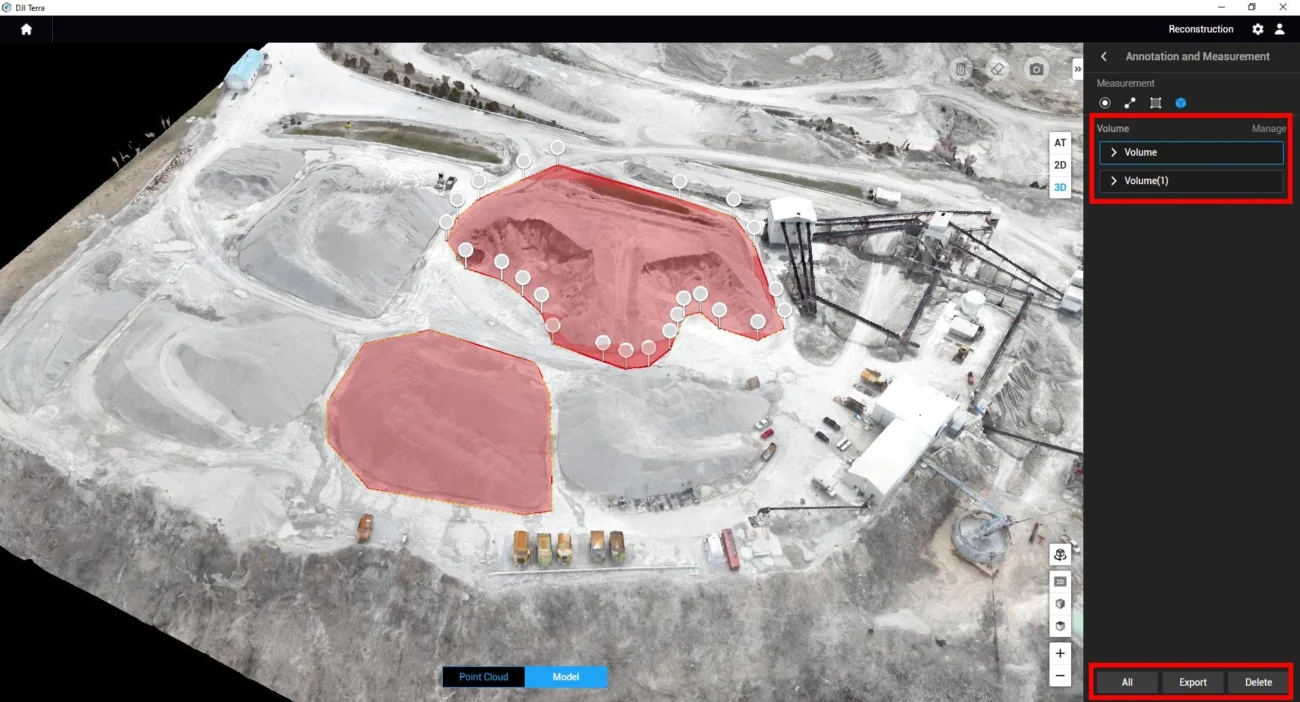
| DJI Terra | 2D/3D reconstruction and LiDAR data processing. | Surveying, mapping, point clouds, orthomosaics and 3D models. |
| DJI FlightHub 2 | Cloud-based operations management, live situational awareness and dock mission management. | Team operations, remote monitoring, FlightHub projects and Dock 3 deployments. |
| GIS / CAD / asset systems | Converts drone outputs into engineering, asset-management and client workflows. | Engineering teams, utilities, local authorities, surveyors and construction companies. |
Ireland Compliance Notes
Drone operations in Ireland should be planned around IAA and EASA rules. The exact route depends on aircraft, location, distance from people, airspace, operational complexity and whether the flight remains within Open Category limits.
Do not skip these checks
- Operator registration: Businesses operating drones with a camera or over 250 g normally need operator registration.
- Remote pilot competency: Confirm the training and competency required for the intended operation.
- Airspace and UAS geographic zones: Check restrictions before planning work near airports, controlled airspace, prisons, ports, critical infrastructure or urban sites.
- Open vs Specific Category: Complex environments, BVLOS, restricted/prohibited airspace or higher-risk operations may require Operational Authorisation.
- Privacy: RGB, zoom, thermal and LiDAR sensors can collect personal or sensitive data. Use clear purpose, permission basis, retention rules and responsible sharing.
- Insurance: Confirm that your policy covers the aircraft, operation type, pilots, payloads, sites and commercial activity.
This section is not legal advice. For higher-risk operations, the business should confirm current requirements with the Irish Aviation Authority, a qualified drone training organisation or a suitable aviation consultant.
KPIs: How to Prove the Programme Is Working
Management will continue funding a drone programme when the benefits are measured clearly. Useful KPIs include:
Safety KPIs
Reduced roof access, fewer manual inspections at height, fewer site shutdowns and fewer staff hours in hazardous areas.
Time KPIs
Inspection time saved, faster survey capture, reduced travel, faster emergency assessment and quicker client reporting.
Quality KPIs
More complete image records, repeatable mapping, better defect evidence, improved asset history and fewer missing site details.
Commercial KPIs
New service revenue, faster quotations, fewer re-visits, stronger tenders and higher-value reporting packages.
FAQ: Building a Professional Drone Programme in Ireland
What is a professional drone programme?
It is a structured business system for using drones safely and consistently. It includes aircraft, payloads, trained people, SOPs, maintenance, insurance, compliance, software, data storage and reporting templates.
Which DJI drone is best for a business starting out?
For compact mapping, start with DJI Matrice 4E. For thermal inspection and public safety, start with Matrice 4T. For larger enterprise inspection, LiDAR or heavier payloads, choose Matrice 400 with the correct payload. For automated recurring missions, review Dock 3 with Matrice 4D or 4TD.
Does every business need LiDAR?
No. LiDAR is valuable for terrain, forestry, complex structures, corridor mapping and high-value geospatial deliverables. If the business mainly needs visual inspection or simple site progress photos, LiDAR may not be necessary at the start.
When does a business need Operational Authorisation?
Operations outside Open Category limits, complex environments, BVLOS missions, restricted or prohibited airspace, or higher-risk commercial work may require Specific Category planning and Operational Authorisation. Always confirm the current position before flying.
Should we train one pilot or a full team?
Start with a responsible pilot and a programme owner, then train additional users as demand grows. Surveyors, engineers and managers also need basic drone-data understanding so they can request the right outputs and interpret reports correctly.
Can Irish Drone help select the correct setup?
Yes. The best starting point is to list your industry, site type, required output, flight frequency, budget and whether you need mapping, thermal inspection, LiDAR, remote monitoring or public safety capability.
Need Help Building a Drone Programme?
Irish Drone can help your business choose the right DJI aircraft, payload, software workflow and operational setup for surveying, inspection, asset management, construction, public safety, agriculture, forestry and remote monitoring.
Recommended next step: prepare a short list of your target sites, required outputs, current inspection/survey method, safety concerns and expected flight frequency.
Product and regulatory notes should be checked against current DJI Enterprise specifications and Irish Aviation Authority guidance before purchase, flight planning or automated deployment. This article is general guidance for business planning and is not legal advice.
Leave a comment