
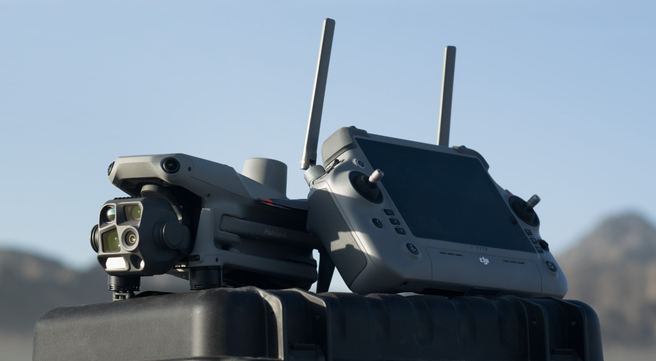

Choosing an enterprise drone starts with the business problem, not the model name. A surveyor, a fire officer, a quarry manager, a solar farm operator and a telecom contractor all need different aircraft, sensors, software and operating procedures.
This guide explains how to choose a DJI Enterprise drone for common Irish industry use cases, including surveying, construction, utilities, renewables, public safety, agriculture, forestry, asset inspection and automated remote operations.
Quick Recommendation
For most Irish businesses, the shortlist can be reduced quickly:
- Choose DJI Matrice 4E for compact surveying, mapping, construction progress, quarry mapping and routine site data capture.
- Choose DJI Matrice 4T for portable inspection, thermal checks, emergency response, security, utilities and low-light work.
- Choose DJI Matrice 400 when you need longer mission windows, heavier payload flexibility, advanced inspection sensors or LiDAR workflows.
- Choose DJI Dock 3 with Matrice 4D or 4TD when the business needs repeatable, remote or scheduled operations from fixed or mobile locations.
- Choose Zenmuse L3 or Zenmuse H30T when the payload is more important than the aircraft itself: LiDAR mapping for L3, high-performance zoom and thermal inspection for H30T.
1. Start with the Job, Not the Drone
A common buying mistake is to compare drones only by flight time, camera resolution or price. In enterprise work, the more important question is: what decision should the drone data help your team make?
Before choosing equipment, define the final deliverable. That may be an orthomosaic map, a stockpile volume report, a thermal inspection record, a tower defect photo set, a LiDAR point cloud, a live emergency video feed, or a repeatable weekly construction progress update.
What data do you need?
RGB images, zoom inspection photos, thermal readings, LiDAR point clouds, multispectral crop data, 2D maps and 3D models all require different sensor choices.
Where will it fly?
A city-centre roof, rural powerline route, quarry face, harbour wall, forest block, wind farm and emergency scene create different risk, access and weather requirements.
How often will you operate?
A one-off inspection may need a portable system. Daily site monitoring, perimeter checks or repeated remote asset inspections may justify Dock-based operations.
Who uses the output?
Surveyors, engineers, safety officers, insurers, asset owners, emergency commanders and GIS teams may all need different levels of accuracy and reporting detail.
2. Best Enterprise Drone Choices by Industry
The table below gives a practical starting point for Irish companies. It is not a fixed answer for every project, but it helps narrow the shortlist before a site review or demonstration.
| Industry | Recommended Setup | Best For | Why It Fits |
|---|---|---|---|
| Surveying, mapping and civil engineering | Matrice 4E; Matrice 400 + Zenmuse L3 for LiDAR | 2D maps, 3D models, LiDAR point clouds, stockpile measurement | Matrice 4E suits compact mapping. Matrice 400 with L3 suits larger corridors, vegetation, terrain and high-value geospatial deliverables. |
| Construction and site progress | Matrice 4E; Dock 3 + Matrice 4D; DJI Terra; FlightHub 2 | Progress records, earthworks, site logistics, safety checks | Works well where managers need repeatable site views and measurable records without waiting for manual site walks. |
| Utilities, powerlines and substations | Matrice 4T; Matrice 400 + Zenmuse H30T | Visual inspection, thermal checks, conductor and component review | Thermal, zoom and laser rangefinding help teams inspect assets from safer standoff distances. |
| Wind, solar and renewables | Matrice 4T; Matrice 400 + H30T; Dock 3 for repeated routes | Blade inspection, solar PV thermal checks, inverter and roof review | Drones reduce unnecessary climbing, shutdowns and manual access while producing visual and thermal inspection evidence. |
| Public safety and emergency response | Matrice 4T; Matrice 400 + H30T; Dock 3 + Matrice 4TD | Search, incident overview, thermal detection, command support | Fast deployment, thermal awareness, zoom and live video help teams understand a scene before sending people into risk areas. |
| Agriculture and forestry | Mavic 3 Multispectral; Matrice 4E; Matrice 400 + L3 | Crop health, field mapping, drainage, tree stands, terrain and access routes | Multispectral data supports crop monitoring; LiDAR supports terrain and forestry structure where ground access is difficult. |
| Telecoms, towers and industrial assets | Matrice 4T; Matrice 400 + H30T | Tower photos, antennas, fasteners, corrosion, heat signatures, site security | High zoom and thermal inspection reduce climbing and improve defect documentation. |
3. If You Need Surveying and Mapping
For surveyors, engineers, quarry teams and construction companies, the first question is whether the project needs photogrammetry, LiDAR, or both.
Compact mapping choice
DJI Matrice 4E
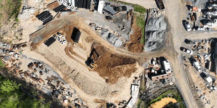
Matrice 4E is the practical choice for routine site mapping, construction progress, quarry work, land surveys and 3D models where a compact enterprise drone is enough.
- Suitable for 2D maps and 3D models
- Useful for construction and quarry progress records
- Good fit when speed and portability matter
- Recommended when LiDAR is not required
Advanced LiDAR choice
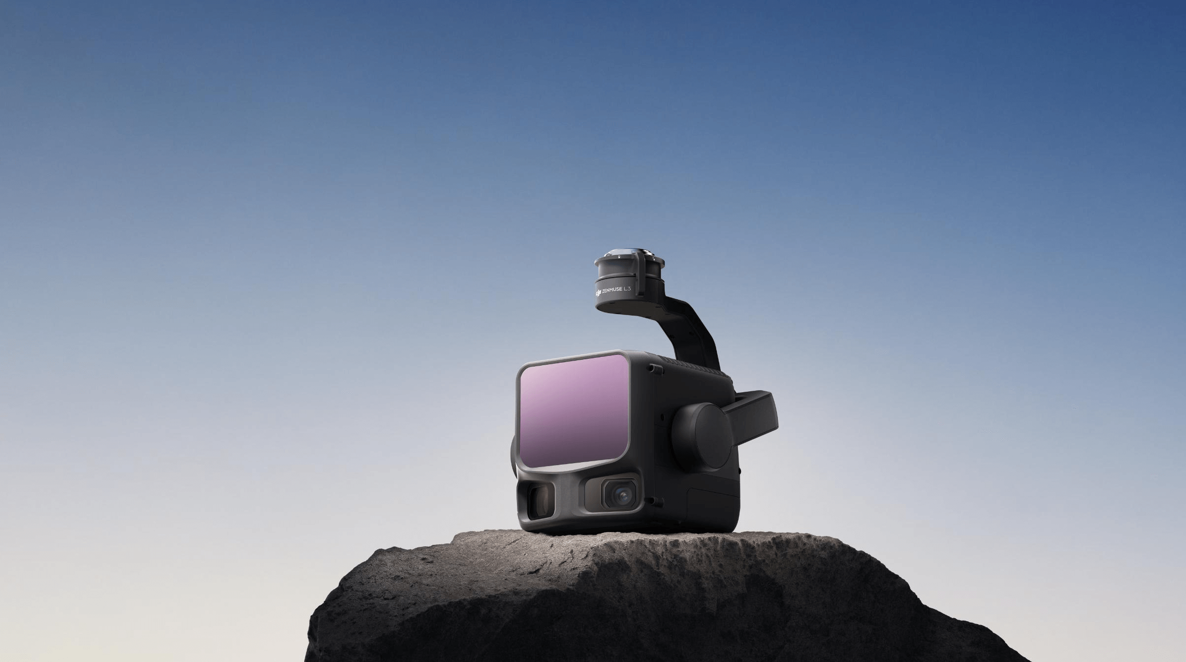
DJI Matrice 400 + Zenmuse L3
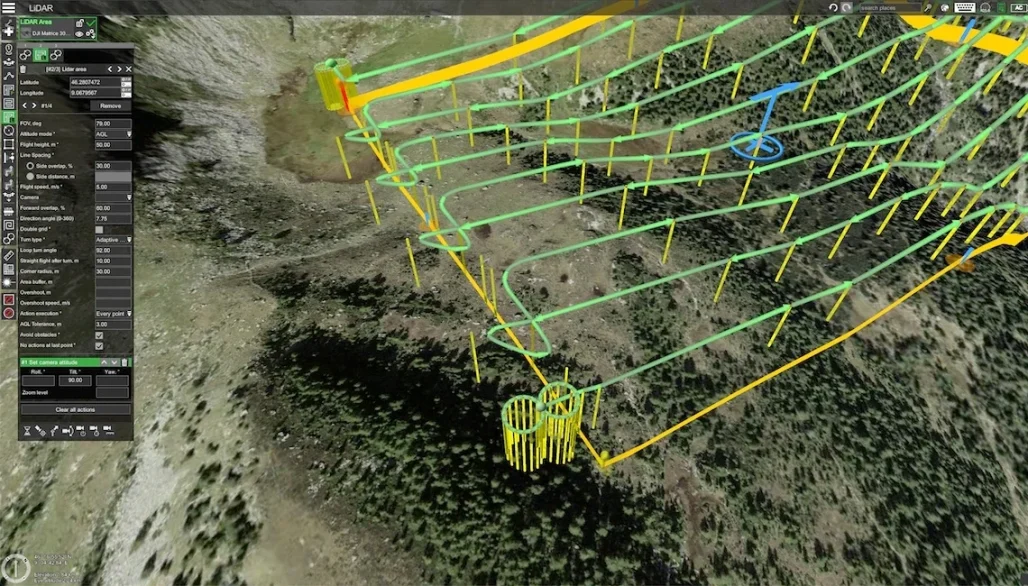
For larger sites, corridors, vegetation, complex terrain and high-value infrastructure surveys, Matrice 400 with Zenmuse L3 is the stronger enterprise mapping setup.
- Suitable for LiDAR point clouds
- Useful for corridors, slopes and vegetation
- Supports larger survey workflows
- Best when point cloud detail matters
4. If You Need Inspection
Inspection work usually depends on how close the drone can safely get to the asset and what type of evidence the report needs. A roof defect, telecom antenna, substation hotspot, wind turbine blade crack and bridge bearing problem all require different imaging distances and sensor combinations.
Choose Matrice 4T for portable inspection
Matrice 4T is a strong choice when teams need a compact enterprise drone for thermal checks, asset inspection, emergency support and fast site deployment.
- Building, roof and façade inspection
- Solar PV thermal checks
- Telecom tower and utility inspection
- Security, search and public safety support
Choose Matrice 400 + H30T for demanding assets
For larger industrial sites, long-distance inspection, high structures and complex infrastructure, Matrice 400 with Zenmuse H30T provides a stronger inspection platform.
- Powerlines and substations
- Wind farms and solar farms
- Ports, harbours and industrial estates
- Major public safety or emergency scenes
Inspection buying rule
Do not buy an inspection drone only by looking at aircraft specifications. Start with the payload: zoom, thermal resolution, laser rangefinding, low-light capability and reporting workflow are often more important than the aircraft alone.
5. If You Need Public Safety or Emergency Response
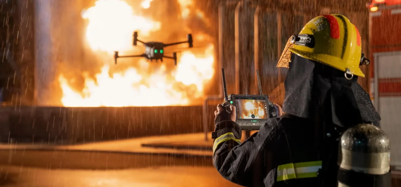
For public safety, the priority is fast situational awareness. Fire services, search and rescue teams, civil defence units, local authorities and private security teams often need to understand a scene before sending people into it.
In this case, thermal imaging, zoom, live video, low-light performance, communication with command teams and reliable field deployment matter more than cinematic image quality.
| Need | Recommended DJI Setup | Why |
|---|---|---|
| Fast response from a vehicle | Matrice 4T | Portable, fast to deploy, and suited to thermal search or incident assessment. |
| Large incident or wide-area scene | Matrice 400 + H30T | Longer mission windows, high-performance zoom and thermal capability for complex scenes. |
| Repeatable response from a known location | Dock 3 + Matrice 4TD | Remote operations and scheduled readiness can reduce response time for repeatable missions. |
6. If You Need Remote or Repeatable Operations
Some businesses do not need a drone that only flies when a pilot arrives on site. They need scheduled or repeatable aerial data: daily construction progress, remote perimeter checks, utility corridor monitoring, security patrols, stockpile updates, or emergency readiness.
For these workflows, DJI Dock 3 with Matrice 4D or Matrice 4TD becomes the more relevant option. Dock-based operations are most valuable when the site is known, the mission is repeated, and the organisation wants drone data as part of a regular operational process.

7. Match the Payload to the Mission
In enterprise work, the payload often defines the value of the drone system. The aircraft keeps the payload in the air; the payload collects the data that your team uses to make decisions.
| Payload / Sensor | Best For | Typical Irish Use Cases |
|---|---|---|
| Matrice 4E mapping camera | Photogrammetry, site mapping, 3D models | Construction, quarries, land development, drainage planning, civil works |
| Matrice 4T thermal and zoom system | Portable inspection and thermal awareness | Solar PV, roofs, utilities, public safety, farm buildings, security checks |
| Zenmuse H30T | High-performance zoom, thermal and laser rangefinding | Powerlines, wind turbines, substations, ports, public safety and large industrial sites |
| Zenmuse L3 | LiDAR point clouds and advanced geospatial data | Road corridors, forestry, rail, flood-risk areas, quarries, utilities and terrain modelling |
| Mavic 3 Multispectral | Crop health and vegetation index mapping | Agriculture, agronomy, crop scouting, trial plots and field monitoring |
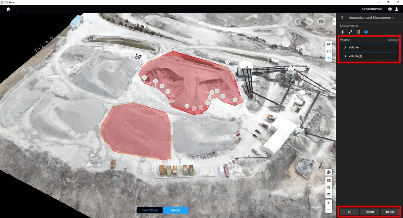
| DJI Terra / FlightHub 2 | Processing, mission management and reporting | 2D/3D outputs, point clouds, team coordination, remote operation workflows and data review |
8. Do Not Ignore Software and Reporting
A drone is only useful when the captured data can be processed, shared and trusted. For mapping, the workflow may include mission planning, RTK, ground control points, image overlap, coordinate systems, DJI Terra processing and quality checks. For inspection, it may include asset naming, defect tagging, thermal evidence, image comparison, report templates and repeatable mission records.
For fleet management and remote operations, DJI FlightHub 2 can become part of the planning and management layer. This is especially important when several people need to see drone activity, review missions, coordinate teams or manage repeatable workflows across multiple sites.
Practical advice
When comparing drones, ask your team what the final report should look like. If the output is wrong, the aircraft specification will not save the project. Choose the drone, payload and software together.
9. Ireland Compliance and Operational Planning
Enterprise drone work in Ireland must be planned around the operating environment, the people nearby, airspace restrictions, the aircraft type, pilot competency, insurance, privacy and data management. Most commercial enterprise drones are over 250 g and carry cameras or sensors, so operator registration and pilot training should be reviewed before the first job.
Higher-risk operations, such as complex industrial sites, operations close to people, controlled or restricted airspace, night operations, BVLOS planning, or remote operations may require additional preparation and possibly an Operational Authorisation route.
Compliance checklist before buying
- Will the operation stay within the Open category, or is a Specific category route likely?
- Will the drone operate near roads, railways, power infrastructure, people, buildings or controlled airspace?
- Is BVLOS, night operation, thermal inspection or Dock-based remote operation planned?
- Who will be the registered operator and who will hold pilot competency?
- How will images, video, thermal data and mapping outputs be stored and protected?
- Does the organisation need insurance, SOPs, risk assessments and a maintenance process?
10. Common Buying Mistakes
Buying the drone before defining the output
A drone that captures beautiful images may still fail if the client needs survey-grade mapping, thermal evidence or LiDAR data.
Ignoring the payload
For inspection and mapping, the sensor usually matters more than the aircraft body. Match the payload to the mission first.
Underestimating compliance
Enterprise operations need training, registration, risk review and sometimes authorisation. Plan this before promising project timelines.
Forgetting data processing
If the business cannot process, interpret and archive the data, the drone programme will not deliver its full value.
Final Recommendation
Choose the enterprise drone around the workflow. If the work is surveying and mapping, begin with Matrice 4E and consider Matrice 400 with Zenmuse L3 for advanced LiDAR projects. If the work is inspection, begin with Matrice 4T for portable operations and move to Matrice 400 with Zenmuse H30T for larger or more demanding assets. If the business needs automated repeatable operations, evaluate DJI Dock 3 with Matrice 4D or Matrice 4TD.
The right enterprise drone is the one that matches your industry, your operating environment, your reporting requirements and your compliance pathway in Ireland.
FAQ: Choosing an Enterprise Drone in Ireland
What is the best enterprise drone for surveying in Ireland?
For compact mapping and construction site work, DJI Matrice 4E is usually the first model to consider. For larger LiDAR projects, corridor surveys, forestry or complex terrain, Matrice 400 with Zenmuse L3 is the stronger enterprise setup.
What is the best enterprise drone for inspection?
Matrice 4T is a practical portable inspection drone for roofs, utilities, solar PV, security and public safety. Matrice 400 with Zenmuse H30T is better for larger industrial assets, wind farms, substations, powerlines and long-distance inspection.
When should a business choose DJI Dock 3?
DJI Dock 3 is most useful when an organisation needs remote, scheduled or repeatable missions from a known site or mobile deployment point. It is less relevant for one-off manual projects where a portable drone and pilot are enough.
Is LiDAR necessary for every surveying project?
No. Many sites can be mapped effectively with photogrammetry. LiDAR becomes more important when vegetation, corridors, steep ground, complex structures or high-value engineering deliverables require dense point cloud data.
Do Irish businesses need drone registration?
In many cases, yes. Enterprise drones usually exceed 250 g and carry cameras or sensors. Operator registration, pilot training and airspace checks should be planned before commercial work begins.
Can one drone cover surveying, inspection and public safety?
Some drones can support more than one use case, but no single platform is perfect for everything. Matrice 4T is versatile for inspection and emergency support, while Matrice 4E is stronger for mapping. Matrice 400 gives more payload flexibility for advanced operations.
Need help choosing the right DJI Enterprise drone?
Irish Drone can help you compare DJI Enterprise aircraft, payloads and software workflows for surveying, inspection, construction, utilities, public safety, agriculture, forestry and remote operations in Ireland.
Tell us your industry, site type, operating location and required deliverable. We can help you build a practical equipment shortlist before you invest.
Contact Irish Drone
Leave a comment