Quick Answer
Drones improve powerline inspection by reducing the need for people to access hazardous structures, speeding up routine and post-event checks, and capturing structured visual, thermal and spatial data for maintenance planning. For large corridors, DJI Matrice 400 with Zenmuse H30T is a strong inspection combination. For LiDAR corridor mapping, Matrice 400 with Zenmuse L3 is more suitable. For compact thermal checks and local distribution assets, DJI Matrice 4T is often the practical choice.
The best setup depends on the inspection objective: defect identification, thermal anomaly review, vegetation clearance, post-storm response, substation checks or recurring remote inspection.
Why Powerline Inspection Needs a More Structured Approach
Irish power infrastructure covers urban distribution networks, rural overhead lines, substations, renewable grid connections, coastal areas and long access routes across farmland, hillsides and industrial sites. These environments create practical challenges for inspection teams: weather exposure, access permissions, difficult terrain, traffic management, live electrical assets and the need to document defects clearly.
Traditional inspection methods still matter. Ground crews, electrical engineers, line workers and specialist contractors are essential for testing, repair and sign-off. The problem is that not every first inspection needs a person climbing, using a MEWP, walking a long corridor or arranging a helicopter survey. A drone can provide the first layer of evidence, helping teams decide what needs urgent attention, what can be monitored and what requires a physical intervention.
The strongest drone inspection programmes are not random flights. They are repeatable workflows. The aircraft captures the asset from known angles, the payload records the right data, the operator logs site conditions, and the report connects each image or thermal observation to an asset ID, location and recommended follow-up.
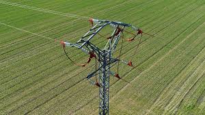
1. Safer access
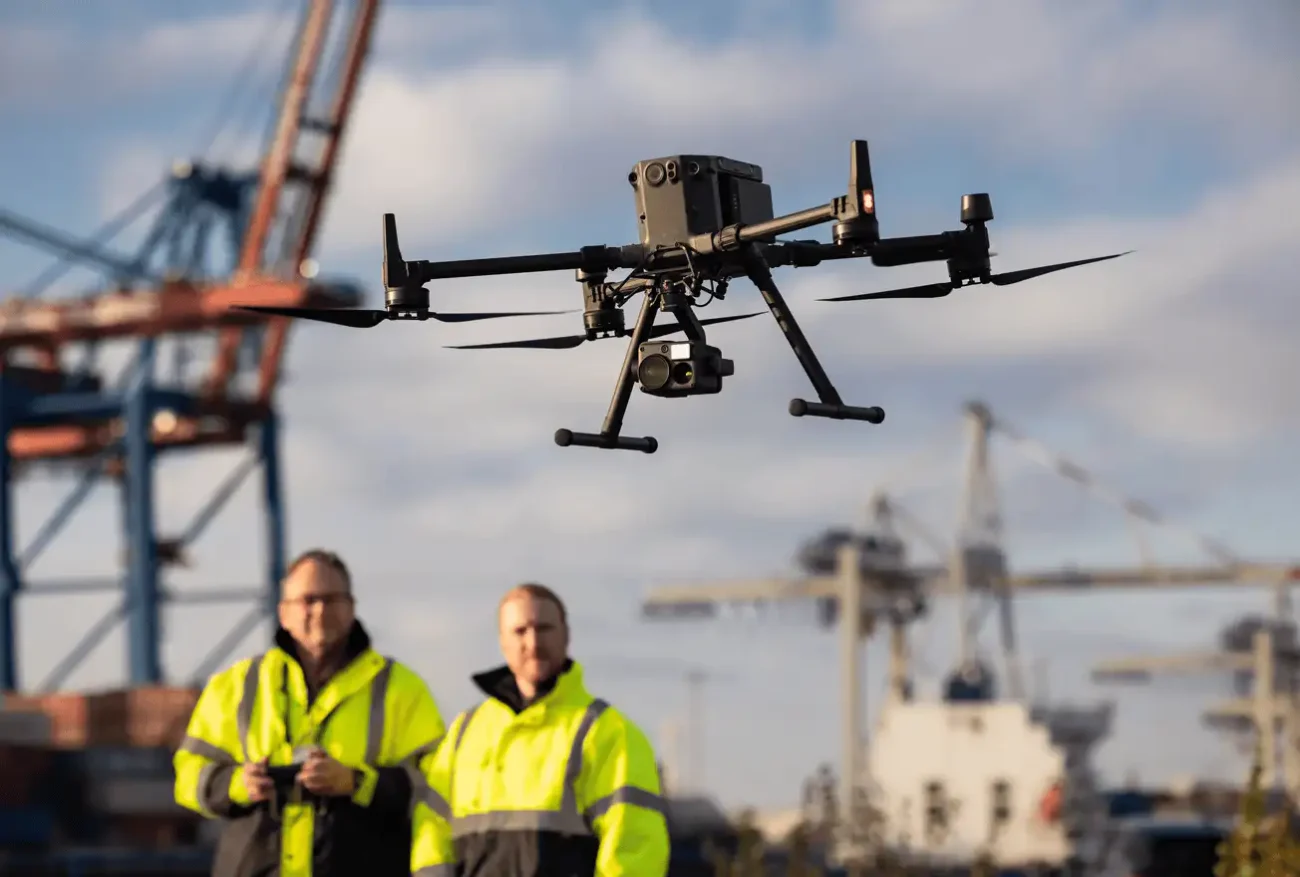
Teams can inspect poles, towers, conductors, insulators and substations from a controlled take-off point, reducing unnecessary exposure to height, uneven ground, live equipment and difficult weather.
2. Faster decisions
A drone can quickly capture visual and thermal evidence after wind, lightning, flooding, suspected faults or vegetation damage, helping maintenance planners prioritise the right crew and equipment.
3. Better records
Repeatable imagery, thermal readings, LiDAR point clouds and annotated reports create a stronger inspection history than isolated field notes or one-off site photos.
What Can a Drone Inspect on a Powerline Network?
A powerline inspection flight can support both routine asset management and targeted fault investigation. The exact checklist should be agreed with the engineering team before flight, but the most common inspection targets include:
Visible damage, sag context, foreign objects and span-level access issues.
Cracks, contamination, broken hardware, corrosion, missing components and alignment issues.
Structural condition, visible damage, leaning, bolt condition and storm-related impact.
Abnormal heating on connectors, transformers, switches or other electrical components.
Tree encroachment, corridor risk, access routes and seasonal growth patterns.
Equipment overview, thermal checks, perimeter context and repeatable inspection routes.
The Three Inspection Data Layers: Visual, Thermal and Spatial
A well-planned powerline drone inspection does not rely on one sensor. The best results come from combining the right data layers for the problem being investigated.
Visual zoom data
Useful for inspecting hardware, insulators, clamps, spacers, dampers, tower components, identification plates and visible damage from a safer standoff distance.
Thermal data
Useful for identifying abnormal heat patterns. Thermal results should always be reviewed with load, weather, angle and qualified interpretation in mind.
LiDAR and spatial data
Useful for corridor modelling, vegetation clearance, terrain relationship, conductor context and 3D asset records where measurements and repeatability matter.
Best DJI Enterprise Equipment for Powerline Inspection in Ireland
Different missions require different aircraft and payloads. A compact distribution check is not the same as a long rural corridor survey, and a thermal fault investigation is not the same as LiDAR vegetation clearance analysis. The table below shows practical equipment choices for current DJI Enterprise workflows.
| Inspection need | Recommended DJI setup | Why it fits |
|---|---|---|
| Large powerline corridors | DJI Matrice 400 + Zenmuse H30T | Long endurance, strong payload capacity, enterprise obstacle sensing, zoom, thermal and laser rangefinder support. |
| Thermal fault investigation | Zenmuse H30T | Combines wide-angle, zoom, thermal, laser rangefinder and NIR support for multi-sensor inspection. |
| Vegetation and corridor modelling | Matrice 400 + Zenmuse L3 | LiDAR point clouds help model conductors, towers, vegetation, terrain and clearance context. |
| Local distribution assets | DJI Matrice 4T | Portable multi-sensor aircraft for quick deployment, local inspection routes and smaller utility tasks. |
| Recurring remote inspection | DJI Dock 3 + Matrice 4TD | Supports scheduled and repeatable visual or thermal checks for fixed sites and remote locations. |
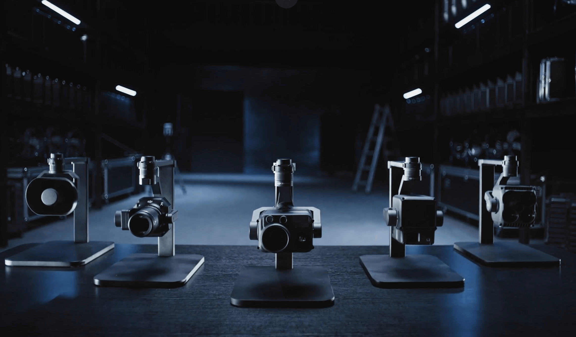
Payload selection matters: zoom, thermal, LiDAR and lighting payloads support different field decisions.
When to Use Matrice 400 + H30T
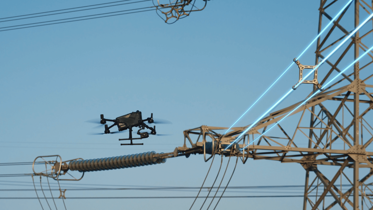
The Matrice 400 and Zenmuse H30T combination is suited to serious inspection work where long endurance, stability, high-quality visual data and thermal context are important. It is especially useful for rural transmission corridors, high-value infrastructure, substations, renewable energy grid connections and post-incident inspections where the team needs a detailed first look before deciding the next step.
Zenmuse H30T is particularly useful when a single mission needs multiple perspectives: a wide view for context, zoom for component detail, thermal for heat patterns, and a laser rangefinder for target distance and positioning support. For inspection teams, this reduces the need to switch equipment between separate flights.
A Practical Drone Powerline Inspection Workflow
Decide whether the mission is routine condition monitoring, post-storm response, suspected thermal fault, vegetation review, substation check, LiDAR corridor mapping or repair verification.
Check airspace, land access, road or rail proximity, livestock, public areas, weather, take-off locations, visual line of sight, privacy and operational authorisation requirements.
Use zoom for detail, thermal for heat patterns, LiDAR for corridor and clearance modelling, and a dock-based system for repeatable fixed-site checks.
Plan flight lines, standoff distance, camera angles, inspection order, asset IDs, photo naming, thermal conditions and any required overlap for mapping deliverables.
Record clear visual images, thermal data, notes, GPS context and repeatable viewpoints. Avoid over-relying on one image where the viewing angle or weather may affect interpretation.
Group findings by asset, location, defect type and severity. The report should make it easy for engineers and maintenance planners to take action.
Recommended Report Structure for Irish Powerline Projects
A drone inspection report should be built for action. It should not only contain photographs. It should explain what was inspected, where the issue is, how confident the observation is, and what follow-up is recommended.
- Project details: client, site, date, weather, operator, aircraft, payload and mission objective.
- Asset list: pole, tower, line, span, substation or component references.
- Inspection evidence: annotated zoom images, thermal screenshots, LiDAR outputs or map references where relevant.
- Findings: defect category, severity level, likely maintenance priority and confidence notes.
- Access notes: roads, gates, terrain, vegetation, waterlogged areas or obstacles that may affect a repair crew.
- Recommendations: immediate action, monitor, re-inspect, physical test, vegetation work or engineer review.
Where LiDAR Adds Value
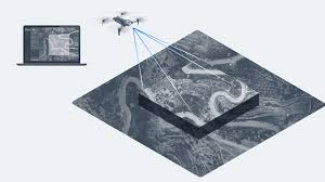
Thermal and zoom inspections are excellent for component-level evidence, but some powerline projects need a broader spatial model. This is where LiDAR becomes valuable. A LiDAR payload can help create a 3D record of conductors, towers, terrain, tree lines, embankments and access routes.
For Irish surveyors and infrastructure teams, Matrice 400 with Zenmuse L3 is relevant where the project requires corridor modelling, vegetation clearance checks, route planning, asset geometry or repeatable mapping deliverables. It is not necessary for every inspection, but it is very useful when the problem is spatial rather than purely visual.

Substations and fixed electrical assets benefit from repeatable visual and thermal inspection routes.
Drone Inspection vs Manual Inspection
Drone inspection does not replace qualified electrical inspection, testing or repair. It improves the decision-making process around those tasks. A drone can help identify where a crew should go, what access equipment may be needed, what component should be reviewed, and whether the issue is urgent enough to escalate.
Manual work remains essential when a component needs physical testing, replacement, tightening, isolation or engineering sign-off. The drone’s role is to reduce unnecessary exposure, improve the quality of pre-work evidence and create a better record before and after the physical task.
| Method | Best used for | Limitations |
|---|---|---|
| Drone inspection | First-look checks, visual records, thermal evidence, corridor mapping and post-event review. | Cannot perform physical repair or electrical testing. Results depend on planning, weather and interpretation. |
| Manual inspection | Hands-on testing, repair, replacement, confirmation and engineering sign-off. | Slower access, higher safety planning burden and less efficient for broad first-pass inspection. |
| Helicopter inspection | Very long routes or specialist high-level patrols where permitted and justified. | Higher cost, more complex logistics and less practical for frequent local repeat inspections. |
Important Compliance Note for Ireland
Powerline and substation drone work can involve complex environments, public roads, private land, controlled or restricted airspace, critical infrastructure, BVLOS planning, night operations or higher-risk flight profiles. In Ireland, operators must assess whether the mission fits within the Open Category or requires Specific Category operational authorisation from the Irish Aviation Authority.
Before commissioning a project, confirm that the operator has the correct registration, remote pilot competency, insurance, operating procedures and any required authorisation for the actual site and flight profile.
Common Irish Use Cases
Post-storm inspection
Assess visible damage, access problems, vegetation impact and suspected faults before dispatching repair teams.
Renewable grid connections
Inspect overhead connections, substations and access routes around wind farms, solar farms and battery storage sites.
Vegetation management
Use visual and LiDAR data to understand tree encroachment, clearance issues and future maintenance priorities.
Industrial site utilities
Support inspections of private electrical infrastructure across factories, ports, data centres and large commercial sites.
Planning a Powerline or Electrical Infrastructure Drone Inspection?
IRISH Drone can help Irish organisations choose the right DJI Enterprise aircraft, payload and workflow for powerline inspection, substations, renewable energy connections and critical infrastructure monitoring.
FAQ: Drone Inspection for Powerlines in Ireland
What is the best drone for powerline inspection?
For large powerline corridors, DJI Matrice 400 with Zenmuse H30T is one of the strongest current DJI Enterprise options because it combines long endurance, payload flexibility, zoom, thermal imaging and laser rangefinder support. For compact distribution checks, DJI Matrice 4T may be more practical.
Can drones detect overheating electrical components?
Thermal-capable drones and payloads can help identify abnormal heat patterns on electrical components. However, interpretation should be done by qualified personnel because load, viewing angle, wind, rain, surface condition and background temperature can affect results.
Is LiDAR useful for powerline inspection?
Yes. LiDAR is useful for corridor mapping, vegetation clearance analysis, terrain modelling and 3D records of powerline infrastructure. It is most valuable when the project needs spatial measurements and repeatable corridor data, not just visual defect photos.
Can drones replace manual powerline inspections?
No. Drones reduce risk and improve evidence gathering, but they do not replace physical testing, repair or engineering sign-off. They work best as part of a complete inspection and maintenance workflow.
Do Irish businesses need permission to inspect powerlines with drones?
It depends on the site and flight profile. Complex environments, restricted or controlled airspace, BVLOS missions, night operations or operations outside Open Category limits may require an IAA Operational Authorisation. The operator should confirm the correct permissions before flying.
What should a drone powerline inspection report include?
A useful report should include asset references, site conditions, flight date, aircraft and payload used, annotated images, thermal findings, defect categories, severity, access notes and recommended follow-up actions.


Leave a comment