
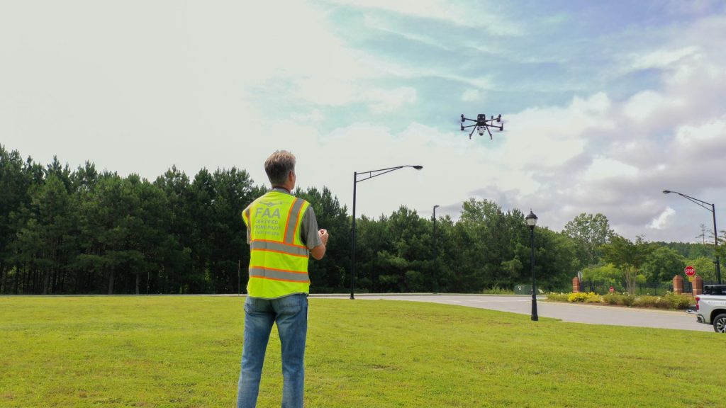
Beyond Visual Line of Sight operations can help Irish businesses inspect long assets, monitor remote sites and respond faster to incidents. But BVLOS is not simply “flying further”. It is a higher-risk operating model that needs the right use case, the right aircraft, the right procedures and the right authorisation pathway.
Quick answer
For most Irish enterprise users, BVLOS should be treated as a planned operational programme, not as a simple drone feature. The drone may be capable of remote flight, automated routes or dock-based deployment, but the business still needs to prove how it will manage airspace risk, site risk, communications, emergency procedures, pilot responsibility and data security.
The strongest starting point is to define the job first: powerline inspection, wind farm monitoring, port security, construction progress capture, quarry mapping, emergency response support or remote asset patrol. Only after that should the team choose between DJI Dock 3, DJI Matrice 400, Matrice 4E, Matrice 4T, Matrice 4D, Matrice 4TD or specialist payloads such as Zenmuse H30T and Zenmuse L3.
1. What BVLOS means in practical terms
BVLOS means Beyond Visual Line of Sight. In a normal VLOS operation, the remote pilot keeps the aircraft in unaided visual sight and can directly judge its position, attitude and surrounding risks. In a BVLOS operation, the aircraft flies beyond that direct visual range, so the operator must rely on planning, technology, procedures, communications, monitoring tools and risk controls.
This is why BVLOS is valuable for enterprise work. Many professional assets are not compact. A powerline, road corridor, wind farm, pipeline, rail section, port estate or large industrial site may stretch far beyond what a pilot can inspect from one safe take-off point. BVLOS can reduce repeated site visits, reduce time on dangerous ground and allow better coverage of assets that are difficult to access.
However, BVLOS also changes the safety case. The operator must think about other airspace users, emergency landing areas, command and control link quality, detect-and-avoid measures, local restrictions, weather, site security, public privacy and what happens if the aircraft or communications system does not behave as expected.
2. Why Irish businesses are interested in BVLOS
Irish infrastructure owners and contractors are under pressure to collect more data, more often, with fewer safety risks. Traditional inspection methods may require road closures, climbing teams, elevated platforms, offshore access, remote travel or repeated visits to the same site. BVLOS does not remove the need for expert inspection, but it can change how the evidence is captured.
Long linear assets
Powerlines, roads, rail corridors and pipelines are difficult to inspect efficiently when every flight must stay close to a pilot.
Remote and exposed locations
Wind farms, coastal infrastructure, quarries, forestry and utility assets can involve difficult ground access and changing weather.
Repeatable monitoring
Construction, ports, logistics yards and industrial sites may need the same route flown repeatedly for comparison and reporting.
Emergency response
Remote visibility can support fire assessment, search operations, flood monitoring and fast situational awareness.
The commercial value is not only the flight itself. The value comes from reliable data: images, thermal records, point clouds, route histories, inspection notes, asset evidence and repeatable reports that engineers, safety teams and managers can actually use.
3. Ireland compliance: BVLOS is usually a Specific Category discussion
In Ireland, drone operations are assessed by risk. A low-risk visual inspection may fit within the Open category if it stays within the relevant limits. BVLOS is different. It normally moves the discussion into a more advanced regulatory pathway because the pilot is no longer maintaining direct unaided visual contact with the aircraft.
For complex operations, operations in restricted or prohibited airspace, or operations beyond visual line of sight, Irish operators should expect to examine whether an Operational Authorisation is required from the Irish Aviation Authority. In the wider EASA framework, many operations outside the Open category fall under the Specific Category, with either a declaration route where a standard scenario is applicable or an operational authorisation route for other missions.
What an enterprise team should prepare
- Clear Concept of Operations: what the drone will do, where it will fly, who controls it and what output is required.
- Risk assessment: airspace, ground risk, people nearby, controlled sites, emergency landing options and lost-link procedures.
- Operating procedures: pre-flight checks, weather limits, route approval, pilot supervision, contingency actions and incident recording.
- Technology controls: aircraft capability, command link, geo-awareness, route design, payload suitability, battery margins and remote monitoring tools.
- Data governance: image handling, privacy, client access, retention periods and secure storage.
4. Practical BVLOS use cases for Irish enterprise teams
BVLOS should be justified by the mission. It is strongest when the operation is repeatable, measurable and difficult to perform efficiently under normal visual-line-of-sight conditions.
| Use case | Why BVLOS helps | Typical output | Suitable DJI direction |
|---|---|---|---|
| Powerline inspection | Lines cover long distances and often pass through fields, hills, roads and restricted access areas. | Visual defects, thermal anomalies, corridor condition, LiDAR point cloud, asset record. | Matrice 400 + H30T or L3; Dock 3 for repeat routes where authorised. |
| Wind farm monitoring | Turbines are distributed over large sites, often in remote or exposed areas. | Blade imagery, access road condition, substation checks, incident response footage. | Matrice 400 + H30T for detailed zoom and thermal support; Dock 3 for scheduled monitoring. |
| Solar farm inspection | Large arrays benefit from planned routes and repeat thermal checks. | Panel anomaly records, string-level observations, site overview, maintenance evidence. | Matrice 4T/4TD for compact thermal work; Matrice 400 + H30T for larger or more demanding sites. |
| Road, bridge and rail corridors | Linear inspection may reduce repeated access, lane closures or hazardous site exposure. | Condition imagery, structural observations, orthomosaic, LiDAR model, progress record. | Matrice 400 + L3 for corridor data; Matrice 4E for local mapping and construction capture. |
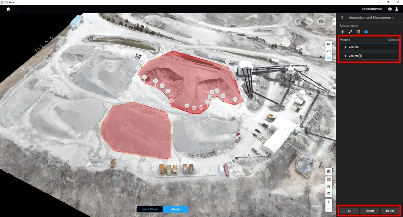
| Ports, quarries and industrial sites | Sites may need routine security patrols, stockpile updates, safety checks and rapid incident response. | Repeat route reports, site progress records, stockpile data, inspection media. | Dock 3 + Matrice 4D/4TD; Matrice 4E for mapping; Matrice 400 for specialist payloads. |
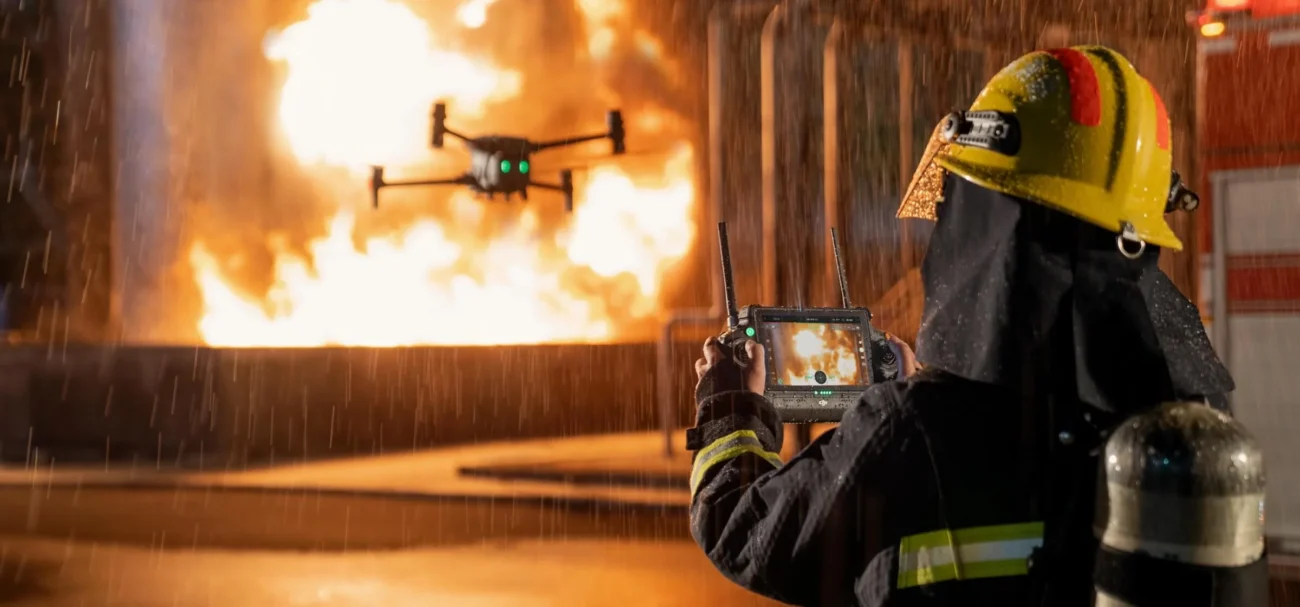
| Emergency response and public safety | Fast remote visibility can support command decisions before crews enter risky areas. | Thermal search support, fire spread visibility, flood monitoring, incident documentation. | Matrice 4T/4TD for thermal and low-light support; Dock 3 for rapid readiness where approved. |
5. DJI enterprise platforms that make sense for BVLOS-style workflows
No aircraft should be selected only because the word “BVLOS” appears in the project brief. The correct platform depends on route length, payload needs, weather exposure, data output, safety case, site infrastructure and whether the operation is fixed, mobile or manually deployed.
DJI Dock 3 with Matrice 4D or Matrice 4TD
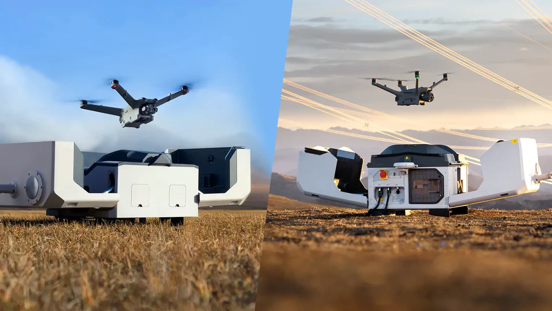
DJI Dock 3 is the most relevant DJI solution when the business needs repeatable remote operations from a fixed or mobile deployment point. It is designed around Matrice 4D and Matrice 4TD aircraft, with 24/7 remote-operation positioning and support for vehicle-mounted deployment. This makes it attractive for industrial sites, ports, utilities, construction projects, emergency response teams and security operations.
Choose Matrice 4D when the main output is visual inspection, site mapping or construction progress capture. Choose Matrice 4TD when thermal imaging, night support, security monitoring or emergency response visibility is central to the job.
DJI Matrice 400 for demanding inspection and mapping
DJI Matrice 400 is better suited when the project needs longer endurance, higher payload flexibility and specialist sensors. It is a stronger choice for large-scale infrastructure inspection, powerline workflows, LiDAR capture and multi-payload enterprise missions.
For inspection, Matrice 400 with Zenmuse H30T gives Irish teams a powerful combination of zoom, thermal imaging and rangefinding. For geospatial work, Matrice 400 with Zenmuse L3 is the stronger route for LiDAR point clouds, terrain capture and corridor mapping.
Matrice 4E and Matrice 4T for compact enterprise work
The Matrice 4 Series is highly relevant for compact professional workflows. Matrice 4E is most suitable for surveying, construction mapping, mining and geospatial work. Matrice 4T is more suitable for inspection, public safety, forestry, utilities and thermal work. These aircraft may not replace a full dock-based programme, but they are practical for field teams that need a fast, portable enterprise drone.
6. How to build a BVLOS drone programme
The best BVLOS programmes are built from the business problem backwards. Buying the aircraft first often creates confusion because the team then tries to force the drone into a mission that may not be authorised, measurable or commercially useful.
- Define the asset and the output. Decide whether the business needs inspection photos, thermal evidence, LiDAR data, an orthomosaic, a live feed, a security patrol or an emergency response view.
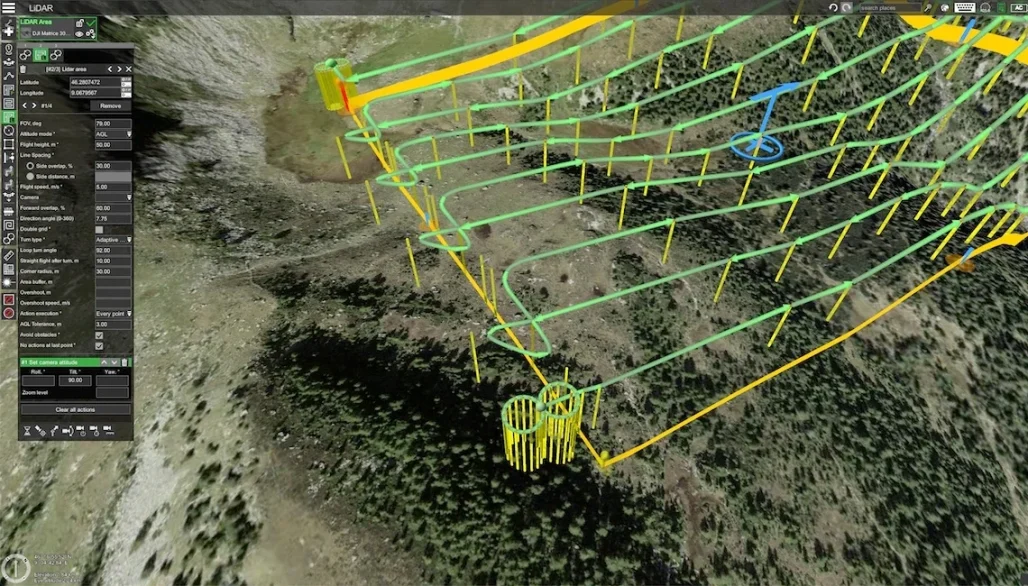
- Map the route and airspace. Identify flight path, height, distance, obstacles, people nearby, surrounding roads, restricted zones and emergency landing options.
- Decide whether the job is VLOS, EVLOS or BVLOS. Some work can be completed with visual observers or multiple take-off points. BVLOS should be used when it genuinely adds operational value.
- Choose the right aircraft and payload. Match the aircraft to endurance, payload, sensor output, weather exposure and reporting requirements.
- Build the safety case. Document how the team will manage other aircraft, ground risk, lost link, geofencing, weather, battery margins and emergency actions.
- Prepare operating procedures. Include route approval, role allocation, pilot handover, maintenance checks, communications, stop criteria and incident reporting.
- Test under controlled conditions. Start with VLOS or restricted-area validation flights before expanding to more complex remote operations.
- Integrate the data workflow. Decide how images, thermal data, point clouds and reports will be reviewed, stored, shared and compared over time.
Recommended starting point
Start with one repeatable route and one measurable outcome. For example: “inspect this 4 km powerline section every month and produce a defect report”, or “capture this construction site every Friday and produce a progress model”. Once the team can deliver that reliably, it becomes easier to scale the programme.
7. Buying logic for Irish enterprise users
The best purchase is not always the most expensive aircraft. It is the system that fits the permission pathway, the job, the people and the reporting workflow.
- Choose DJI Dock 3 when the business has a repeatable site, reliable connectivity, a clear remote-operations case and the ability to support compliance documentation.
- Choose Matrice 400 + H30T when the business needs high-value inspection, zoom, thermal data, longer endurance and specialist payload flexibility.
- Choose Matrice 400 + L3 when the main value is survey-grade LiDAR, terrain data, infrastructure modelling, forestry or corridor mapping.
- Choose Matrice 4E when the team needs portable mapping, construction capture, quarry data or general geospatial work.
- Choose Matrice 4T or 4TD when thermal inspection, public safety, forestry, utility checks or low-light visibility are key requirements.
For many Irish teams, the correct long-term model will be a mixed fleet: one portable aircraft for daily work, one heavier aircraft for specialist inspection or LiDAR, and one dock-based solution for locations where remote repeat operations are commercially and legally justified.
FAQ: BVLOS drone operations in Ireland
Is BVLOS allowed in Ireland?
BVLOS can be possible, but it is not something a business should assume is automatically permitted. It generally requires a more advanced assessment and, in many cases, an appropriate authorisation route through the Irish Aviation Authority under the relevant EASA framework.
Does DJI Dock 3 automatically make a business BVLOS-ready?
No. Dock 3 can support remote and repeatable drone operations, but the operator still needs to manage airspace, site risk, procedures, supervision, connectivity, maintenance, documentation and authorisation.
What is the best DJI drone for BVLOS-style infrastructure inspection?
For repeat remote site operations, Dock 3 with Matrice 4D or Matrice 4TD is the most relevant DJI direction. For demanding infrastructure inspection, Matrice 400 with Zenmuse H30T is stronger. For LiDAR corridor mapping, Matrice 400 with Zenmuse L3 is the better fit.
Is BVLOS useful for small businesses?
Only if the business has a repeatable use case that justifies the extra planning and compliance work. A small contractor doing local roof or site inspections may get better value from VLOS operations with Matrice 4E or Matrice 4T. BVLOS becomes more attractive when routes are long, remote, repeated or operationally difficult.
What should be checked before proposing BVLOS to a client?
Check the site, airspace, operational category, required output, route length, people nearby, emergency options, connectivity, insurance, data handling, pilot competence, aircraft suitability and whether the operator has or can obtain the correct authorisation.
Final recommendation
For Irish businesses, BVLOS is best approached as a controlled operational upgrade. Start with the asset, the route and the data output. Then choose the platform that supports the mission. For remote repeat work, consider DJI Dock 3. For complex infrastructure inspection, consider DJI Matrice 400 with Zenmuse H30T or Zenmuse L3. For compact field work, Matrice 4E and Matrice 4T remain practical choices.
IrishDrone.ie can help Irish enterprise teams compare aircraft, payloads, dock workflows and operational requirements before committing budget to a BVLOS-ready drone programme.

Leave a comment