


Description
Take a Closer Look
Metashape Professional combines image alignment, point-cloud processing, elevation models and georeferenced orthomosaics. Decide which output will answer the job: a current site image, terrain information, a measured stockpile or a textured record of a structure. That decision should guide the photographs, reference data and export settings you prepare.
Plan the deliverable before the survey
Construction and survey basemaps
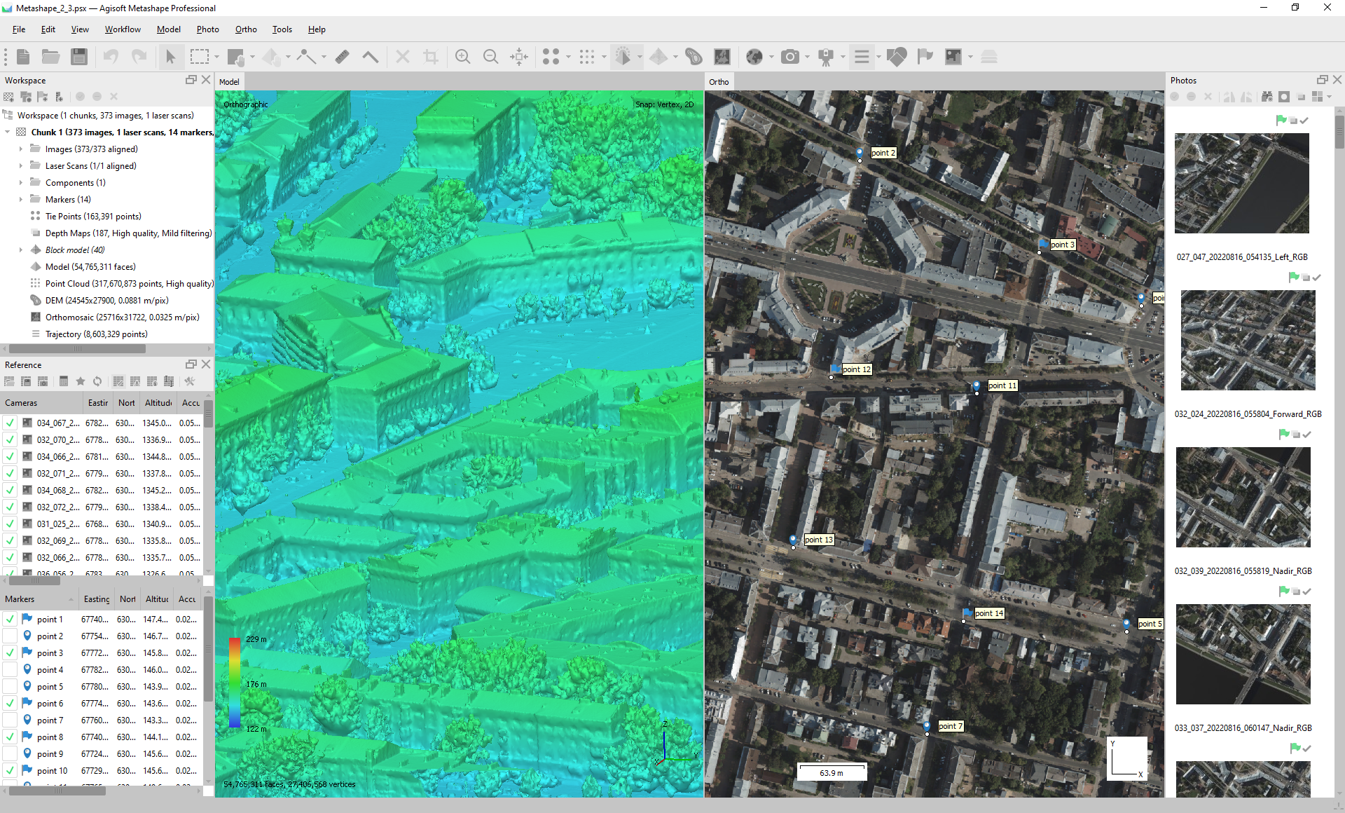
For a site-mapping workflow, load the photographs and camera reference data, check the coordinate system, align the images and review the reference settings. Where surveyed control is used, mark it carefully and optimise the alignment before building the point cloud, DEM and orthomosaic. Keep the reference data and processing project with the exported deliverables so the work can be reviewed.
Stockpiles and earthworks
Draw a boundary around the area to measure and choose a suitable volume reference: best-fit, mean-level or a defined custom plane. Record that choice with the result. For repeat measurements, a consistent custom level can help make the comparison understandable. A volume is a result relative to the selected base, so the boundary and base definition are part of the deliverable.
Separate the surface from the ground
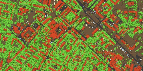
A surface model can include buildings, vegetation and other visible objects. When a bare-ground terrain model is required, classify and inspect the ground points, then use the relevant class when building the DEM. Review the classification around slopes, vegetation and structures rather than treating an automatic result as an unquestioned terrain surface.
Buildings, assets and heritage records
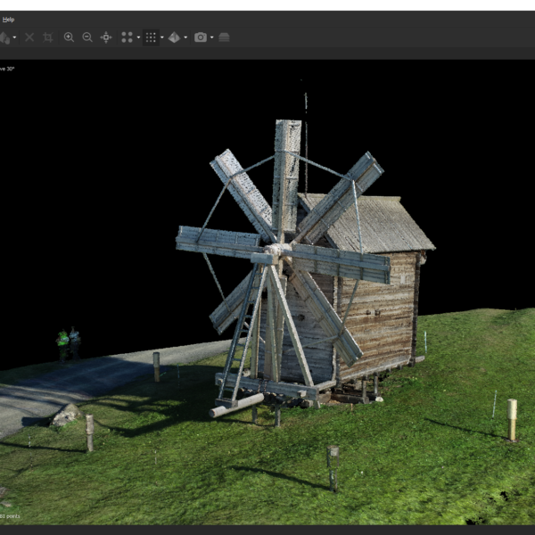
For a building or monument, plan connected views along surfaces and around corners. Include elevated and oblique coverage where it is needed to see the geometry. Photographs with changing reflections, deep shadows or unseen areas can leave gaps. A textured model is useful for visual review, while any dimensional or georeferenced deliverable needs its reference and quality checks to be planned separately.
Check before handing over
Use surveyed control to reference the model and separate check points to test the result. Review the check-point differences and record the reference system, capture date and processing choices. For repeat surveys, retain a consistent control framework and validate successive surfaces before interpreting changes. A convincing-looking reconstruction alone is not evidence that a measured change is reliable.
Frequently asked questions
Can RTK or PPK photographs be processed without ground control?
Yes, Professional has a workflow based on measured camera locations. That does not remove the need to assess the result. Independent check points help test the reconstructed positions rather than simply repeating the control used to fit them.
Does a very dense point cloud guarantee survey accuracy?
No. Camera configuration, image scale and source-image quality all matter. Validate the surface against independent observations before relying on it for measurement. Point count and visual detail are not a substitute for a project-specific accuracy assessment.
Why can the same stockpile produce different volume totals?
Check the boundary, the surface used and the reference plane. Professional can calculate volume above and below a selected level; changing that level or the polygon changes what is being measured. Record those choices when comparing reports.
Is a DTM the same as a DSM?
No. A ground-only DTM is built from points identified as ground, while a DSM represents the surface selected for reconstruction. For terrain work, check the classification and source classes before generating or exporting the elevation model.
Which outputs can I take into a GIS workflow?
Professional can export georeferenced orthomosaics and elevation rasters, including GeoTIFF. Choose the required coordinate system and export resolution, and check the receiving application's format requirements before delivering a large project.
Why are parts of a roof or structure missing?
Reconstruction needs photographs that show the surface. Ground-level images cannot supply roof detail they never captured. Review coverage before processing; masks and editing can exclude unwanted areas, but they do not replace missing source views.
Can I create vegetation-index outputs from multispectral imagery?
Professional supports multiband processing and vegetation-index workflows. For quantitative reflectance work, follow the sensor-specific calibration process and include the required panel or sun-sensor information. A colourful index display alone should not be treated as a calibrated measurement.
Documentation, tutorials & brochure
Product documentation
Workflow tutorials
Brochure & trial
Licence and evaluation information
- A fully functional 30-day trial is available for evaluation. Download the official installer and choose the trial option in the activation dialogue. The separate demo mode cannot save or export.
- The desktop licence is not time-limited. It includes software updates through version 2.x and 12 months of email support. This does not promise free updates to every future major version.
- Educational licences are available to eligible accredited educational institutions, their students and employees, solely for academic use. Commercial use is prohibited.
- All licences in a multi-licence pack must be for the same end user. Packs cannot be split between separate customers.
- A node-locked licence is activated on one machine at a time and can be transferred to another computer. Floating licences are available for Professional only, use a licence server and are limited by the number of concurrent licences purchased.
Final price and VAT treatment confirmed on quotation.
Sources and further reading
- Agisoft: Metashape Professional Edition features
- Agisoft: Aerial data processing with GCPs
- Agisoft: DEM based measurements
- Agisoft: Point Cloud Classification
- Agisoft: Terrestrial shooting scenario
- Agisoft: Metashape User Manual, Professional Edition 2.3
- Agisoft: Control and Check points for aerial surveys
- U.S. Geological Survey: Fine-resolution repeat topographic surveying of dryland landscapes using UAS-based structure-from-motion photogrammetry
- Agisoft: Aerial data processing without GCPs
- U.S. Geological Survey: Camera system considerations for geomorphic applications of SfM photogrammetry
- Agisoft: 3D model reconstruction
- Agisoft: MicaSense RedEdge MX processing workflow including Reflectance Calibration
- Agisoft: Licensing Options
- Agisoft: Metashape Installer and free trial

Reviews
There are no reviews yet.