Quick answer
Yes — for many Irish mapping projects, the DJI Matrice 4E is an excellent choice. It is especially suitable for construction progress mapping, land development records, roof and facade modelling, quarry documentation, solar site planning, heritage structures and smaller infrastructure surveys.
However, it is not the best option for every job. If the project needs thermal inspection, choose DJI Matrice 4T. If the project needs long-range LiDAR, heavy payloads or large corridor mapping, step up to DJI Matrice 400 with Zenmuse L3.
Why Irish survey teams are looking beyond traditional ground surveys
Traditional ground surveying remains essential for control, legal boundaries and engineering-grade verification. But many Irish projects now need faster visual records as well: weekly site progress, earthworks changes, roof measurements, facade documentation, solar layout planning, road and drainage updates, quarry stockpile checks and project communication with clients.
The problem is that these sites can be time-consuming or unsafe to inspect from the ground. A well-planned drone mapping workflow can capture the full site quickly, create repeatable records and provide image-based deliverables that are easier for engineers, developers, contractors and asset owners to understand.
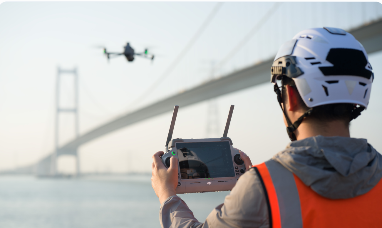
This is where the DJI Matrice 4E fits well. It is compact enough for a small field team, but it has the mapping-focused camera and RTK workflow needed for professional photogrammetry.
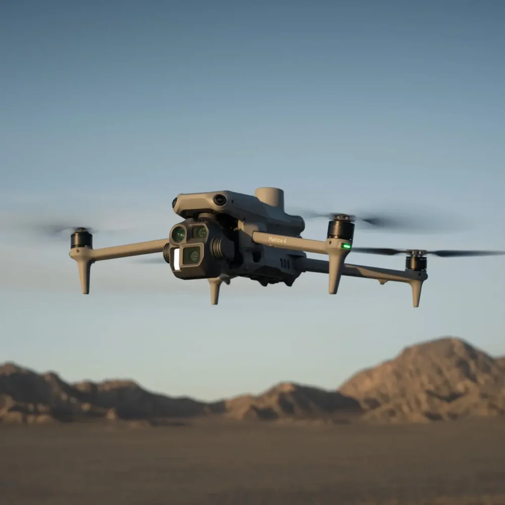
What makes the Matrice 4E a mapping drone?
4/3 CMOS 20MP camera
The Matrice 4E wide camera uses a 4/3 CMOS sensor with 20MP effective pixels, giving survey teams a stronger mapping camera than ordinary visual inspection drones.
Mechanical shutter
The mechanical shutter helps reduce rolling-shutter distortion during mapping flight lines, which is important for photogrammetry accuracy and clean image alignment.
Fast 0.5s interval capture
Fast interval shooting helps maintain overlap during mapping missions, so teams can cover more ground without sacrificing image density.
RTK positioning
With RTK enabled and suitable correction sources, the aircraft can support centimetre-level positioning workflows. Final map accuracy still depends on control, flight planning and processing quality.
Best-fit projects in Ireland
Real deliverables from a Matrice 4E survey workflow
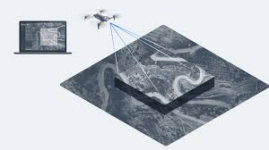
A drone is only useful if the final data matches the project requirement. With the Matrice 4E, Irish teams can build a repeatable workflow around visual mapping and 3D reconstruction.
| Deliverable | Typical use | Why Matrice 4E helps |
|---|---|---|
| Orthomosaic map | Site overview, progress reports, planning records | Mechanical shutter, RTK workflow and fast interval shooting support consistent mapping images. |
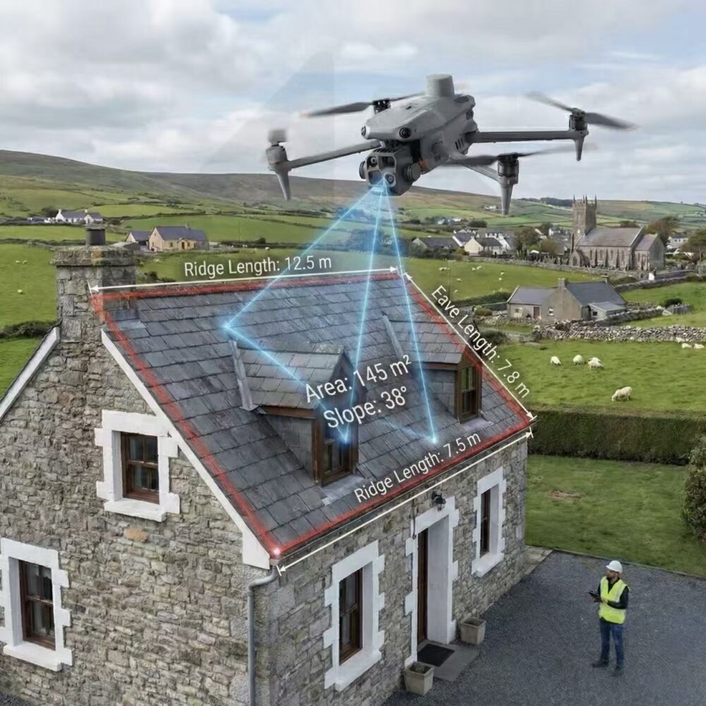
| 3D model | Roofs, facades, heritage, bridges, irregular buildings | Smart 3D Capture and oblique imagery help collect angled data for reconstruction. |
| Digital surface model | Earthworks, drainage review, construction layout support | Consistent nadir imagery and control workflow can support elevation-related review. |
| Progress comparison | Weekly site updates for contractors and developers | Repeatable flight routes make it easier to compare the same area over time. |
| Inspection image set | Roof detail, bridge elements, facade condition, site access issues | Medium tele and tele cameras allow safer visual checks without standing close to hazards. |
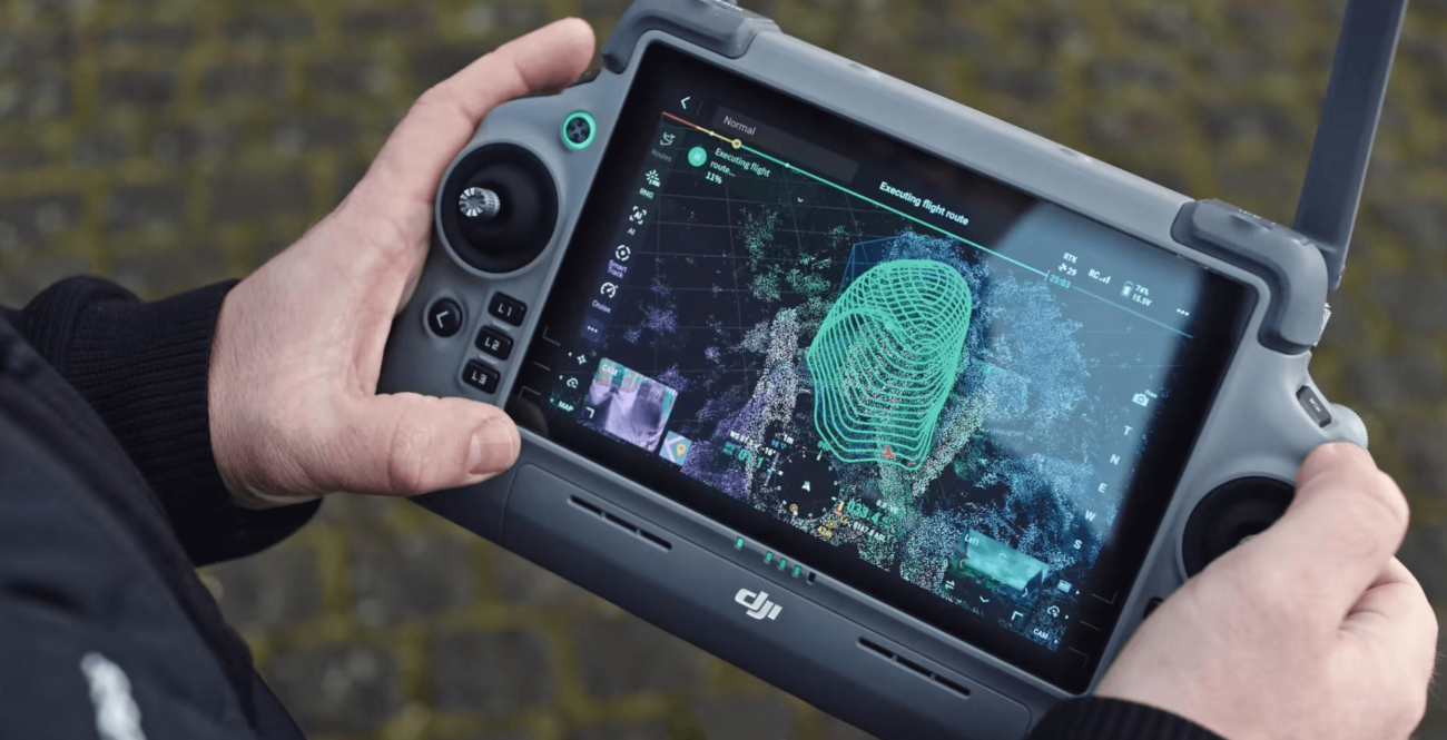
A practical Matrice 4E workflow for Irish survey projects
Decide whether the project needs an orthomosaic, DSM, 3D model, facade record, stockpile estimate or progress report.
Review local airspace, people, roads, railways, power assets, privacy, landowner permissions and weather.
Use suitable correction sources and add ground control or check points where accuracy must be proven.
Use nadir capture for orthomosaics, oblique capture for buildings and closer detail capture for complex structures.
Use DJI Terra or compatible photogrammetry software, then check overlap, control accuracy and model quality.
Export maps, models, annotated images and clear notes for the engineer, contractor, architect or asset owner.
Matrice 4E vs Matrice 4T vs Matrice 400 with Zenmuse L3
The best drone depends on the data required. The Matrice 4E is not automatically the best option just because it is new. It is best when the job is centred on high-quality RGB mapping and photogrammetry.
| Project need | Recommended DJI solution | Reason |
|---|---|---|
| 2D mapping, 3D photogrammetry, construction progress | DJI Matrice 4E | 4/3 20MP mapping camera, mechanical shutter, RTK support and Smart 3D Capture. |
| Thermal inspection, night response, heat-loss checks | DJI Matrice 4T | The 4T adds thermal imaging and NIR capabilities. The 4E does not include a thermal camera. |
| Large-scale LiDAR, forestry, vegetation, corridor mapping | DJI Matrice 400 + Zenmuse L3 | Dedicated LiDAR is better when terrain under vegetation or long-range point-cloud capture is the main requirement. |
| Automated dock missions | DJI Dock 3 with Matrice 4D / 4TD | Dock workflows are built around the dock-compatible 4D / 4TD aircraft, not the standard Matrice 4E. |
Where the Matrice 4E is not the best choice
The Matrice 4E is a strong mapping drone, but it should not be oversold. It is not a full replacement for every survey instrument, every inspection drone or every LiDAR workflow.
- Not for thermal-first work: choose Matrice 4T if the main requirement is heat detection, night search or thermal inspection.
- Not for canopy penetration: choose a LiDAR payload such as Zenmuse L3 where vegetation, forestry or long corridor point-cloud capture is central.
- Not for flying in rain: plan around Irish weather carefully and avoid wet-weather operation.
- Not a legal boundary survey by itself: final survey deliverables still require professional methodology, control points, QA and, where needed, qualified survey validation.
Irish compliance and flight planning notes
For Irish commercial survey work, the flight plan must be matched to the operating category, airspace, pilot competence and site risk. The Matrice 4 Series has C2 certification in Europe, which can be useful for Open Category planning where all conditions are met. However, many real survey sites are more complex than a simple open field.
Operations near roads, people, utility assets, railways, restricted airspace, congested areas or beyond visual line of sight may require additional planning or authorisation. The Irish Aviation Authority states that UAS operators may require Operational Authorisation for advanced operations in complex environments, BVLOS, or restricted/prohibited airspace.
In practice, the safest approach is to plan the deliverable, risk assessment, pilot competence, airspace check, privacy controls and data workflow before going to site.
Recommended Matrice 4E package for Irish mapping teams
DJI Matrice 4E with RC Plus 2 Enterprise controller.
Multiple Matrice 4 Series batteries, charging hub and spare propellers.
D-RTK 3 Multifunctional Station or suitable RTK/NTRIP correction workflow.
DJI Terra or compatible photogrammetry software, plus a documented QA process.
Final verdict
For Irish surveyors, construction firms, engineering consultants and asset owners who need fast and repeatable visual mapping, the DJI Matrice 4E is one of the best compact enterprise options available. Its strongest advantages are the 4/3 20MP mapping camera, mechanical shutter, RTK workflow, fast interval capture, telephoto inspection support and Smart 3D Capture.
Choose Matrice 4E when the job is photogrammetry, orthomosaics, 3D modelling and project documentation. Choose Matrice 4T when thermal data is the priority. Choose Matrice 400 with Zenmuse L3 when LiDAR or large payload flexibility is required.
FAQ: DJI Matrice 4E for surveying in Ireland
Is the DJI Matrice 4E good for land surveying?
Yes. It is well suited to photogrammetry, orthomosaic mapping, 3D modelling and repeatable project documentation. For legal boundary or engineering deliverables, professional control and QA are still required.
Does the Matrice 4E have a mechanical shutter?
Yes. The Matrice 4E wide camera supports a mechanical shutter, which is one of its main advantages for mapping and photogrammetry.
Can Matrice 4E replace a LiDAR drone?
No. The Matrice 4E is primarily a visual photogrammetry platform. If the project requires LiDAR point clouds, vegetation penetration or long corridor survey data, consider Matrice 400 with Zenmuse L3.
Is Matrice 4E better than Matrice 4T for surveying?
For mapping and photogrammetry, Matrice 4E is usually the better choice because of its 4/3 20MP wide camera and mechanical shutter. Matrice 4T is better when thermal inspection or night operations are the main requirement.
Can the Matrice 4E be used for roof measurement and solar PV design?
Yes. It can support roof mapping, area measurement, slope records, 3D roof models and pre-design site documentation for solar PV planning.
Does the Matrice 4E include thermal imaging?
No. If you need thermal imaging for solar inspection, heat-loss surveys, public safety or night search, choose the DJI Matrice 4T instead.
Can Irish Drone help choose the correct mapping setup?
Yes. Irish Drone can help compare Matrice 4E, Matrice 4T, Matrice 400, Zenmuse L3, D-RTK 3 and software workflows based on your real site requirements.
Need help choosing a DJI mapping drone?
Tell Irish Drone what you need to survey — construction site, roof, quarry, road, facade, farm, solar site or heritage structure — and we can recommend the most suitable DJI drone, RTK setup and processing workflow.
Contact Irish DroneTechnical references: DJI Matrice 4 Series specifications, DJI Matrice 4 Series support FAQ, and Irish Aviation Authority Operational Authorisation guidance.

Leave a comment