

CONSTRUCTION · EARTHWORKS SURVEY WORKFLOW
Plan the reference system, boundaries, independent checks and accepted surface inputs with the survey professional before an RTK capture.
Evidence reviewed 3 November 2026 · Ireland
The practical answer
For earthworks, agree the survey reference, comparison surface, boundary and checks before capture. CT-02 supplies M4E and D-RTK 3 equipment for a specified workflow; the survey professional must define and accept the measurement method and resulting deliverable.
Name the quantity you actually need
A request for site volumes can mean stockpile inventory, change between surveys or comparison with a design surface. Begin by stating which question the project needs answered and who will accept the result. Ask the survey professional to explain the required surfaces, boundary and treatment of gaps.
Keep the quantity question distinct from the aircraft purchase. The same images can feed different calculations depending on the chosen reference and processing decisions. Put those decisions in the brief before capture so the contractor, surveyor and receiving team are discussing the same proposed measurement rather than matching numbers after delivery.
Agree the project coordinate and height reference
RICS measured-survey scope includes reference systems, control, accuracy and deliverables. [1] Ask the project surveyor to identify the approved coordinate and height references and how the new data will be tied to them. Preserve the relevant reference documentation with the dataset.
Check the units, drawing revision and any project-specific transformation before comparing survey and design. Ask who approves an updated design surface and how superseded versions will be retained. A visually convincing overlay can distract from a reference mismatch; a clear version and reference check gives the receiving team a practical acceptance step.
Use RTK as part of a survey method
D-RTK 3 has distinct broadcast, rover and relay modes. [2] For CT-02, have the surveyor and equipment trainer agree the supported setup and relevant calibration, coordinate and recording procedure for the intended task. Keep the actual firmware and workflow versions with the handover record.
Ask how independent checks will assess the finished product, not just how an RTK status will appear during capture. Ground targets have roles within that method; their quantity is not the acceptance criterion. Define who establishes control, who checks the output and what happens if the check evidence does not meet the brief.
Make the comparison surface and boundary explicit
For a stockpile, ask which base surface and perimeter define the calculation. For change between visits, identify both accepted survey surfaces and their dates. For design comparison, name the approved design revision and the area to which the result applies. Keep those choices with each calculation.
Agree how vegetation, water, machines, temporary materials and inaccessible edges will be treated. The surveyor should decide which areas can be represented adequately and which need a different method or an excluded boundary. Show those decisions on the delivered plan so a reviewer can see where the reported quantity applies.
Plan a capture that can be checked
Provide the surveyor with the site boundary, changing work areas, intended comparison and access constraints. Let the appointed operator develop the capture plan within the site’s arrangements. Agree how interruptions and rapid changes during the visit will be recorded so the finished dataset has a meaningful capture context.
Keep original images, relevant positioning records, control and check information, processing settings and the coverage record with the project files. Ask the surveyor to identify what must be retained for later review. A complete evidence trail helps the receiving team assess a result without depending on a single exported volume figure.

Inspect the surface before accepting the volume
Ask the survey professional to review coverage, unusual geometry, gaps and the suitability of the chosen surface before calculating the final quantity. Keep any edited surface separate from the original processing output and record why the edit was made. The receiving team should understand the calculation’s input, not only its result.
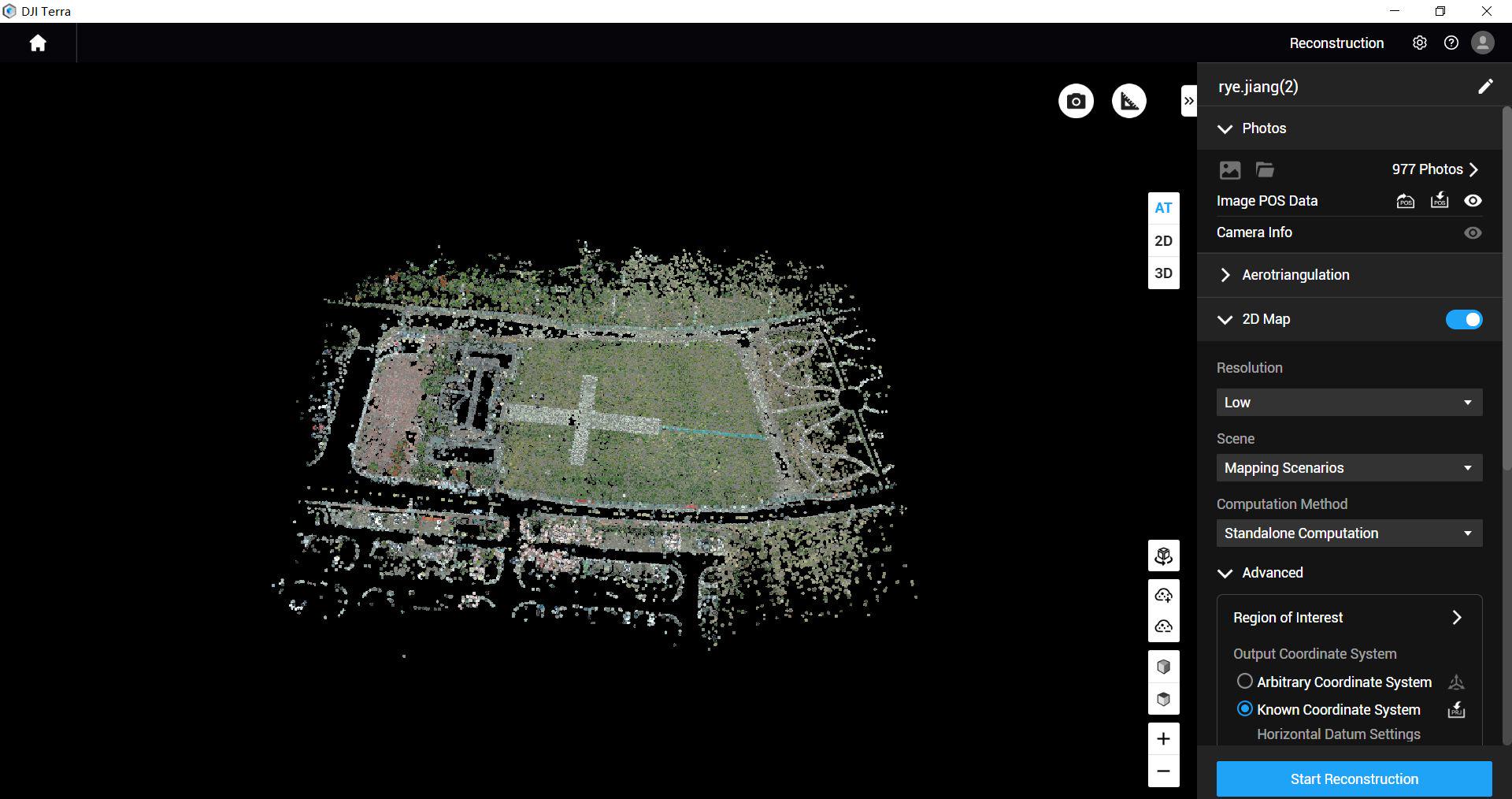
Terra Standard for M4E/M4D data is included for one year in CT-02. During handover, use a representative dataset to demonstrate the agreed processing route and export. Have the surveyor verify how that output enters the project’s quantity workflow. A software licence does not itself establish a contractual measurement convention.
A hypothetical comparison brief
Suppose a contractor wants to compare an excavation with the current design. The brief could name the work-area boundary, accepted survey reference, approved design revision, capture date, check method and intended report. It should also identify any wet or obscured area that needs a separate decision.
Ask the reviewer to trace one reported area back to its survey surface and design reference. Then ask how an excluded area affects the result and what follow-up is required. This acceptance exercise tests the evidence chain without assigning a blanket accuracy percentage or assuming the output is automatically suitable for payment certification.
Read the earthworks package accurately
CT-02 contains M4E, five flight batteries in total, D-RTK 3 Multifunctional Station, survey pole and tripod kit, targets and a restricted one-year Terra Standard licence. Training, support and three dataset quality reviews are included. Power 2000 is not part of this configuration.
Use the training and review appointments around the agreed survey workflow, including coordinate records, check evidence and output handover. Send Irish Drone the intended deliverable and team requirements so the equipment scope supports that process. The project surveyor remains the right person to specify the measurement and professional acceptance.

Questions to settle before the survey
Does RTK remove the need for independent checks? Ask the survey professional to define the evidence needed to accept the final output. Can a drone see the original ground under a stockpile? Agree how the base surface will be established; capture of the visible surface does not supply a hidden base.
What belongs in the enquiry? Send the boundary, quantity question, approved references, design revision and desired handover. Use the progress-record guide for visual reporting and the package selection guide when deciding which information route the project actually needs.
Explore the equipment packages on Irish Drone
Package illustrations show the listed configurations. Battery quantities are whole-package totals.
Official manuals and setup guidance

Continue with the guide for your work

Documentation and evidence
Sources for the cited guidance
- RICS: Measured surveys of land, buildings and utilitiesRead source ↗
Reviewed 3 November 2026.
- DJI D-RTK 3 Multifunctional Station FAQRead source ↗
Reviewed 3 November 2026.
Compare equipment packages
Explore Construction & Earthworks drone packages →
To discuss equipment for earthworks survey records, contact Irish Drone with the site, reference system and volume-reporting requirements.




Pingback: Construction Site Docks: Commissioning and Repeat Capture
Pingback: Choosing a Construction Drone Package: Progress, Earthworks or a Site Dock
Pingback: Construction Progress Drone Records That a Project Team Can Use