
ENVIRONMENT & HABITATS · RESTORATION MONITORING
Give restoration monitoring a clear evidence question, repeatable records and field verification before interpreting changes in vegetation imagery.
Evidence reviewed 3 November 2026 · Ireland
The practical answer
Separate the record of restoration works from evidence of ecological response. Define what is being compared, how the imagery will be processed and which field observations will support interpretation. EN-01 supplies the capture package; its processing software remains customer supplied.
Name the question at this stage
A restoration team may first need to document where work was completed and later examine how the site is changing. State which stage the proposed record supports. This creates a more useful enquiry than asking the equipment to prove that restoration has succeeded in every sense.
List the intended observations with the project lead. They may concern a visible work feature, a vegetation pattern or an unresolved place requiring a field visit. Give each question an appropriate reviewer and evidence requirement. Keep the scope connected to the management plan, so a later interpretation can be understood alongside the actual intervention and its timing.

Create a baseline that can be revisited
Agree stable site references, existing plans and an observation register. Preserve the original capture files and the version of the plan used for comparison. Document anything already changed before the first visit so that the baseline is not presented as an untouched starting condition.
For a hypothetical restoration area, the initial deliverable could be an overview linked to a small set of field records and outstanding questions. Keep its purpose modest and explicit. Another reviewer should be able to identify what was observed, which information came from previous surveys and what remains to be checked. This helps the baseline remain useful when staff or contractors change.
Use field evidence in the interpretation
An Irish peatland study compared drone-derived vegetation maps with field-based habitat records. [1] Its experiment supports asking for validation rather than assuming every processed layer has the required ecological meaning. The study’s classification results are not a performance promise for EN-01.
Ask the ecological reviewer how reference observations should be selected and what they can establish. Keep a record of method and timing. Where imagery and field notes disagree, retain the disagreement for review. A useful output may be a clearer field-check plan rather than a final condition class, particularly during an early pilot when the processing approach is still being assessed.
Specify the processing before capture
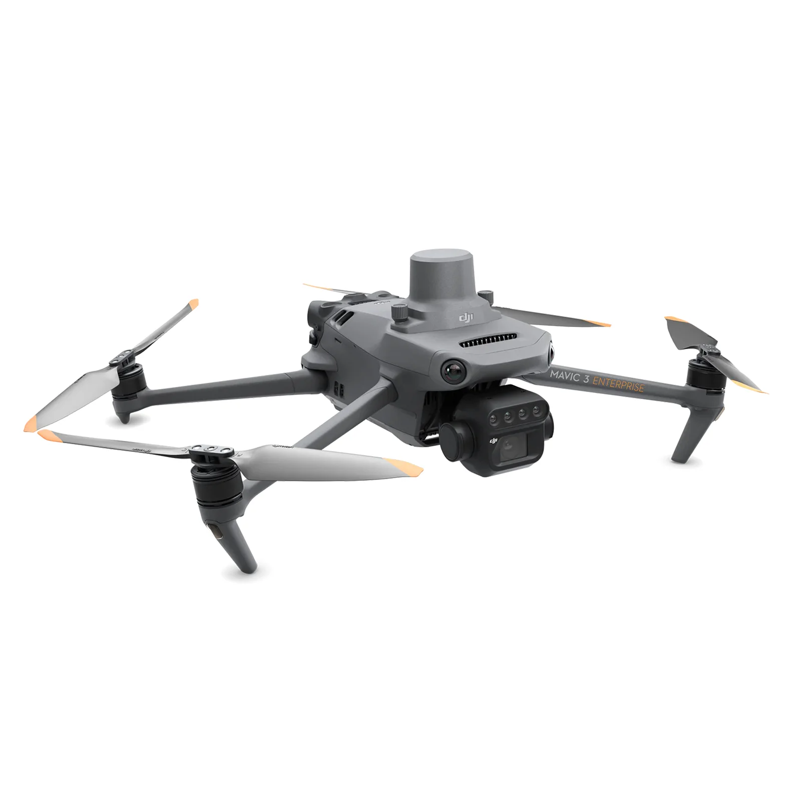
EN-01 includes Mavic 3 Multispectral, four total flight batteries, the listed calibrated reflectance panel and capture accessories. No processing licence is supplied. Identify the tool, person and deliverable before the first flight, with a sample showing what the project expects to receive.
Agree file formats, version records and how missing or unsuitable imagery is handled. Confirm whether the recipient receives originals and intermediate information or only a presentation. If the workflow changes, document the change before comparing results with older visits. Keep the equipment supply and specialist ecological interpretation as distinct responsibilities so neither is assumed from the other.
Make a repeat visit answer a question
A follow-up might document an agreed work feature, investigate a place previously hidden or contribute a new observation to the monitoring plan. Record what has changed in access, management and the evidence available. A repeated flight is useful only when the resulting comparison serves the question.
NatureScot’s condition research highlights the importance of field validation and long-term evidence. [2] This provides context for careful interpretation, not a prescribed interval for an Irish project. Choose timing with the project lead and reviewer, and retain uncertainty where the available observations cannot separate a meaningful ecological change from a difference in the record.
Keep works verification identifiable
A Bord na Móna practice example combines photographs with rehabilitation plans. [3] If a customer needs that type of record, identify the planned features and the evidence required by the recipient. Confirmation of a visible work item has a narrower purpose than assessing the whole site’s ecological condition.
Connect each observation to the relevant plan version and reviewer. Record whether a feature was visible, obscured or outside the agreed coverage. Preserve original notes after review so the reasoning remains traceable. Any certification, contractual acceptance or compliance decision needs its own defined professional process; it is not created by the camera or included automatically with a dataset-quality review.
Evaluate the first dataset together
Choose a representative area and prepare independent information before evaluating the output. Review useful observations, ambiguous records, processing time and gaps. Agree which limitations can be improved and which mean a different method is required.
EN-01 includes four hours of training for up to two people, six months of introductory email support and two dataset-quality reviews, by agreement. Scope those reviews around the capture questions and the customer’s processing arrangement. Keep a concise action list afterwards, with responsibility and evidence needed to close each item. This makes the pilot a decision about the working process, not just a demonstration of attractive imagery.
Questions about restoration monitoring
Can an index map certify restoration success? The reviewer must assess the intended ecological question and supporting evidence. Is water-table or carbon measurement included? Those outcomes are not supplied by this package. Can we compare every visit directly? Document the method and have comparability assessed.
How do we begin? Review EN-01, identify processing and field-review responsibilities, then send the monitoring brief. Use the handover guide for data requirements or the selection guide for the broader equipment choice.
Explore the equipment packages on Irish Drone
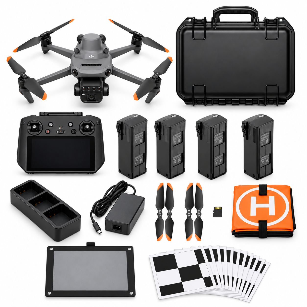
Package illustrations show the listed configurations. Battery quantities are whole-package totals.
Official manuals and setup guidance
Continue with the guide for your work
Documentation and evidence
Sources for the cited guidance
- Irish peatland mapping studyRead source ↗
Reviewed 3 November 2026.
- Peatland condition research guidanceRead source ↗
Reviewed 3 November 2026.
- Peatland rehabilitation evidenceRead source ↗
Reviewed 3 November 2026.




Pingback: Choosing Drones for Environmental and Habitat Records | Irish Drone