

COASTAL & MARINE · ASSET HANDOVER
An organised visual record helps an asset owner decide where specialist inspection should focus next.
Evidence reviewed 3 November 2026 · Ireland
The practical answer
For MI-01 coastal asset work, agree the asset sections, required views and review owner first. Deliver an index linking overview and detail images to each section, with dates, conditions and coverage gaps. Keep observations separate from structural conclusions and make the next review or inspection action explicit.
Define what the reviewer needs to decide
Start with the asset owner’s question. It may want a current visual record, a closer look at a previously noted area or a comparison after planned works. Ask the responsible engineer or asset manager which views will support that decision and which further inspection methods may still be needed.
England’s Environment Agency guidance distinguishes visual, engineering and specialist inspection. [1] That is a useful general workflow distinction, not an Irish statutory rule. Use it to agree the role of aerial imagery within the owner’s inspection programme and keep the scope clear when commissioning an equipment demonstration.
Give every image a place in the asset register
Break the agreed asset into sections the receiving team recognises. Use its existing identifiers where available and agree how new references will be approved. A section plan or annotated overview can make the index easier to navigate than a collection of camera-generated filenames.
For each section, retain the capture date, file references, view direction or descriptive location and any coverage exception. Test the naming with somebody who was not present during capture. If that person can identify the correct section and original file, the handover is already doing useful work for future inspections and maintenance planning.
Plan an overview-to-detail sequence
The overview shows where a feature sits within the asset. A detail image supports the specific observation. Agree both together so the reviewer can move from the wider context to the area of interest without guessing. Keep adjacent views and the relationship between files in the index.
Describe the intended coverage in advance, then log what was actually captured. Some features may remain obscured or unsuitable for an aerial view. Make those areas visible in the report and refer them back to the reviewer. The aim is a trustworthy record of the agreed visible features, with a clear boundary around what remains to be inspected.

Keep coastal context with the observation
Record the circumstances that matter to the review, including capture time, relevant water-level context and visibility of the required surfaces. The asset owner should help identify what information is useful for its particular structures. Use factual entries and distinguish observed conditions from assumptions.
If the programme will revisit the same feature, keep a consistent view list and retain the previous record. Explain any difference in coverage or conditions before presenting a visual comparison. A new photograph may reveal something that was simply hidden last time. The reviewer needs that context to decide whether the apparent difference warrants closer investigation.
Separate the visual observation from the conclusion
| Entry | Example of its purpose |
|---|---|
| Asset identity | Locate the exact section and linked files |
| Observation | Describe what is visible without assigning an unsupported cause |
| Limitation | Identify obscured, submerged or otherwise unobserved areas |
| Review action | Name the responsible reviewer and next inspection decision |
Agree the vocabulary with the receiving engineer. A capture team can flag a feature for review while leaving its cause, extent and structural significance to the appropriate professional assessment. This preserves the value of the evidence without asking the image to answer a different question.
Test the index and files on the receiving system
Keep original images separately from marked-up illustrations. The report should point back to the source files using stable names or agreed links. Confirm the storage, access and retention arrangements with the owner, especially where a coastal asset has operational or security sensitivities.
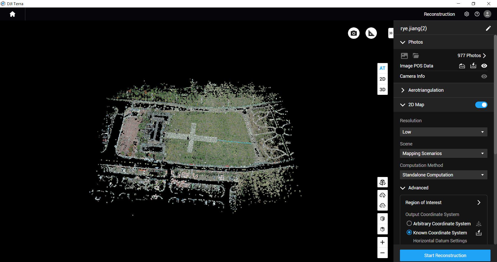
Open a sample handover on the customer’s actual system. Check that the index, overview, details and exception list can be used together. Where a model or mapping output is requested, specify and test that processing route separately. MI-01’s included Standard entitlement is scoped to M4E/M4D data; a licence entry should be connected to the customer’s intended output.

Use one representative section as the acceptance sample
An illustrative pilot could follow one approved waterfront section with known asset identifiers. The owner appoints a reviewer and supplies a view list. The capture team delivers the section index, overview and detail files, conditions and gaps. The reviewer checks whether the record can support a follow-up instruction to the correct location.
Then ask a second colleague to find the same feature using only the handover. Note any missing context or ambiguous naming. Revise the template before expanding capture. This simple test can reveal practical problems that remain invisible when the person who took the photographs is also the only person presenting them.
Questions about the asset record
Does an aerial visual record establish structural capacity?
That conclusion belongs to the appropriate engineering assessment. Use the visual record to support the agreed review and further inspection.
What about surfaces below the waterline?
Identify them as outside the aerial record and ask the owner to specify the appropriate specialist inspection method.
Can the included dataset review sign off the asset?
The listed package service is dataset-quality review, not an on-site inspection, signed certification, diagnosis or repair.
Should the report contain every photograph?
Agree a useful review set and preserve a route to the originals. A navigable index is more helpful than an unstructured image dump.
Discuss MI-01 against an example asset record
Review MI-01 M4E Coastal Asset Survey Package with a sample section plan and expected handover. The approved package includes five total flight batteries, Power 2000, workflow training, support and two scoped dataset-quality reviews.
Ask Irish Drone to demonstrate how the proposed team will capture, organise and hand over that example. Identify the customer’s engineering reviewer and required formats early. If the purpose is measuring change along a shoreline, use the separate repeat-survey workflow to address feature definition, reference and uncertainty before capture.
See the software workflow
The software image is a manufacturer workflow reference. Check the written licence edition and the supported aircraft, file type and project method before choosing a processing route.
Explore the equipment packages on Irish Drone
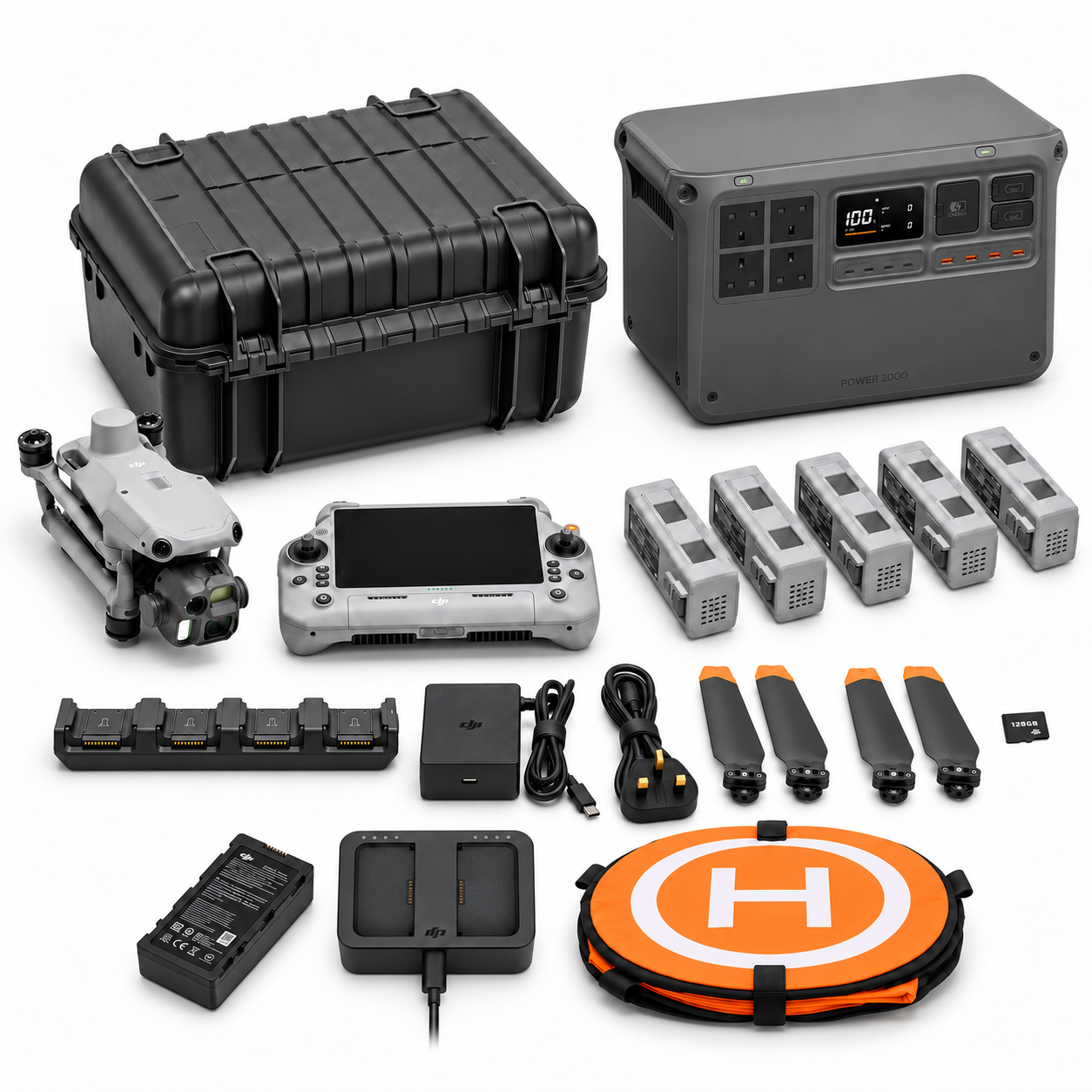
Package illustrations show the listed configurations. Battery quantities are whole-package totals.
Official manuals and setup guidance
Continue with the guide for your work

Documentation and evidence
Sources for the cited guidance
- Flood risk asset maintenance and inspection: good practice guidanceRead source ↗
Reviewed 3 November 2026.
Compare equipment packages
Explore Coastal & Marine Operations drone packages →
To discuss equipment for coastal asset records, contact Irish Drone with the asset identifiers, areas of interest and handover needs.





Pingback: Coastal Drone Team Exercise: M4TD Readiness and Handover
Pingback: Coastal Drone Packages Ireland: M4E or M4TD Workflow
Pingback: Repeat Shoreline Drone Surveys: Tide and Comparison Planning