

COASTAL & MARINE · SELECTION GUIDE
Choose the system for the coastal task: planned land-based records or a trained team’s coordinated observation workflow.
Evidence reviewed 3 November 2026 · Ireland
Choose the guide for your task
The practical answer
Choose MI-01 for planned M4E shoreline and coastal-asset records with Power 2000 and the listed Terra Standard entitlement. Consider MI-02 for a trained team’s standalone M4TD observation workflow, including AL1 and AS1. Both have five total flight batteries. MI-02 does not include Dock 3, portable power or image-processing software.
Start with the decision and the receiving team
A coastal engineer reviewing a seawall, a survey team recording an exposed shoreline and a trained response team supporting an authorised task need different evidence. Write the purpose and recipient into the brief before discussing an aircraft. An attractive waterfront image is only the start of the decision.
For planned work, ask for a representative output: an indexed asset record, a referenced survey sample or a dated comparison. For a team-observation role, ask how a reported observation reaches the person coordinating the task. This helps distinguish equipment capability from the operating arrangements and specialist judgement needed to use it.
Compare the approved configurations
| Route | Approved core contents | Useful first test |
|---|---|---|
| MI-01 coastal asset survey | M4E, five total batteries, Power 2000, twelve-month Terra Standard for M4E/M4D data | A reviewable coastal record and sample processing handover |
| MI-02 coastal response team | Standalone M4TD, five total batteries, RC Plus 2 Enterprise, AL1 and AS1 | A coordinated observation exercise and evidence handover |
MI-01 already includes portable power. MI-02 is a separate manually controlled team kit, not a dock installation, and it has no included image-processing licence. Confirm the required workflow against the written contents instead of assuming a common software or deployment arrangement.

Use planned capture to build a consistent record
For a coastal asset programme, identify the asset sections, views and information needed by the reviewer. A repeated overview can make a new observation easier to locate, while detail files can support the next inspection decision. Keep the date, source files and agreed limitations with the record.
UNSW’s Water Research Laboratory describes separate coastal survey and specialist interpretation roles. [1] Use that distinction when buying equipment: decide who will process the files and who will interpret them. The asset-record guide sets out a practical handover for visible above-water features without treating imagery as a complete structural assessment.
Make the coastal conditions part of the dataset
A visible water edge is an observation at a particular time. If the purpose is comparison, agree what feature will be compared and what context is needed. Keep capture time, relevant water-level information and the method used with each date. This gives the receiving specialist a fair basis for judging differences.
The Marine Institute’s tide predictions exclude weather-driven storm surge. [2] Use the appropriate official information and observed conditions in the team’s planning process. A prediction alone should not be treated as the complete description of a capture. The repeat shoreline guide explains how to organise a comparison brief.
Match the response kit to an established team process
MI-02 fits a discussion about a trained team’s observation needs: which view is requested, how a possible finding is reported and who acknowledges it. Plan an exercise before an operational commitment. Include image handling, task updates and how the team ends or hands over a request.
The Irish Coast Guard coordinates maritime search and rescue response. [3] An equipment package does not make an independent team part of that response system. Where support is proposed, establish the requesting authority and coordination arrangements first. The team-exercise guide focuses on procurement and readiness rather than rescue instructions.

Plan a suitable land-based operating location
Both approved packages describe capture from suitable land-based operating locations. Include the proposed access, launch area, site contact and changing coastal conditions in the operating brief. Consider how the team will retain access and finish the work if the original plan becomes unsuitable.
Wildlife planning belongs in the initial site discussion. NPWS identifies irresponsible drone use as a marine-wildlife disturbance risk. [4] Seek appropriate site and ecological advice for the proposed location and season. A planned capture should fit the site’s constraints, with clear criteria for postponing or revising the task instead of pursuing an image at any cost.
Ask the pilot to prove the whole workflow
An illustrative asset pilot could select one approved stretch with clear identifiers and an appointed reviewer. The capture team supplies overview and detail files, context and a short index. The reviewer checks whether a later team can find the same feature and understand the record.
A response-team exercise would use a different test: an authorised request, an agreed observation, a clear report and acknowledgement by the coordinator. Keep the exercise separate from a real incident. In either case, record what was accepted, what was missing and what training is needed. That gives the purchase a practical acceptance point beyond a successful flight.
Questions about the coastal packages
Does MI-02 include Dock 3?
No. It is a standalone M4TD team configuration with the listed remote controller and charging equipment.
Does MI-01 include a general Terra licence for every aircraft?
The listed twelve-month Standard entitlement is for Matrice 4E/M4D data. Keep the intended files and processing route within the agreed licence scope.
Can these packages be purchased as an underwater survey system?
The approved contents describe land-based coastal capture. A bathymetric or submerged-structure requirement needs a separately specified specialist method.
Is training the same as rescue accreditation?
The listed service is application workflow training. Confirm any organisational competence and operational requirements independently.
Bring a sample task to Irish Drone
Review MI-01 M4E Coastal Asset Survey Package for planned records and MI-02 M4TD Coastal Response Team Package for an established team’s observation workflow.
Share the intended output, capture frequency, receiving software and responsible reviewer with Irish Drone. Ask for a walkthrough of the written equipment, training and dataset-quality review against that task. The right starting point is a workflow your team can test and accept, with responsibilities clear before the first operational visit.
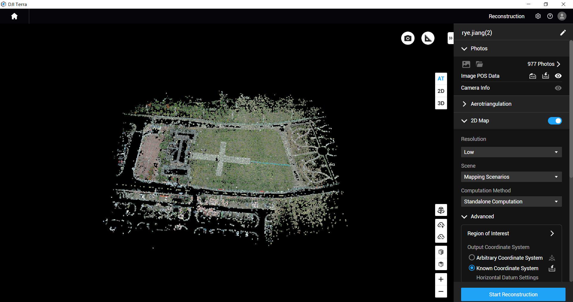
See the software workflow
The software image is a manufacturer workflow reference. Check the written licence edition and the supported aircraft, file type and project method before choosing a processing route.
Compare the confirmed package configurations
Explore the equipment packages on Irish Drone
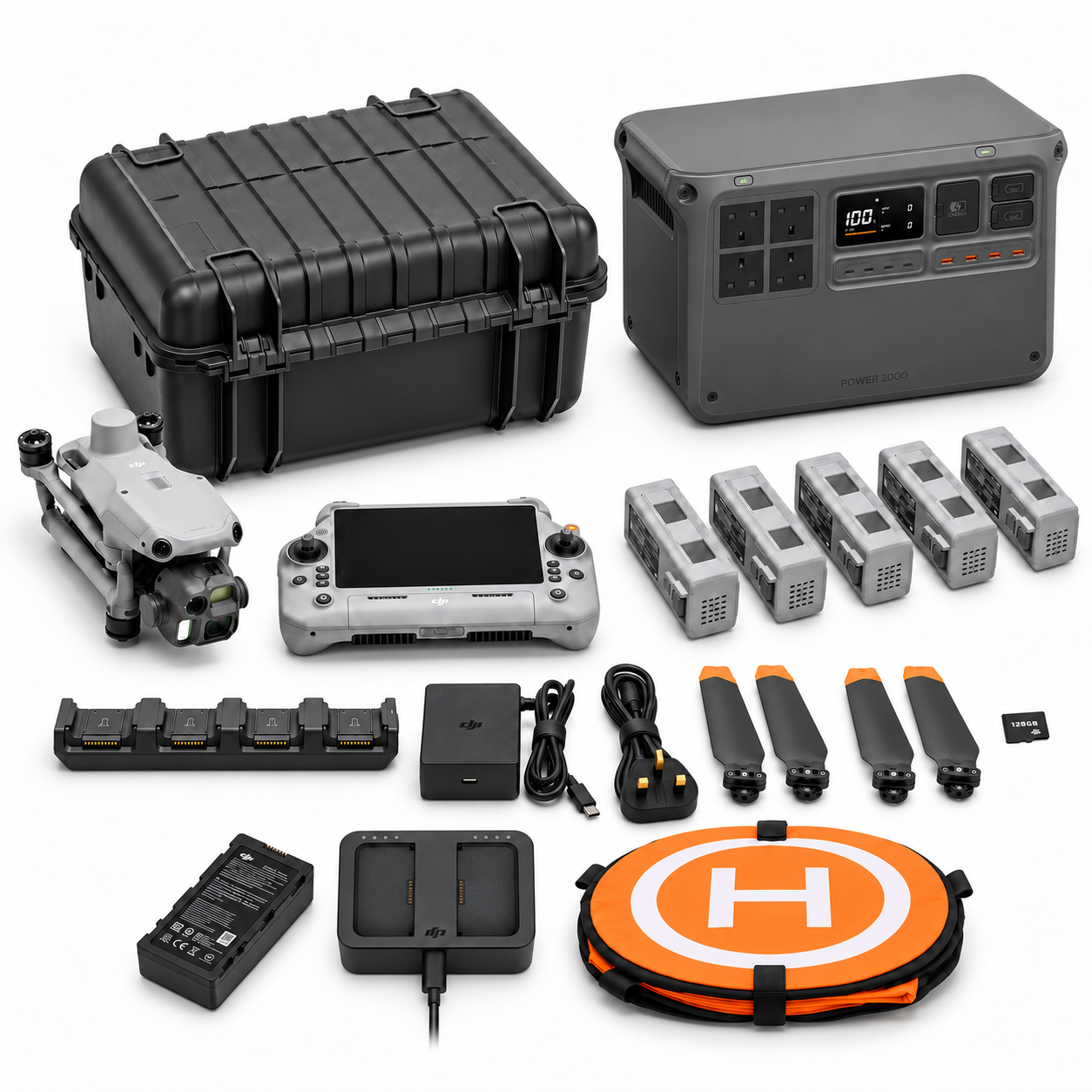
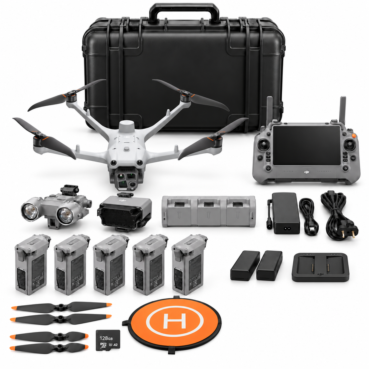
Package illustrations show the listed configurations. Battery quantities are whole-package totals.
Official manuals and setup guidance


Continue with the guide for your work
Documentation and evidence
Sources for the cited guidance
- UNSW Water Research Laboratory: UAV/drone surveyingRead source ↗
Reviewed 3 November 2026.
- Marine Institute: Tidal PredictionsRead source ↗
Reviewed 3 November 2026.
- Irish Coast Guard: Our OrganisationRead source ↗
Reviewed 3 November 2026.
- NPWS: Responsible Marine Wildlife Watching initiativeRead source ↗
Reviewed 3 November 2026.
Compare equipment packages
Explore Coastal & Marine Operations drone packages →
To discuss equipment for a coastal project, contact Irish Drone with the asset, shore access and intended evidence handover.





Pingback: Coastal Drone Team Exercise: M4TD Readiness and Handover
Pingback: Coastal Asset Drone Records: Inspection Handover Guide
Pingback: Repeat Shoreline Drone Surveys: Tide and Comparison Planning