
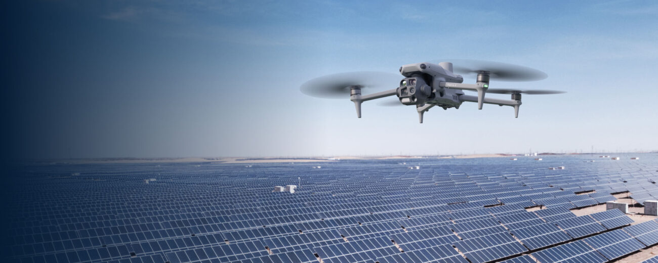
SOLAR & PHOTOVOLTAICS · 2026 EQUIPMENT GUIDE
A practical, evidence-led guide for Irish solar asset owners and O&M teams: portable Matrice 4T, Matrice 400 with H30T, and fixed or vehicle-mounted Dock 3.
Evidence reviewed 3 November 2026 · Ireland
This guide compares the configurations in the listed Irish Drone solar packages. DJI also documents newer systems, including DJI Dock 4. Availability, compatible aircraft and the operating design require their own review and quotation.
Three platform options, matched to your inspection workflow
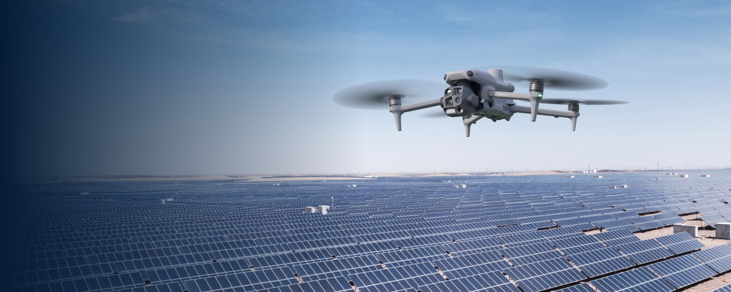
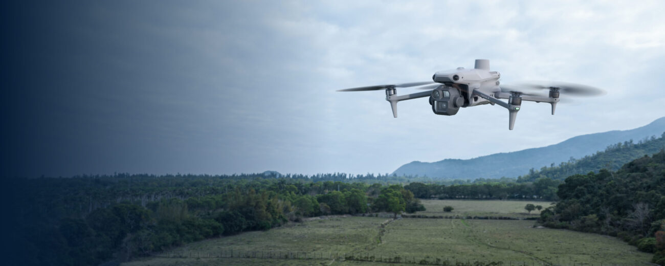
Matrice 4T
A compact thermal aircraft for visiting teams moving between rooftops, distributed arrays and ground-mounted sites.
Explore portable inspections →
Matrice 400 + H30T
Evaluate the higher native thermal sampling for detailed campaigns across large, contiguous arrays; choose around the evidence your team needs.
Explore large-site inspections →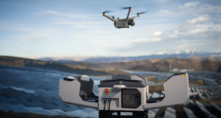
Dock 3 + Matrice 4TD
Repeat inspections at one prepared site, or move between sites with a separately engineered vehicle-mounted system that operates while parked.
Explore fixed-site inspections →Explore mobile & distributed inspections →DJI application visuals illustrate the platforms. They are not Irish Drone project results or proof of the conditions needed for a thermal inspection; the Dock scene does not identify the 4D/4TD variant.
The quick choice
Choose the Matrice 4T when portability and visits across several sites dominate the job. Evaluate the Matrice 400 with Zenmuse H30T when the inspection brief justifies a larger platform and a higher-native-resolution thermal payload. Evaluate Dock 3 with Matrice 4TD when frequent repeat capture at a prepared location is the operational priority.
These are workflow recommendations, rather than a manufacturer-approved ranking by plant capacity. The decision should be tested against the required evidence, site access, weather window, operator arrangements and data-review process.
Aircraft and compatibility facts are drawn from DJI documentation. Suitability recommendations are our editorial interpretation and require a site-specific brief. [1], [2], [4], [5], [6]
| Route | Native thermal sampling | Deployment question |
|---|---|---|
| Matrice 4T | 640 × 512 | Does a portable visiting team meet the capture brief? |
| Matrice 400 + H30T | 1280 × 1024 on the H30T | Does the required evidence justify the payload and larger system? |
| Dock 3 + Matrice 4TD | 640 × 512 on the M4TD | Does repeat deployment justify the infrastructure and operation? |
Why MW alone does not choose the aircraft
A capacity figure describes an electrical installation; it does not fully describe the flying task. A compact contiguous array and several separated arrays can have the same combined rating but different travel, access and launch requirements. Establish whether the quoted capacity is MWp/DC or MW/AC, then obtain the layout and required inspection deliverable.
Worked example, not a sizing rule: for a hypothetical 1.8 MW site, the M4T is a sensible starting point if a visiting team needs portable RGB and thermal capture, safe access is available and a test flight meets the required image quality. It is not automatically the right aircraft below 1.8 MW, nor automatically unsuitable above it. Dispersed sites can favour a portable system even when their combined capacity is substantial.
For a large contiguous plant, compare the achievable thermal detail and validated survey time of the M400/H30T route. For a plant needing frequent revisits, compare the full cost and feasibility of a docked operation. A bigger site may need a combination of systems rather than one aircraft.
Published engineering work relates inspection quality to image distance, acquisition geometry and localisation. The sources reviewed here do not establish a universal 1.8 MW boundary between these DJI models. Require a representative trial before accepting a coverage-rate promise. [15]
Matrice 4T: portable inspections across sites
The M4T combines visible-light and thermal capture in a compact aircraft. Its native infrared image is 640 × 512; DJI also lists an enhanced 1280 × 1024 output. Enhanced output should not be presented as a native sensor equivalent to the H30T. [1]
We would shortlist it for contractors moving between customers, portfolios of separated installations, and teams who value a simpler transport and deployment routine. Check safe pilot positions, roof access restrictions, battery logistics and the ability to identify the relevant module in the final report.
Before specifying a flight height, agree whether the task is array-level screening, module-level anomaly localisation or closer follow-up. Inspect sample radiometric files rather than judging the system from a colourful video alone. A compact aircraft still needs a defensible measurement process; portability does not establish diagnostic certainty.
Matrice 400 + H30T: justify the extra imaging capability
DJI supports the H30 Series on the Matrice 400, subject to the relevant firmware requirements. The H30T provides a native 1280 × 1024 thermal sensor, alongside visible imaging. Confirm the complete aircraft, payload, controller, battery and charging configuration rather than comparing an aircraft-only price with an integrated M4T. [4], [2]
The engineering question is whether the extra native thermal sampling helps deliver the specified evidence at a workable distance and geometry. Larger native images alone do not establish a fixed acreage-per-hour advantage, fault-detection rate or permission to fly higher.
Recording mode matters. DJI states that the H30T’s High-Res gain mode does not support temperature measurement. A survey requiring radiometric measurements must use a suitable supported mode and preserve the measurement-bearing originals; an attractive high-resolution view is not enough. [2], [3]
This is the route we would evaluate for detailed campaigns on large contiguous arrays, or a team with other justified payload requirements. Ask for a representative capture and review exercise before accepting the additional transport, handling and charging workload.
 EXPLORE THE EQUIPMENTDJI Zenmuse H30TView the product on Irish Drone →
Dock 3 + Matrice 4TD: repeatability at a prepared site
Dock 3 changes the deployment model. Use compatible Matrice 4TD hardware for the thermal route; a Matrice 4T cannot substitute in the dock. [6]
The M4TD’s native thermal image is 640 × 512, with enhanced output also available. A dock does not turn it into an H30T sensor. [5]
A fixed installation can be worth evaluating where the same assets need frequent observation and the site can support the required power, connectivity, launch clearance and operating arrangements. FlightHub 2 provides the mission-management and remote-operation workflow. Schedule missions around both flight conditions and the conditions needed for valid PV thermography. [9]
Do not select a dock merely because the estate is large. Review terrain, obstacles, radio/connectivity conditions, access to inspect and maintain the dock, recoverability and the approved operational area. The site assessment should establish whether one location is useful or whether a different deployment design is required.
Recurring image acquisition can support a baseline-and-revisit programme. Someone still needs to review the data, investigate significant changes and close maintenance actions. A schedule is not a complete inspection service.
 EXPLORE THE EQUIPMENTDJI Matrice 4TDView the product on Irish Drone →
Vehicle-mounted Dock 3: a parked mobile base
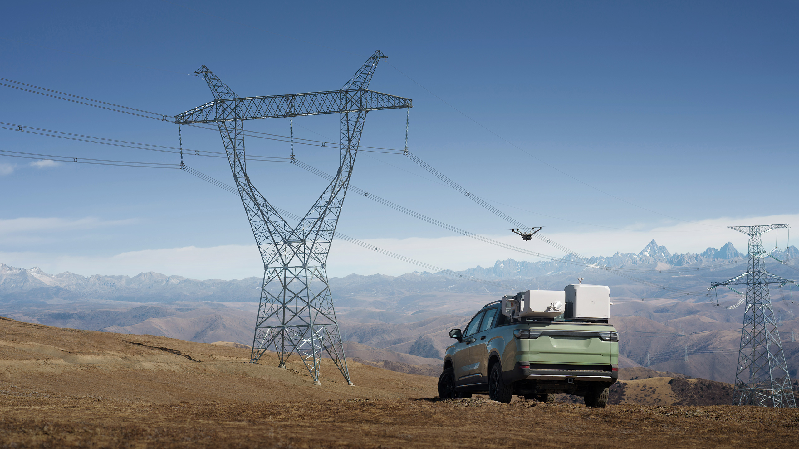
A vehicle-mounted system is a distinct design option for a team moving between sites or working along a large estate. DJI requires stationary aircraft operations with the vehicle parked below 3° slope. [6]
At the deployment location, check power, network and positioning, complete the calibration workflow and verify aircraft readiness. Close and check the dock before driving. [24]
The DJI Vehicle-Mounted Gimbal Mount and the structural vehicle platform are separate items. The manufacturer installation material describes a user-prepared mounting platform. Purchasing the named DJI accessory does not by itself supply a van-specific roof rack, structural approval or a complete installation. [7]
Dock 3 weighs approximately 55 kg without the aircraft, and its specified electrical input is 100–240 V AC with an 800 W maximum. Check the complete installed mass, roof-load suitability, retention, access and clearance, grounding, ventilation, electrical design and network coverage. A pickup demonstration does not certify a particular van roof. [5]
Lighting, communication and site awareness
Compatible AL1 lighting and AS1 audio can support observation and communication. FlightHub 2’s Virtual Cockpit documents AL1 constant and strobe controls. [8]
Accessory trade-off: DJI’s FAQ states that installing AL1 disables upward obstacle avoidance; switching the light on deactivates obstacle avoidance. Accessories also affect endurance. Commission the complete hardware/firmware combination and brief operators on these changes. [6]
Lighting and audio are not a guarantee of theft prevention or a replacement for the site’s security procedures.
Keep the missions distinct: daytime PV thermography seeks useful evidence from operating modules; a security patrol is a separate observation task. A spotlight does not reproduce the solar loading required for a meaningful daytime PV thermal survey.
How a vehicle-mounted system comes together
A simple planning overview for the customer and installer. Structural and electrical work should follow the current manuals and a vehicle-specific design.
- Assess the vehicle
Have a competent installer assess the specific vehicle, combined load, mounting location, clearances and suitability. DJI’s pickup demonstration does not approve a different van roof. [7]
- Design the support
Specify a secure vehicle-specific platform and retention arrangement. Treat that structural platform and the required DJI Vehicle-Mounted Gimbal Mount as separate items. [7]
- Fit and check
With power isolated, install the dock and correct DJI accessory following their manuals. Check retention, cable routing, cover movement, access and ventilation before energising. [35], [7]
- Provide the services
Have qualified personnel arrange appropriate power, networking, grounding and drainage. Verify the actual vehicle power and communications design rather than assuming a portable battery alone completes the installation. [7], [24]
- Park and calibrate
At the operating location, park appropriately, check positioning and connections, and complete FlightHub 2’s vehicle-deployment calibration and readiness checks. Observe the stationary-operation limits explained above. [24]
- Commission the whole system
Complete a supervised handover and representative test with the installed accessories, operating plan, media upload and recovery arrangements. Record responsibilities and the checks required before the vehicle next moves. [24]
Hardware supply and agreed system setup are separate from van conversion, structural roof work, electrical installation and connectivity services. Confirm the scope in the quotation.
What makes thermal evidence useful?
The IEC 62446-3 publisher scope covers outdoor thermographic inspection of operating PV modules and plants, including equipment, ambient conditions, procedure, reporting and personnel. Owning an appropriate aircraft is only one part of that process; this guide does not claim that a purchase automatically meets the specification. [11]
IEA PVPS guidance recommends stable, strong irradiance, including a 600 W/m² in-plane benchmark for aerial IR work. Record the actual conditions and agree the acceptance envelope. The aircraft’s wind-resistance rating should not be used as the inspection-quality limit. Cloud changes, cooling, viewing angle and reflections can alter the interpretation of an apparent hot area. [12], [13]
A 2025 DTU research presentation explicitly investigates irradiance and imaging-distance effects. Its lesson for procurement is to validate the acquisition conditions, not simply buy the largest displayed image. The exact protocol should reflect the inspection question and the standard or contract being used. [14]
The research behind these inspection checks
Bommes and colleagues document how resolution, reflections, vegetation and irregular rows affect an aerial IR-video workflow. Thermal-pattern labels in a dataset are not the same as independently verified electrical causes. Their older aircraft and camera do not establish performance for these 2026 configurations. [21]
Corley and colleagues examine large-scale aerial thermal data, including environmental and dataset-transfer challenges. Most collection used crewed fixed-wing aircraft. Its flight productivity or image sampling should therefore not be repackaged as a DJI multirotor promise. [22]
Winkel and colleagues experimentally investigate soiling-related hot spots and identify the representativeness of wind measurements as an important issue. This supports checking environmental context and physical evidence before deciding that a warm area proves failed hardware. [23]
Three things a coloured heatmap does not establish
- The physical cause of an anomaly.
- A verified energy-loss value or repair priority.
- The precise module location without a reliable mapping and identification workflow.
Preserve the original measurements and assess findings alongside visible evidence, site records and appropriate technical follow-up.
A repeatable capture-to-maintenance workflow
The following is an editorial planning checklist, not a reproduced standard or a certification procedure. It turns the equipment choice into a brief a customer and inspection provider can agree.
- Define the decision. State whether the visit supports screening, a baseline, a targeted investigation or a revisit. Agree the report audience and the level of asset identification required.
- Map the site. Gather module/block identifiers, layouts, access arrangements and relevant operating records. Establish legal pilot positions or the approved remote-operation concept.
- Set capture acceptance criteria. Choose appropriate thermal sampling, distance, geometry and coverage. Record irradiance, wind and other relevant conditions; check samples before committing to the full survey.
- Preserve provenance. Retain original RGB and radiometric files, timestamps, aircraft/payload identifiers, recording settings and processing versions. Keep enhanced display images distinguishable from original measurements.
- Review and localise. Link observations to a module, string or block using the agreed method. Flag uncertainty and arrange qualified follow-up where the image evidence cannot establish the cause.
- Close and revisit. Record the action owner, subsequent checks and outcome. Compare later surveys using the documented conditions and method rather than treating every colour change as asset deterioration.
Computer-vision research explores automated anomaly detection and segmentation, but a particular paper’s dataset or algorithm is not an included capability of every DJI package. Validate the processing pipeline on relevant data before relying on an automated output. [16]
FlightHub 2, Terra and thermal review have different jobs
| Layer | What to establish |
|---|---|
| FlightHub 2 | Dock/device management, missions and remote collaboration. Confirm the current plan, device entitlements, storage and other quotas. |
| DJI Terra | The applicable reconstruction and thermal-data workflow, supported aircraft/data, version and licence edition. |
| Thermal review and O&M | Radiometric interpretation, asset localisation, follow-up and maintenance decisions. Do not assume fault classification or a signed engineering report is included. |
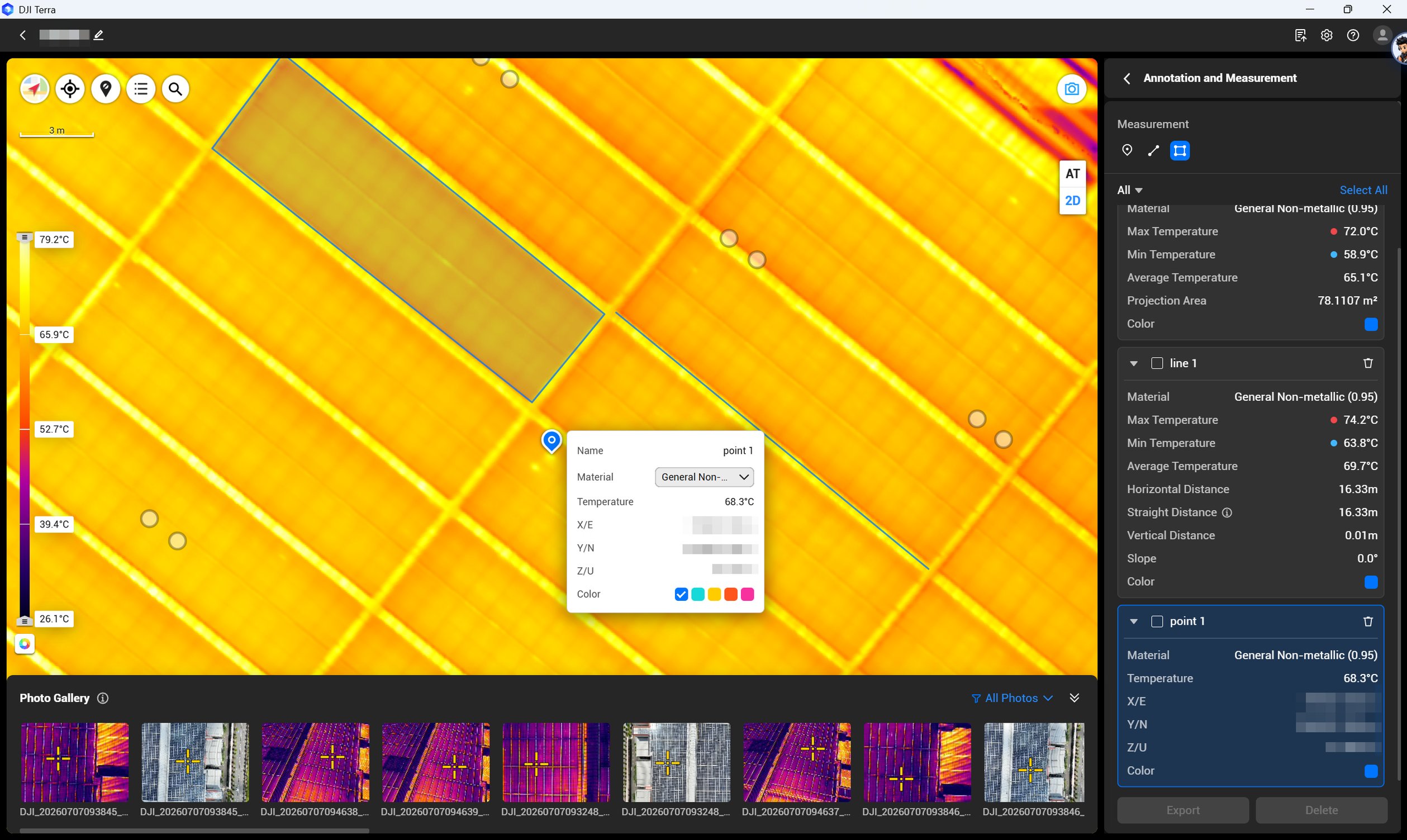
DJI’s 2026 Terra update adds thermal-map and temperature-analysis capabilities. It does not make Terra interchangeable with FlightHub 2, nor establish that every edition, source dataset or inspection output is supported. Confirm entitlement against the exact deliverable and current DJI documentation. [10], [9]
The existing solar-package terms distinguish the separate 12-month Terra Flagship licence and any manufacturer-supplied three-month entitlement. They should not be advertised as one combined 15-month licence. Package contents and agreed service scope determine what is supplied.
DJI Thermal Analysis Tool 3Review an individual thermal photograph
Review and document individual supported radiometric thermal photographs.
- Protect the originals. Make a backup, then add the local folder of supported R-JPEG thermal photographs. A normal coloured JPEG or video screenshot is not an interchangeable radiometric source. [31]
- Open one image. Double-click the selected photograph. Check its device/file information and the measurement parameters available for that camera, including distance, humidity, emissivity and reflected temperature. [31]
- Measure the concern. Place spot readings, a measurement line, or rectangular/circular areas over the relevant features. Compare temperatures with the capture context rather than assigning a failure cause from colour alone. [31]
- Document the observation. Add clear annotations and remarks, then check the measurements, palette and scale. [31]
- Export and retain. Export the selected image’s measurement report as PDF or DOC, or a JPG carrying measurements and the colour scale. Use Save cautiously: it overwrites the source R-JPEG and its saved analysis is specific to this tool. [31]
Use this for image-level review and reporting. It is different from reconstructing a whole-site thermal map or providing a signed electrical diagnosis.
DJI TerraBuild and measure a thermal map
Reconstruct a 2D temperature-bearing map from supported paired imagery, then measure and export map-level evidence.
- Create and load. In Terra, open Reconstruction Project, create a Thermal Infrared project and choose its name and storage location. Import the folder containing both visible photos and temperature-bearing R-JPEG thermal photos. [26]
- Check the dataset. Check that at least ten visible and ten thermal images are present, with matching counts. Inspect the capture points for gaps. Use supported High Gain or Low Gain imagery, not Super Clear capture. [26], [30]
- Set meaningful parameters. Review the coordinate system, material/emissivity and recorded environmental settings. Use custom values only when justified by the capture conditions; a palette change is not a measurement correction. [26], [27]
- Reconstruct and verify. Start reconstruction, then inspect the visible and thermal layers. Use point, line or polygon measurements and compare the associated original photos before interpreting an apparent anomaly. [27], [28]
- Export the agreed evidence. From map measurement, export the PDF measurement report and XLSX measurement data. Retain originals and processing settings with the inspection record; the export is evidence for review, not an automatic electrical diagnosis. [28]
This feature creates a 2D thermal reconstruction, not a thermal 3D model. Confirm supported aircraft, capture modes, current version and licence. In Photo Measurement Mode, annotations on that individual photo cannot be exported as its own report; use map measurement for the map report. [27], [30], [29]
DJI FlightHub 2Run and review repeat dock missions
Manage acquisition, remotely observe operations and return media for subsequent analysis.
- Open the commissioned system. Log in to the correct FlightHub 2 organisation/project and use the bound, commissioned Dock 3 / Matrice 4TD system with the appropriate operating permissions. [8], [24]
- Create a controlled plan. In Single-Dock Plans, select a validated route and the intended dock. Choose an immediate, timed or recurring plan and review return and link-loss settings before dispatch. [33]
- Monitor the operation. Open the device status or Virtual Cockpit to follow live video and device/flight status. If fitted, use AL1’s light controls and AS1’s file or live broadcast controls only within the commissioned accessory limits. [33], [8]
- Confirm the upload. After the task, inspect its completion and media-upload status. A completed flight does not necessarily mean every original file has finished uploading. [33]
- Hand off the evidence. Use the project Media File Library to review and download the relevant media for Terra or individual-image analysis. Preserve the full radiometric originals needed by the next application. [34]
Cloud mission management, media transfer and thermal analysis are separate jobs. Confirm plan quotas, supported accessories and the current operating permissions; see the lighting limitations in the vehicle section.
These are documentation-based workflows. Screens and entitlements depend on the installed version and purchased plan; they are not a claim of a test performed on your site.
Connect the workflow to the right package
The approved configuration plan links these existing product pages. Final availability, software terms and delivery scope should be confirmed in the quotation; this article does not state a package price.
| Workflow | Package route | What the power option changes |
|---|---|---|
| Portable thermal inspection | PV-02 · Matrice 4T Professional PV-05 · With DJI Power 2000 | A field-power option for compatible charging equipment; it does not change the thermal sensor. |
| M400/H30T solar campaigns | PV-03 · Solar Farm PV-06 · With DJI Power 2000 | Different field-charging logistics, with the same core aircraft/payload route. |
| Visible-light site planning | PV-04 · Matrice 4E Site & Rooftop Planning | A separate planning use case; the 4E is not the thermal substitute for a 4T. |
| Fixed or vehicle-deployed remote capture | Discuss a Dock 3 configuration with Matrice 4TD | Specify site/vehicle engineering and service entitlements separately. A vehicle-mounted solar package is under development. |
Both M4T and M400/H30T solar configurations specify five flight batteries in total. Training, support and dataset-review allowances vary by package. A dataset review is not automatically an on-site visit, an electrical diagnosis or signed certification.
Start with your site and required evidence
Send the layout, site locations, inspection frequency, intended report and available power/network arrangements. Include the capacity basis—DC or AC—and whether a visiting team, fixed dock or vehicle is envisaged.
Discuss your solar inspection configuration →Irish operations and data responsibilities
A dock or live video link does not grant permission for beyond-visual-line-of-sight flight. EASA places operations outside Open-category limits within the applicable higher-risk framework. Specific-category routes include operational authorisation, eligible standard-scenario declarations and LUC privileges; the correct route depends on the actual operation. [17]
For an Irish deployment, establish the operating concept and applicable geographical-zone requirements before committing to the installation. The IAA’s current UAM012 guidance provides an application reference. A supplier’s equipment handover is not an operational authorisation. [18]
Site-monitoring cameras can capture workers, visitors, neighbouring land or passers-by. Identify the purpose and lawful basis, minimise unnecessary capture and set access, retention and response arrangements. Consult the Irish Data Protection Commission’s drone guidance when designing surveillance-related tasks. [19]
See the systems and workflows in action

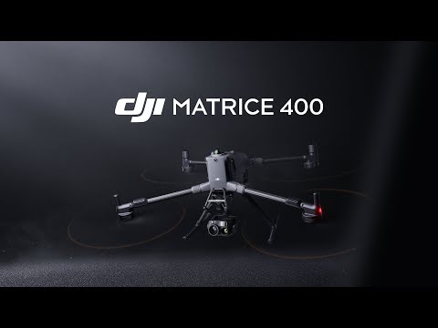
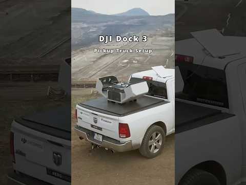
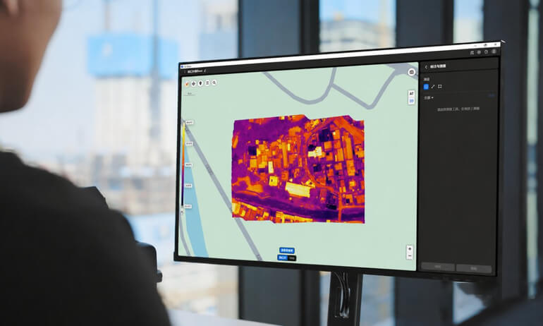
Watch the manufacturer demonstrations here or open the official platform. The pickup example explains the deployment concept; suitability for a specific van remains an installation assessment.
DJI also documents an inspection at a 181 MWDC solar farm using an earlier-generation DJI Dock and Matrice 30T Dock Version. It is useful background on remote-capture workflows, not a Dock 3 benchmark, an Irish Drone project, or proof that a particular plant size requires a dock. [20]
Official manuals and setup guidance
Keep the instructions for your exact hardware and software to hand. The DJI download pages also carry release notes and updated files.


Frequently asked questions
Is the M4T enough for a 1.8 MW solar site?
It can be a sensible candidate, but capacity alone cannot settle the choice. Check the layout, access, required thermal detail, inspection frequency and a representative capture. Treat 1.8 MW as an example, not an aircraft limit.
Does enhanced 1280 × 1024 make the M4T equivalent to the H30T?
No. The M4T starts with 640 × 512 native thermal sampling; the H30T has a native 1280 × 1024 thermal sensor. Compare source data and the required measurement mode, not only displayed resolution. See the imaging sections above.
Can Dock 3 use my Matrice 4T?
No. Dock 3 requires compatible Matrice 4D Series hardware. The thermal route discussed here uses the Matrice 4TD.
Can the van drive while the drone operates from its dock?
The vehicle-mounted Dock 3 workflow discussed here requires stationary operation. Park appropriately, calibrate at the location and keep the vehicle and dock stationary throughout aircraft operation.
Can a night security patrol replace a daytime PV inspection?
No. These tasks answer different questions. A security patrol can support observation and communication; useful daytime PV thermography depends on the modules’ operating and environmental conditions.
Are an automated fault report and all software included?
Only items and services explicitly listed in the selected package are included. Flight management, reconstruction, radiometric review and engineering diagnosis are different parts of the workflow.
Explore the equipment and packages on Irish Drone
Compare the complete configurations and software options behind the workflows in this guide.
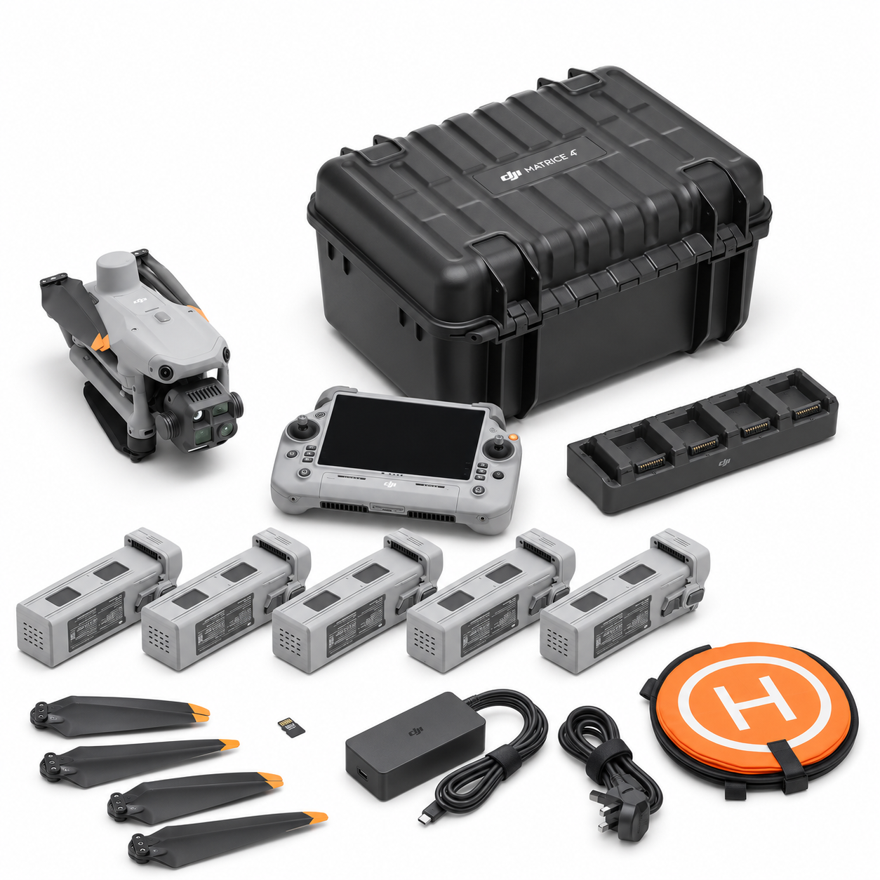
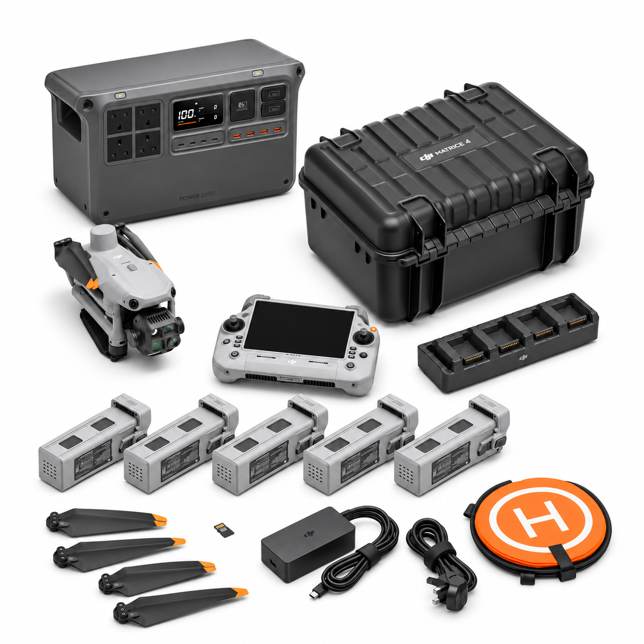
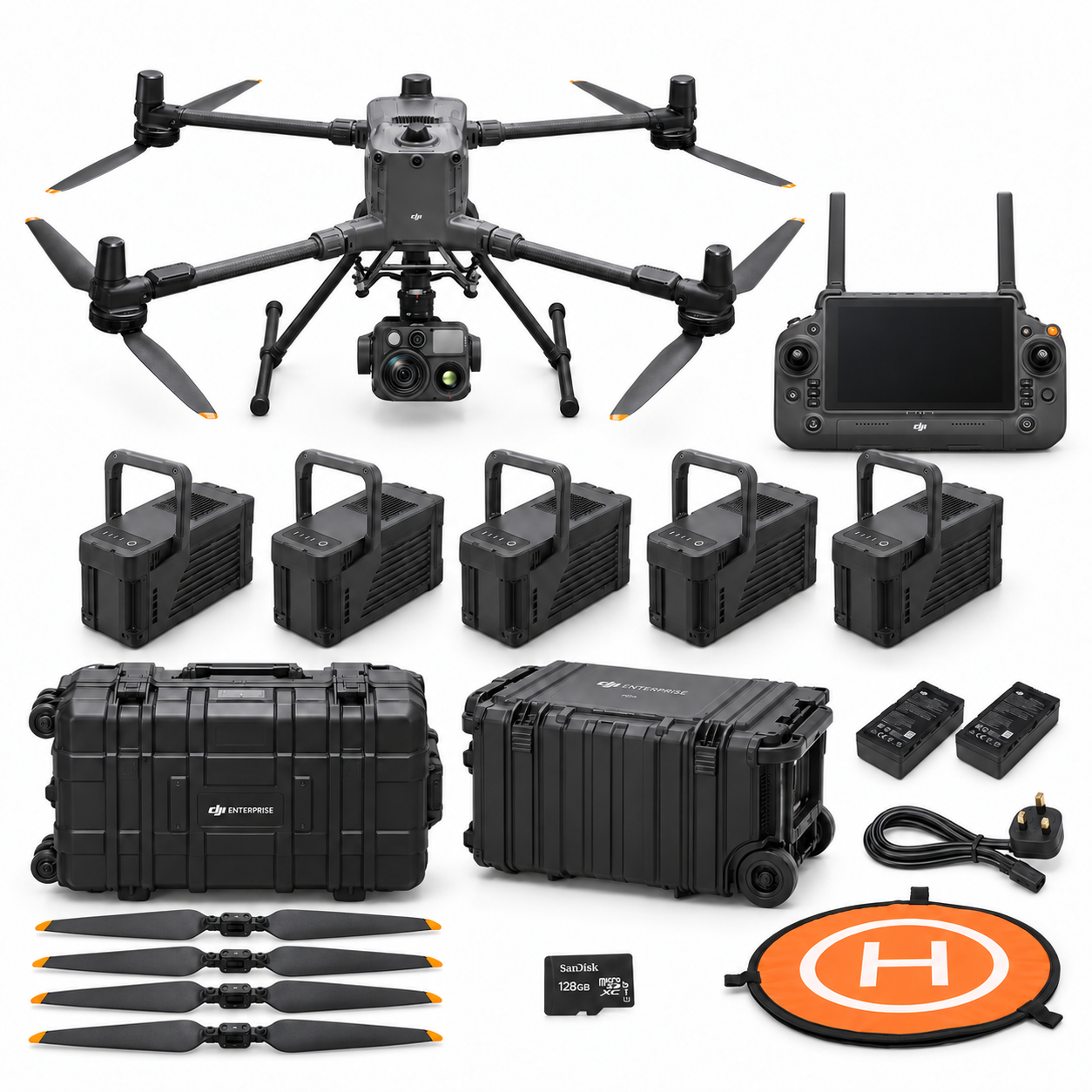


Package images illustrate each configuration; check the included-items list for supply details. Devices shown in software illustrations are not included with the licence.
Continue with the guide for your work
Official operating guidance
Technical notes and research references
The guide draws on the technical publications below. Manufacturer instructions and regulator guidance are linked in the relevant resource sections.
- DJI Matrice 4 Series specifications
Manufacturer specifications; native versus enhanced thermal output. Reviewed 3 November 2026.
- DJI Zenmuse H30 Series FAQ
Manufacturer FAQ; native sensor and High-Res gain limitations. Reviewed 3 November 2026.
- Zenmuse H30 Series User Manual v1.0
Manufacturer manual; operating modes and radiometric capture. Reviewed 3 November 2026.
- DJI Matrice 400 FAQ
Manufacturer compatibility information; current firmware must be checked. Reviewed 3 November 2026.
- DJI Dock 3 specifications
Manufacturer specifications; Matrice 4TD sensor and dock power/weight. Reviewed 3 November 2026.
- DJI Dock 3 FAQ
Manufacturer compatibility, vehicle and accessory restrictions. Reviewed 3 November 2026.
- DJI Dock 3 Installation and Setup Manual — cover v1.0, 2025.03
DJI installation manual, cover v1.0, dated March 2025; includes the vehicle-mounted deployment requirements. Reviewed 3 November 2026.
- DJI FlightHub 2 manual: Virtual Cockpit
Official operational interface documentation; hardware-specific support still applies. Reviewed 3 November 2026.
- DJI FlightHub 2 FAQ
Manufacturer service plans and operation roles; licence quantities need quotation. Reviewed 3 November 2026.
- DJI Terra thermal mapping update, July 2026
Manufacturer workflow update; not independent proof of diagnostic performance. Reviewed 3 November 2026.
- IEC TS 62446-3:2017 — Outdoor infrared thermography
Publisher public scope only; paid full standard not read or reproduced. Reviewed 3 November 2026.
- IEA PVPS T13-24:2021 — Qualification of PV Power Plants using Mobile Test Equipment
Institutional engineering guidance, especially section 2.4; not a 2026 drone comparison. Reviewed 3 November 2026.
- IEA PVPS T13-10:2018 — Review on Infrared and Electroluminescence Imaging for PV Field Applications
Institutional methods review; dated equipment/throughput examples are not reused as current benchmarks. Reviewed 3 November 2026.
- Spataru, DTU (2025) — Frame Conditions for Thermography Inspections of Photovoltaic Plants
Research presentation; its experimental conditions do not establish universal aircraft thresholds. Reviewed 3 November 2026.
- Data Quality Analyses for Automatic Aerial Thermography Inspection of PV Power Plants (2025)
IEEE Journal of Photovoltaics 15(5), 722–731; DOI 10.1109/JPHOTOV.2025.3587297. Publisher abstract reviewed; full article not claimed read. Reviewed 3 November 2026.
- Ramirez et al. (2024) — Infrared Computer Vision for Utility-Scale Photovoltaic Array Inspection
Author-deposited abstract; arXiv:2407.00544 reports IISA2024 acceptance. No independent accuracy claim imported. Reviewed 3 November 2026.
- EASA — Specific Category, Civil Drones
Current official category and authorisation pathways. Reviewed 3 November 2026.
- IAA UAM012 v6 — Guidance on Applications for Operational Authorisation
Irish authority publication dated 15 May 2026; public guidance entry reviewed. Reviewed 3 November 2026.
- Irish Data Protection Commission — Guidance on the use of drones
Official guidance; surveillance may capture personal data. Reviewed 3 November 2026.
- DJI — Lessons from a 181 MWDC solar inspection with DJI Dock
Manufacturer case from the original Dock/Matrice 30T generation, not a Dock 3 or Irish Drone case. Reviewed 3 November 2026.
- Bommes et al. (2021) — Computer Vision Tool for Detection, Mapping and Fault Classification of PV Modules in Aerial IR Videos
Accessible author manuscript; DOI 10.1002/pip.3448. Older M210/XT2 workflow, not a trial of the current DJI routes. Reviewed 3 November 2026.
- Corley et al. (2025) — Aerial Infrared Health Monitoring of Solar Photovoltaic Farms at Scale
Accessible author preprint; final CVPR Workshop publication has DOI 10.1109/CVPRW67362.2025.00431. Collection was mainly crewed fixed-wing, not a DJI comparison. Reviewed 3 November 2026.
- Winkel et al. (2024) — Electrothermal Modeling of Photovoltaic Modules for the Detection of Hot-Spots Caused by Soiling
DLR institutional full-text deposit; DOI 10.3390/en17194878. Module-level experiment, not an aircraft/camera accuracy specification. Reviewed 3 November 2026.
- DJI Matrice 4D Series Flight Manual — cover v1.2, 2025.07
Official indexed vehicle-operation section, printed p. 61; full PDF not independently rendered. Reviewed 3 November 2026.
- DJI Terra Downloads
Official software downloads, release notes and supported tools. Reviewed 3 November 2026.
- DJI Terra User Manual — Data Import
DJI online manual: importing paired RGB and thermal images. Reviewed 3 November 2026.
- DJI Terra User Manual — Parameter Configuration and Reconstruction
DJI online manual: thermal reconstruction settings and supported modes. Reviewed 3 November 2026.
- DJI Terra User Manual — Temperature Measurement and Output
DJI online manual: map measurements and exported results. Reviewed 3 November 2026.
- DJI Terra User Manual — Photo Measurement Mode
DJI online manual: individual-photo measurement and its export limitations. Reviewed 3 November 2026.
- DJI Terra FAQ — Thermal Infrared Project
DJI FAQ: thermal infrared projects and supported data. Reviewed 3 November 2026.
- DJI Thermal Analysis Tool 3 User Guide
Official user guide: image-level thermal review, annotations and reporting. Reviewed 3 November 2026.
- DJI Thermal Analysis Tool 3 Release Notes
Official release notes; app version and guide version are separate. Reviewed 3 November 2026.
- DJI FlightHub 2 User Manual — Single-Dock Plans
DJI online manual: single-dock task planning. Reviewed 3 November 2026.
- DJI FlightHub 2 User Manual — Media File Library
DJI online manual: media upload, review and download. Reviewed 3 November 2026.
- DJI Dock 3 Vehicle-Mounted Gimbal Mount Product Information
Manufacturer product information for the vehicle-mounted gimbal mount; a vehicle-specific structural platform is a separate requirement. Reviewed 3 November 2026.
Research notes and limits
This guide was prepared from manufacturer specifications and manuals, engineering guidance, research publications and Irish/EU authority sources reviewed on 3 November 2026. Manufacturer documents establish supported features; they do not constitute independent comparative field trials. Research using other aircraft or cameras informs the method without proving a performance ranking between the three routes here.
The site-size examples and recommendations are editorial reasoning. No head-to-head Irish field trial, guaranteed detection rate, energy-recovery percentage, inspection-time saving or theft-prevention result is claimed. Research access limitations are recorded in the source notes below; a source title does not imply its entire full text was available.




Pingback: Fixed vs Vehicle-Mounted Dock 3 for Solar Inspection
Pingback: M400 + H30T vs Dock 3 for Solar Farms | Irish Drone
Pingback: Rooftop Solar Inspection with Matrice 4T | Ireland