

SURVEYING & MAPPING · OFFICE HANDOVER
A purchase is only useful when checked observations reach the people making the decision.
Evidence reviewed 3 November 2026 · Ireland
The practical answer
Agree the handover before the first flight: intended outputs, reference system, independent checks, software versions, omissions and who accepts the result. Test a small dataset in the recipient’s actual environment. The supplied Terra Standard entitlement covers M4E / M4D data; it does not automatically produce every drawing, feature classification or professional sign-off a project might require.
Start with the person who will use the files
A site manager may need a readable overview while a designer needs a surface that behaves correctly inside a wider project. Ask each recipient what they will actually do with the delivery. Name the software environment, the reference information they already hold and the decision that depends on the new dataset.
Do not let a file extension stand in for that conversation. A file can open successfully while representing the wrong surface, reference or survey date. Make acceptance a practical task: locate a known feature, inspect the agreed checks and use a small representative section in the normal office workflow before finalising the delivery specification.

Distinguish the image, model and interpreted drawing
A photographic overview, a reconstructed surface and a feature drawing are different products. Decide which of them the project needs and who will create each one. If a drawing requires selected breaklines, asset labels or other interpretation, name that work rather than assuming it follows automatically from reconstruction.
RICS separates survey deliverables within a broader measured-survey specification. [1] For your own brief, write one sentence describing each output’s intended use and the information it must contain. Mark optional products separately. This keeps the pilot manageable and helps prevent an apparently complete delivery from omitting the one item the receiving team actually required.
Read the licence as one part of the workflow
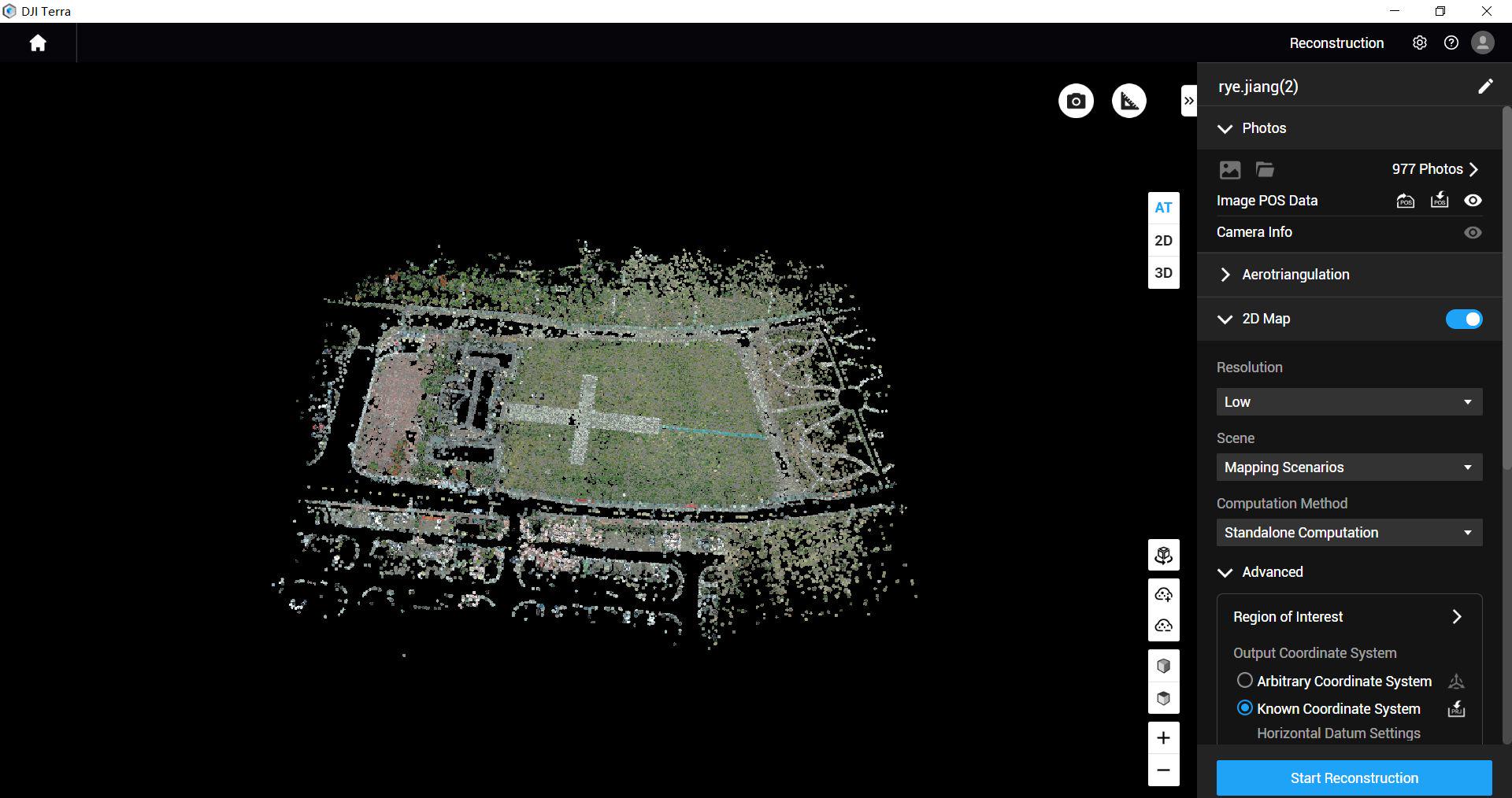
The approved M4E surveying packages include a twelve-month manufacturer-supplied Terra Standard licence for M4E / M4D datasets. Keep that scope visible when planning mixed fleets or importing historical work. It is not a general entitlement for every aircraft or an assurance that every desired downstream product is included.
Ask the processing lead to demonstrate the intended task with the actual version and a representative sample. Identify any separate software, specialist editing or additional services before promising a delivery date. A successful installation is not an end-to-end test. The useful question is whether the checked data can travel through the complete chain without losing required meaning or reference information.
Keep the reference attached to every transfer
Make the project’s grid, height basis and units explicit in the handover note. Record any transformation applied and identify its authority. Where an older drawing is supplied, resolve differences with the survey lead before combining the data. Do not conceal a mismatch by dragging one layer until it looks aligned on screen.
SCSI recommends specifying compatible delivery and exchange formats. [2] Test that compatibility using a small file containing representative features and the agreed reference information. Keep a record of the import settings and what the recipient checked. That record makes later support easier than relying on a message saying the files seemed fine.
Deliver the evidence behind the result
Ask the surveyor to define the checks that will accompany the chosen outputs. The review should explain whether the delivered information meets the agreed use, not merely display a successful processing status. Separate measurements used during adjustment from observations used to assess the finished work.
Include a plain account of omissions, questionable areas and any supplementary measurements. If a section is withheld, tell the recipient why and what would resolve it. The goal is a useful decision record. A technically elaborate report with no clear acceptance conclusion can leave the receiving engineer guessing about whether an attractive model is appropriate for the task.
Pilot the handover with a realistic office question
Consider a hypothetical engineering team preparing options for a new access route. Its trial brief might ask for a checked surface around the route corridor, a readable site overview and an explicit record of inaccessible edges. The office then tests those outputs against its existing project data and identifies which further measurements are required.
This does not establish a universal deliverable list. Its purpose is to expose dependencies early: a different vertical reference, a missing feature, an import problem or a need for interpretation. A pilot that finds such a dependency has provided useful buying evidence. Resolve it before extending the workflow across larger or more consequential projects.
Preserve a version that can be reviewed later
Retain the original capture, the accepted output and the decisions that connect them. Give versions unambiguous names and distinguish a draft issued for review from a final accepted delivery. Record who changed a boundary, excluded an area or requested a different interpretation, together with the reason.
Plan storage and access around the organisation’s actual needs. A public share link is not automatically the right place for site information. Agree who can see the files, how long records remain available and what happens when a staff member or supplier changes. These are practical handover responsibilities, not extra capabilities created by an aircraft purchase.
Match training and review to the weak point
If the team can fly confidently but cannot validate or deliver the result, more flight practice alone will not close the gap. Use the package’s training discussion to identify the stage needing attention: capture planning, reference management, processing review or handover. Agree what the session will demonstrate and what the customer must supply.
SV-02 / SV-05 add a first-project mapping dataset review and expanded service provision compared with the essential route. This review is not a signed survey certificate. Prepare a small, organised dataset and a clear question so the review can examine a real workflow problem rather than reconstructing an undocumented project history.
Questions to settle before routine production
Should we request every available output?
No. Request the products that support a known use and test whether they do so.
Does a Terra licence include all CAD interpretation?
Do not assume that. Confirm each processing and interpretation step with the responsible provider.
How do we choose a package?
Review SV-01 or SV-02 around your capture needs, then send Irish Drone a sample handover requirement. Include the recipient and intended use, not only a list of file extensions.
Explore the equipment packages on Irish Drone


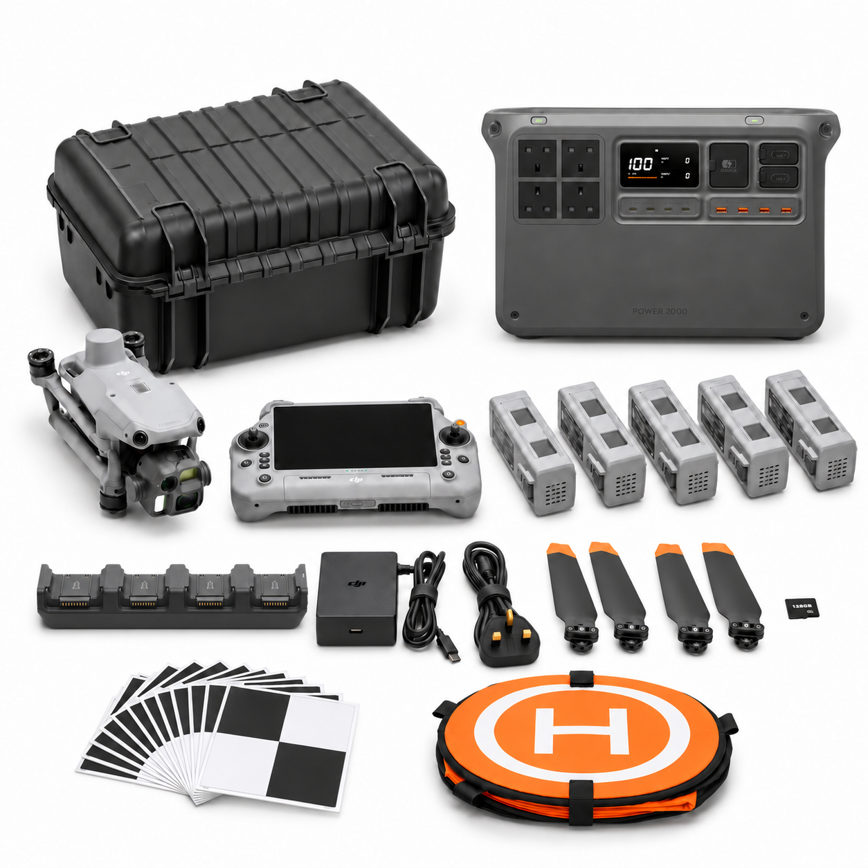

Package illustrations show the listed configurations. Battery quantities are whole-package totals.
Official manuals and setup guidance

Continue with the guide for your work
Documentation and evidence
Sources for the cited guidance
- RICS measured surveysRead source ↗
Reviewed 3 November 2026.
- SCSI measured surveys of landRead source ↗
Reviewed 3 November 2026.





Pingback: M400 L3 Terrain Survey: Pilot and Acceptance Guide
Pingback: Drone Survey Packages Ireland: M4E or M400 L3?
Pingback: SV-01 vs SV-02: M4E RTK and Survey Control