

An IAA operating basis is essential, but it does not settle every question about the land, material, people or data involved in a job.
Make a site permission register before designing the route
A farm, forest or construction site can look empty from an aerial map while having important access, environmental and privacy constraints. Begin with a register covering the flight basis, land access, loading and receiving areas, public routes, material use, environmental conditions, data collection and the customer’s workplace arrangements. Name the person responsible for each item and keep the supporting evidence. A tick beside “landowner agrees” cannot answer the other questions.
Check the current IAA geographical-zone information as part of this process, but do not assume an absence of a displayed restriction is a complete site approval. Aviation information and other permissions serve different purposes. Walk the operational footprint with the customer and identify who actually controls each area. An organisation may own the loading yard while a separate occupier controls the receiving point. A public route, utility easement or neighbouring work crew can change the feasibility of a proposed controlled ground area.
Treat onboard cameras as part of the data workflow
A cargo or spraying aircraft may carry cameras for navigation and operational awareness rather than for a survey deliverable. That does not mean privacy is irrelevant. Images, recordings or telemetry can still include identifiable people or other personal information. The Data Protection Commission drone guidance provides the Irish starting point. Establish what the system collects, whether it records, where it is stored, who can access it and why it is needed.
Map the data path from aircraft and controller to any software or cloud service. Clarify the roles of the operator, customer and service provider instead of assuming the purchaser of the aircraft is automatically the only responsible party. A useful design decision may be to minimise recording, frame operational views away from unrelated property and retain only the information needed for the stated purpose. These are suggested privacy controls; they must be evaluated against the actual task and technology, not presented as a universal exemption from data-protection law.

Choose a lawful basis and assess the privacy risk
Where personal data is processed, identify the applicable lawful basis and the information that must be provided to affected people. Do not use consent as a default answer for every passer-by, or assume a customer’s agreement covers everyone nearby. Consider access controls, retention, disclosure, security and how requests or complaints will be handled. Keep the privacy explanation proportionate and understandable rather than burying it in the flight manual.
Assess whether a data protection impact assessment is required for the particular processing. The EASA DPIA guidance helps explain the assessment, while the DPC is the relevant Irish authority. This is not a claim that every agricultural or cargo flight automatically needs the same DPIA. A temporary materials lift with minimal recording and a persistent monitoring service have different data profiles. Document the actual processing and risks, obtain appropriate advice where needed, and change the recording setup if the proposed collection is unnecessary for the operation.
Put water, materials and ground activity into the assessment
For agricultural work, identify the real material and its legal purpose. Pesticides require their own Irish checks; a SORA does not establish permission to use them. Seed, fertiliser and other materials can also raise site-specific agronomic or environmental questions. Do not call a substance environmentally harmless because it is natural or because the aircraft dispenses a small quantity. The IAA agricultural guidance explains why the task rules and aviation concept need to be considered together.
For cargo work, consider fuel storage, charging, accidental release and access over wet or fragile ground. The aircraft may reduce some vehicle movements while still requiring a support vehicle and a prepared loading area. Compare the complete operation with the alternative method rather than claiming that all drone deliveries automatically reduce environmental impact. An illustrative site review might move the charging station away from a drainage channel, change a receiving point to avoid a sensitive habitat and adjust the route after consultation. Each change should then be reflected in the operating documents.

Coordinate with the customer without outsourcing responsibility
The customer can supply local knowledge about access, workers, livestock, public use and planned activities. The UAS operator still needs to assess whether that information is sufficient and current for the flight. Agree who controls gates, who briefs workers, who communicates with neighbouring teams and who calls a stop if conditions change. The HSA risk-assessment guidance supports the employer’s wider workplace duties, which remain alongside aviation obligations.
Use a site-acceptance checklist as a decision tool, not a document signed after everything has already been booked. If a route cannot be controlled as proposed, change it or decline that part of the task. A customer instruction to “just do the lift quickly” does not resolve an unassessed exposure. Give the crew a clear way to report an unexpected visitor, ecological concern or privacy complaint and a named person to decide the next step. The contract should allow time for those controls to work.
Illustrative example and a useful next step
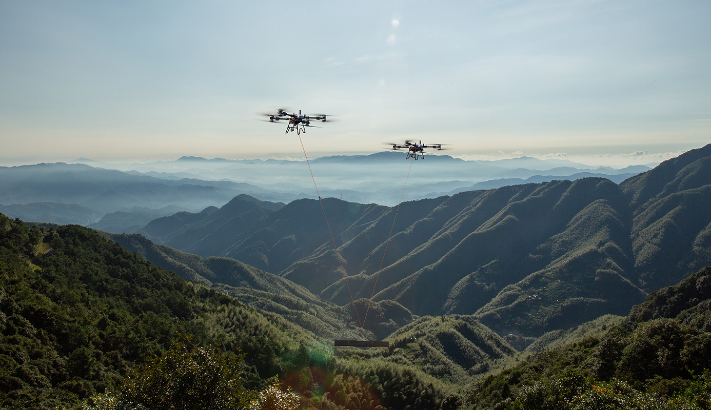
Consider a proposed delivery of fencing materials to a remote field beside a sensitive wetland. This is a planning example, not an approved project. The initial flight route is only one component. The team also checks the access track, loading surface, public use, wildlife sensitivity, camera recording and the receiving crew’s position. If a protected-site issue is identified, the relevant authority determines the necessary assessment or consent; the operator should not decide that absence of visible wildlife settles it.
Bring the findings into one register with resolved items, conditions and open actions. Use the current IAA cross-border guidance where a foreign operator is involved; it specifically recognises local conditions and potential environmental screening. Irish Drone can help match a suitable Agras or FlyCart configuration to the operating concept and organise SORA preparation. Provide a site map, material description and the permissions already held. That creates a useful starting point for a project that addresses the entire site rather than only the aircraft.
Frequently asked questions
Does landowner permission replace the IAA process?
No. Site access, aviation authorisation and other applicable permissions are distinct.
Does every drone flight require the same privacy assessment?
No. Assess the actual personal-data processing and whether a DPIA is required; do not assume that operational cameras create no privacy duties.
Is every protected site subject to one standard drone permit?
No. Check the actual designation, activity, effects and site-management conditions with the relevant authority.
Explore the aircraft and packages
Follow the product page for the exact configuration and included equipment. Equipment selection and operating authorisation are separate parts of the project.


Talk to Irish Drone about your project
Send us the site, task, load or application material, intended operating pattern and available charging supply. We can help scope a suitable aircraft and package and discuss the preparation needed for an Irish operation.
Contact usPlan the next part of your operation
Official sources and technical guidance
These links support specific facts in the guide. Check the current revision and operating conditions when preparing a real project.
- IAA: UAS geographical zones
- Data Protection Commission: Guidance on drones
- EASA: Data protection impact assessment
- NPWS: Activities requiring consent
- National Parks of Ireland: Wild Nephin visitor information
- IAA UAM 016: Agricultural applications, May 2024
- HSA: Safety statement and risk assessment
- IAA UAM 009, Issue 2: Cross-border operations






Leave a comment