

A difficult road does not by itself make an aerial route workable. The useful question is whether the entire transport chain can be controlled.
Define the access problem precisely
A cargo drone may be worth assessing where materials must cross steep ground, a long walking route or an obstacle between controlled working areas. Begin by documenting the access problem: which item is delayed, where it starts, where it is actually needed and what alternative transport is available. A photograph of a difficult hillside is not yet a transport requirement.
Separate occasional delivery from a recurring supply chain. A one-off replacement component may justify a different mobilisation from repeated small consignments. Record the required delivery condition as well as the item: dry, upright, protected from impact or presented in a container that the receiving team can safely move afterwards.
Use the heavy-lifting range to identify candidate load classes. Keep the feasibility exercise independent of a purchase decision so that an unsuitable aerial route can be rejected without inventing productivity claims to defend the equipment.
Make the load ready for a real lift
Weigh the complete assembly that will leave the ground, including packaging, straps, hooks or other fittings as applicable to the manufacturer’s payload accounting. Measure its length and width. Identify anything that can slide, open, snag or change the centre of mass after take-off. A securely closed box can still be unsuitable if its attachment points were designed only for carrying by hand.
For FlyCart 100, the official payload guidance makes clear that the quoted dual-battery payload figure includes specified lifting hardware. That is a warning against treating the headline as an allowance for loose goods alone. The application’s recommended loading value may be lower in the actual conditions.
Ask the person responsible for the load to demonstrate its proposed packaging and attachment method on the ground. Damaged or improvised load-bearing fittings should stop the exercise before route planning gives the project false momentum.

Survey a corridor, not a line on a map
Map the launch area, the receiving area, the terrain between them and the places available for a controlled return or diversion. A straight map distance conceals ridges, trees, cables and the extra height needed to keep a suspended assembly clear. The load’s path and its possible movement require consideration alongside the aircraft’s path.
Walk accessible parts of the route and obtain current site information from people who maintain the land. Mark temporary fences, forestry work, parked plant and places used by walkers or neighbouring workers. Record which observations are confirmed and which remain uncertain. The purpose is a decision-quality site record, not a polished map with unverified gaps.
The FlyCart 200 manual’s safety-system section specifically warns about detection limitations around small obstacles and sloping wires. Sensors therefore do not remove the need to identify such features during the feasibility survey.
Assess exposure and communications at both ends
A sheltered loading area can give a misleading impression of a ridge or exposed receiving point. Obtain suitable weather information and assess local wind, gusts, visibility and precipitation for the proposed operating volume. Establish the operator’s limits and stop conditions before the demonstration, with a method for detecting a change while a consignment is airborne.
Confirm that the pilot and receiving team can communicate from their actual positions. Terrain may obstruct both radio paths and human observation. A good picture at take-off does not prove that the intended route has a dependable control link or an acceptable contingency if it is lost.
Do not turn a manufacturer communication-distance specification into a permitted operating radius. The EASA category guidance treats BVLOS as a Specific-category example. Observers, relay equipment or two controllers must form part of a properly assessed procedure, not a shortcut around the applicable authorisation.

Design the receiving point before the outbound flight
The destination needs more than a person waiting for a hook. Confirm ground condition, load stability, access for moving the item away and how people will remain outside the aircraft and load hazard area. The receiving team must have a clear method to report that the point is unavailable without improvising under an approaching aircraft.
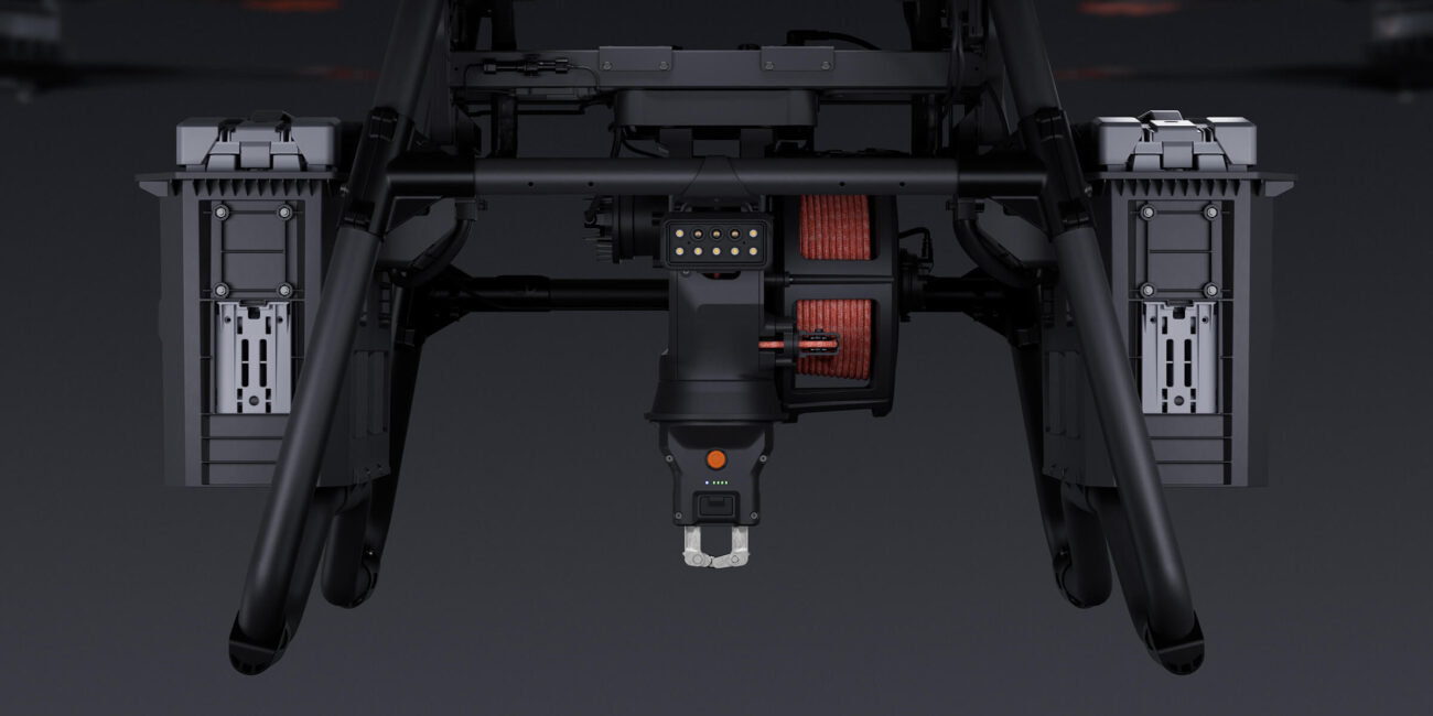
Choose landing, powered lowering or a fixed-cable workflow deliberately. A winch can address some landing limitations but creates cable, snagging and swing considerations. A fixed cable has a different aircraft-height and clearance requirement. Work through the whole sequence, including the unloaded departure, rather than comparing cable lengths in isolation.
DJI instructs FC100 users to wait until the aircraft has left before collecting air-unloaded goods in its operating precautions. Build the clearance and approach signals around the exact system manual and the site’s agreed procedure.
Check whether power can support the route
Document where charging equipment will stand, how it will be powered and how batteries will be protected, inspected and cooled. Moving an aircraft to an accessible lay-by does not solve the problem if the required electrical supply or safe generator location is absent.
The FlyCart 100 Six-Battery Winch Package provides six individual DB2160 flight batteries, which can be organised as three dual-battery sets. That is useful inventory for evaluating a rotation, but it is not a promise of continuous operation. The route’s consumption, charging throughput and actual turnaround must be observed.
Keep an explicit return and contingency allowance. Published manufacturer distance tests are not round-trip route guarantees, especially on a route with elevation change and a loaded outward leg. Use the companion endurance and route-reserves guide to separate forward-flight, hover and ascent requirements before deciding what a demonstration should measure.

Treat remoteness as a condition, not permission
Land that looks empty may still contain paths, temporary workers, low-flying aviation or protected interests. Obtain the appropriate land and site cooperation, identify airspace and geographical-zone requirements and establish how the operation will prevent uninvolved people entering its controlled areas.
The IAA operational-authorisation guidance asks customers to check the operator’s appropriate registration, authorisations, remote-pilot competence and insurance. These checks are relevant even when a landowner supports the proposal. A land-access arrangement does not itself authorise the flight.
China-market FlyCart 200 imagery can illustrate the type of terrain being discussed, but it does not validate an Irish route or prove regional aircraft conformity. Treat the four-battery DL200 configuration as quote-only, with regional supply and the full operational case to be confirmed.
Illustrative feasibility exercise and next decision
Illustrative planning example: a remote maintenance shelter needs a boxed component and separate hand tools. The team first measures each proposed lifted assembly and records whether the component can be divided. It then inspects the two working areas and identifies a ridge that obscures the receiving point from the initial pilot position.
That ridge is a decision gate, not a reason to fly and see what happens. The operator must resolve observation, communications, the operating category and contingency arrangements before a controlled exercise. The team also discovers that the receiver cannot move a heavy box alone after release; ground handling therefore changes the consignment plan.
A useful feasibility report concludes with conditions to satisfy, a proposed configuration and explicit reasons the route might remain unsuitable. Request equipment around that report, then agree measurable commissioning checks. Do not replace missing route evidence with a promised number of trips, a theoretical fuel saving or a photograph from another country.
Frequently asked questions
Does an empty hillside make the operation exempt from authorisation?
No. Airspace, uninvolved people, the aircraft and the complete operational risk still need assessment.
Can the maximum test distance be used as the route length?
No. A real route must account for loading, elevation, weather, return, contingency and the operator’s reserve policy.
Explore the aircraft and packages
Follow the product page for the exact configuration and included equipment. Equipment selection and operating authorisation are separate parts of the project.


Talk to Irish Drone about your project
Send us the site, task, load or application material, intended operating pattern and available charging supply. We can help scope a suitable aircraft and package and discuss the preparation needed for an Irish operation.
Contact usPlan the next part of your operation
Official sources and technical guidance
These links support specific facts in the guide. Check the current revision and operating conditions when preparing a real project.




Pingback: Cargo Drone Route and Crew Survey Method | Irish Drone